Inspiration + Isolation Traverse Loop June 2025

Total, 5 nights, +16,744ft, -16,314ft, 40.205mi. Primus Peak, Isolation Peak, and Snowfield Peak.
Route
Pictures: https://www.icloud.com/sharedalbum/#B2OGRMtznG4j96m
A mind-bending and unforgettable 5-night loop in North Cascades National Park connecting 2 popular climbing traverses. These traverses, named Inspiration & Isolation, live up to their titles. I moved back to Seattle with the intention of "Doing More Mountaineering," & worked toward trips like these for the last 8 months. Inspired by my friend's own successful route 6 years prior, myself and Shaina with The Pink Hair entered through the Thunder Creek trailhead Sunday night at full speed, energy, and hope. We were spit out at the Pyramid Lake trailhead Friday morning, disheveled and raw. We saw our first human since Sunday, a trailrunner that stared at us like wild beasts, in the last 2 hours of travel. As we passed several groups, we exclaimed how clean everyone was, sometimes to their faces.
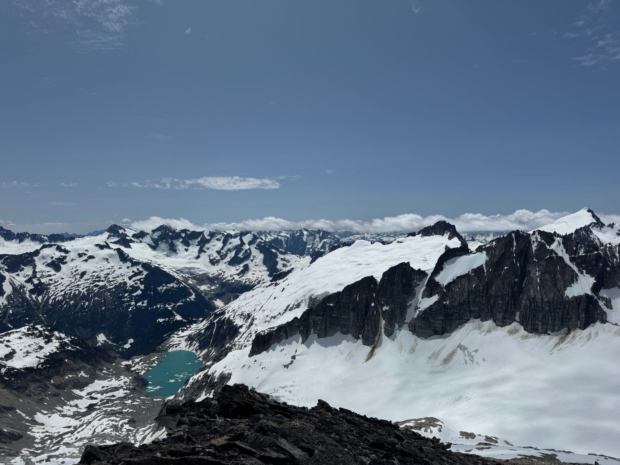
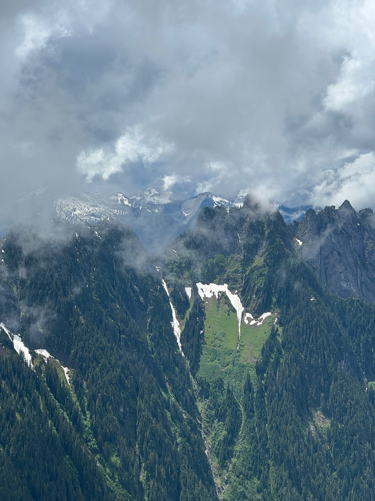
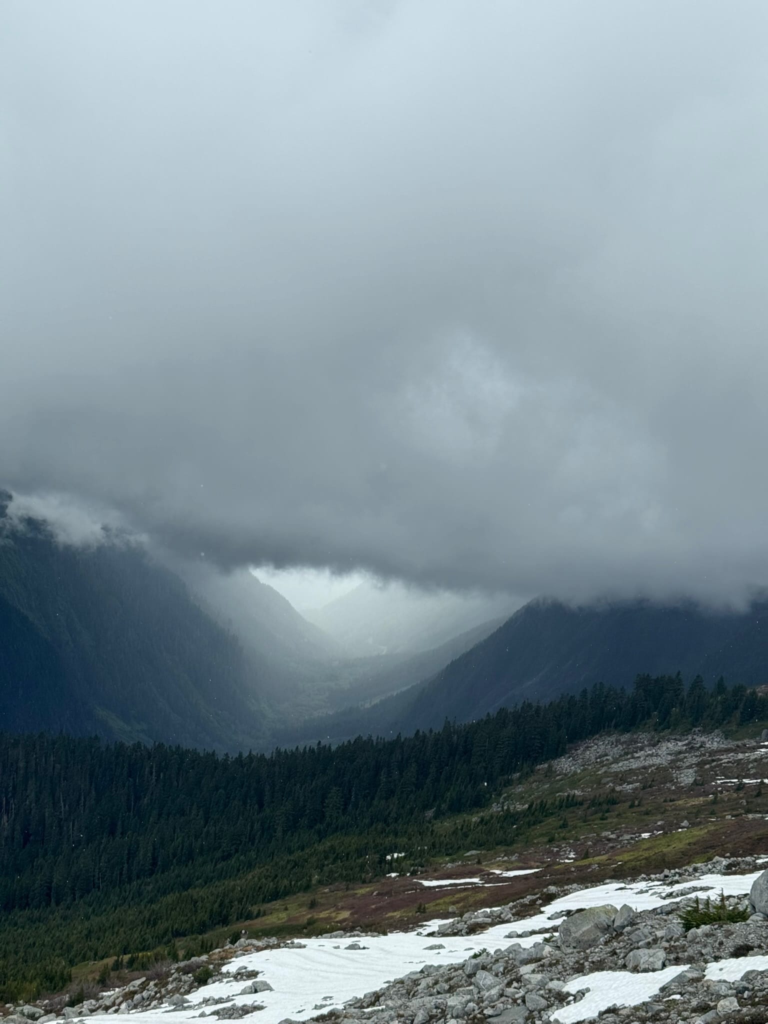
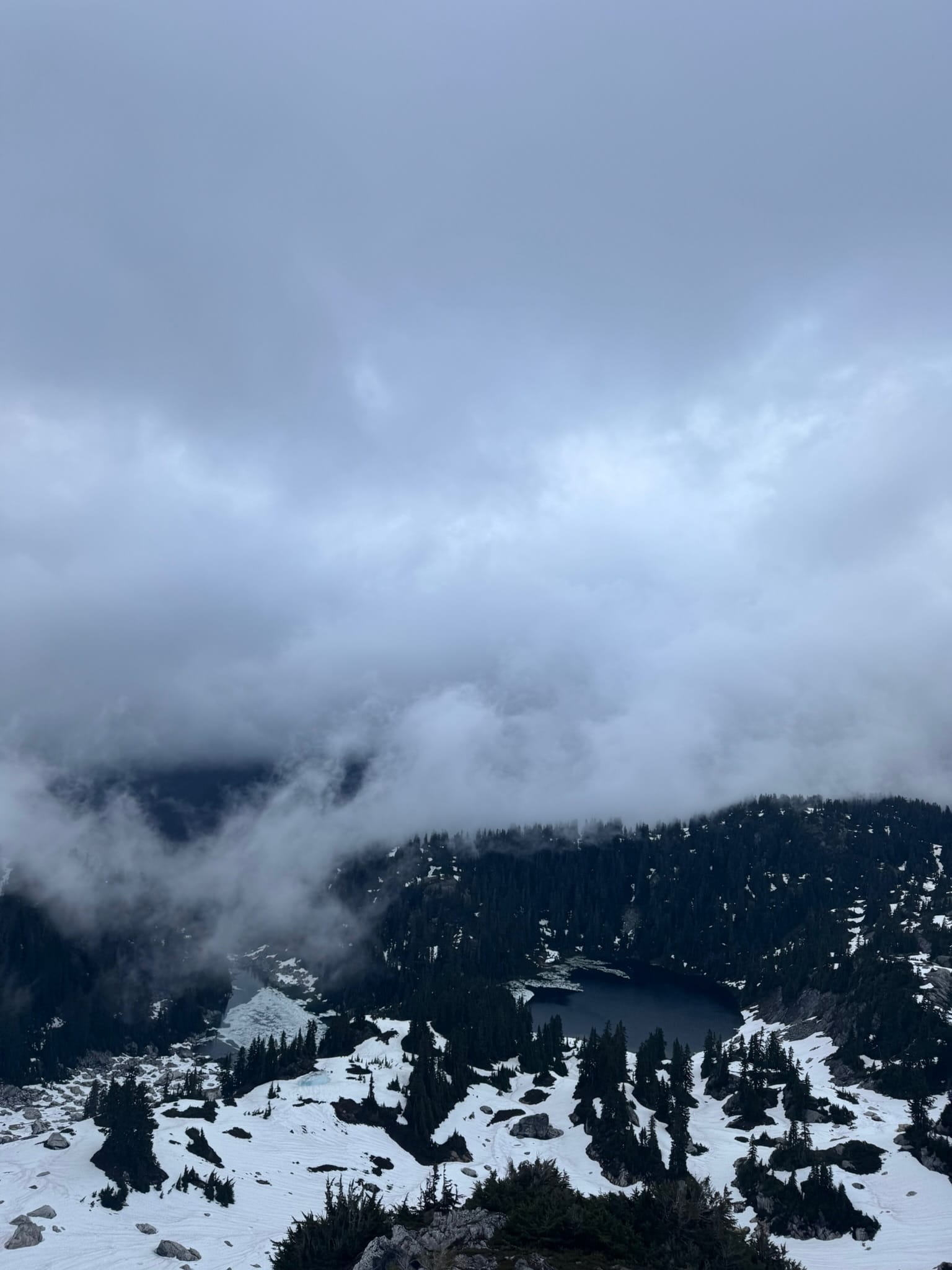
These hidden-from-the-highway ranges contain some of the continental US's largest glacier fields that grasp at toothy peaks as they make a devastating but beautiful retreat into their headwalls. These leviathans connect high landscapes to and under stunning peaks while they carve out incredible valleys, leaving behind stark rock and rubble and gem-like lakes.
We blazed along them in awe, sometimes saying almost nothing but Wow for hours, even as we slid and swore along their backs.
This could be called a "standard North Cascades Trip," - We encountered bear tracks in snow in high places, stinging hornets, roaring creek crossings, violently vertical brush and snow slopes, talus and boulder fields. And many spots where routes and expectations did not converge.
Each of these was done in some combo of torrential sleet, rain, fog, and blazing sunshine. Each had its own moments of lofty highs, or The Mountaineering Special - shivering and shaking with damp in nearly blind navigation, sometimes in butt puckering steep and wet terrain.
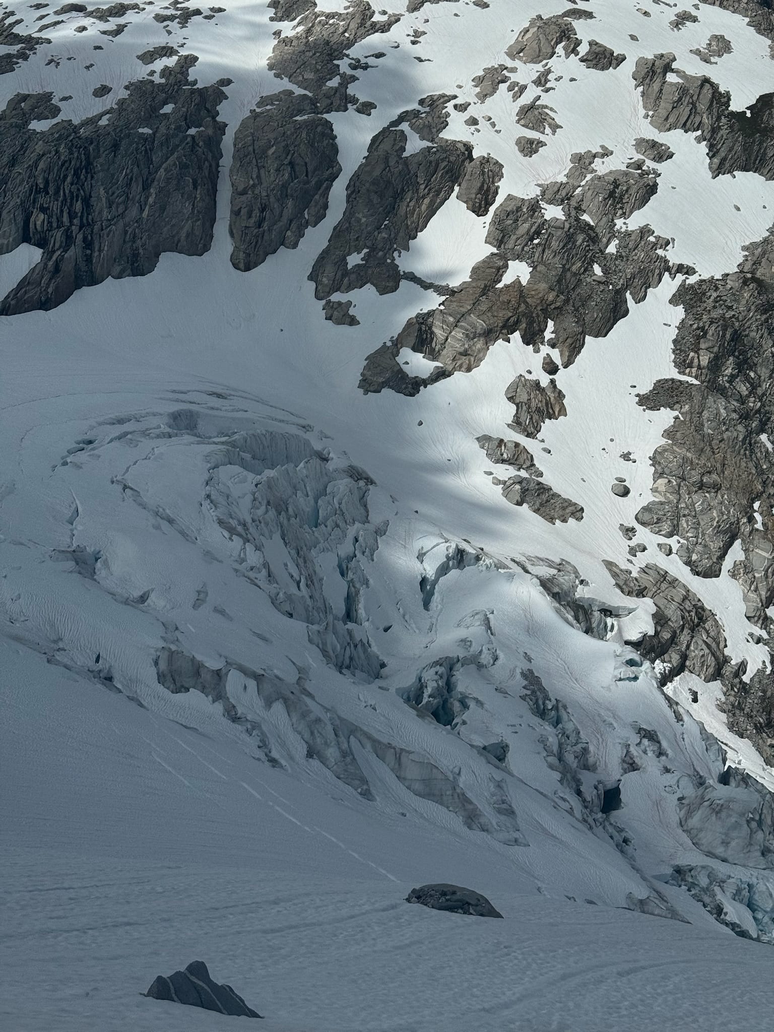
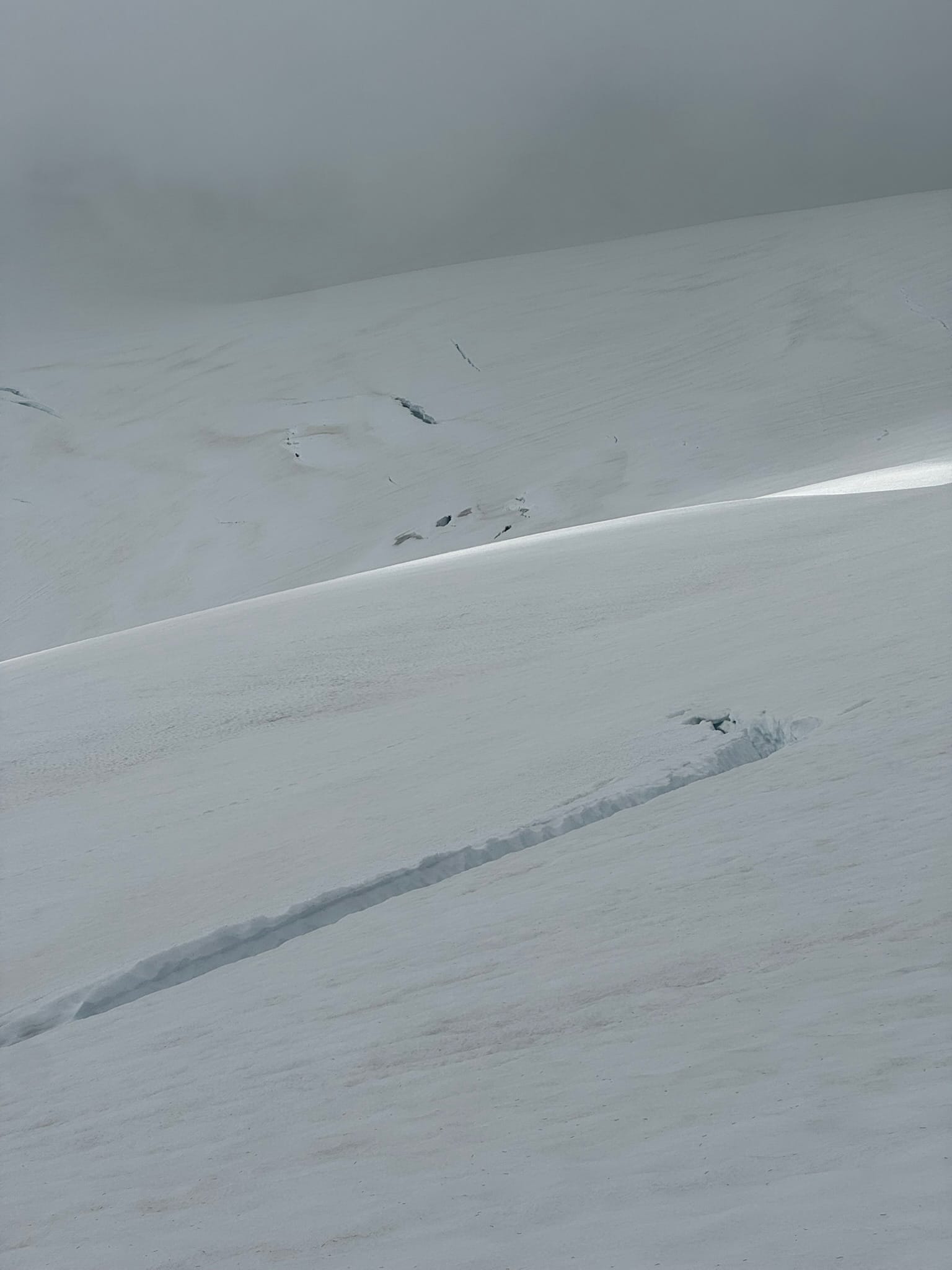
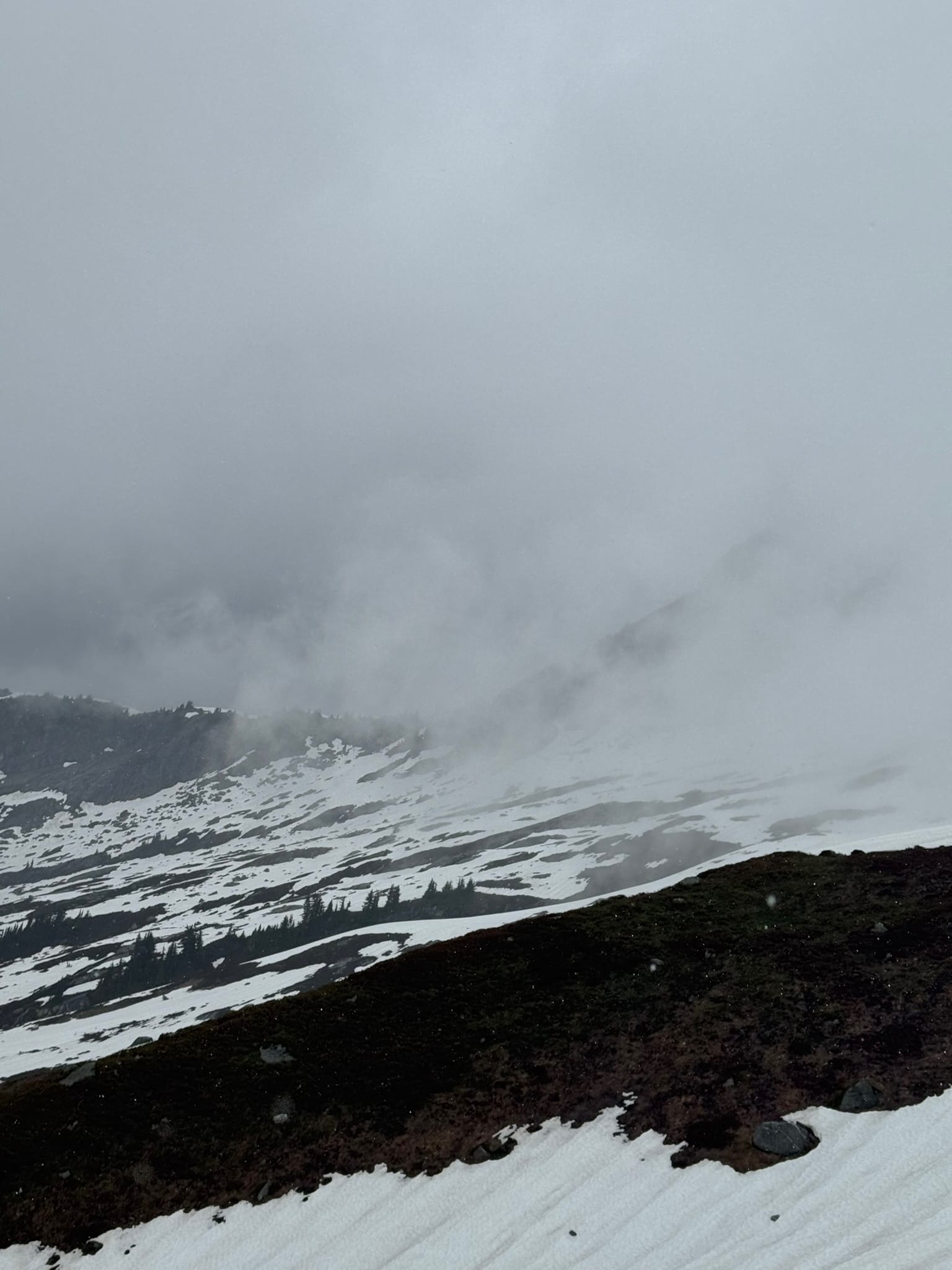
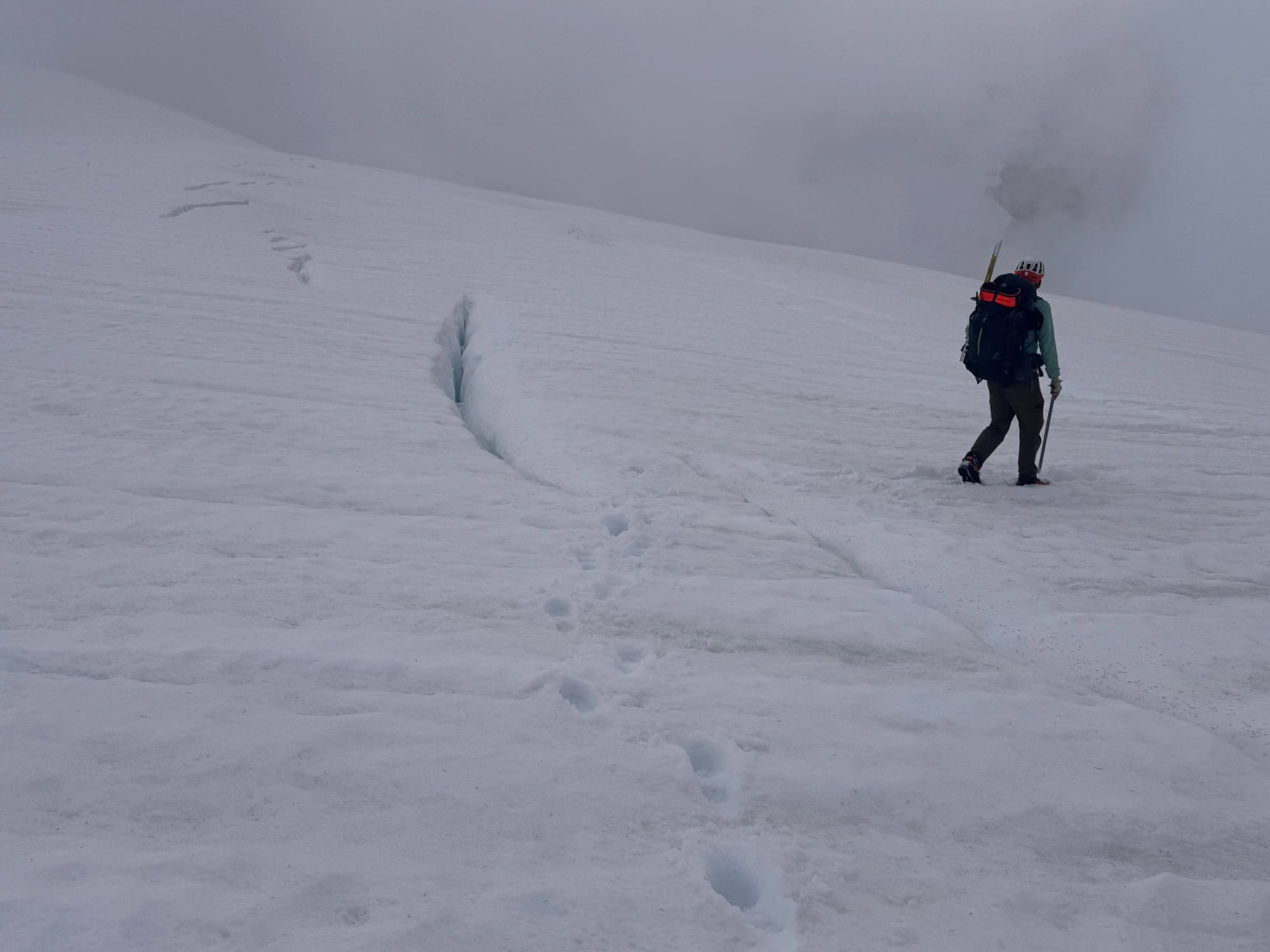
Snow quality was generally good. Sometimes firm enough to slip on and other times soft enough to plunge thigh high. Moats were forming but generally navigable. Snow bridge were on average stable, though we punched through in more than one place. Crevasses were generally filled in if not just starting to open, enough to step over. In some spots, blue ice poked out or lurked just beneath the surface of snow.
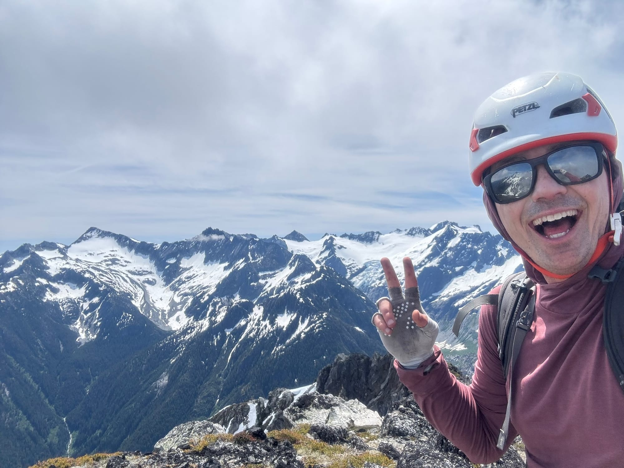
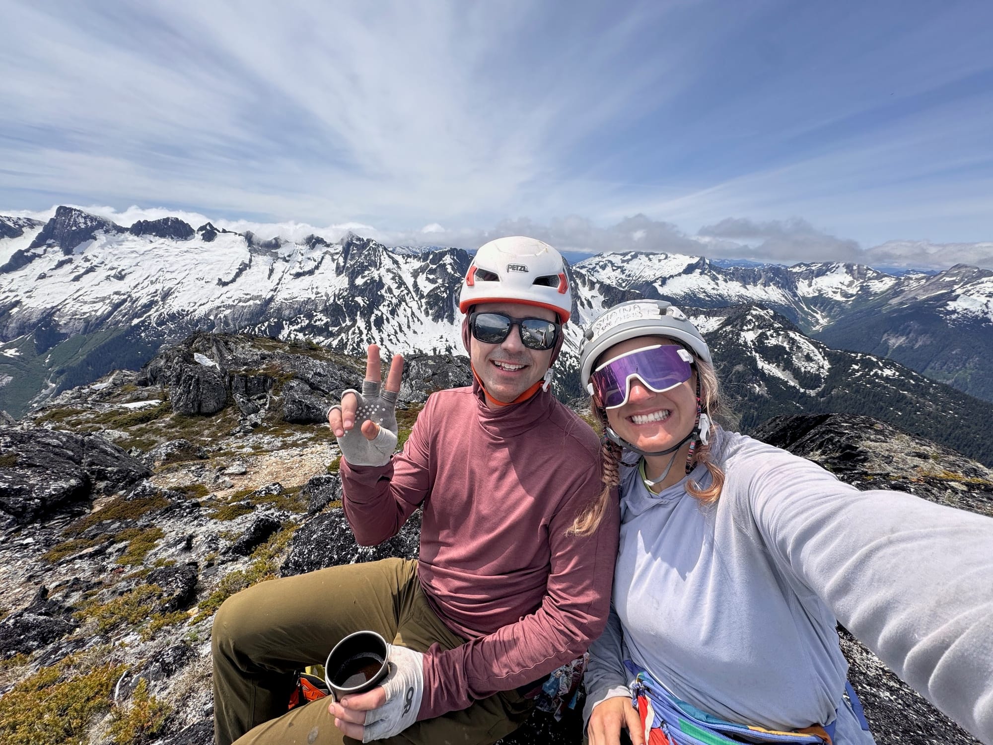
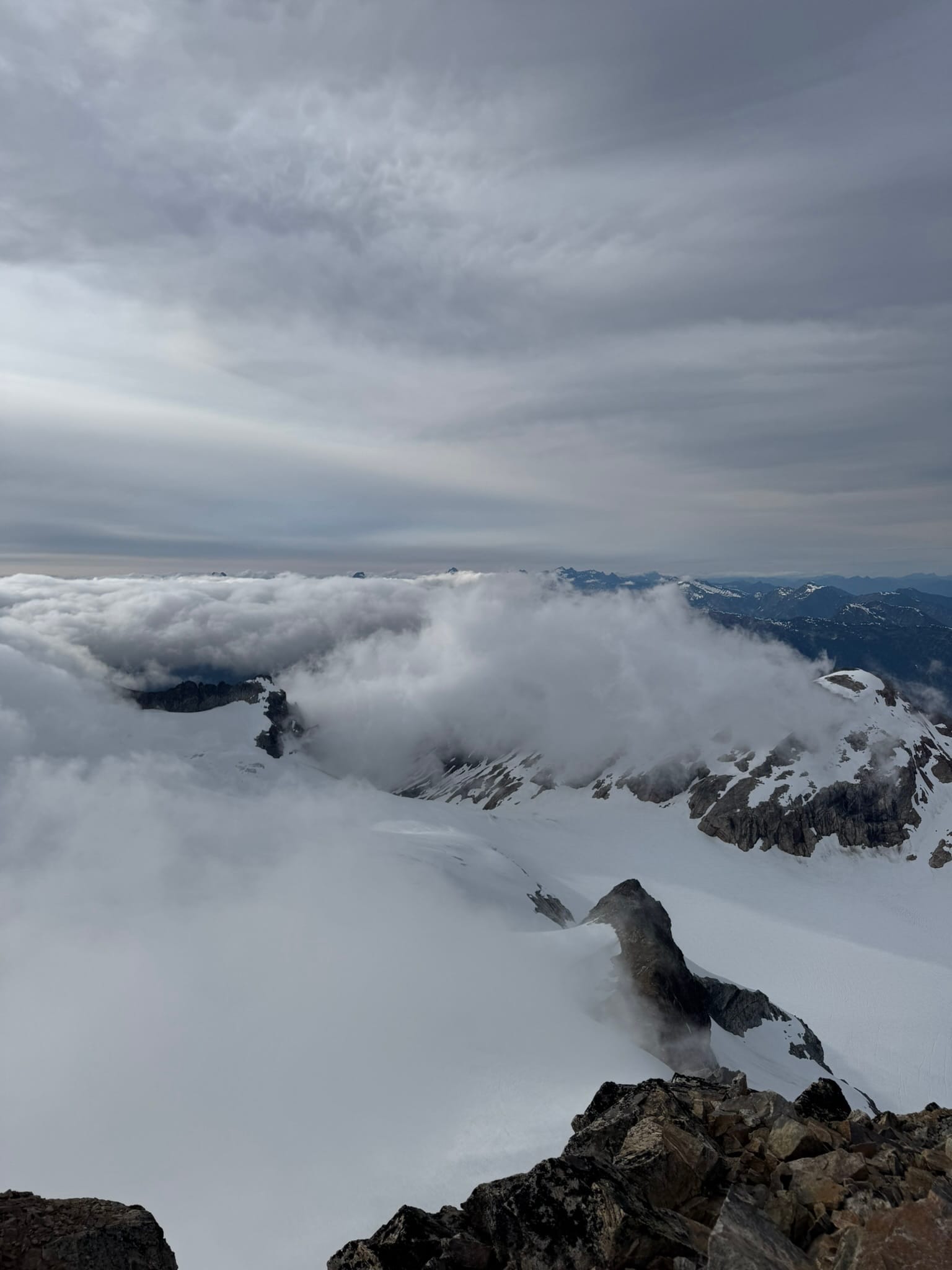
Together we scrabbled over 2 peaks that tower above their landscapes and bathed in nonstop stunning views. I scurried up Snowfield peak solo and was treated to a heaven-like moment above the clouds.
Our plan was ambitious. Sometimes as it goes on these trips, we inched along and broke down to moving one foot hold and hand placement at a time, crampons-in on steep heather and smiles on. At one point, Shaina stared past me and said, "The old Shaina came out of those moves gone." Throughout the trip, she communicated amazingly well and worked through intense and new moments with an incredible attitude. We worked well to keep morale high.
We both grew from each experience. As sometimes happens on these trips, the pressure sometimes felt extreme and we each got a few meltdowns on our back-to-back 06:00am-22:00pm days.
We made sure to check in with each other regularly, told each other how great each other were doing after each intense series of movements, and ended every night by letting out a big breath and breaking into giggles in our tent.
Our mantras were one step at a time and shirts down, pants up.
We were spit out sopping wet after a final steep and slick vegetation descent that saw our bums touch the ground many times.
We were so grateful to have experienced the majesty and intensity of this region and maybe in need of a little cat snuggling and processing time.
Night 1 - Sunday, Thunder Creek Trailhead to McCallister Hikers Camp
Gain: +1189ft, -1732 ft 6.32mi, 3h 25min
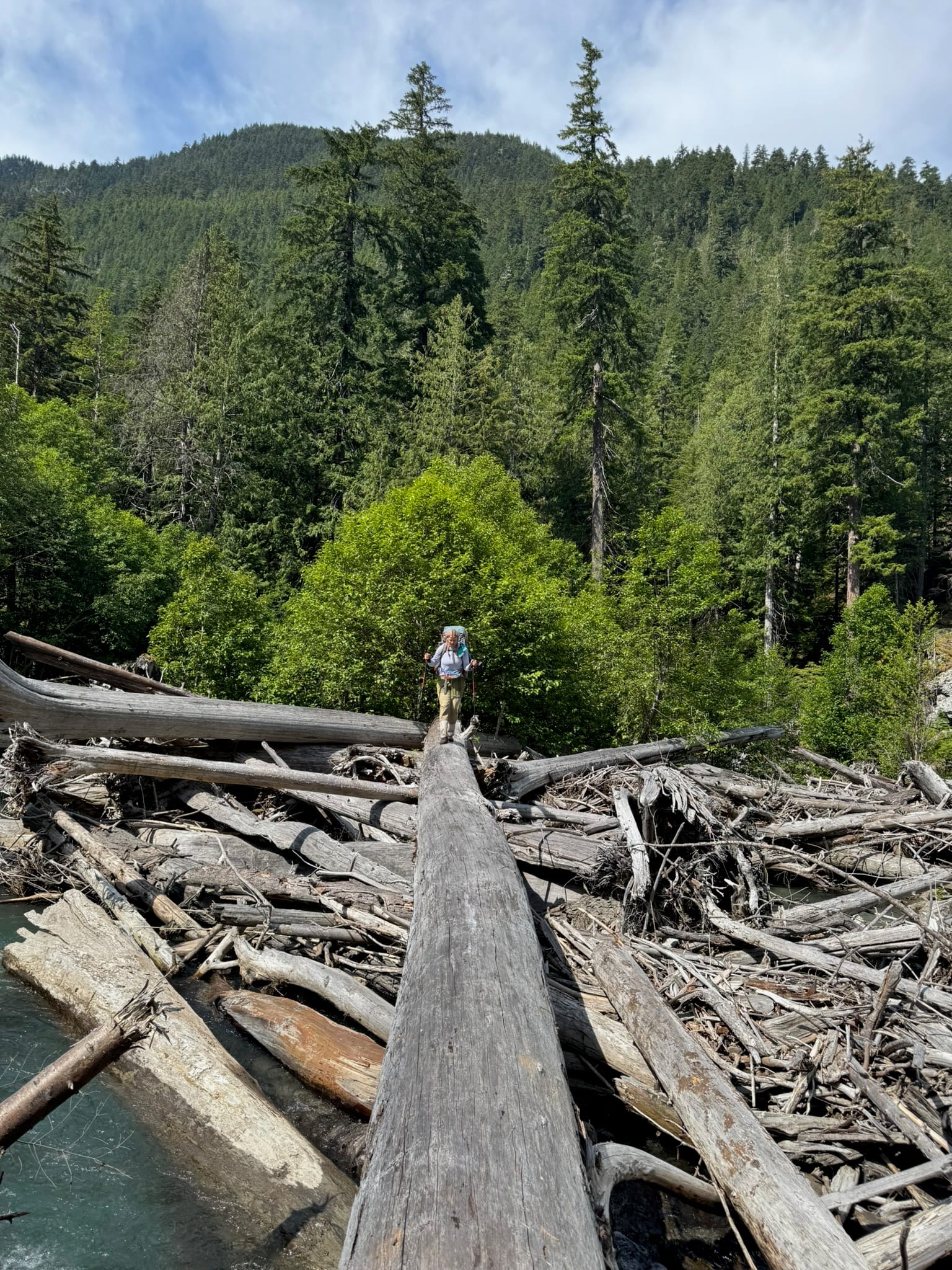
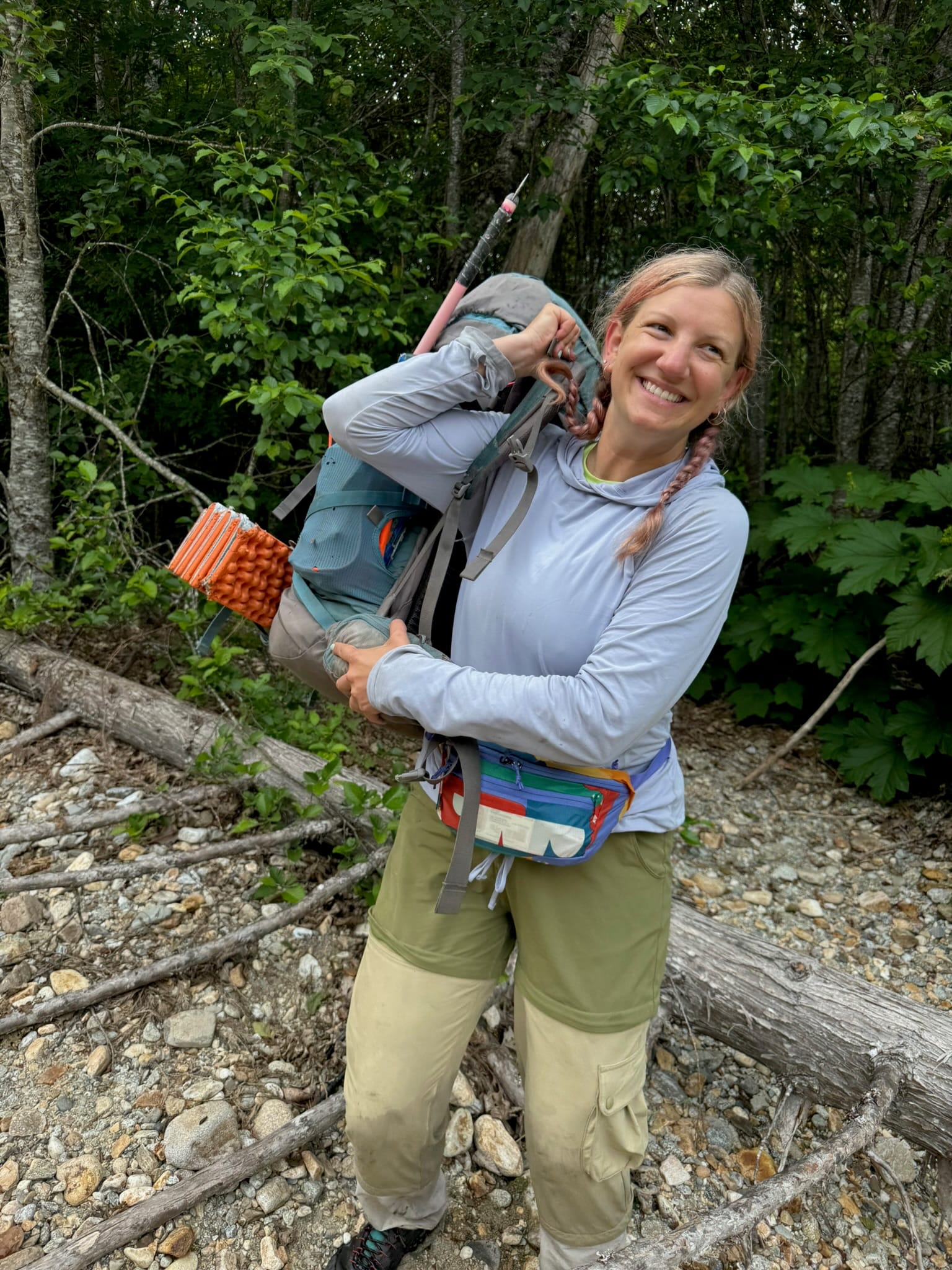
I met Shaina at Pyramid Lake trailhead at 7pm. We speedily moved through group gear and were moving at Thunder Creek Trailhead by 730pm. We blasted along the well-trodden trail, only getting mixed up past the first bridge where you must head toward the group camp and not along the creek as the map says. We ended at just the last dusk by headlamp at the new & stellar McCallister creek hikers camp. It had an almost-amphitheatre-like kitchen area, nice well made tent platforms, and a large bear wire area.
Night 2 - Monday, McCalister Hikers camp to Borealis Ridge Arm
+5,033ft, -385ft. Max Elevation: 6691ft, 6.14mi , 12 h 40 min
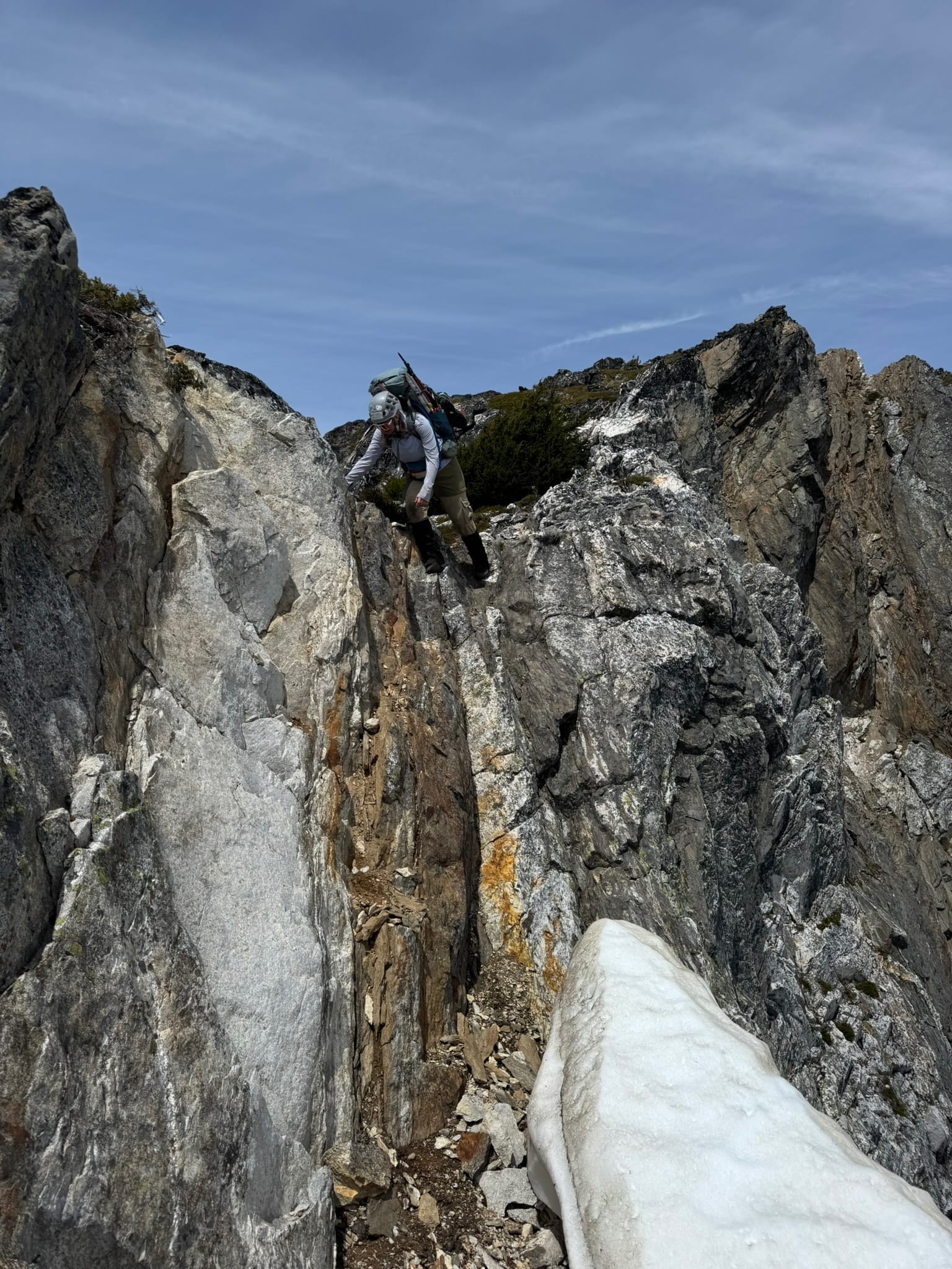
The creek crossing may or may not have haunted us as among the most ambiguous parts of our trip. We left around 8am, went a little upstream before hanging right into our first bushwhack. We moved through the brush and stared out at some roaring sections that had some logs before deciding they weren't right for us. Had we moved 5 feet to look left, where we learned later after a back and forth journey where we faced turning back to the trailhead took 2.5hrs, that was where the crossing was located. Too bad we don't get hindset ahead of time.
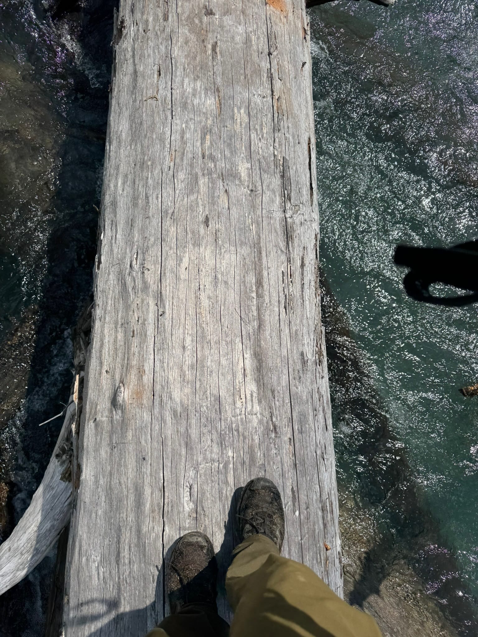
After disintegrating morale and referencing 5 trip reports about it that never defined where it was, we rejoiced at being on the correct side of the river.
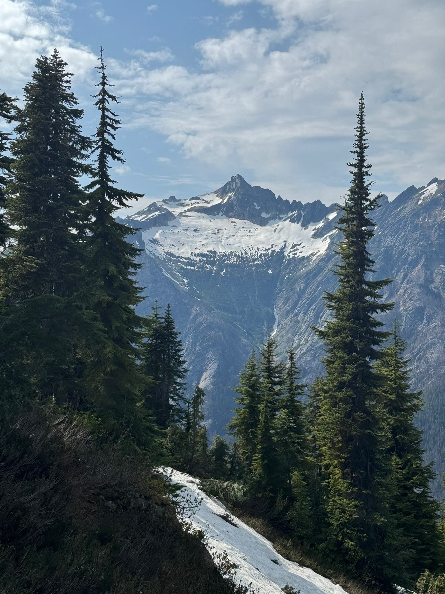
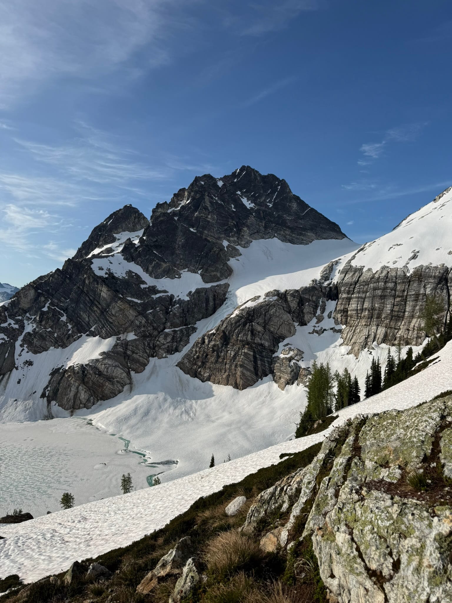
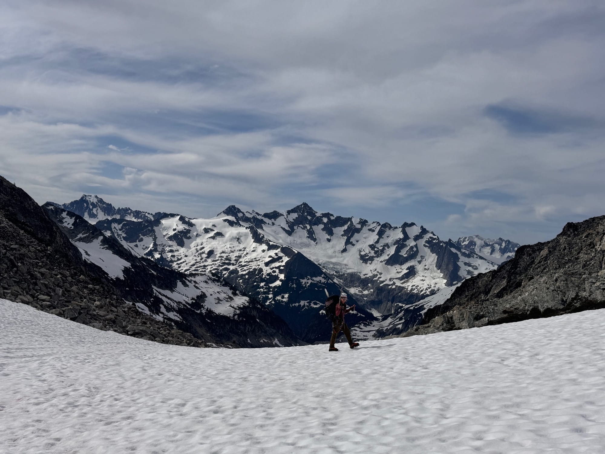
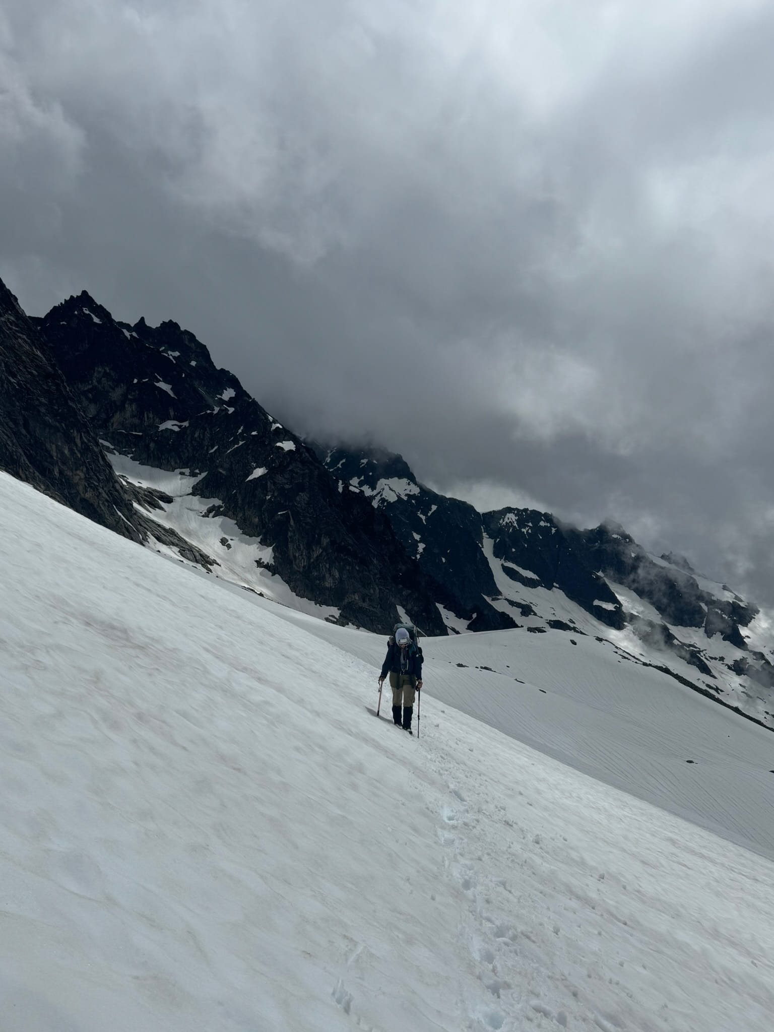
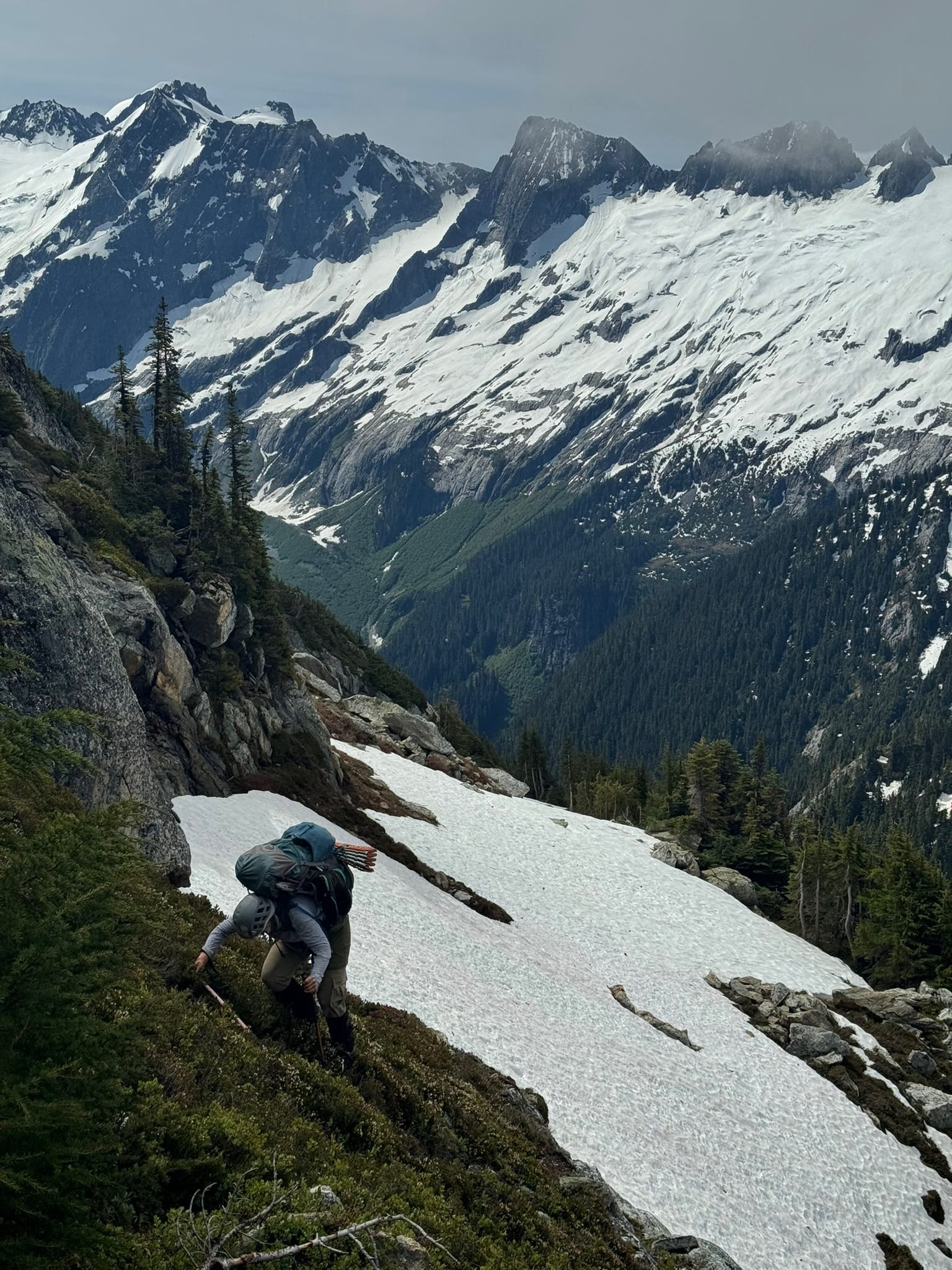
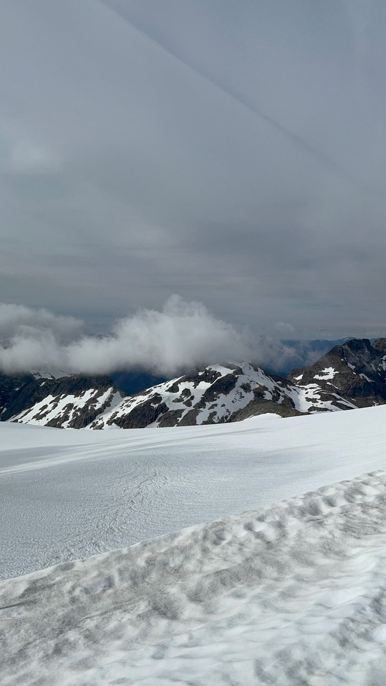
We spent many hours in a light bushwhack and massive climb up a decent climbers path to lucky ridge then the borealis basin, threading along the climbers path. At some point I got stuck on the ground due to pack gear (I was once asked to reflect on what it would be like to carry a 36inch picket vs. a 24inch picket, and ended up learning first-thing what that reflection meant in real life to carry a 36 inch picket) and ended up in a hornets nest. I screamed and slid down face first back toward a startled Shaina. I got stung a couple of times but thankfully we were not chased far. Shaina handled it like a champ and we took a break, ensuring my arm didn't have a nasty reaction. I said that I deserved to have a treat that Shaina nodded in fervent agreement, and enjoyed a few twizzler bites and gummy worms. I snuck my poles way from the now-clear-in-the-ground hornet hive before we resumed and slogged up in the heat. We enjoyed a couple viewpoints as we moved from forest to ragged ridge to snow & boulder field, under the massive rock of Tricouni & Primus soaring above us and the views of Snowfield, where we struggled to fathom being in 4 more nights.
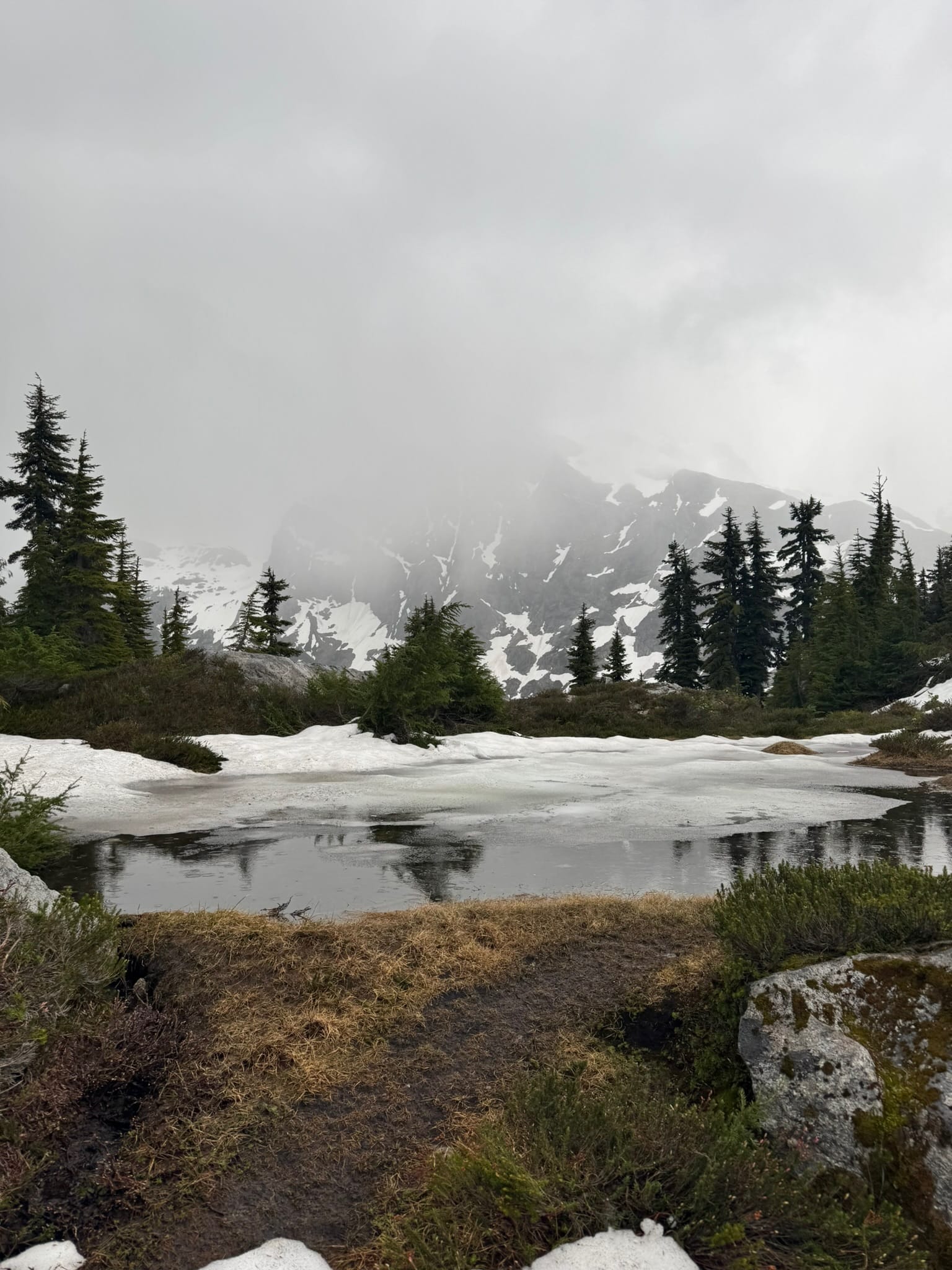
We hit snow around 5500ft in patches that eventually became consistent around 5900ft.
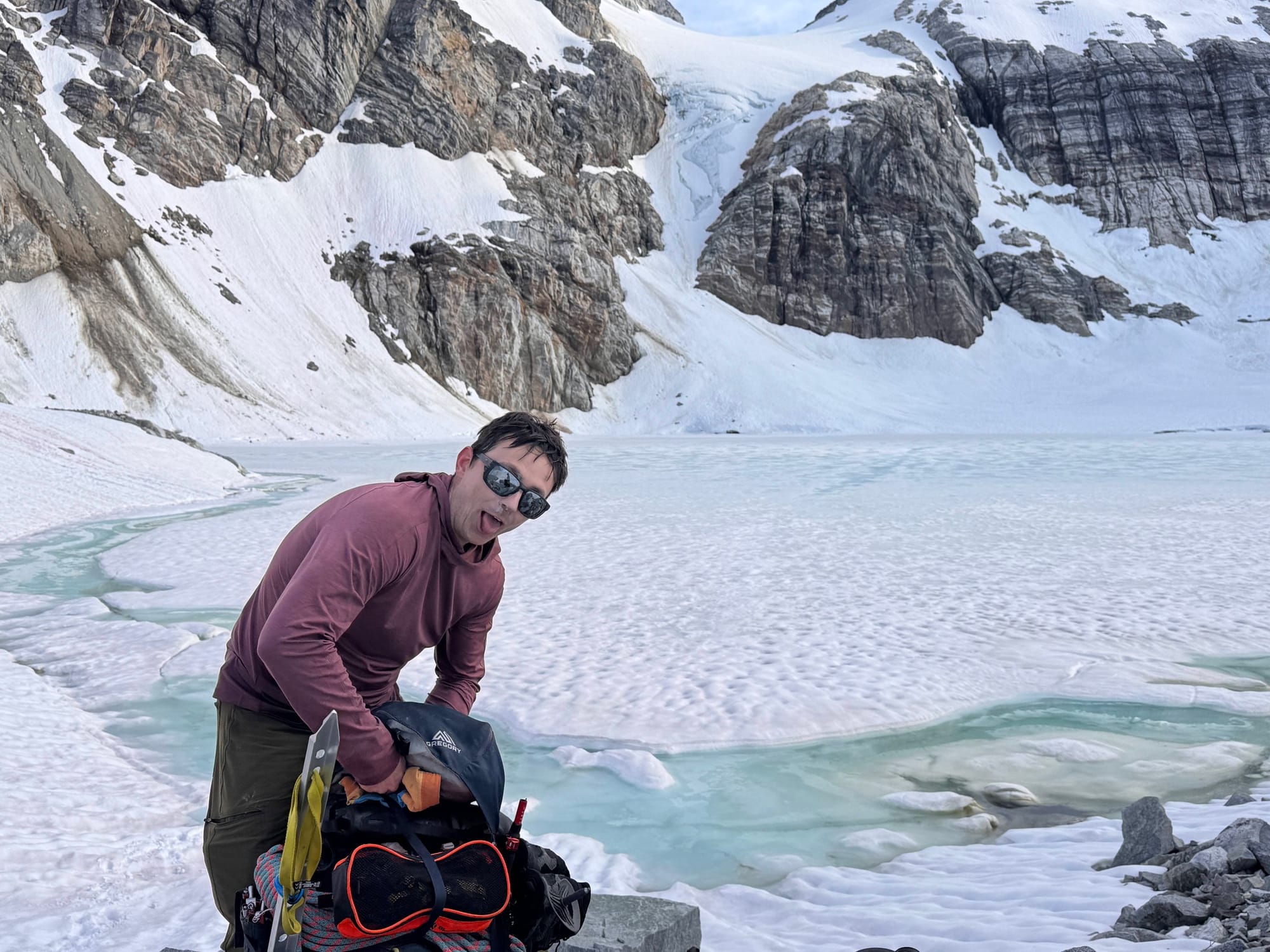
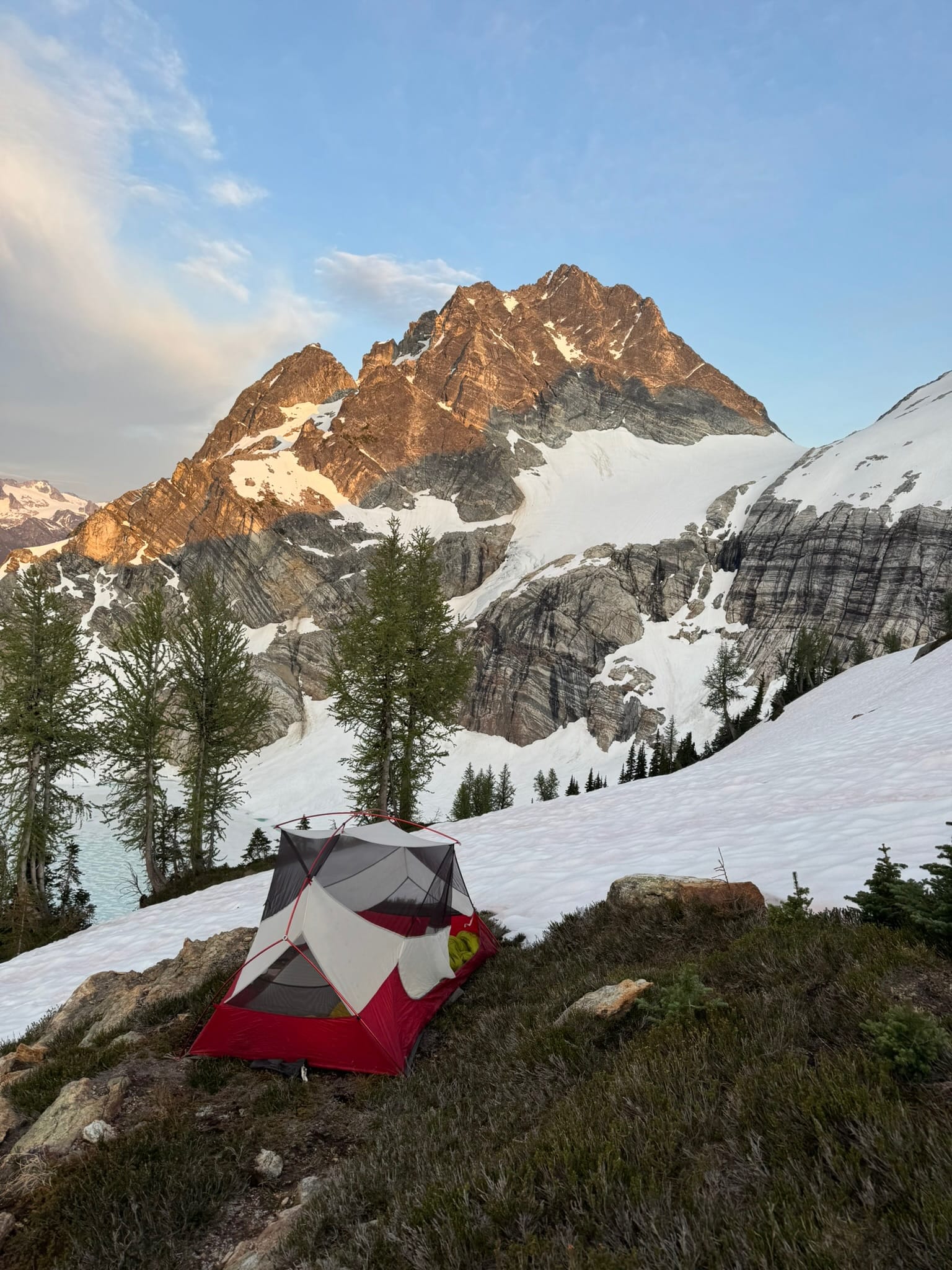
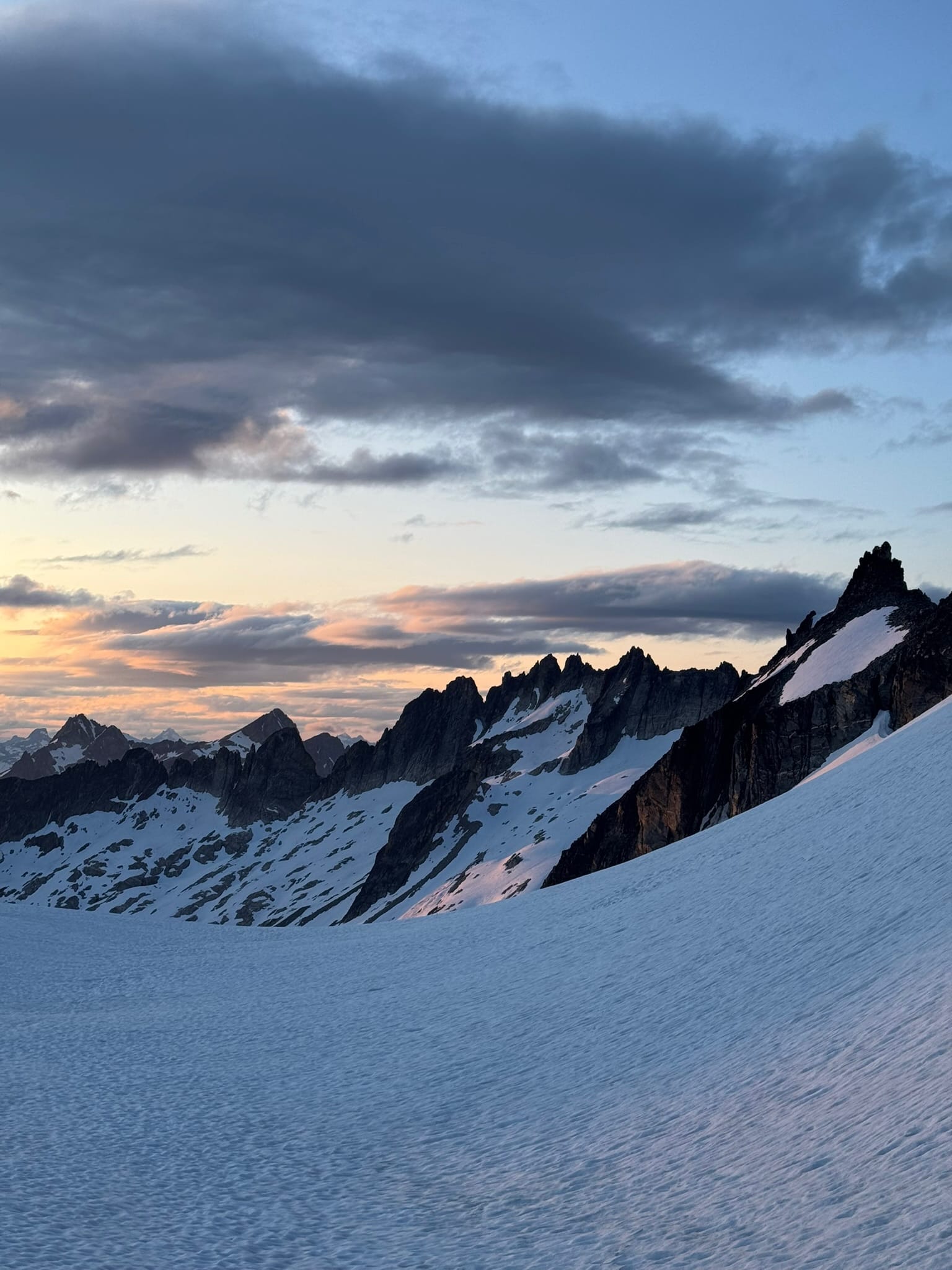
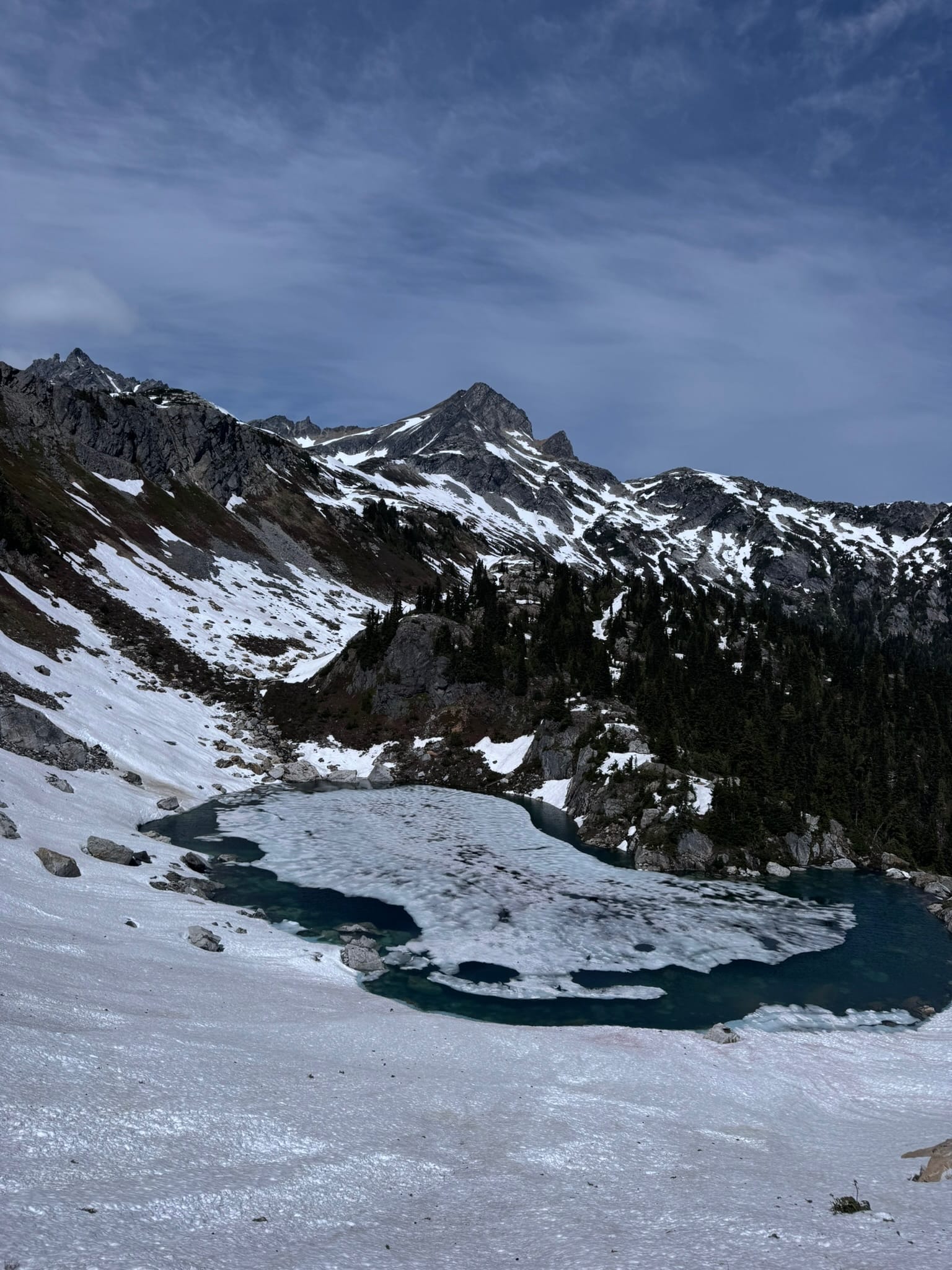
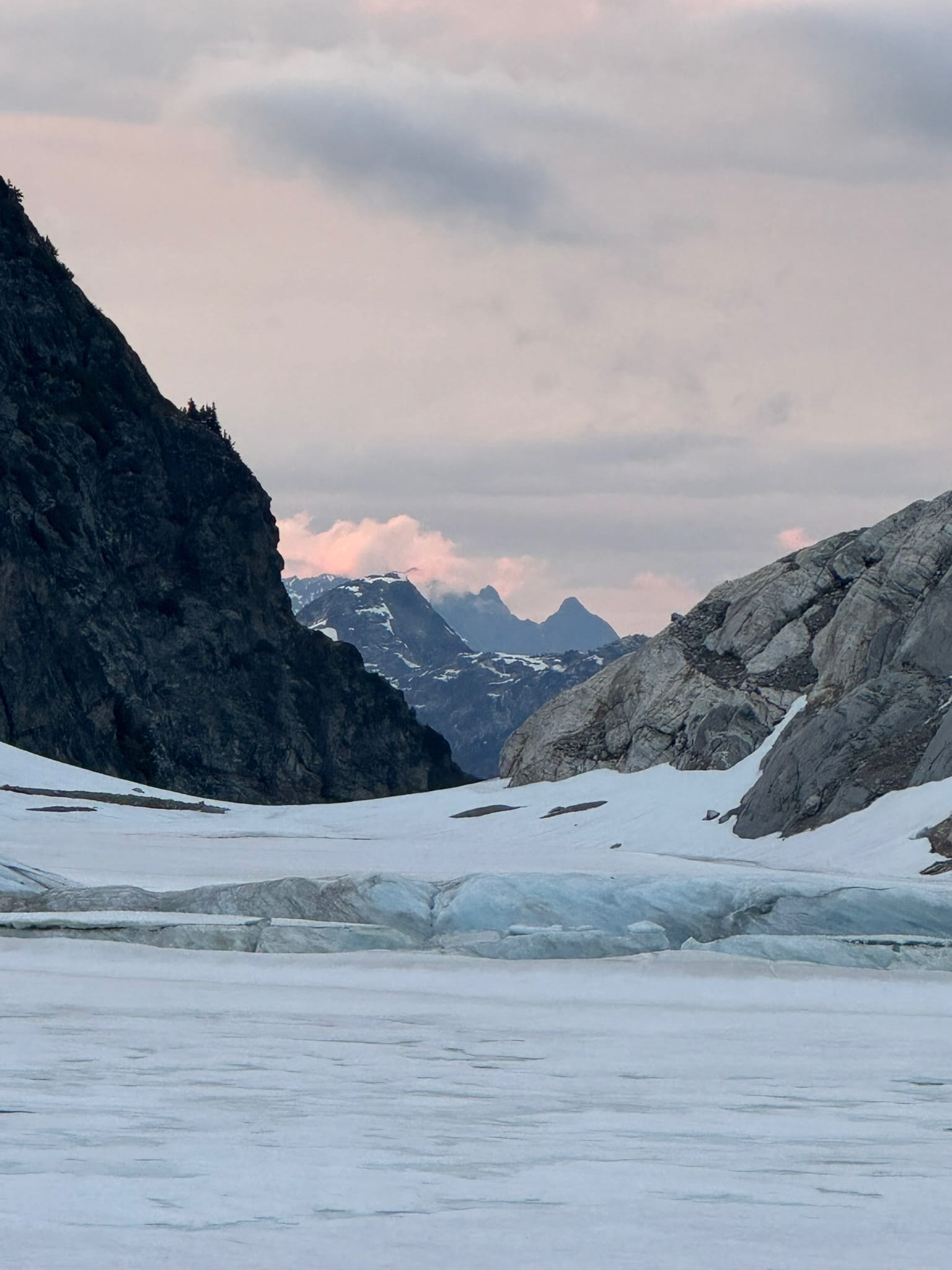
When we made it to Borealis Basin, we enjoyed a long break by the marvelous blue hues of the still-frozen lake. We ended up scooting up on the arm of Borealis glacier, about 550ft above the lake, and camped on a mostly-flat dirt patch surrounded by snow to a stunning sunset. An alarming wildfire smoke haze started to filter in, but otherwise we had an amazing sunset.
Unfortunately I placed my inflatable sleeping pad on a sharp rock and, after 6 marvelous years in so many places around the world, destroyed it. Shaina swooped in with a patch that lasted a couple more nights. A crescent moon watched over us that night.
Night 3 - Tuesday, Borealis Ridge Arm to Klawatti Col
4.94mi, +2,807ft, 10h 52min, descent 1673, max elevation 8481ft, min elevation 6548 ft
We started on the borealis arm with a sunny day ahead of us.
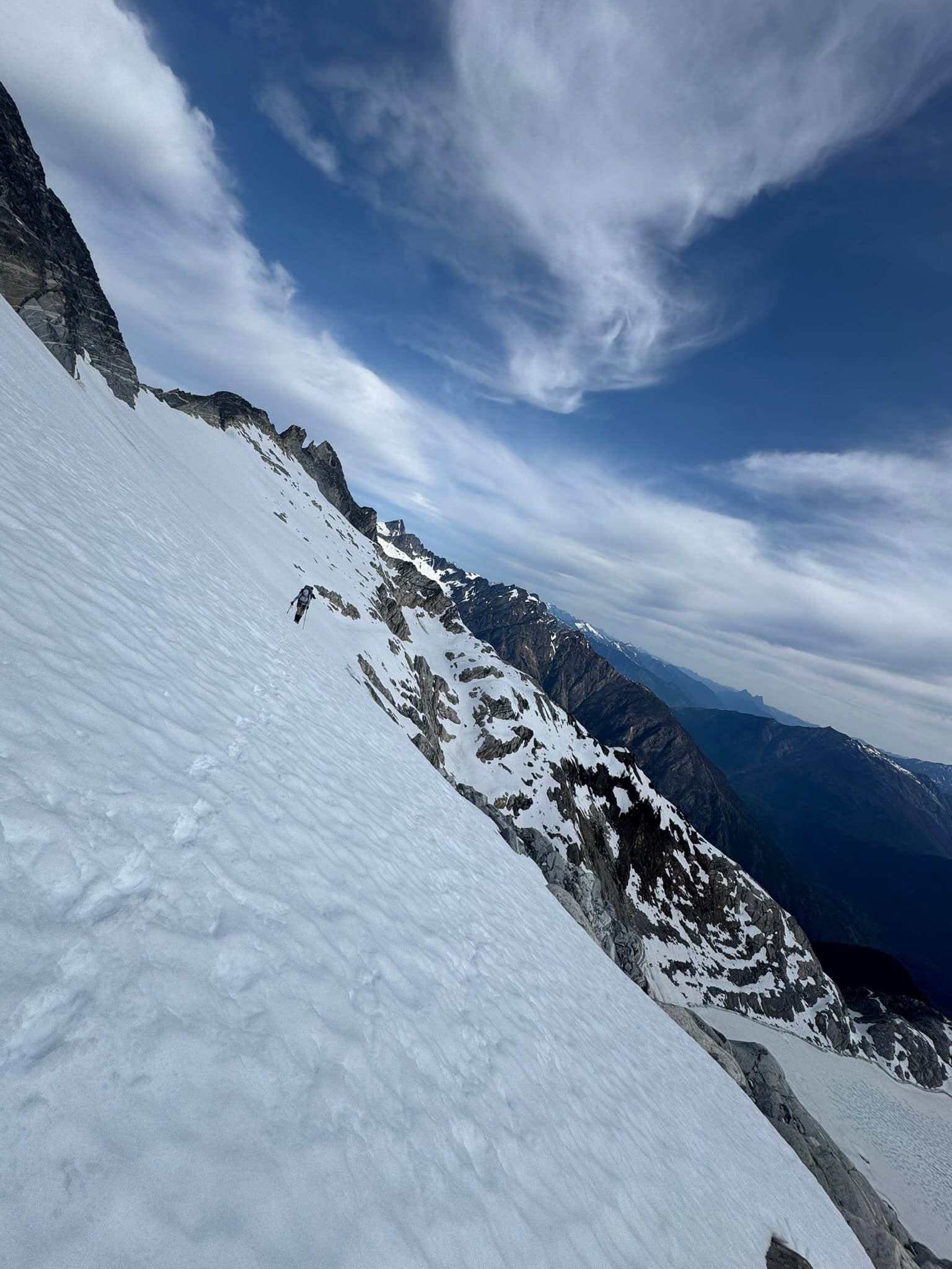
We talked through some wigged out feelings from the steepness and exposure of the borealis glacier that hung under primus, with its exposed blue ice, 3 avalanche slides, and steep fall to rock below.
We came up with the clever chant that "things lay back closer up," (tm) and that we "will take it one step at a time," (tm) which mostly held true as we approached. We stayed close-ish together as we side hilled successfully through the exposure, slide, & rock fall before making it to less exposed snow.
Above the section just before dropping to the saddle has a connection between snow to the east ridge of Primus. For those doing a carry over, I recommend checking this out. We got to plunge step to the saddle and rejoiced before looking at one possible routes. We had one route that plunged down near beautiful blue klawatti lake before descending. We also had some routes that followed up the east ridge. Combining this info, we decided to do a carry over of Primus via its east ridge and down its west ridge.
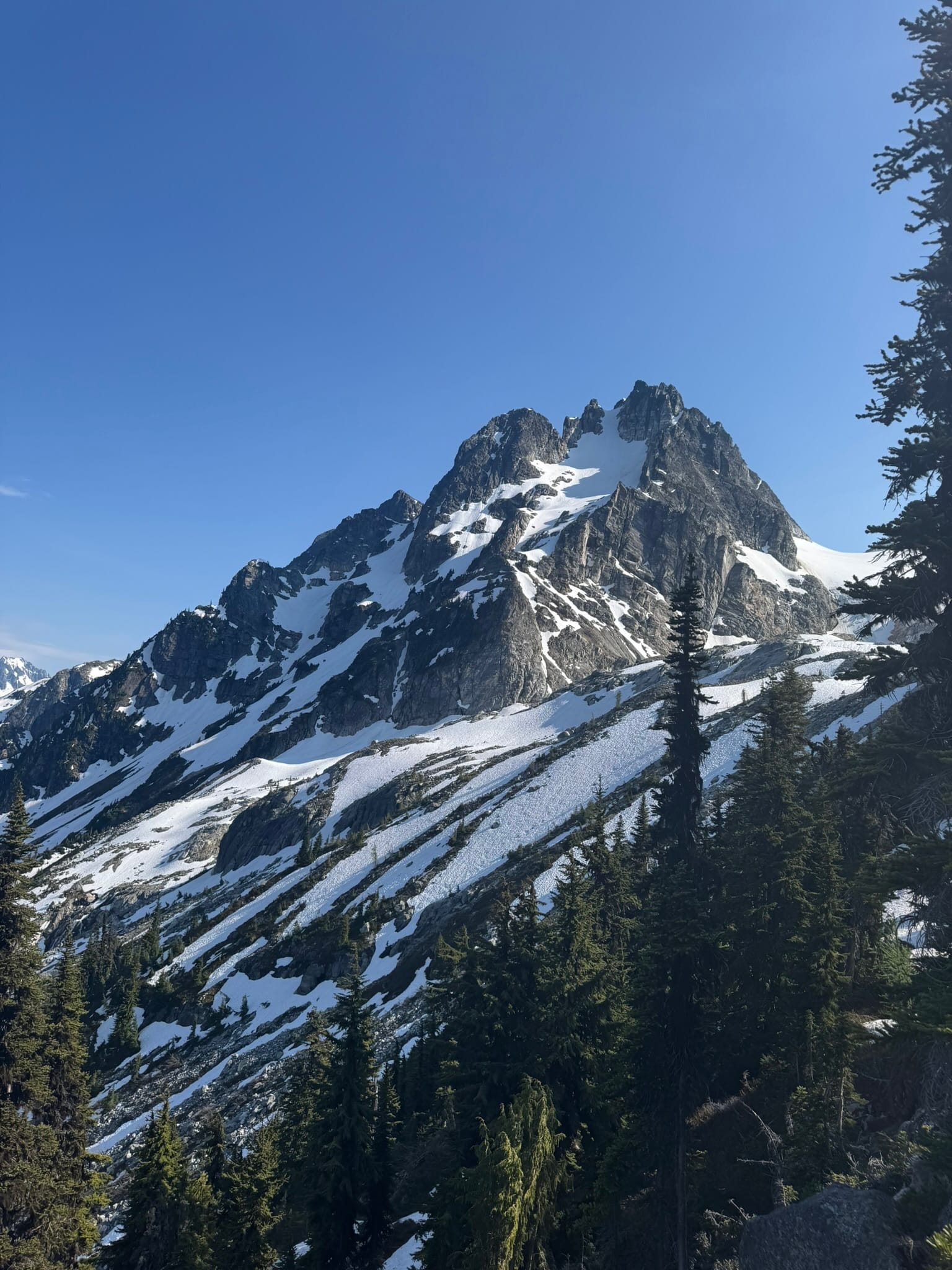
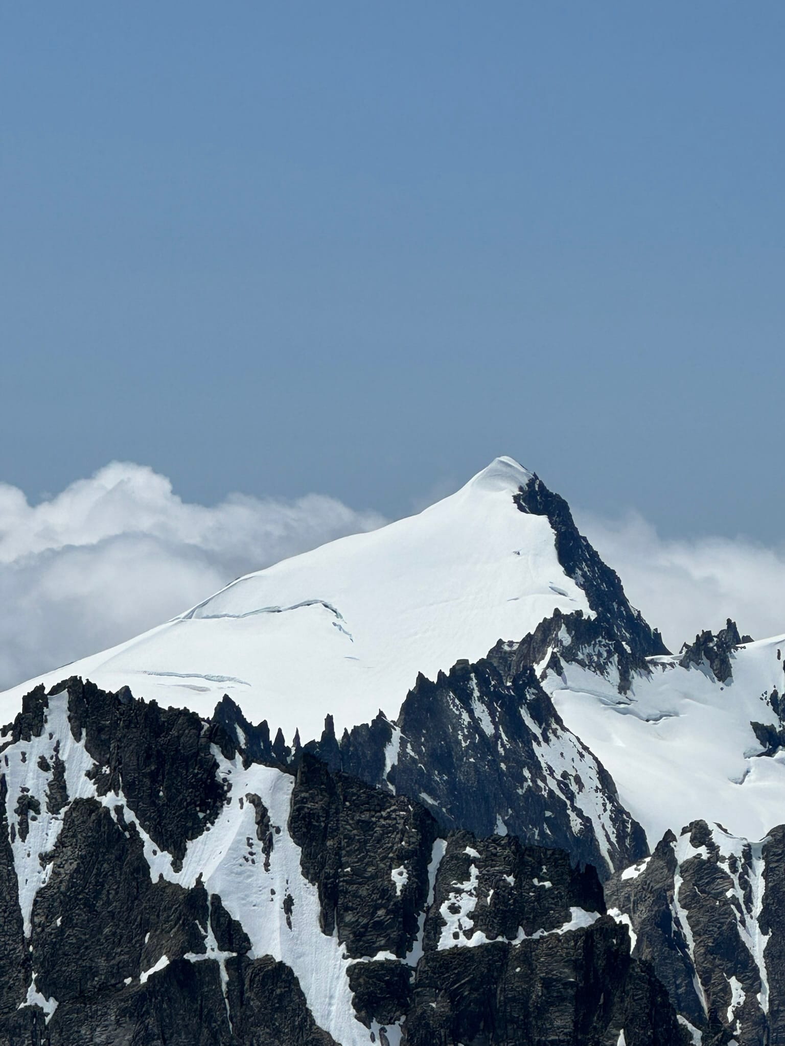
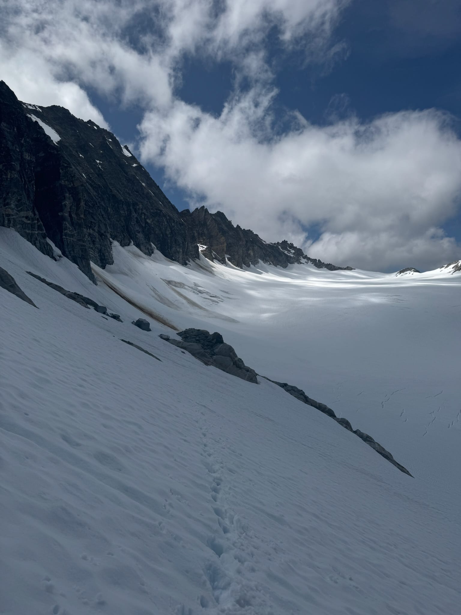
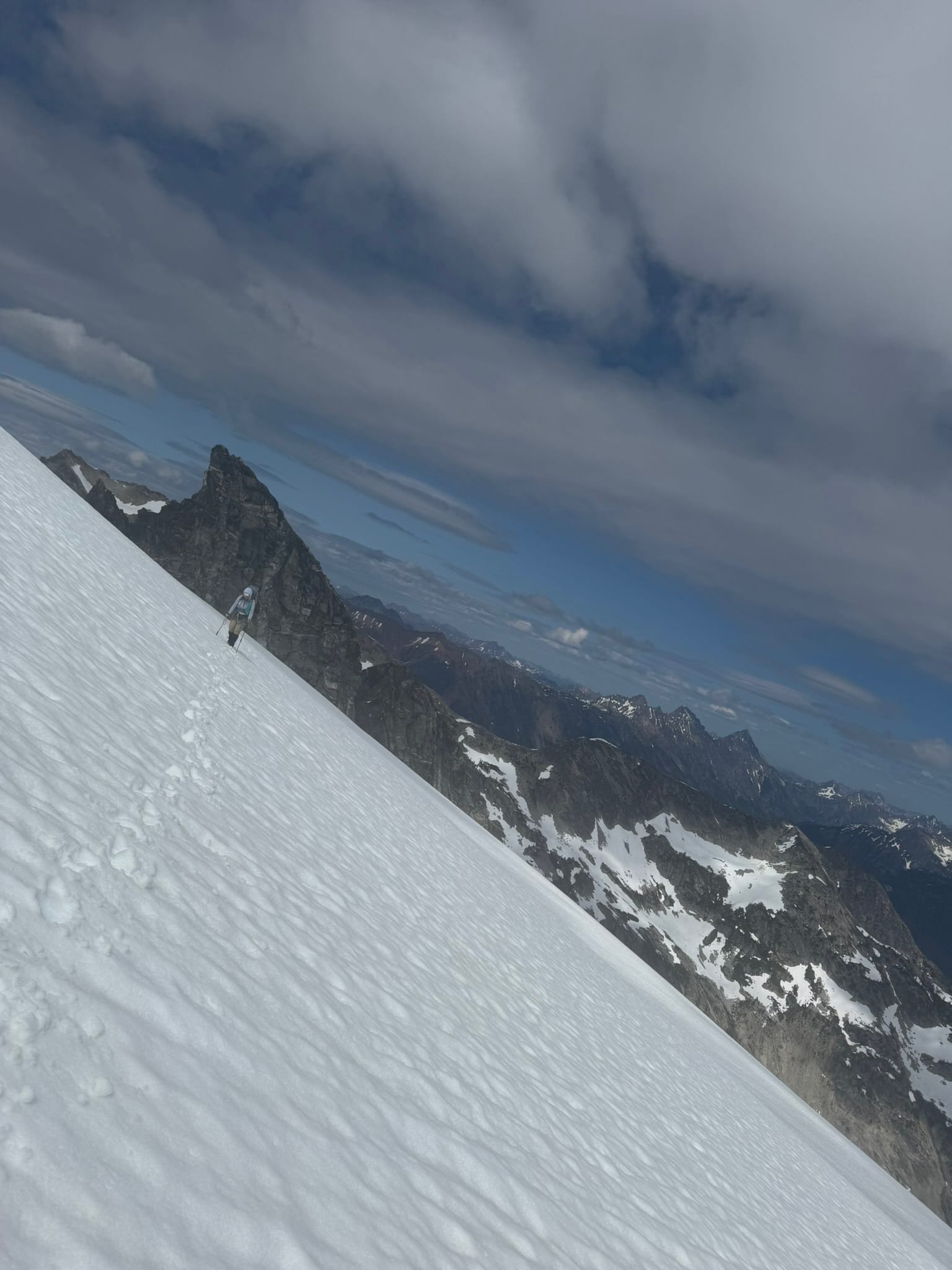
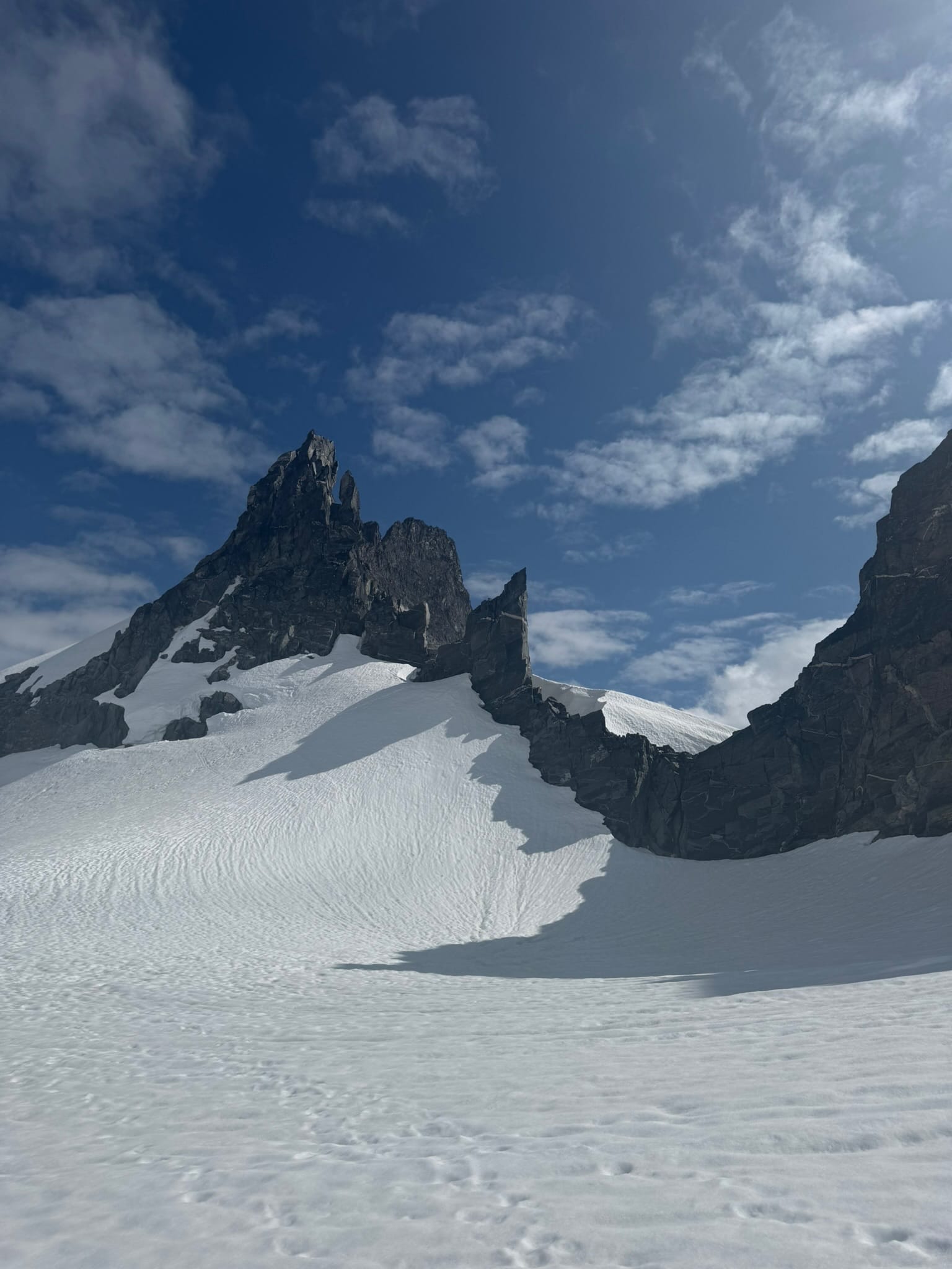
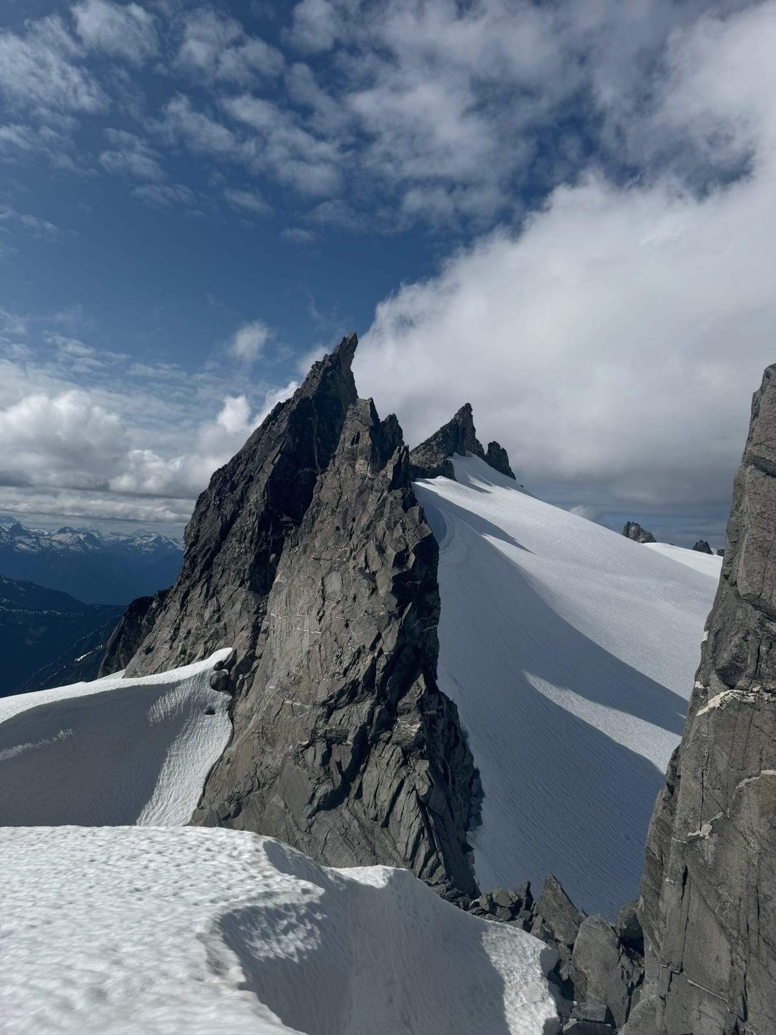
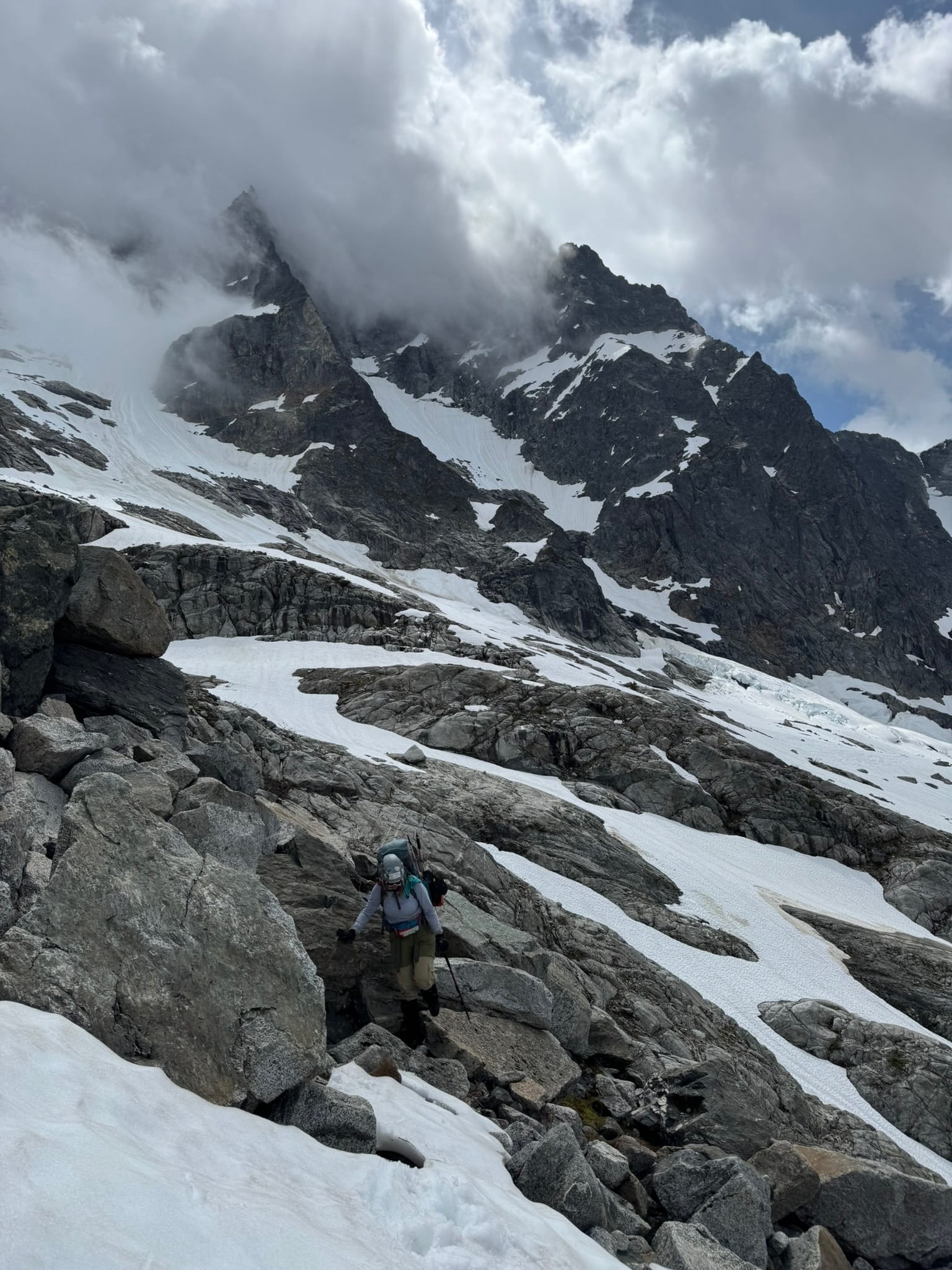
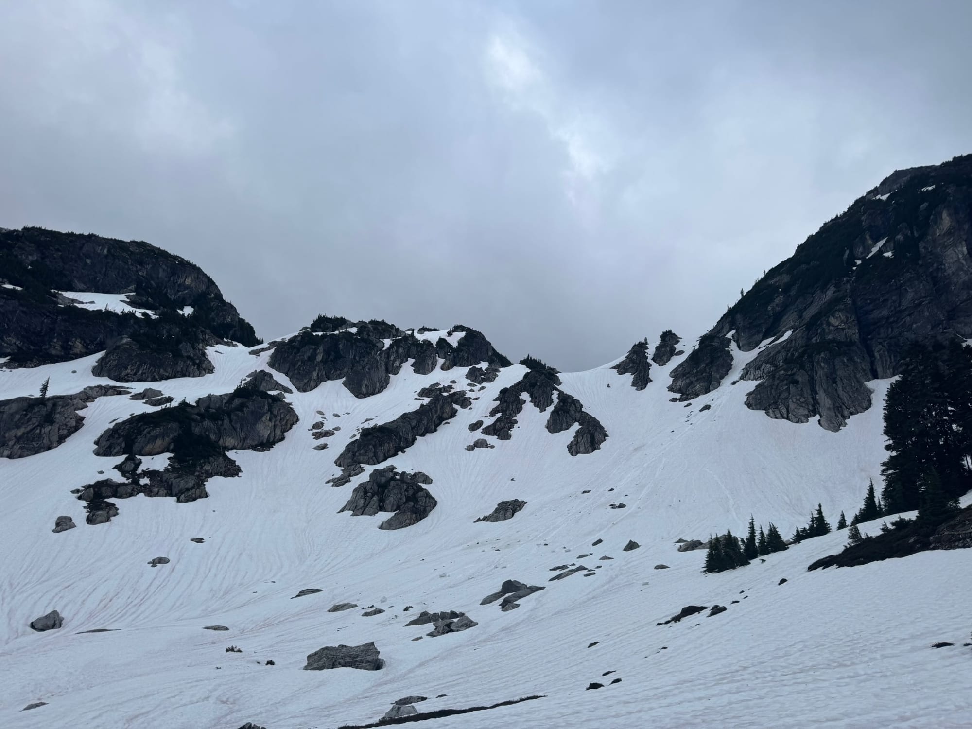
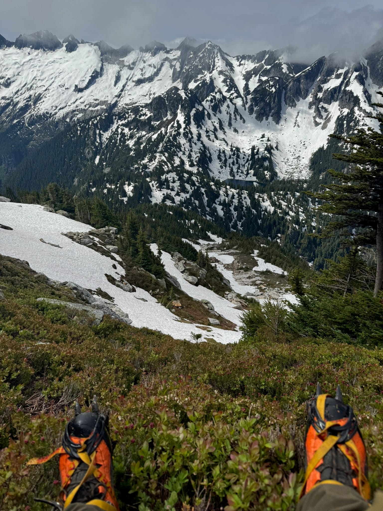
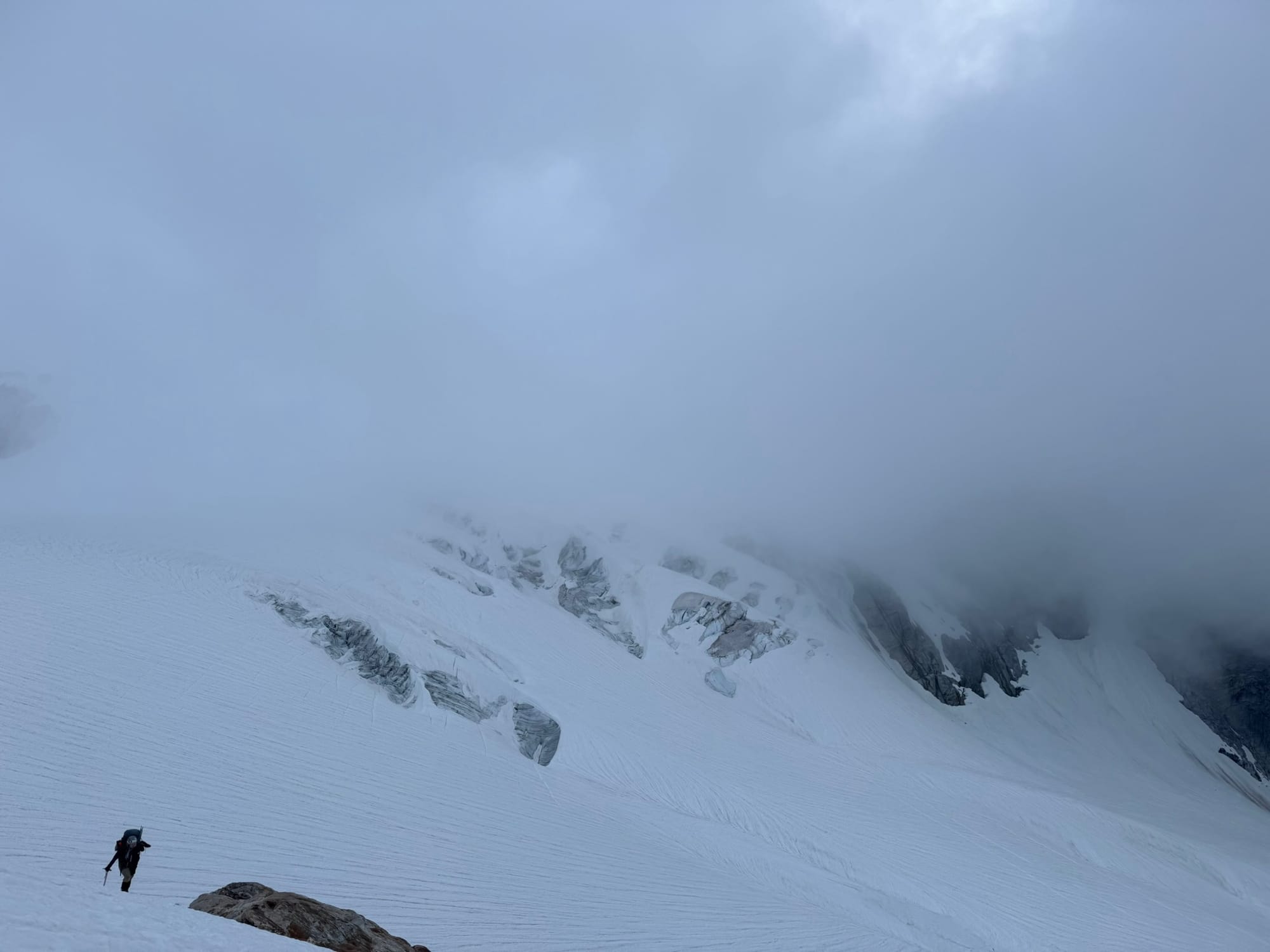
The way up from 7200ft was majorly straightforward until around 8000 ft when we blockade in the form of a dual-horned sub-peak, which contained a number of ramps that made up 3-5 class 3+ / 4 - ish moves to the top. We attempted 1 ramp and decided it was outside the team's comfort limit. We downclimbed off the heather and returned to snow, put on crampons, then continue underneath a rock rib and back up to steep snow via a couloir that faced North East. It was plungey, soft, and hot but straightforward. We ended up just above the part where the ramps would've led-which is a walk off. We were under the peak, with a mound of black lichen boulders and some amazing views. Instead of corkscrewing around to the "standard route", we tumbled up the lichen-y class 2 boulder field to Primus's flat top. We took it in below the summit in a more wind-protected spot, sighing oh shit at the monstrously awesome klawatti glaciers, the Isolation section of our traverse, and that in Shaina's case, we had come from such a steep snow & glacier field.
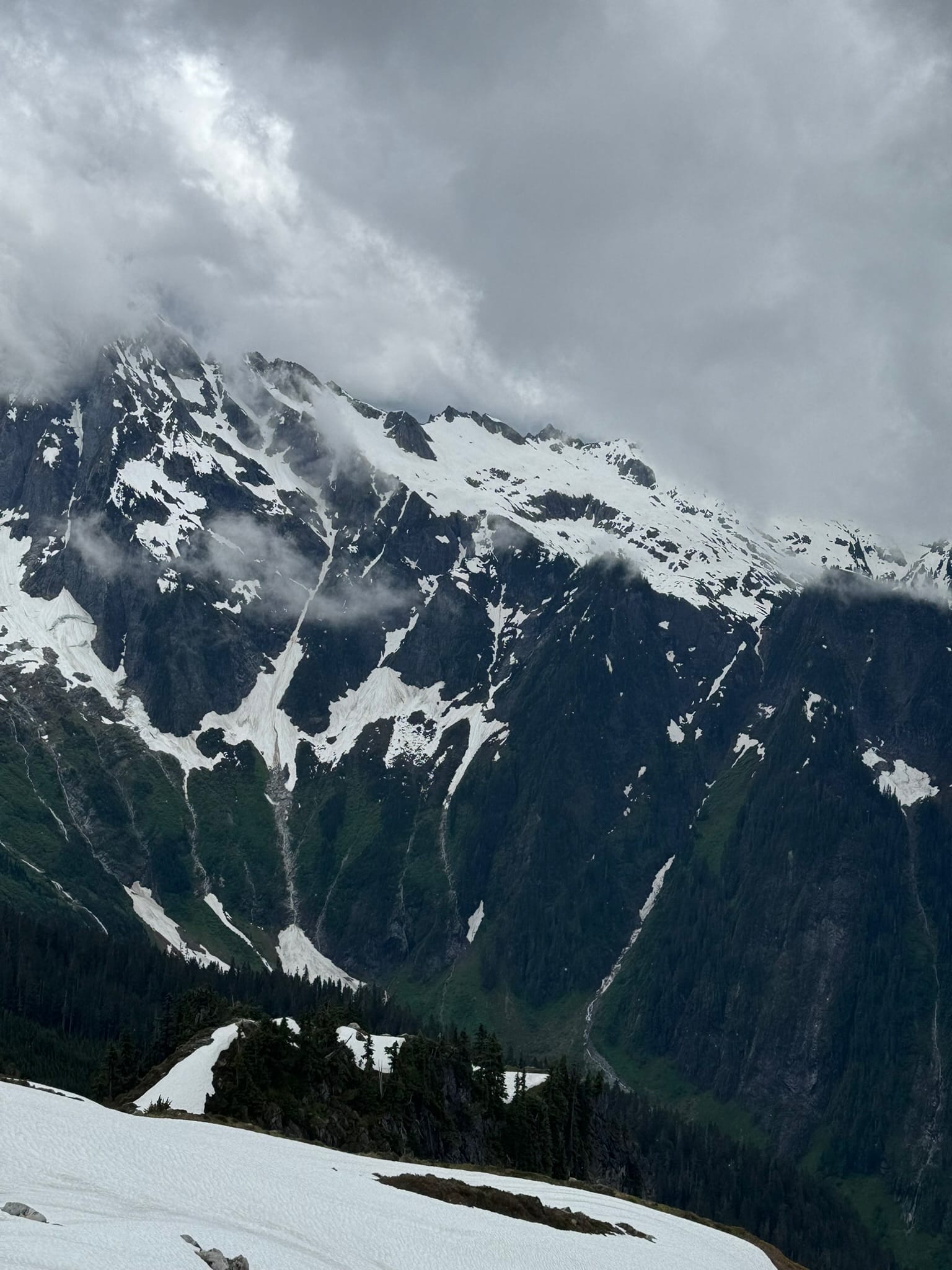
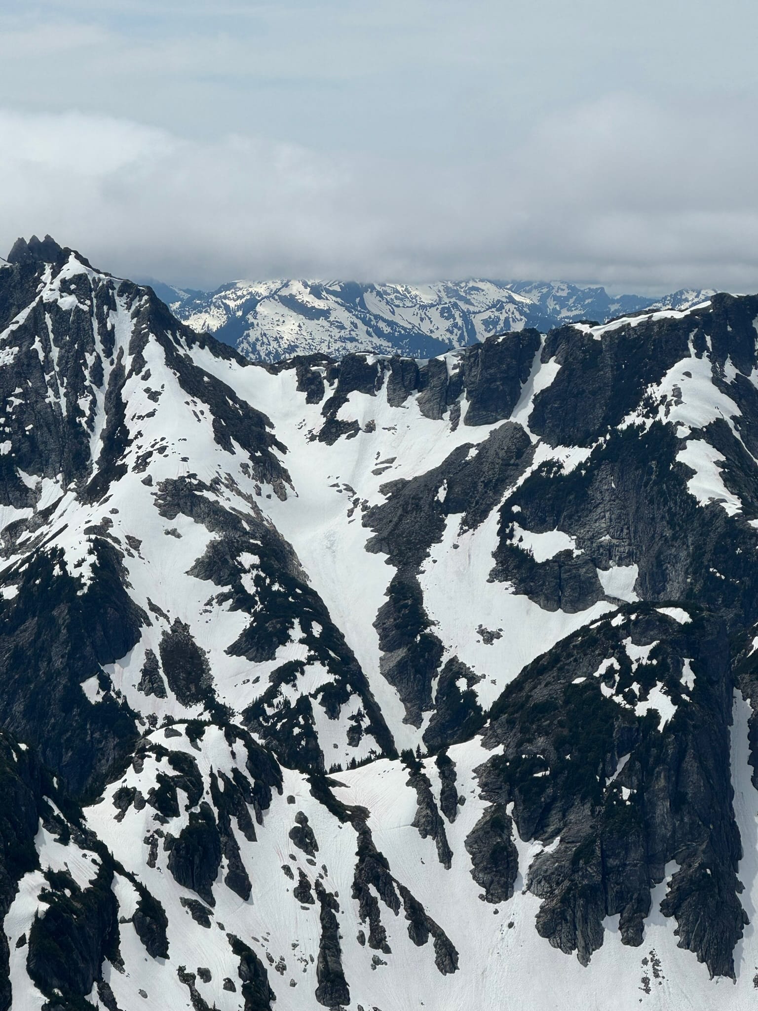
Eyeing the time, our weather, and our ambitions. We moved down talus toward a snowfield on west arm. Then downplunged the north klawatti glacier. A giant beautiful ragged wall faced us, with amazing streaks of volcanic dykes and multi-colored hues. I loved staring at this wall. It gave me thing tingles.
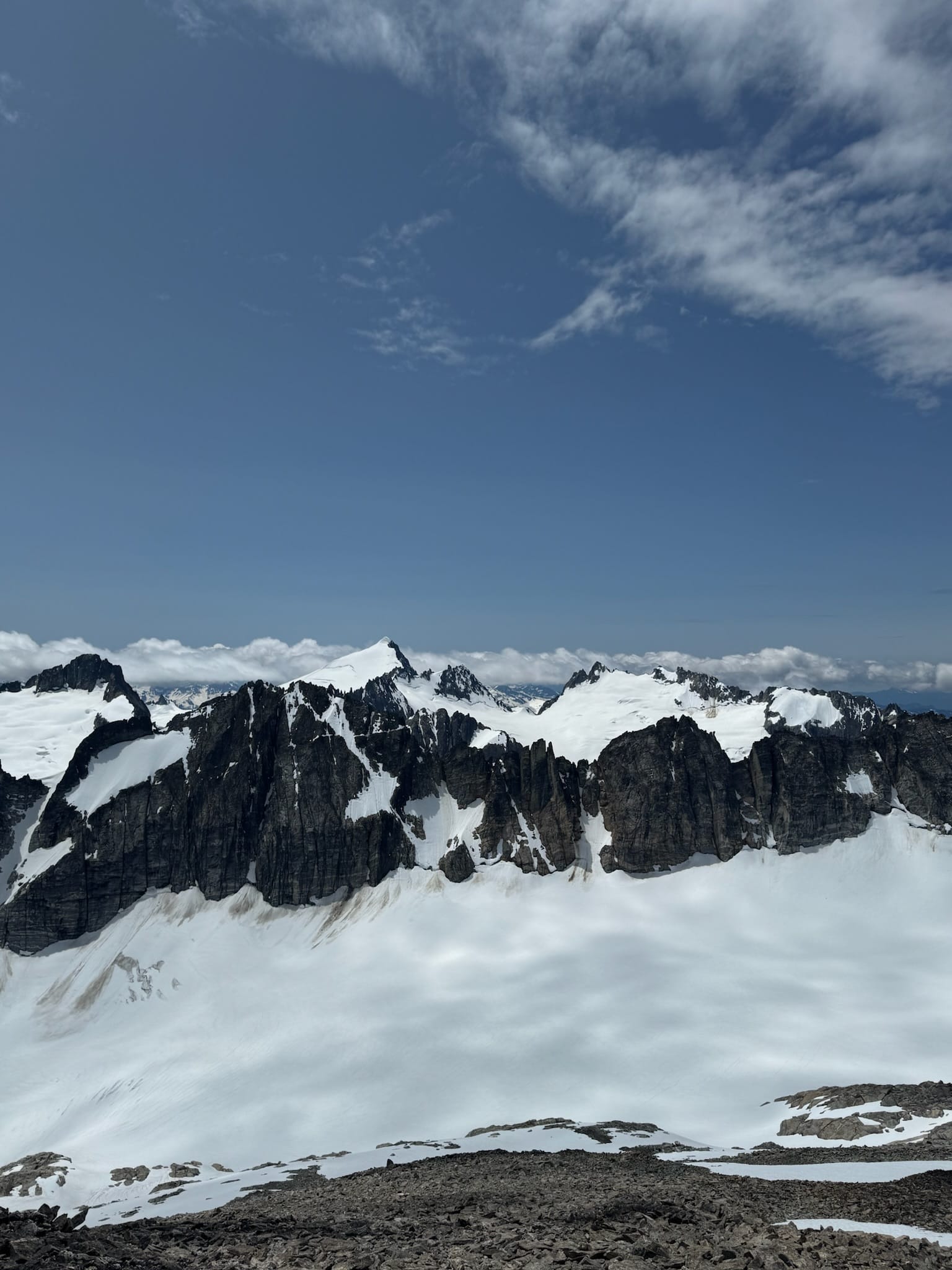
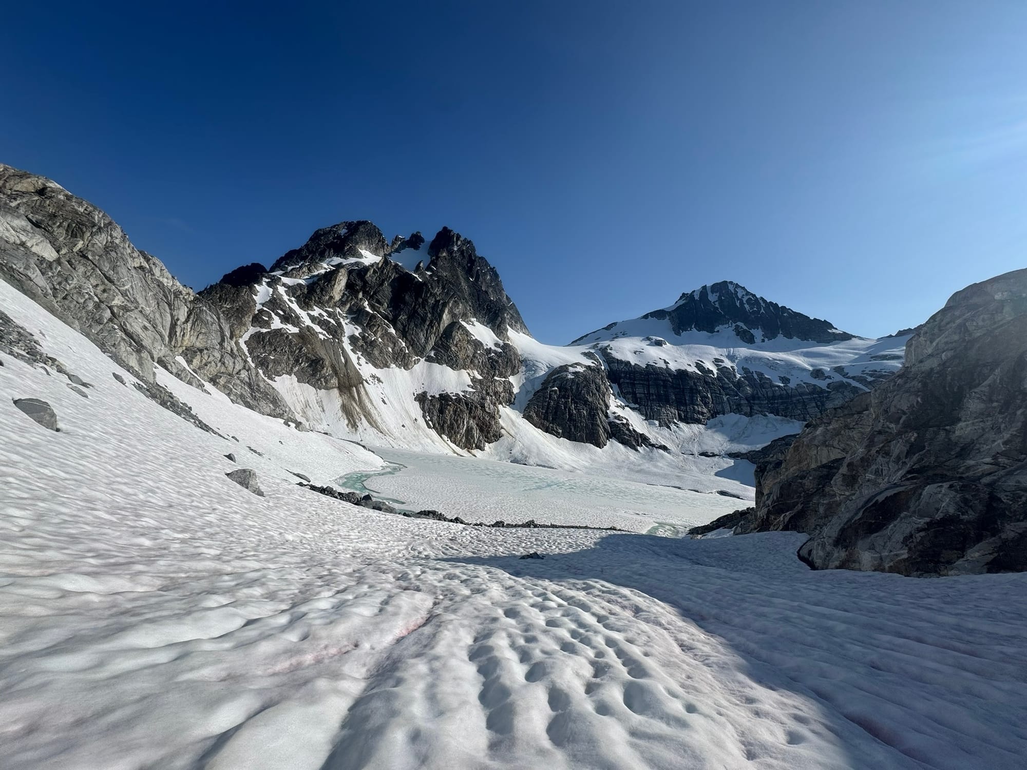
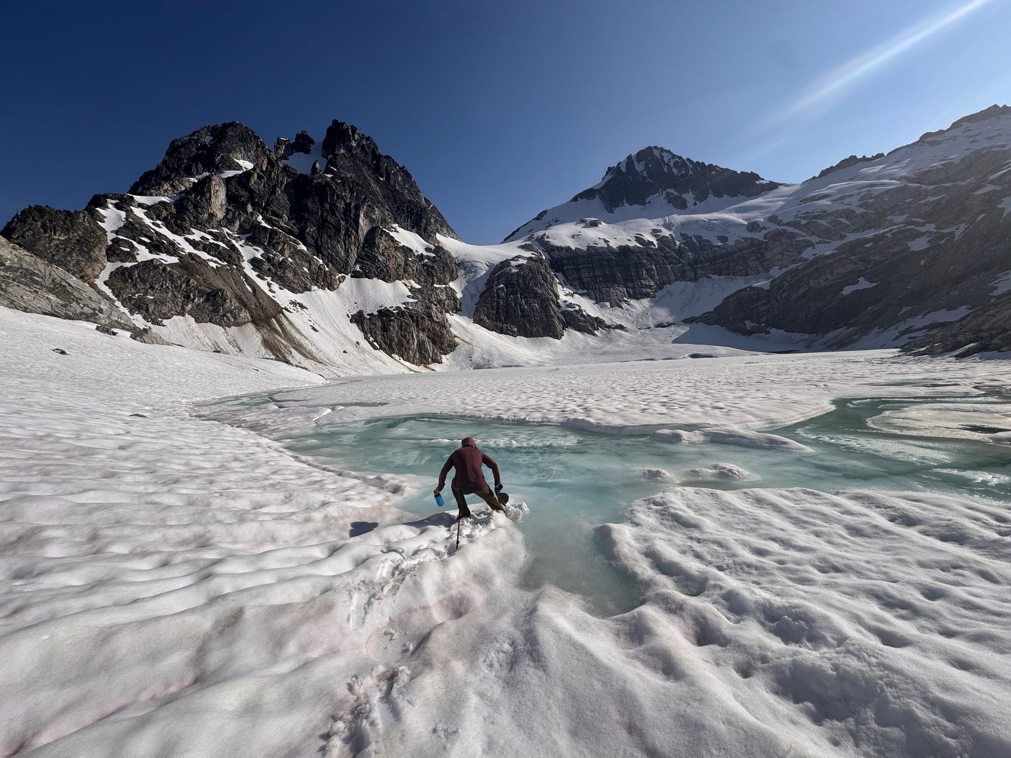
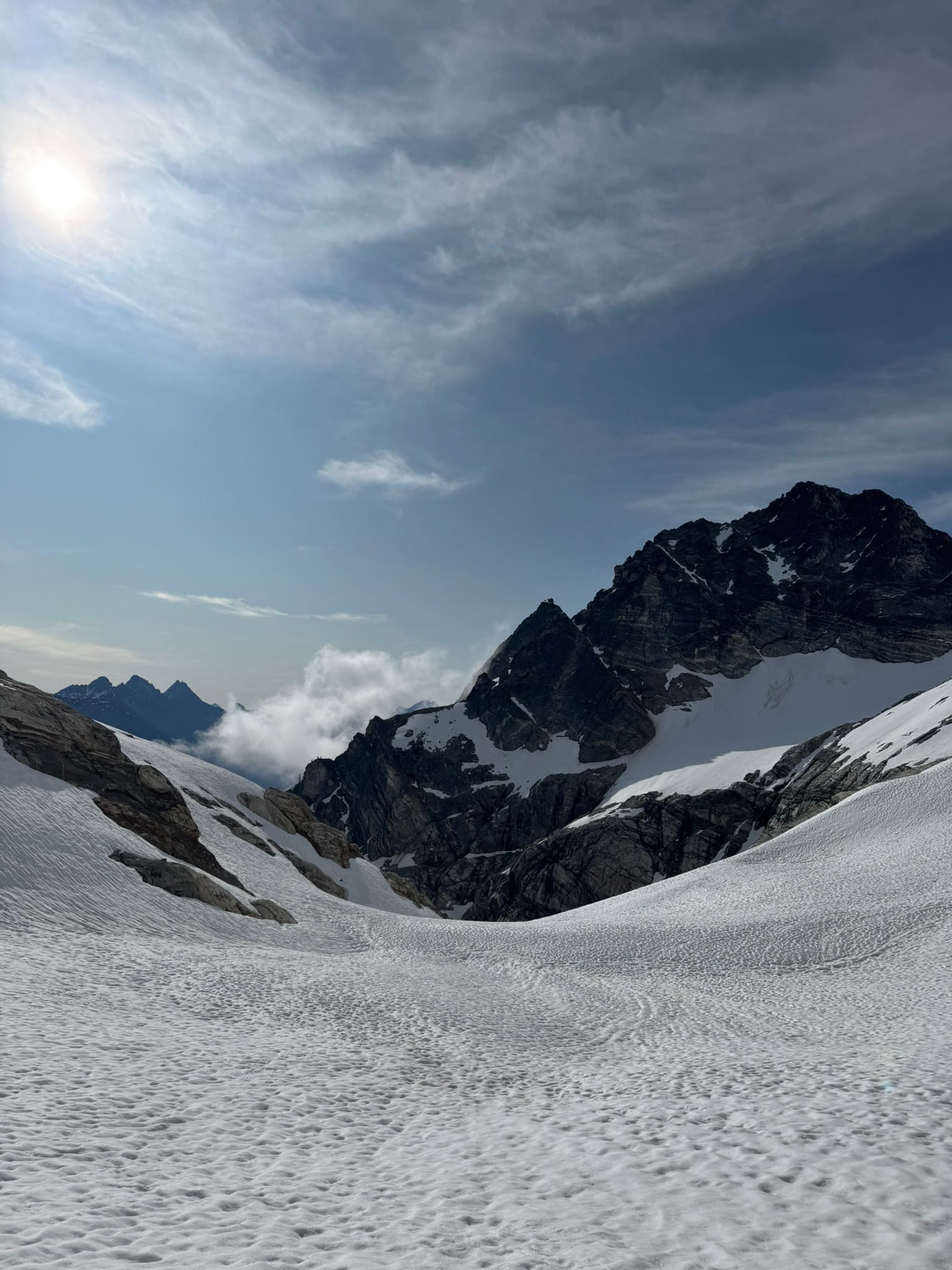
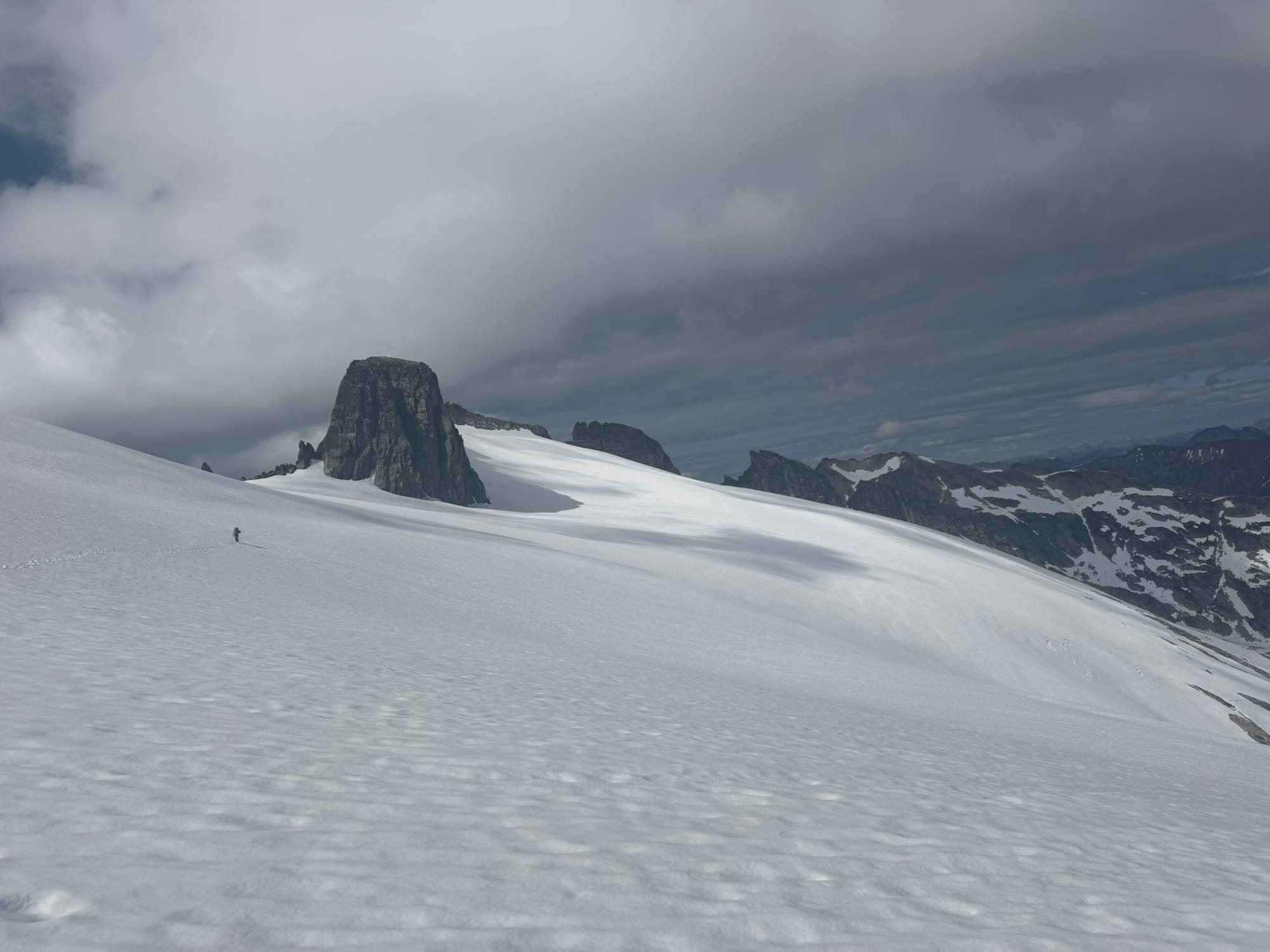
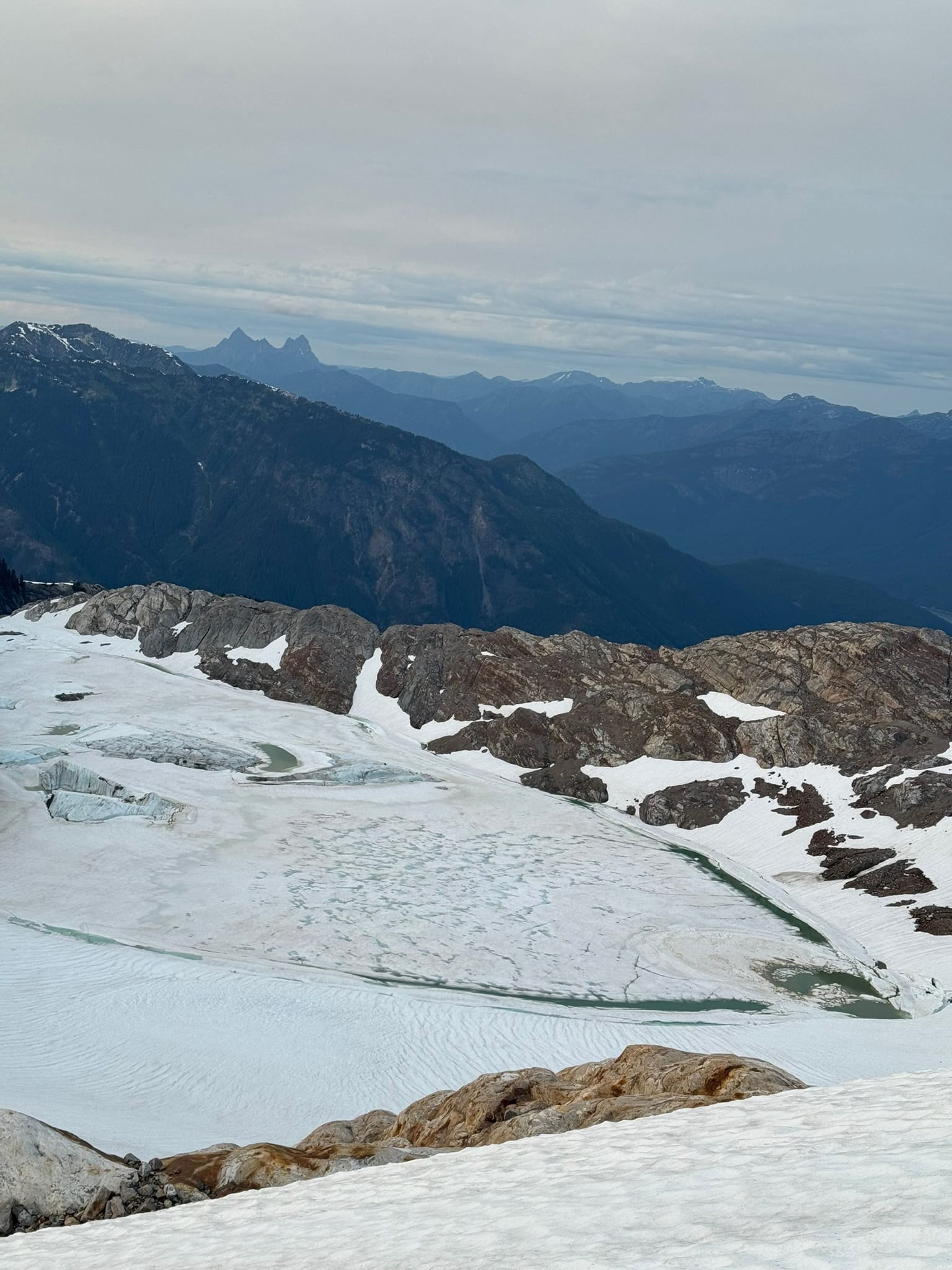
And then we were on a fucking glacier that was so big, we would spend hours on it. One popular peak, Austera, sat in the middle of it. Water sources were plenty with the exposed rock & snow melt, which we stocked up on. Crevasses were very dodgeable or just cracks. We continued under and around the rock rib, in awe of the majestic Klawatti lake below, the glacier around us, and the towering wall.
We turned the corner onto steep snow and paused at a rock outcrop, regrouping with views of Forbidden behind us and the incredible Klawatti glacier ahead of us. Shaina had been here a few weeks prior on a climbing trip and pointed out her and her friend's route.
We started steeply toward austera, before veering to side hill toward Klawatti.
Under an unnamed arm of Austera, we hit chunks moderate-angle blue ice that everything slid off. This lasted maybe 200 feet and we slipped around but kept our footing. We moved along a clear bootpack to the notch between Klawatti glaciers, under Klawatti peak. The snow to rock here is a moat aside from a shrinking finger that connects them.
Our up climb was straightforward thanks to this stable snowfinger and good handholds for a few moves to the notch.
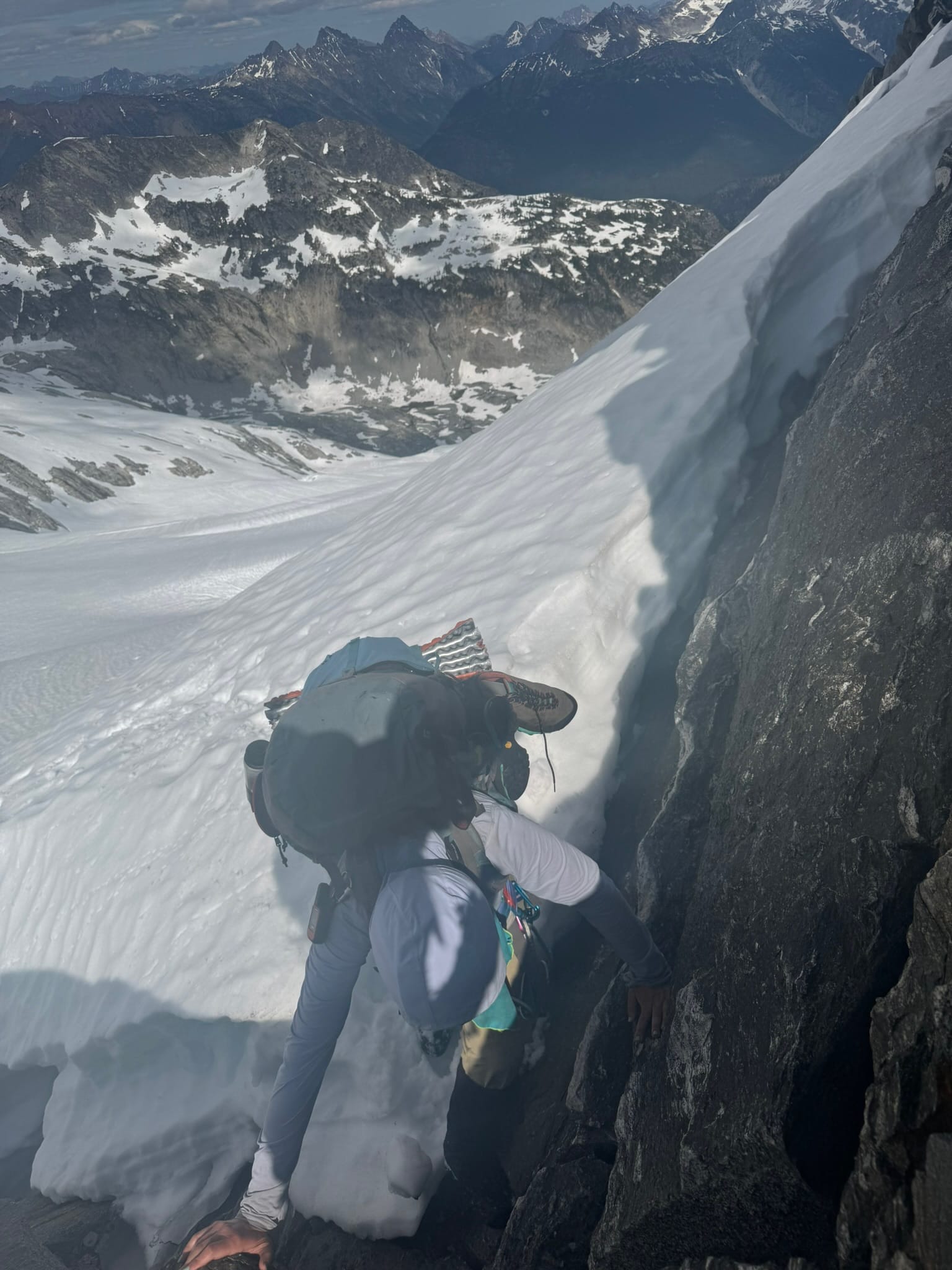
It felt right on the next side to do a butt puckering leap of faith. I like to keep upping the adrenaline, and in this case, other than the jaws of a gargantuan moat that spread along the toothy rock backbone, had a lip of firm-looking snow that we could land on and expect to probably not slide off the side into the moat. Shaina said "ok we're jumping then," as I stood down below where I had jumped. I opened my mouth but nodded with a smile and got one of her "OK's".
We celebrated the thrill, before pulling up out of the lip and onto a view of the McCallister glacier, which was another holy moly moment of awesomeness.
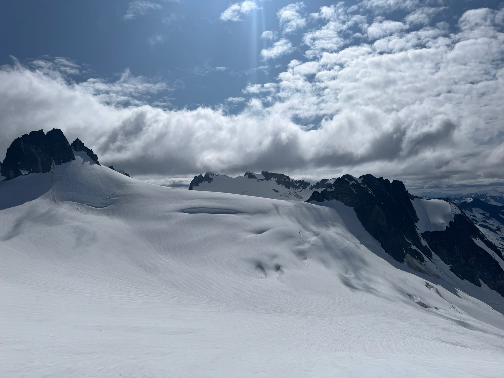
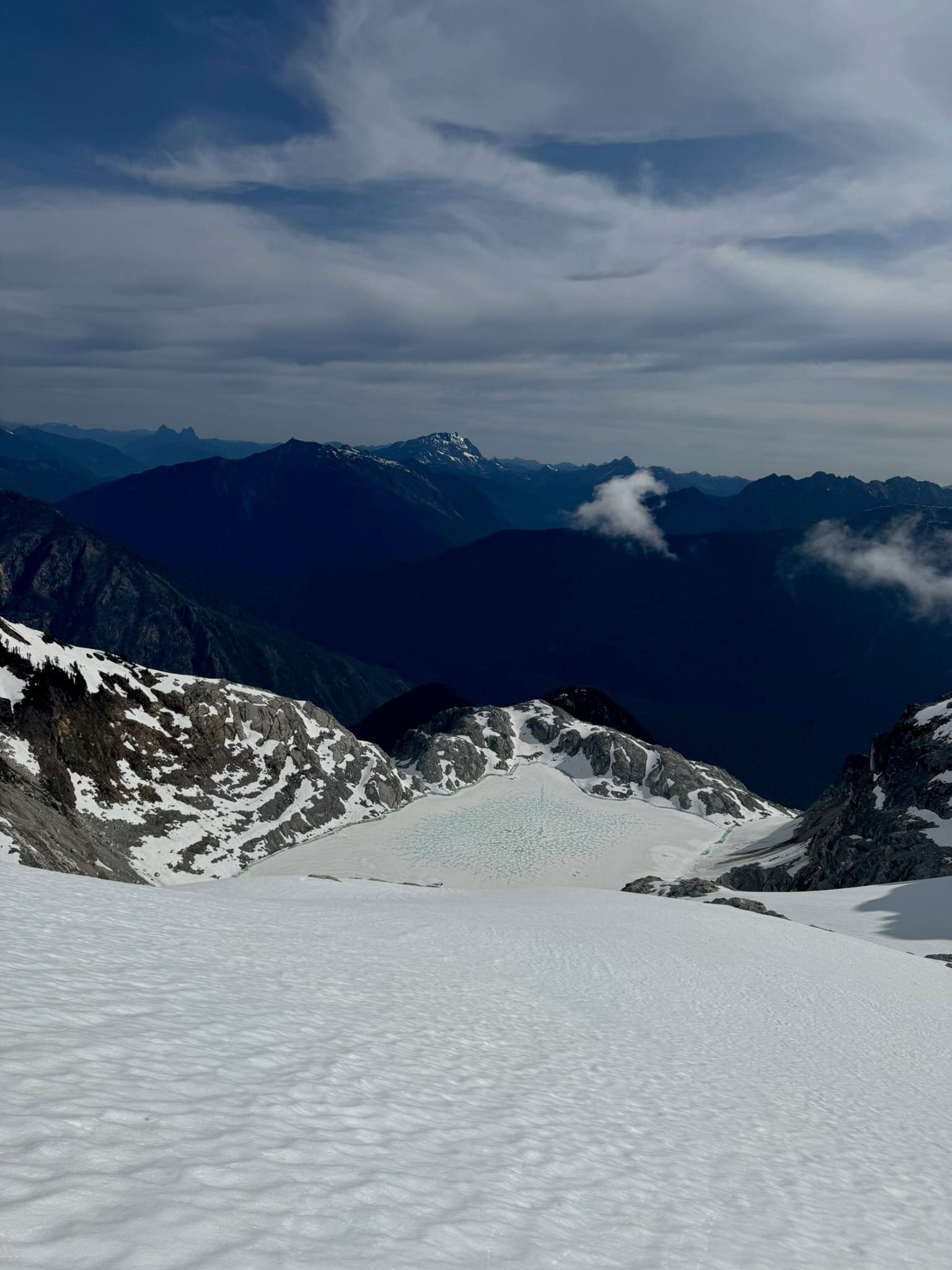
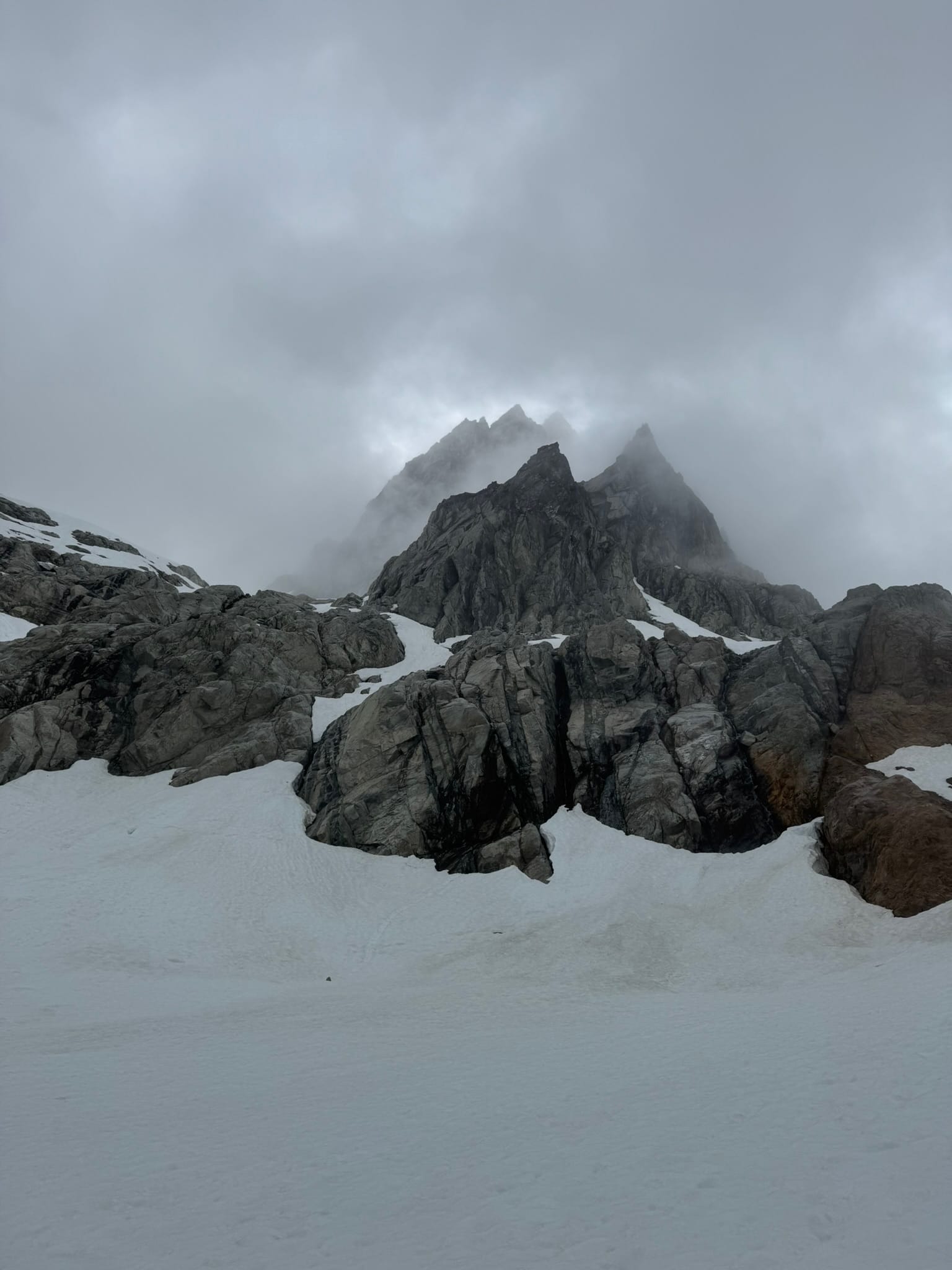
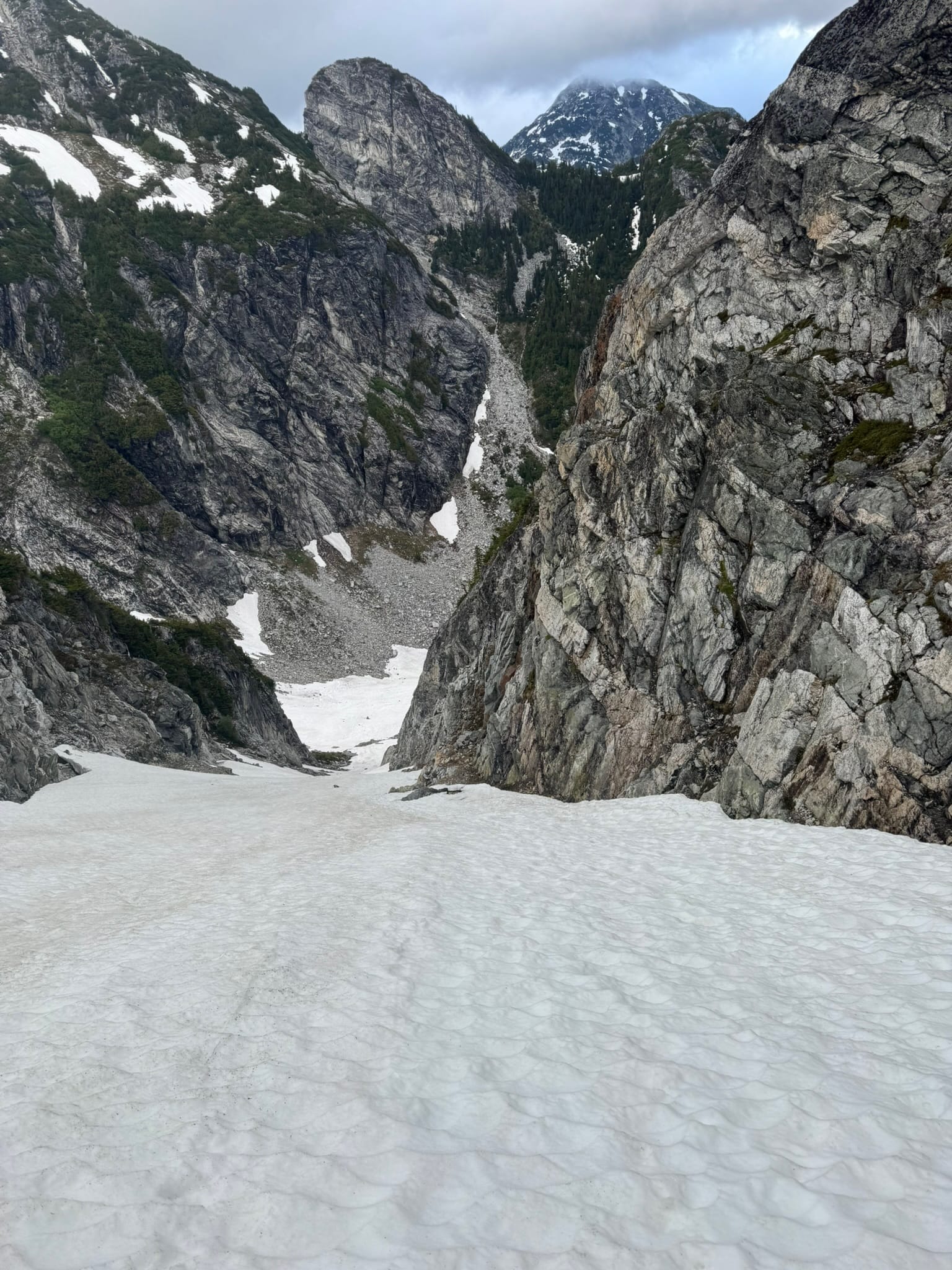
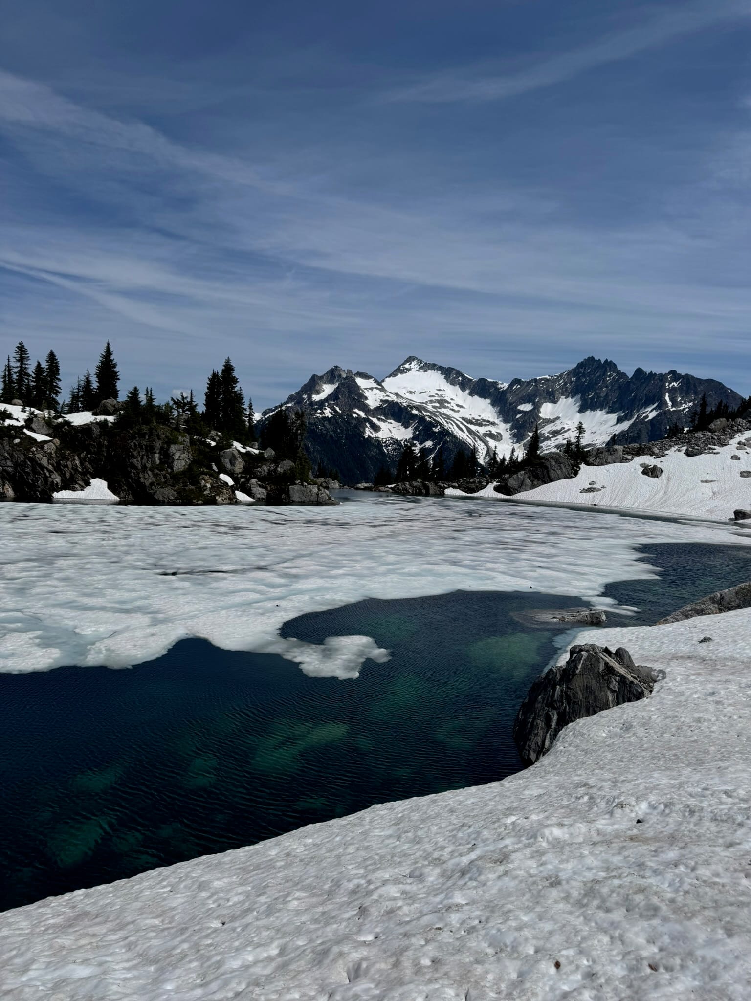
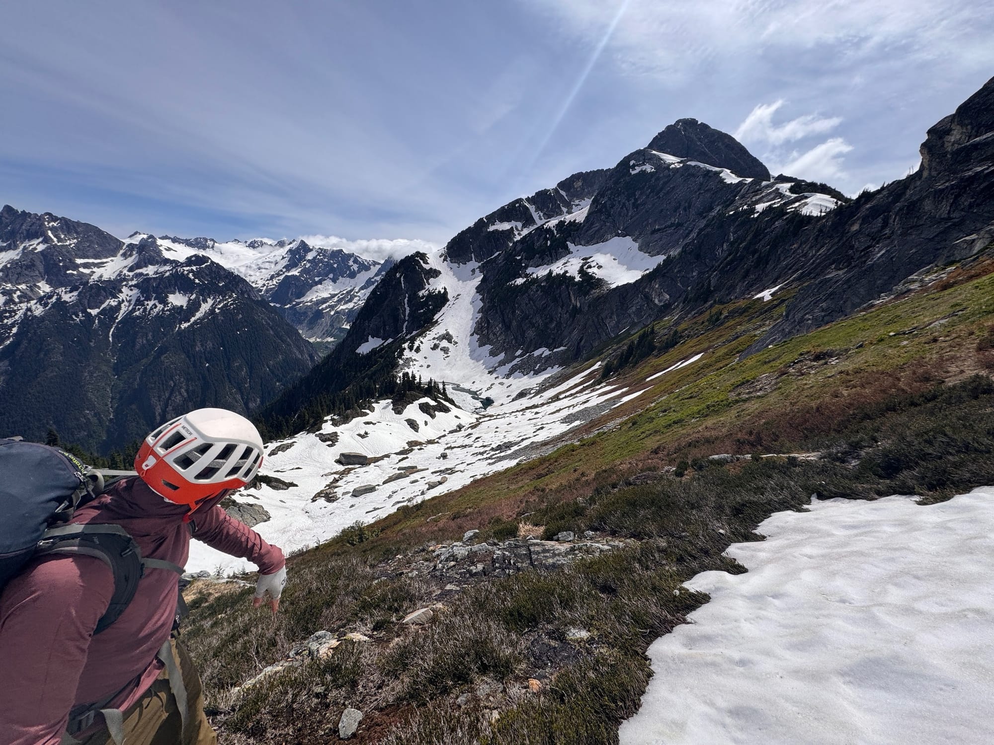
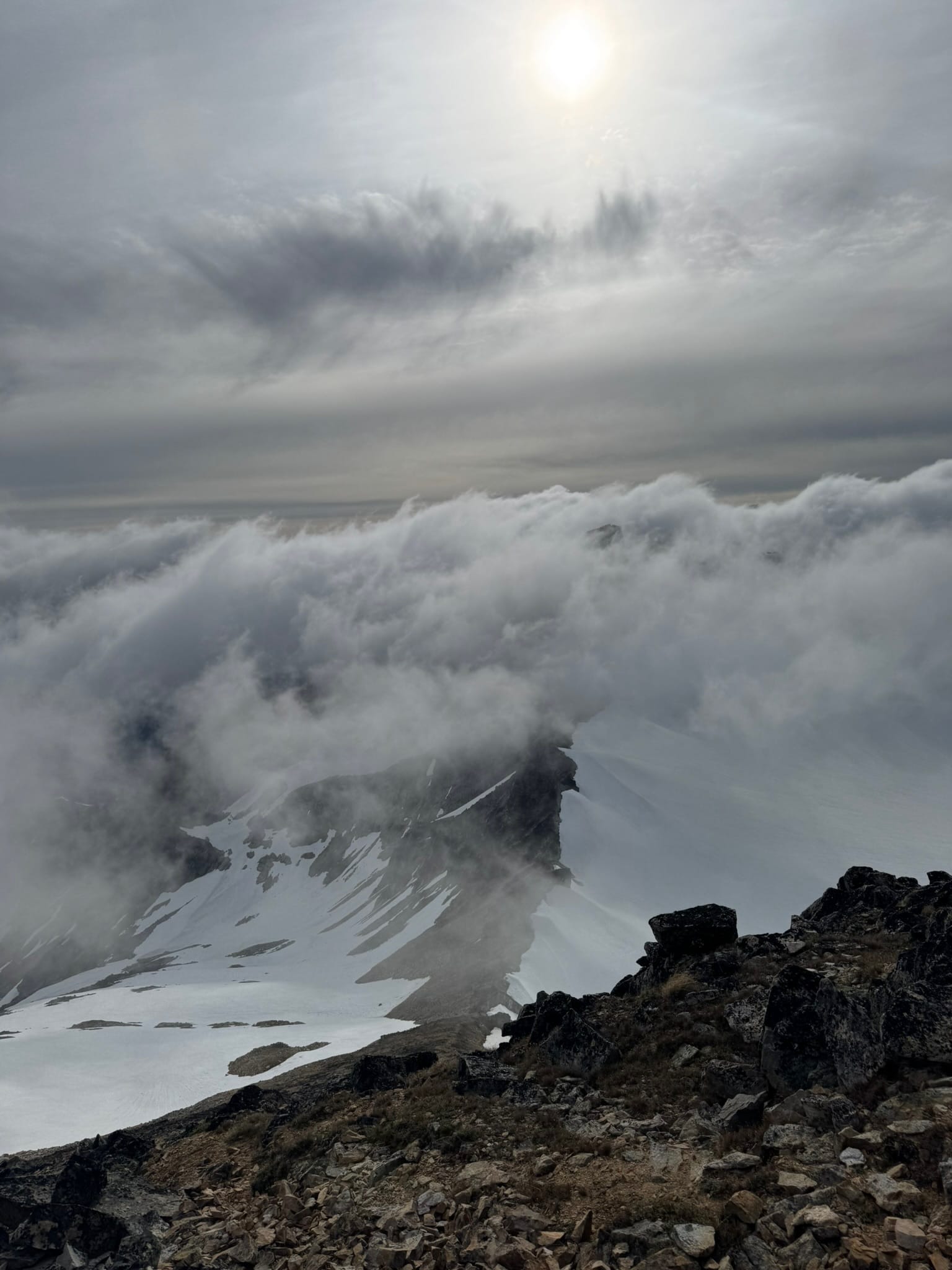
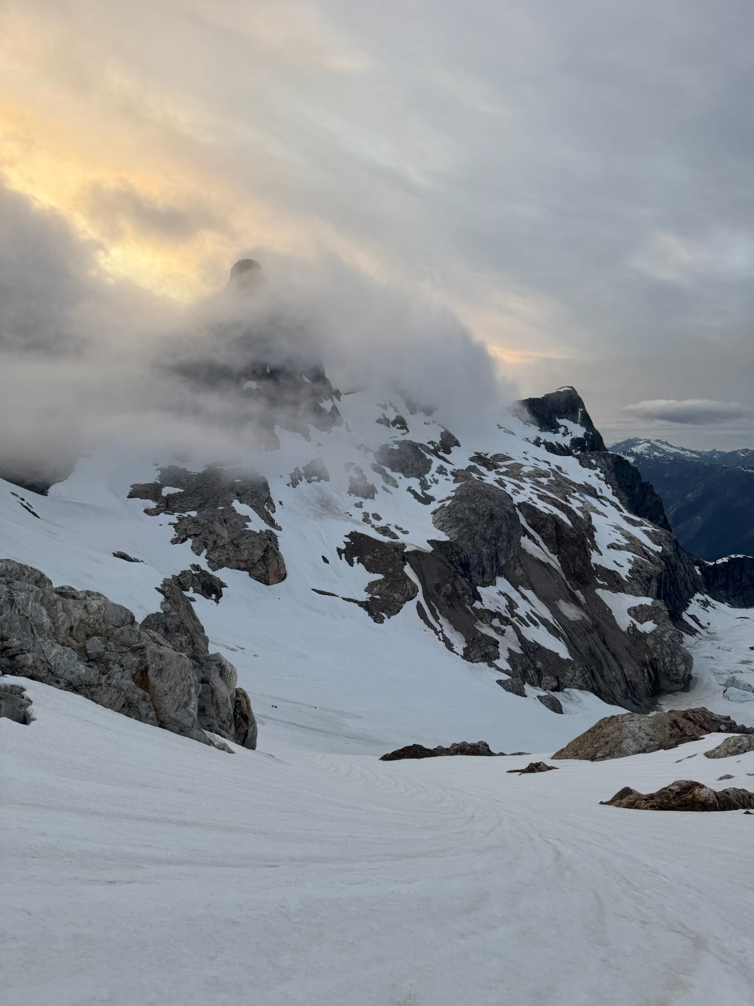
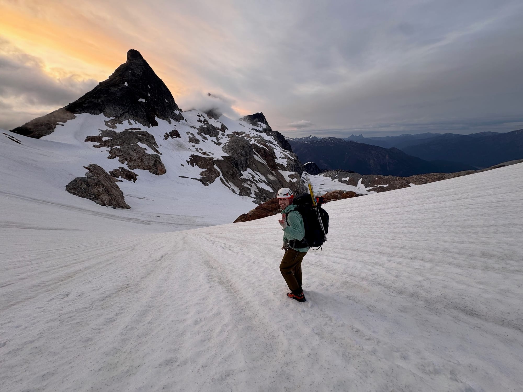
There were some boottracks on the glacier that disappeared - I wondered if that was for us (it was not). We plunged down and around the awesome Klawatti peak to Klawatti col. Signs of small rockfall kept me moving. We worked past a now-exposed rock wall & platform under the descent from Klawatti where we expected to camp to a rock outcrop that gave us oh shit views of El Dorado, Inspiration Glacier, and Forbidden Peak. We took a very late lunch and discussed making it to at least our col between Tepeh towers and Dorado Needle, but decided it was too much ambiguity while we had a camping platform here. We setup camp and enjoyed our probably most normal dinner, just out of the wind with sweeping views of Forbidden, El Dorado, the Klawatti glacier & lake. An absolute stunner.
Night 4 - Wednesday, Klawatti Col to Wilcox Lakes
9.23 mi , +2,880ft, -5,346ft, min elevation 5,013ft
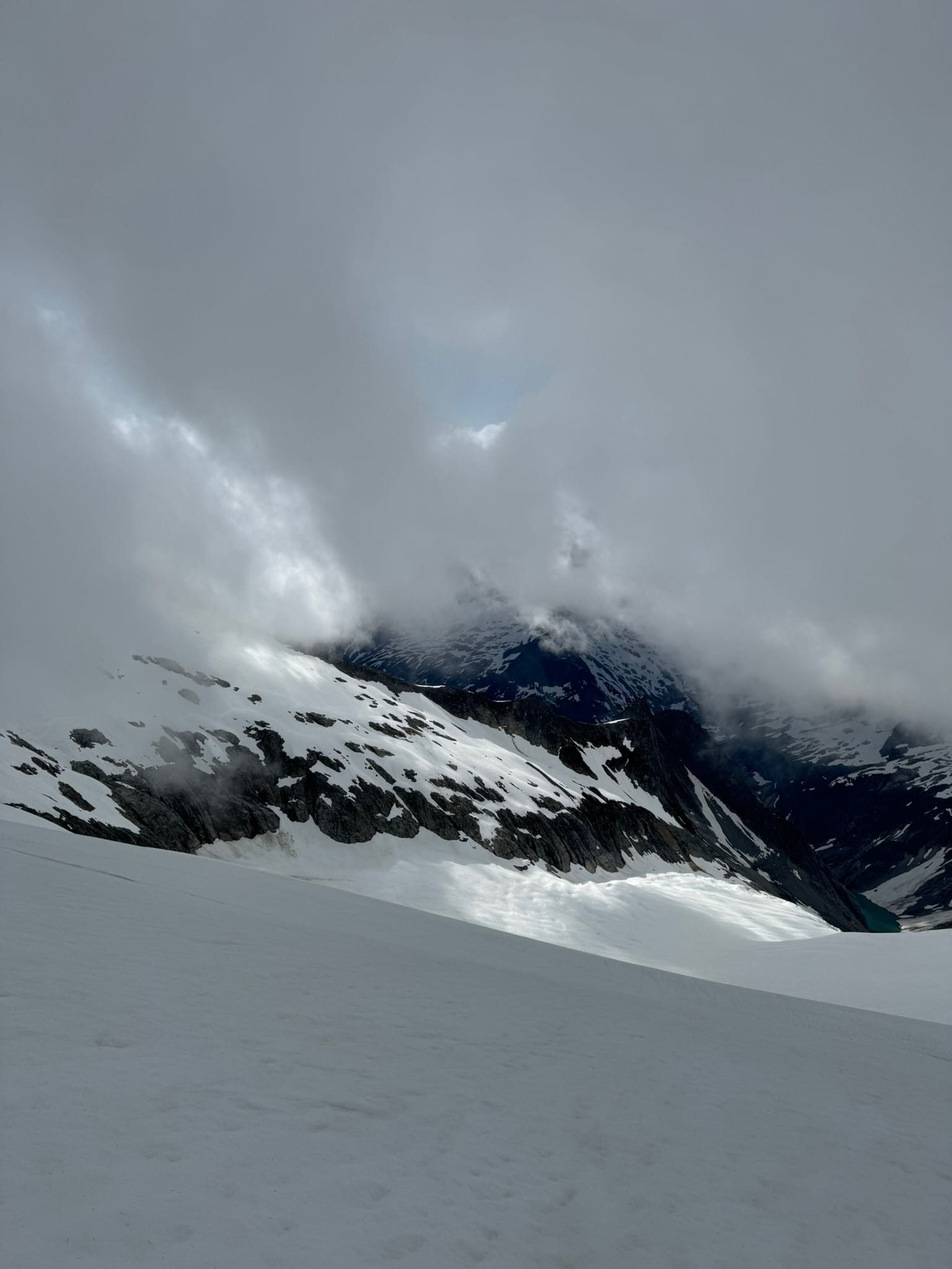
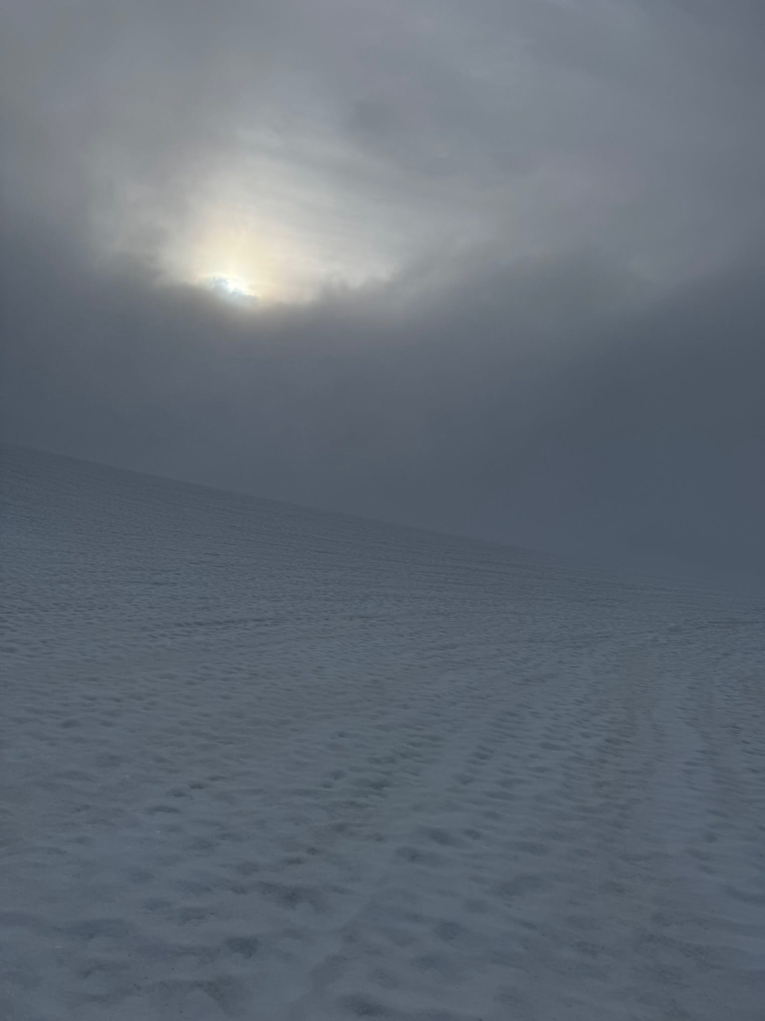
We woke knowing we had a bad weather day ahead of us. We poked our heads out of the tent and noted with a groan and glee that precipitation had not started and visibility was overall decent for seeing the important features, if shifting around. That meant we had to get out of our sleeping bags.
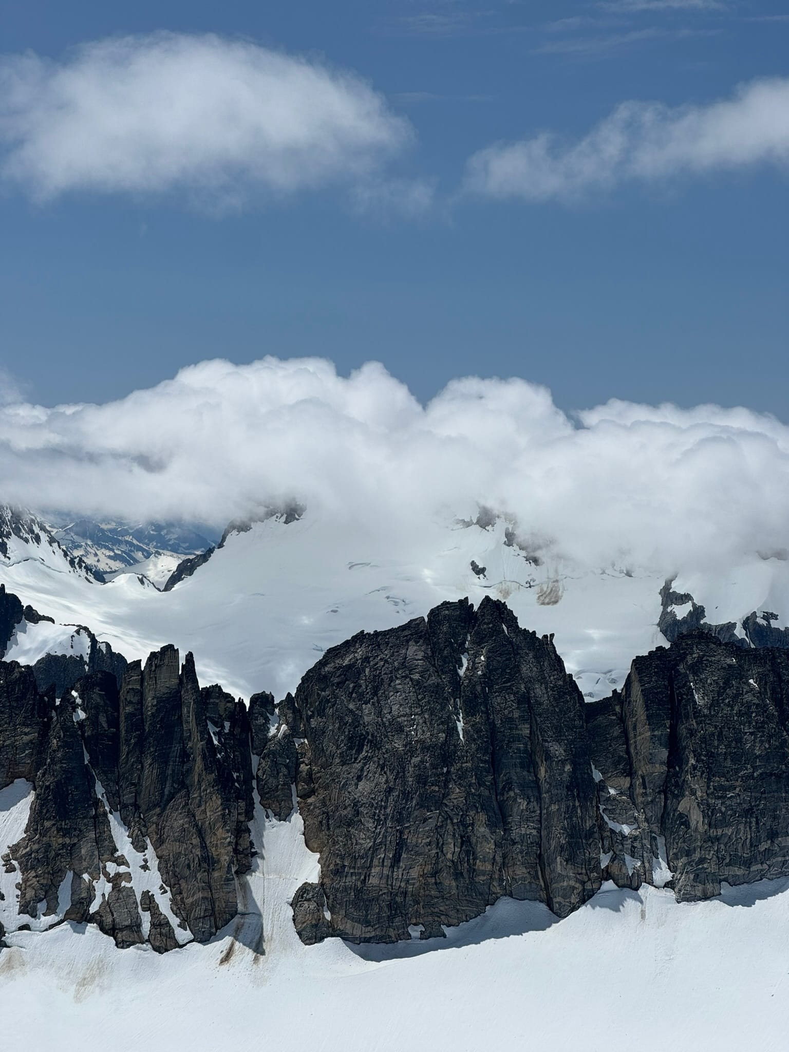
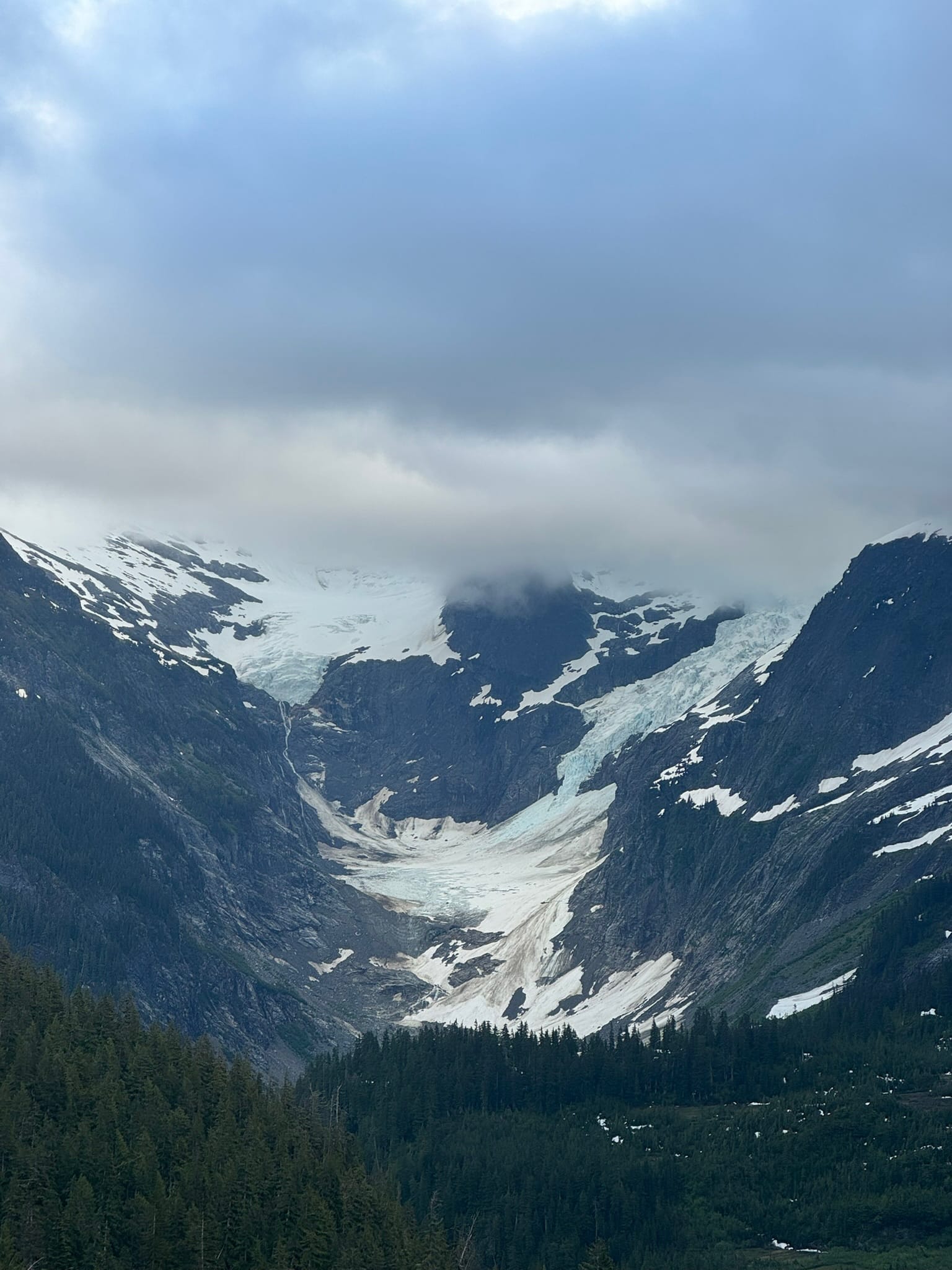
We left in majestic partial clouds that added so much magic to our morning as we moved along toward El Dorado peak. We turned around in awe at where we were, with the El Dorado glacier's blue maw opening before us and Forbidden Peak, and Klawatti/El Dorado Glaciers shifting in and out of cloud & sun like giants playing peakaboo.
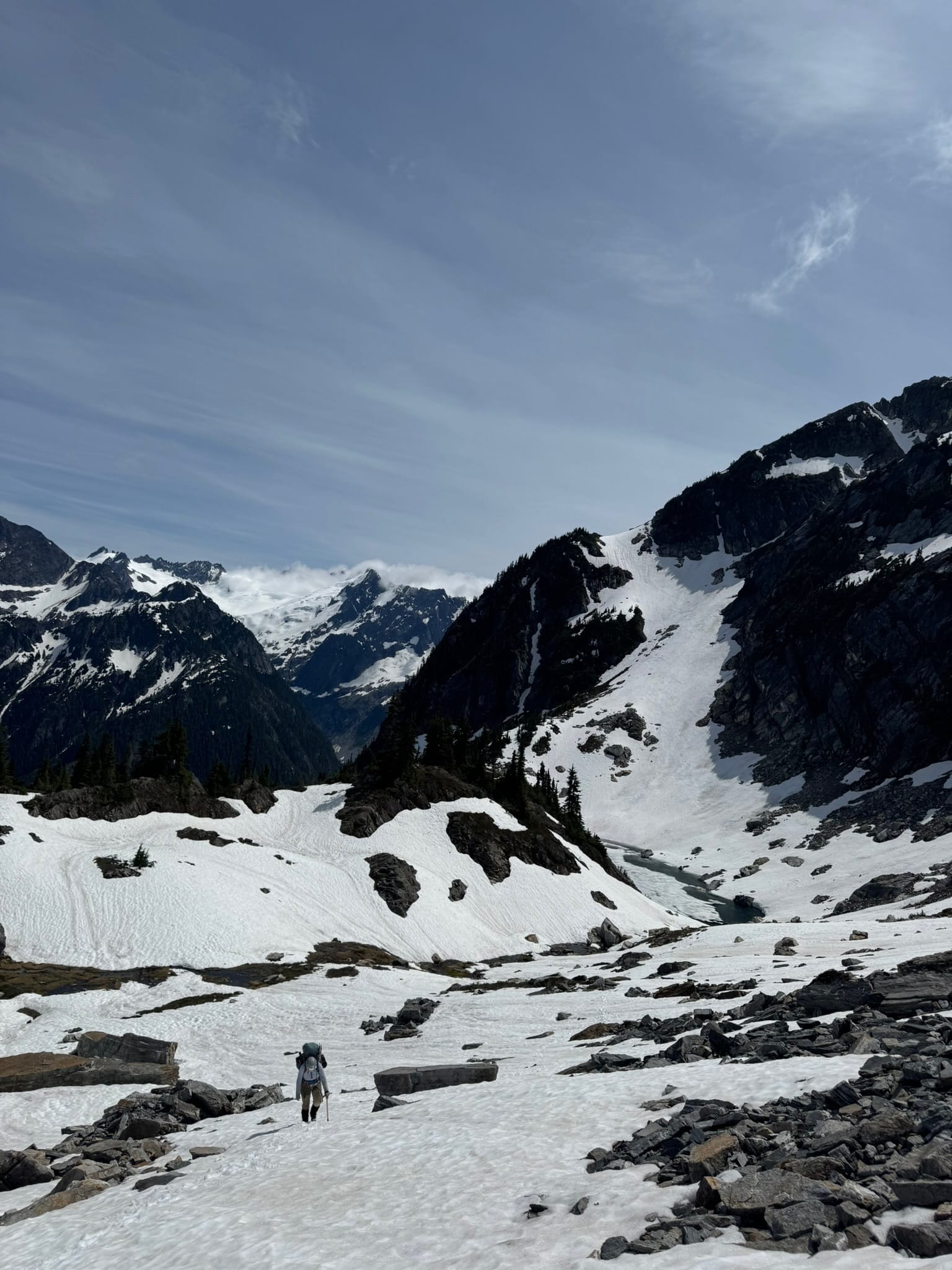
The light that shifted across their features made them look mystical. We went over a saddle onto McCallister, where visibility plunged. On our right was a gargantuan bowl of snow. We turned westward and away from that, pausing to look at our map before noticing a giant wall of blue ice staring us down. We breathed in at this, then moved on. We passed a hole with blue ice at the bottom that reminded me of the Sand Worm Pit in star wars. We plunged onward to a col in between Tepeh & El Dorado. I wasn't sure about this col or a col around the other side. A theme of the trip was that we had gathered too many maps from too many modes of transportation and too many types of topos. We pulled crampons off after I determined this would go. The first section was 40ft of shit wet dirt gully, with nice handholds. Unfortunately ice hid under dirt for the last 8 feet before a snow finger that led to our next glacier. With some coaching, we both made it.
Weather held & we plunged down the snowfield, eager to have straightforward travel. Some massive rockslides occurred in our general area. We shook a bit as we could not see it but could tell it was nearby.
We later found it and saw had our timing happened differently, we might have been in trouble, including a different fall that occurred as we exited this area & landed just where we had been. Clouds shifted, across magnificent steep green-hued walls in front of us and pointy triangular peaks above us.
We tapered to our right underneath buttresses. At a rock arm, we struggled to find the cross-over between the basin we were in & the backbone ridge. I went up a very steep snow finger to a notch and noted that, while I was on a massive cliff, the trees just under the rib were a walk off. As we found it, in steep heather & snow that punched through, The Rain caught us. We had a quick cozy break in a copse of trees while this first wave settled down.
The next section is named after spinal things. I did not believe it the first time I saw it on a map.
We spent many hours traversing the southside of Backbone in rain & sleet. We also had moments where the waves broke and beautiful broken cloud and light filtered across the valley. We took few breaks to stay moving and warm. We managed our spirits as we seesawed up and down with numb feet and hands. I was obsessed with staying between 5800ft and 6080ft. Shaina's patience was on full display as I asked very frequently "what elevation are we at?"
We thought maybe we were stuck in purgatory, or a liminal in between space, before many hours later we made it to the saddle under the Coccyx. Pelvic structures sure can be exciting.
We took a steep but manageable dirt & tree path, swimming through cedar, to get to the snowfield up top.
We cut across under the Coccyx itself, trying to navigate in the fog.
I exclaimed at the manager not providing us better visibility in steep plungey snow, when I got what I asked for - a break in the clouds, I yelled in excitement. We subsisted on talk of how cozy our tent would be that night. At one stop we shared the enjoyment of our feet moving in the lakes of water that we stored in our boots.
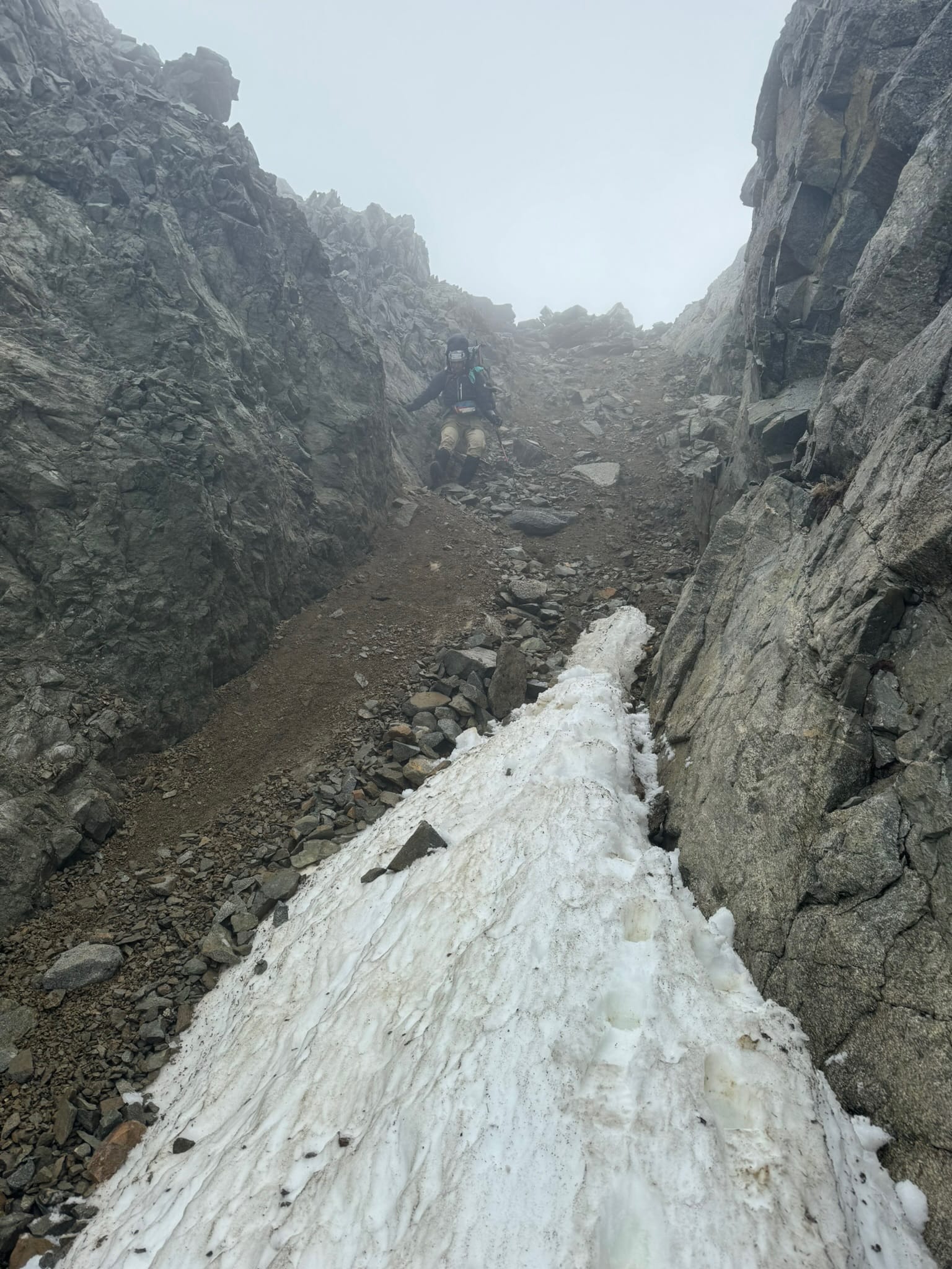
We payed our penance and made it to The Steep Snow Ramp fabled in all trip reports. Without much fanfare, we plunged down, giddy to be turning the literal corner.
It got very firm in a few spots, but we kept going. Shaina showed off her awesome ice axe skills on an occasion. After a bit of a teeth clacker of an ending, we sat on a rubble pile and chat about what was next.
We bemoaned the steep wall in front of us, but repeated our mantra that things lay back, right? We decided that we would move up the wall and get to Wilcox Lakes instead of trying out a visibly possible camping spot below. The bowl we were contained beautiful walls and gave us beautiful views of the backside of the mcallister glacier. While we chatted about our route, it cracked and boomed and crumbled as we looked on, far enough away that the chunks of blue ice looked like a snowcone that spilled out.
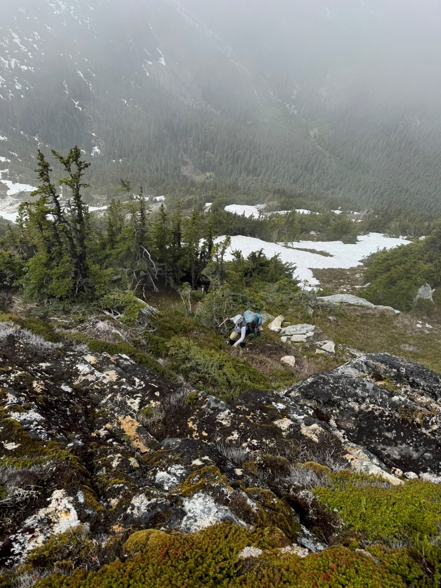
We moved toward the rubble pile in front of us and it did lay back mostly. Then we had a challenging series of steep upward heather and rock and separation between us that left us shaken. Shaina looked at me near the top and stated that the Shaina that started up the route was gone.
After some tense moments, we regrouped and moved.
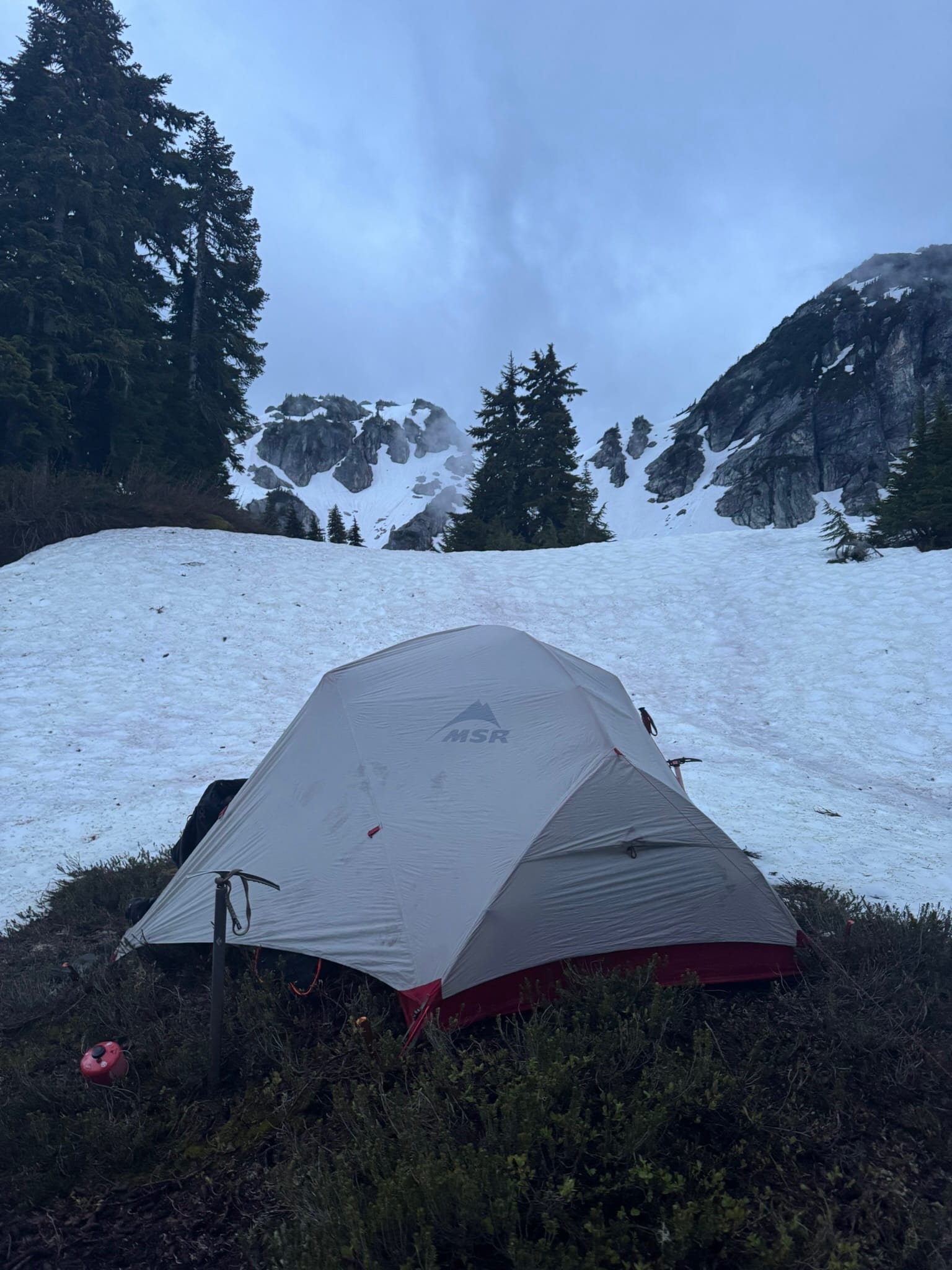
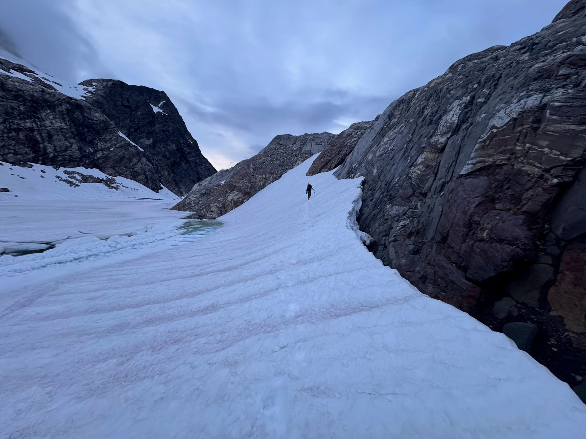
Feet from the top, I noted we were a little off route. It looked challenging to swim through the trees to a saddle that we had ended up above instead of on. I swam up through 15 ft of scrub cedar and found a snow route to easily end up on the same snowpatch as the saddle. We fought up with our packs before exclaiming with Glee at the beauty of the lakes and potential end of day ahead of us. We took in the view of the wilcox lakes, still snowcovered, before doing a steep-ish snow plunge.
I scurried around to find a potential spot and we settled on a dirt patch that was flat enough to make the cozy camp that we dreamed of, happy to see the hues of one of the wilcox lakes as we stayed in our sleeping bags while making dinner.
Night 5 - Thursday, Wilcox Lakes to Colonial Lake Arm
7.85 mi, +4,635ft, -3,989ft, 13h 28m. max elev 8,268ft, min elev 4,852ft
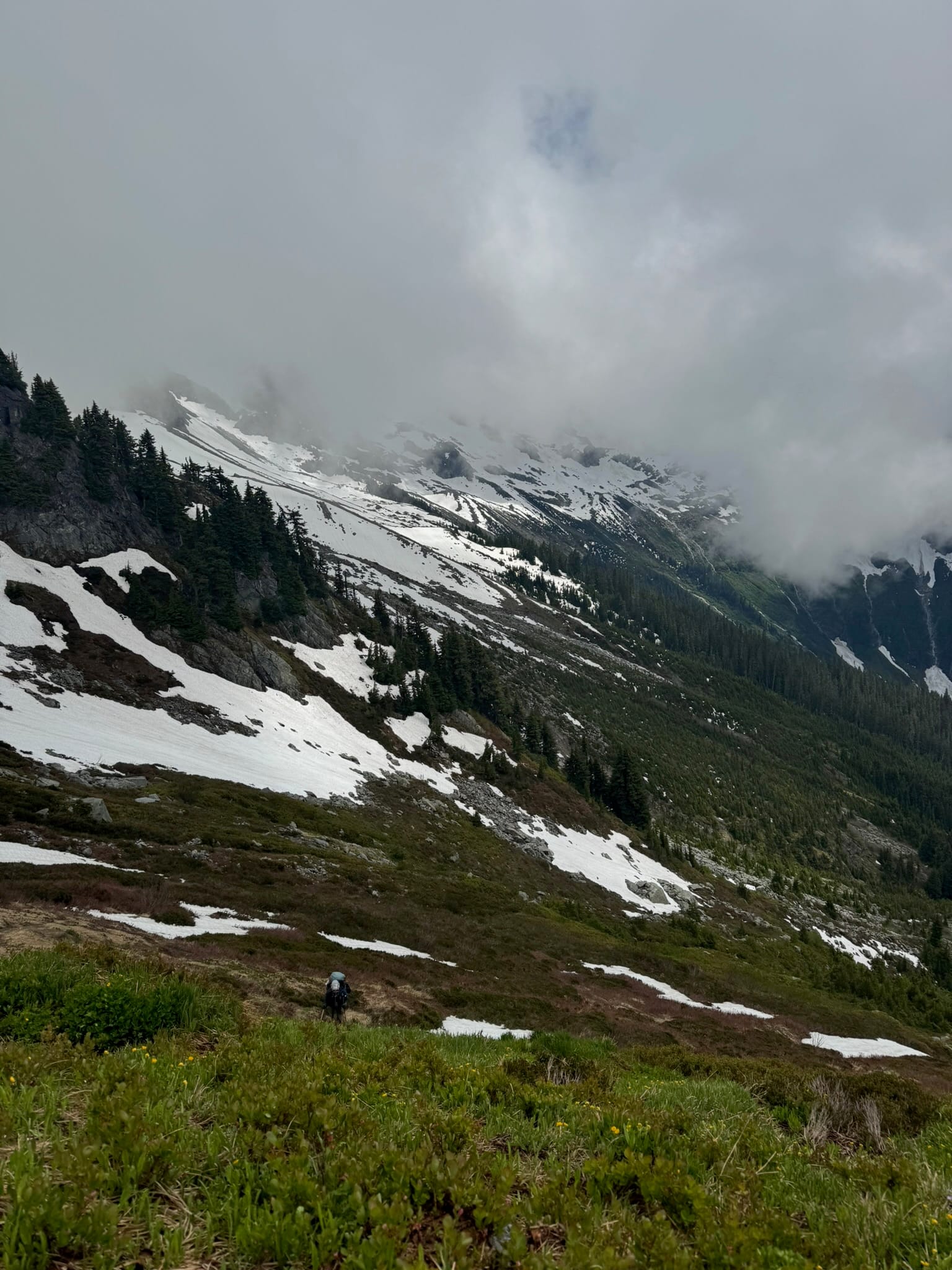
With a major slog behind us, we enjoyed a chilly and partly cloudy morning with the beautiful lakes under us and Isolation Peak, our first destination of the day, shrouded in fog above us. We left camp with high spirits and sprinted up to the Wilcox ridge up toward Isolation Peak. We decided if it de-fogged, we would carryover it, given some trip reports we had about the alternate route that sounded nasty.
We bobbed along the ridge of upper tairns above Wilcox Lakes, admiring as we gained enough vantage point to look out at the north-side Backbone glacier and backside of McCallister glacier and the coccyx ramp we had gone down the day before.
Our spirits were still high as we bobbed up through forest, on and off snow patches, and on a semi-consistent climbers trail.
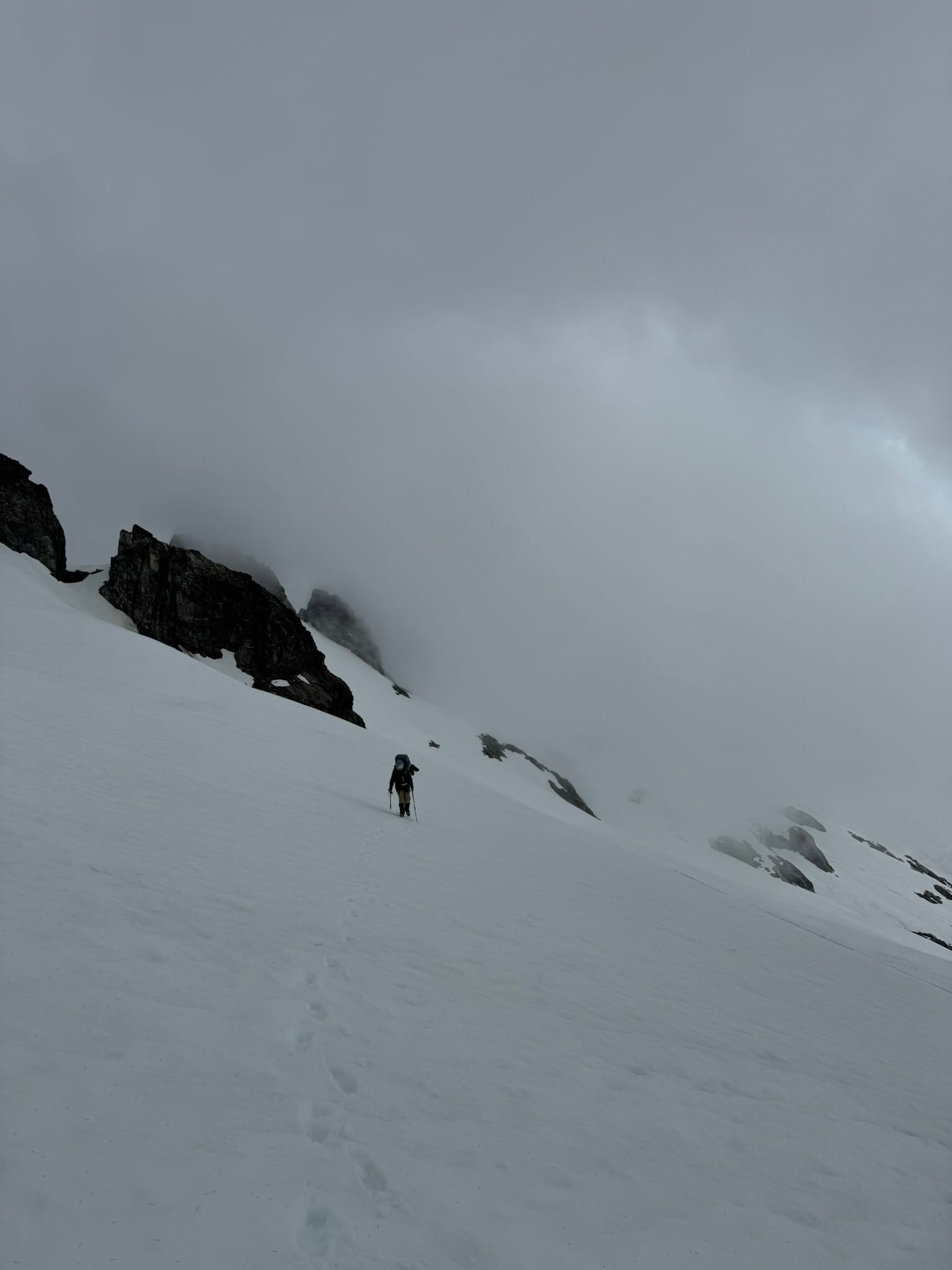
This eventually faded and was replaced by fresh bear track in the snow. Sometimes these tracks were comically angled where the bear had obviously slipped. Without a concrete route, we started Intense Navigation Mode. We broke down our route into digestible chunks. We first decided to go up some snow ramps that steepened on the more northern part of the mountain.
We kept crampons on and reached the foot of some steep heather.
There were narrow but doable routes up steep rockbands. Many of these from our vantage seemed protected by patches of trees. We kept going up. We took it one move at a time and guided ourselves on each handhold and foothold and exposure needs before moving forward. After many hours of this, the terrain began to lay back and we eventually pulled off our crampons and walked up to a summit where the sun burned away all fog. We had holy shit views of the backside of the Inspiration mountain range. We mapped out the Wows of where we had been just days before and how far we had come.
We enjoyed treats and a long lunch at the summit. We were so excited to follow a more standard route that all of our downloaded maps had taken and began our descent in good spirits. We followed isolation's ridgeline to the south...Then things disintegrated. We tried to follow the ridge but it grew outside our capacity for exposure. We had to back track a few times up and down small sections of loose rock just underneath the ridge before making some outward facing rock moves before ending up on a mercilessly steep snowfield. We realized we were too high up and we went back around.
We exclaimed that the route gods had forsaken us. What stopped things in the deep wilderness from just playing along?
We dropped from here on an almost vertical snowfield with rock below that claimed us both in terms of slipping.
Ice axe arrest skills were key here as were temper tantrum reduction skills.
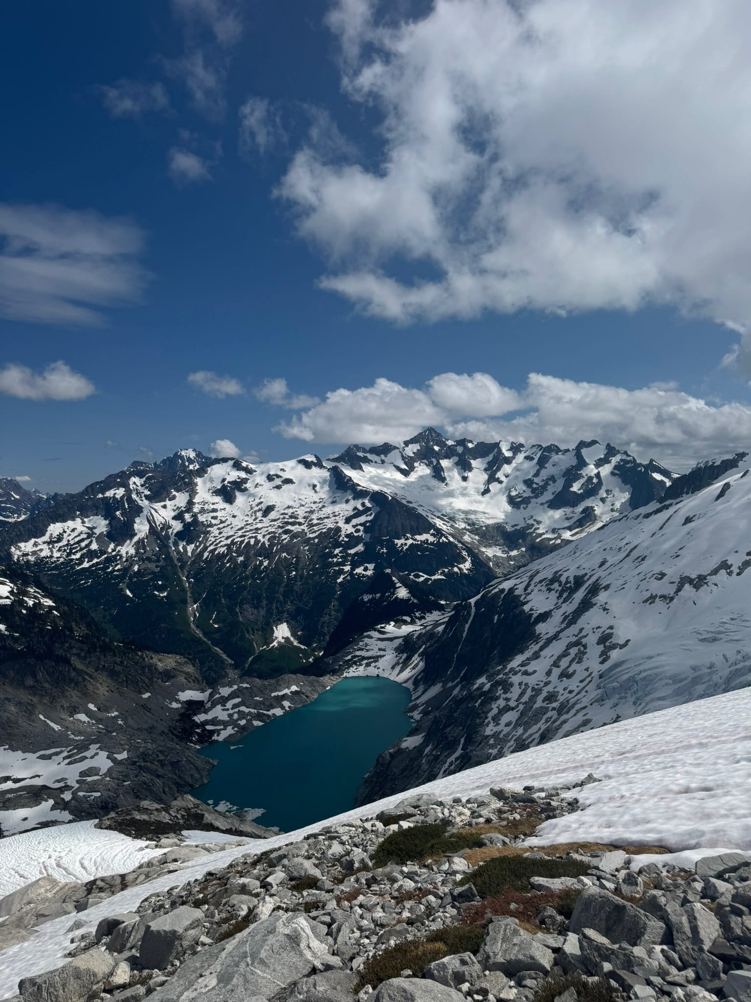
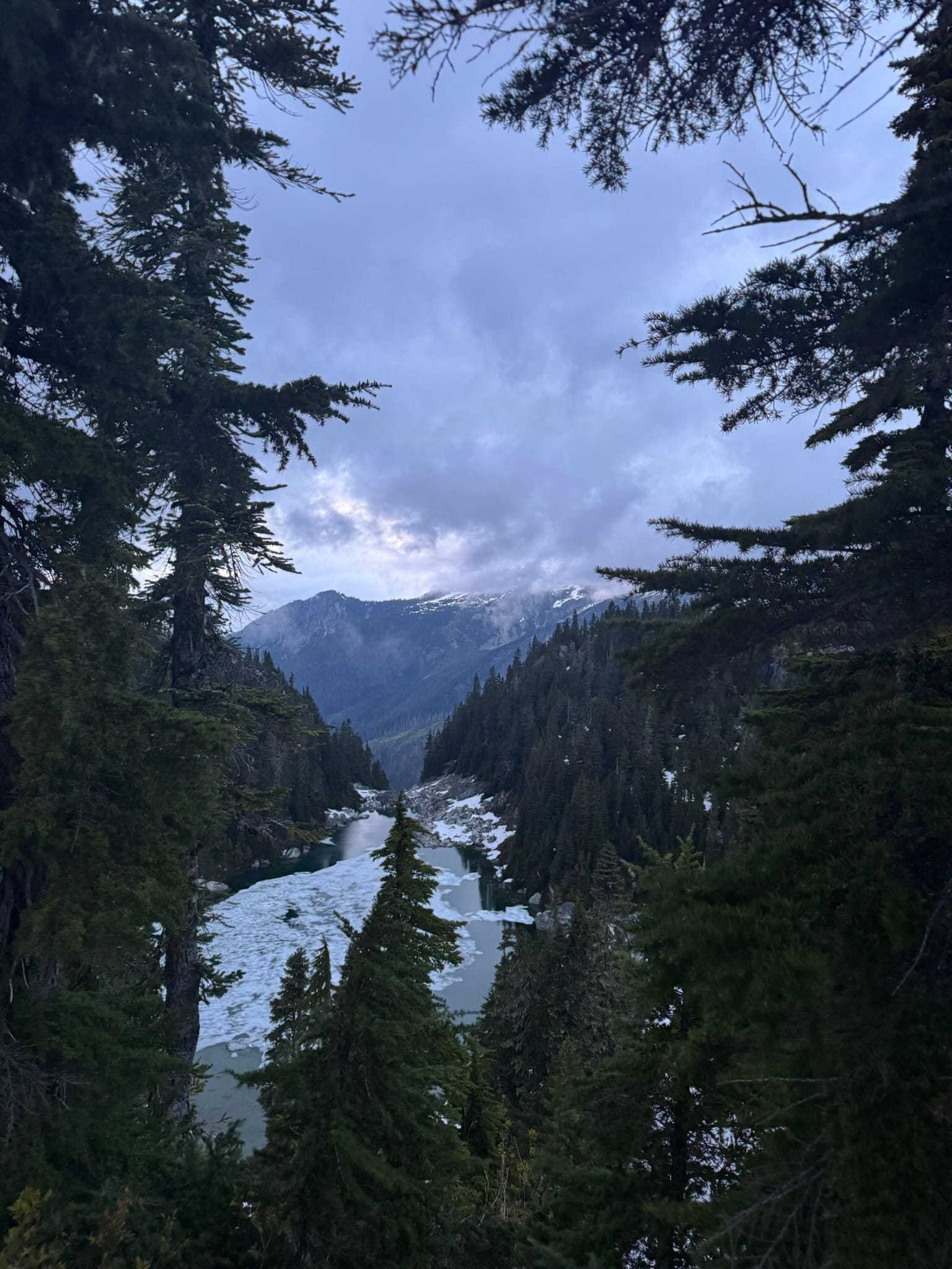
We both stood shaken by the rocks below, collecting ourselves like the regal queens we were. We downclimbed off the rock to snow that connected down to Isolation Lake. This became steep but we plunged without incident down to the blue gem of a lake. After hours of adventure, we were giddy with the botched "straightforward summit walkoff" behind us.
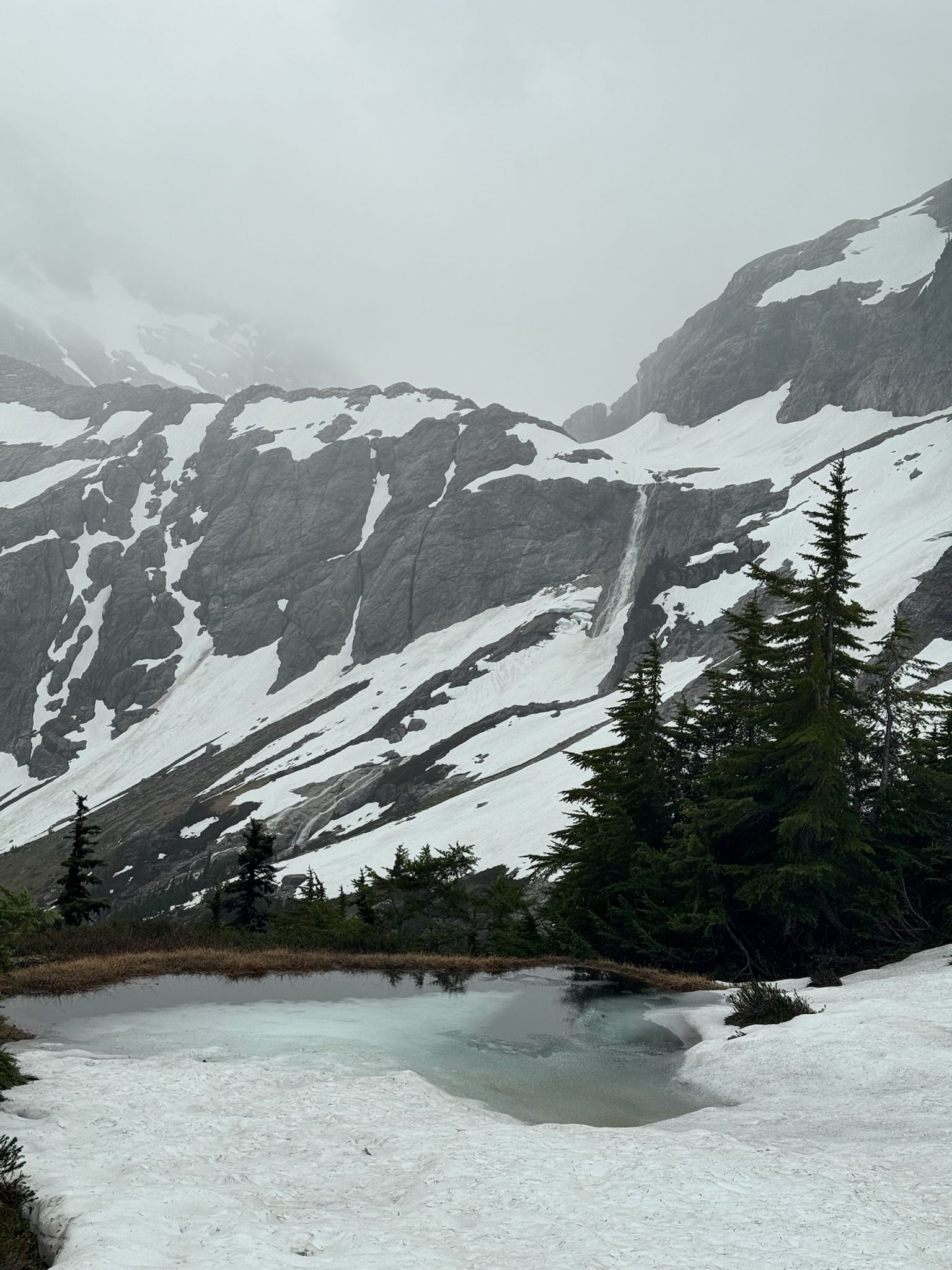
We took a break, filling up with water by the lake, and enjoying its vistas and depth and blueness.
We aimed upward from here on snow and heather and snow before reaching 6700 ft point that we could then leave this area and drop into Snowfield's back basins.
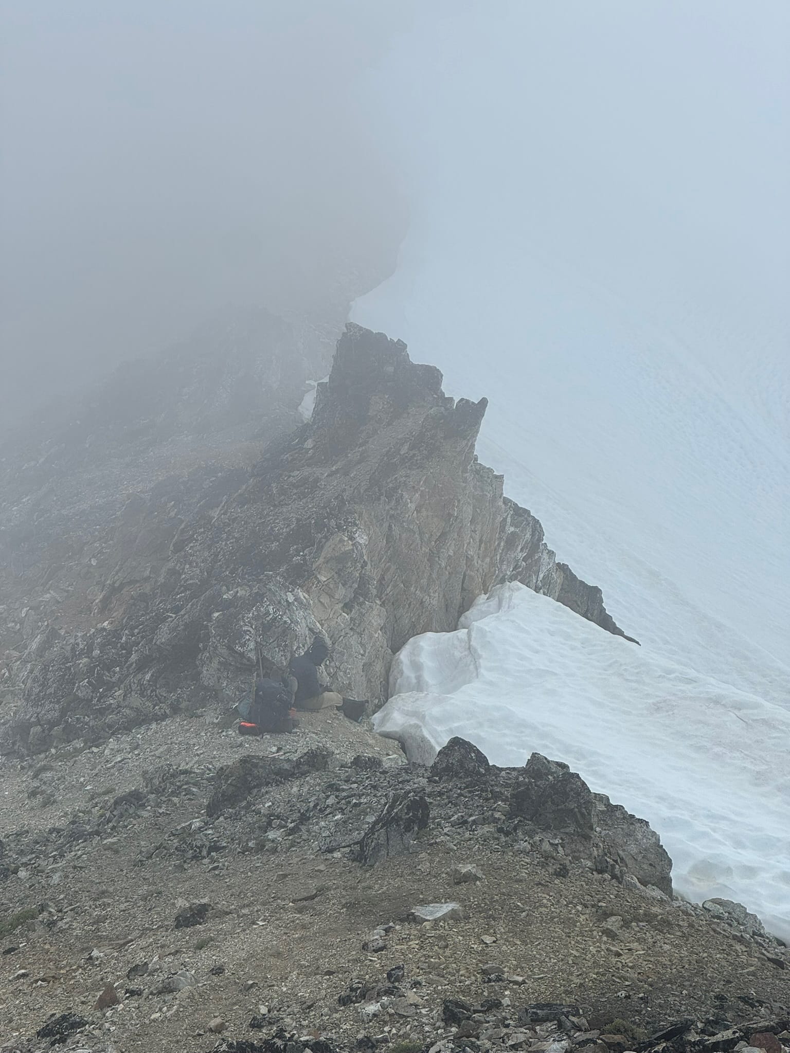
Our exhaustion was high and our feelings of wigged out were growing as we traversed on the back and steep part of the basin. We went, if slow, and zig zagged until we reached a long but kind snow ramp. Shaina exclaimed, "OH IS THIS WHERE WE GO? I thought we meant up THERE!" And pointed to a rough vertical snow patch above us. We laughed with relief that we were not headed there. At around 6pm, we sat on top of the rubble of the saddle.
Shaina waved me off to Snowfield's summit, watching our packs and giving me a chance. We decided until 8pm & I sprinted up an obvious climbers path up and over a notch onto a west ridge.
I noted a worn path that I followed disappeared as I scrambled up a thinning rock ridge that ended with a very non-jumpable gap between it and the summit ridge.
Like a dog that doesn't know how to get his toy, I moved up and down pacing on this ridge before I decided to downclimb and try again on the other side of the gap.
Between this is a walkable gully.
I LOVED the handholds to get up onto this ridge. I started my second west ridge attempt and ended up on pointing rock hanging many feet above a dirty gully leading down Snowfield on one side and a half dozen feet above downsloping thin snow ramp with no clear way to land unless I adopted the mindset and free spirit of a teenager.
I reversed slowly, making it back down to the gully.
On my third attempt I made it to the correct west ridge, someone having left obvious and kind piles of rock ducks to guide me. I scurried to the top on class 3 semi exposed rock, wrapping around to the summit like a princess on their spiral staircase of .. rubble.
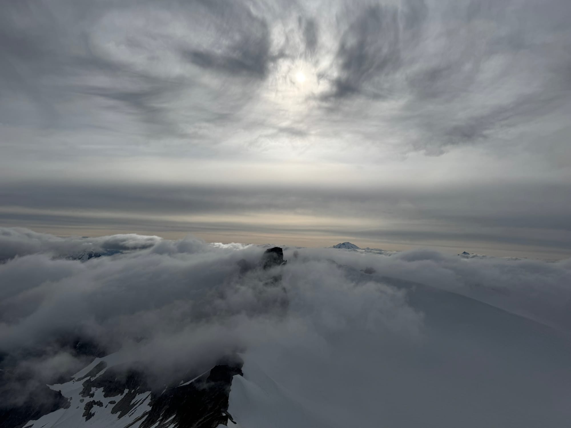
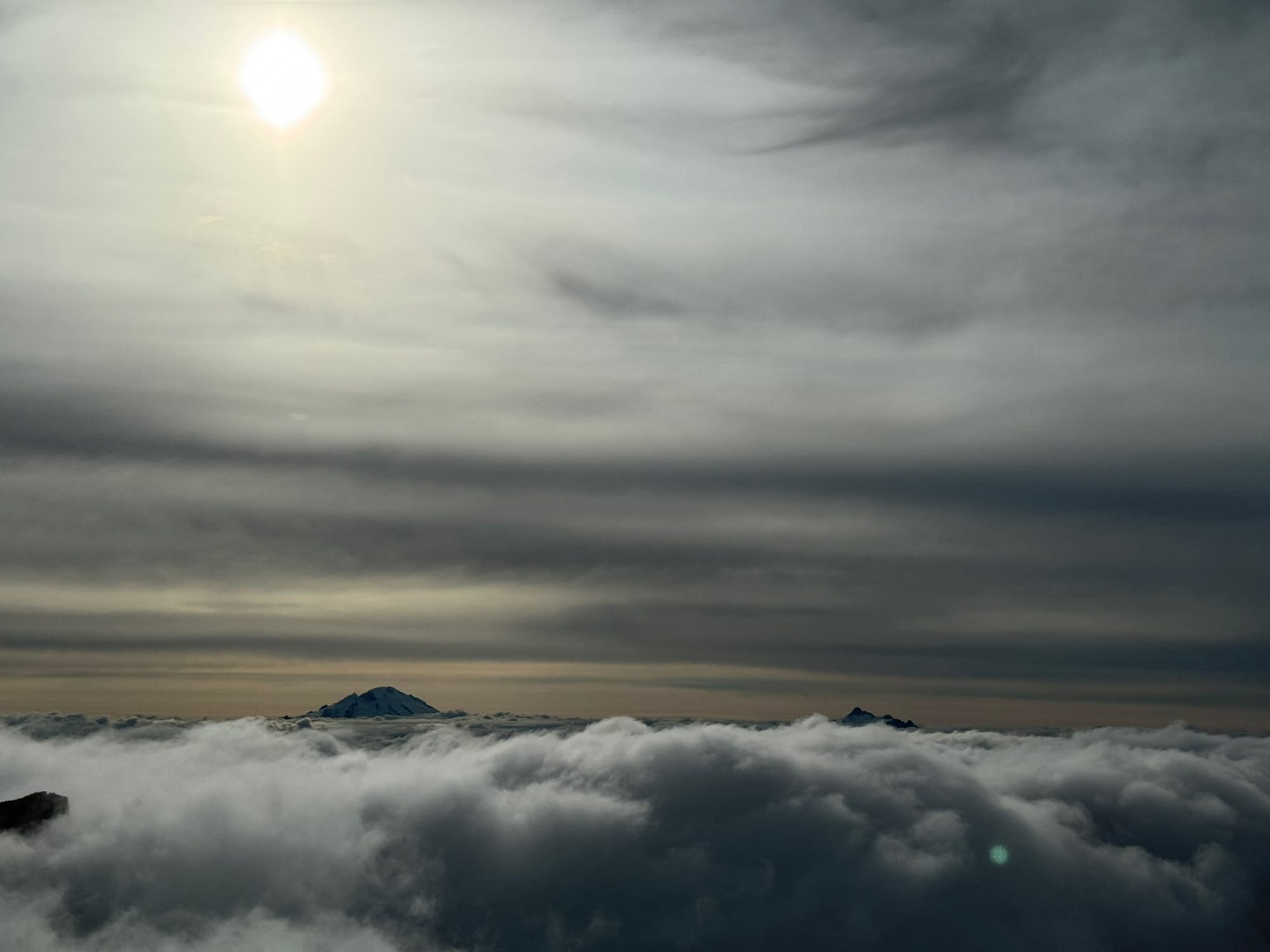
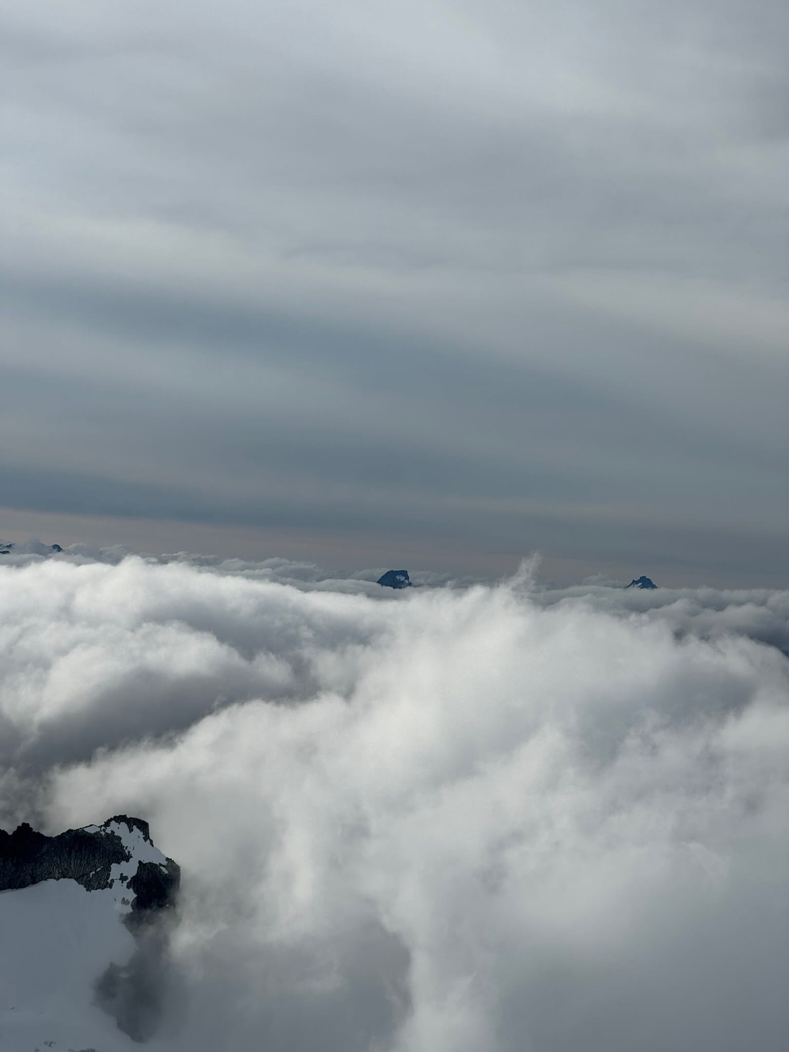
Giddy and elated, I took in a breath as I entered my Olympus era. I turned around with a vast sea of cloud-cover that shifted and moved across pointed peaks. The burning sun hung low, just above Glacier Peak, which pushed above the cloud sea directly in front of me like a sentinal.
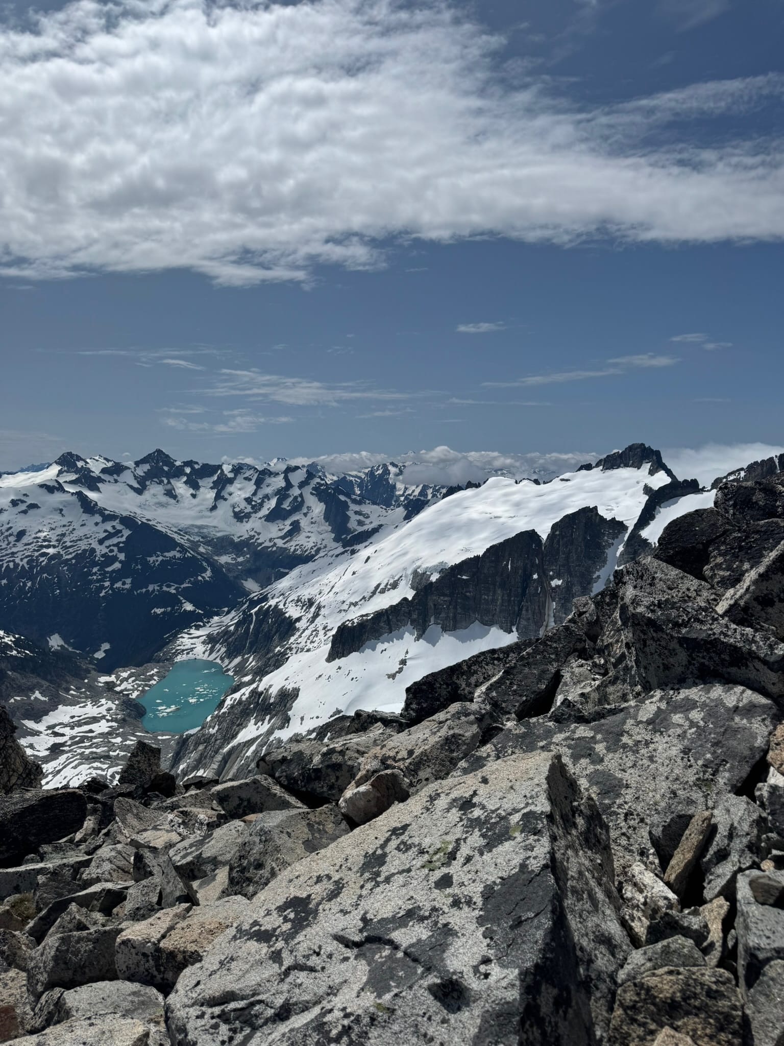
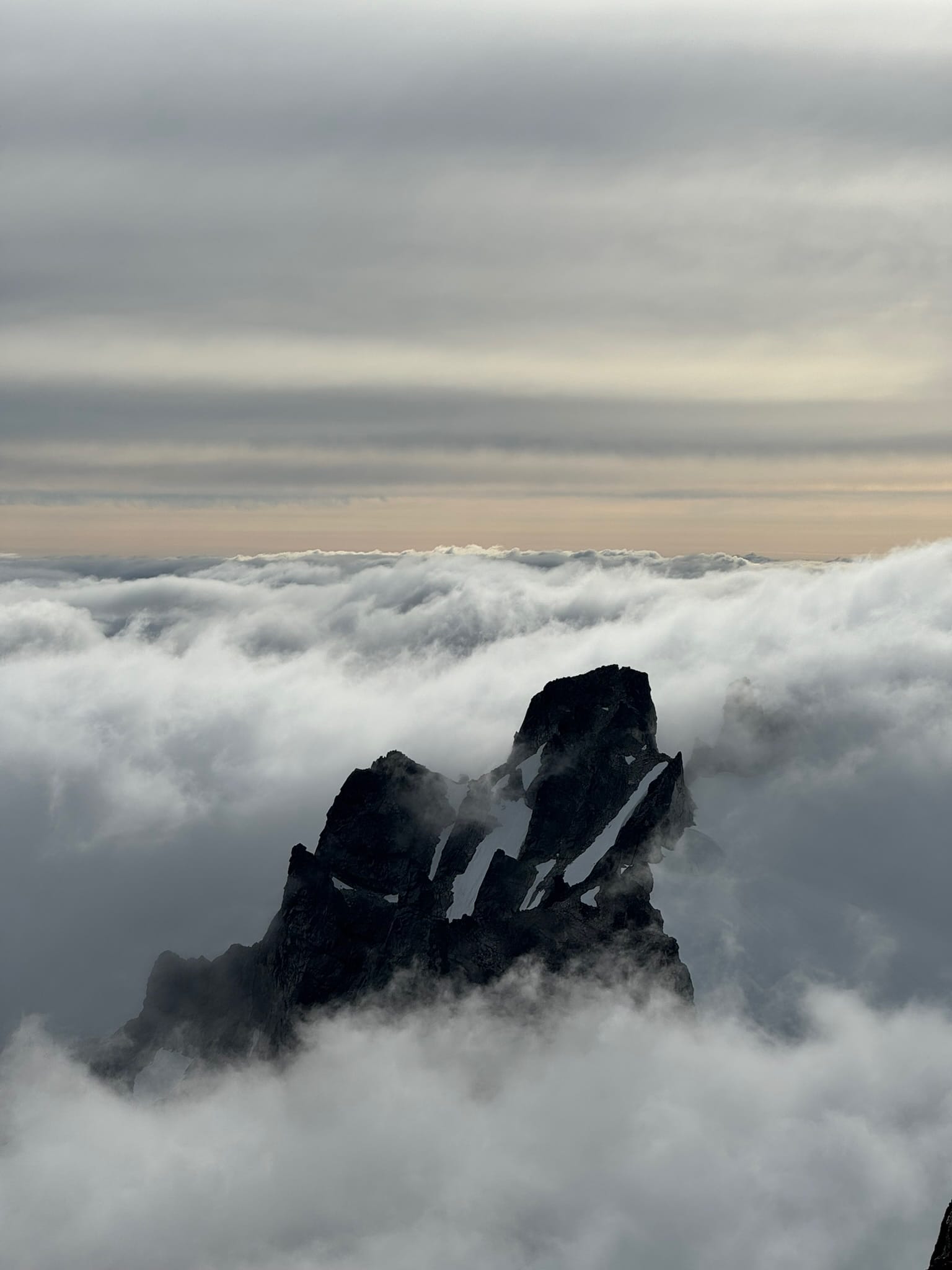
The massive, toothy jaws of peaks that formed the top of the Neve glacier in front of me appeared like shy cats on and off. I did not try to find the summit register, I just enjoyed the moving sea and some gummy worms.
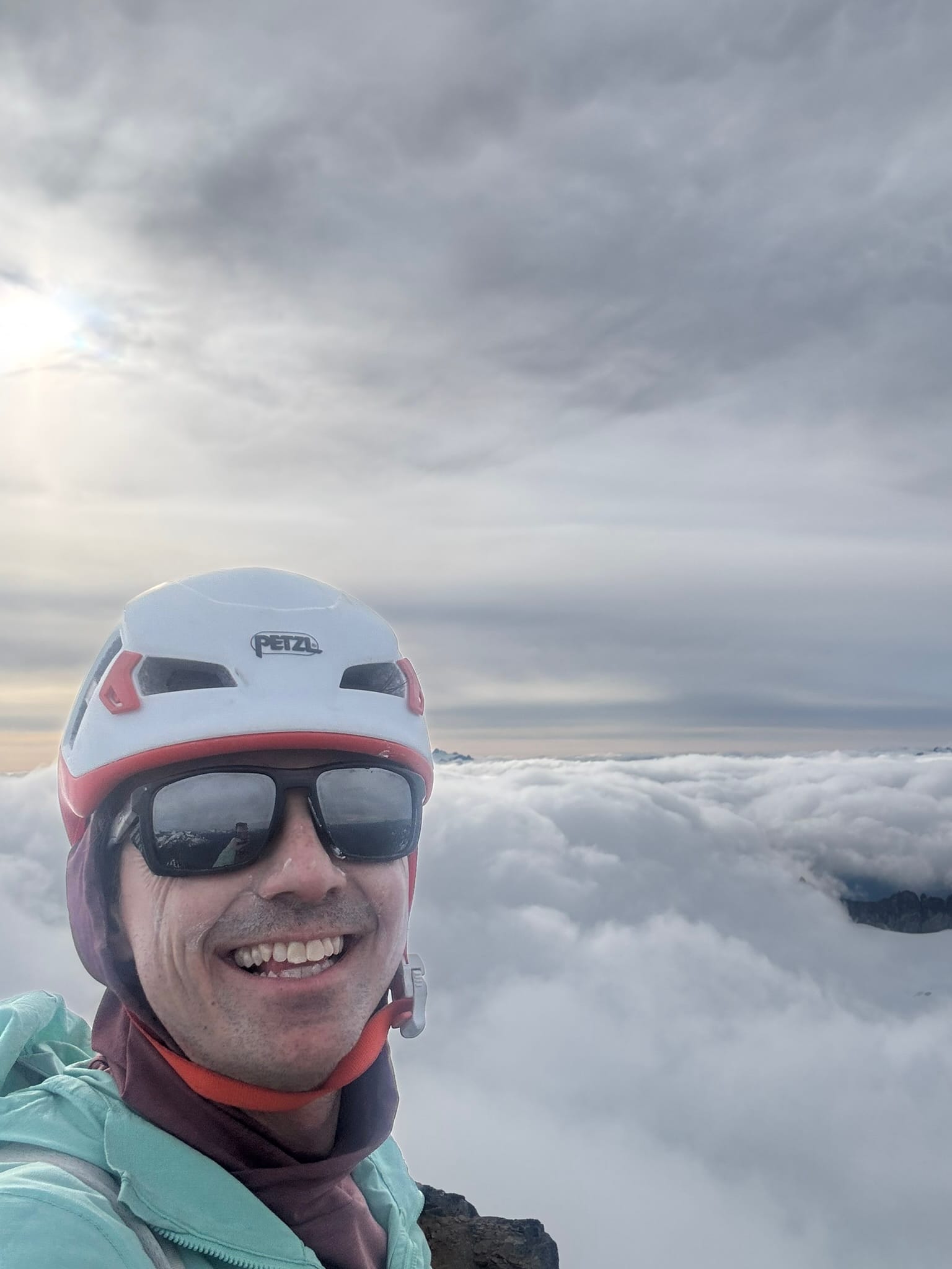
As it approached 7pm, and knowing my teammate sat shrouded in fog, I decided it was time to scurry down. I followed what I learned is the "True" "Obvious" west ridge climbers path and surprised myself and her when it took me 22min from the top to spit out next to her dark form, facing the fog toward the west of neve glacier.
Surprisingly, the correct route makes all the difference.
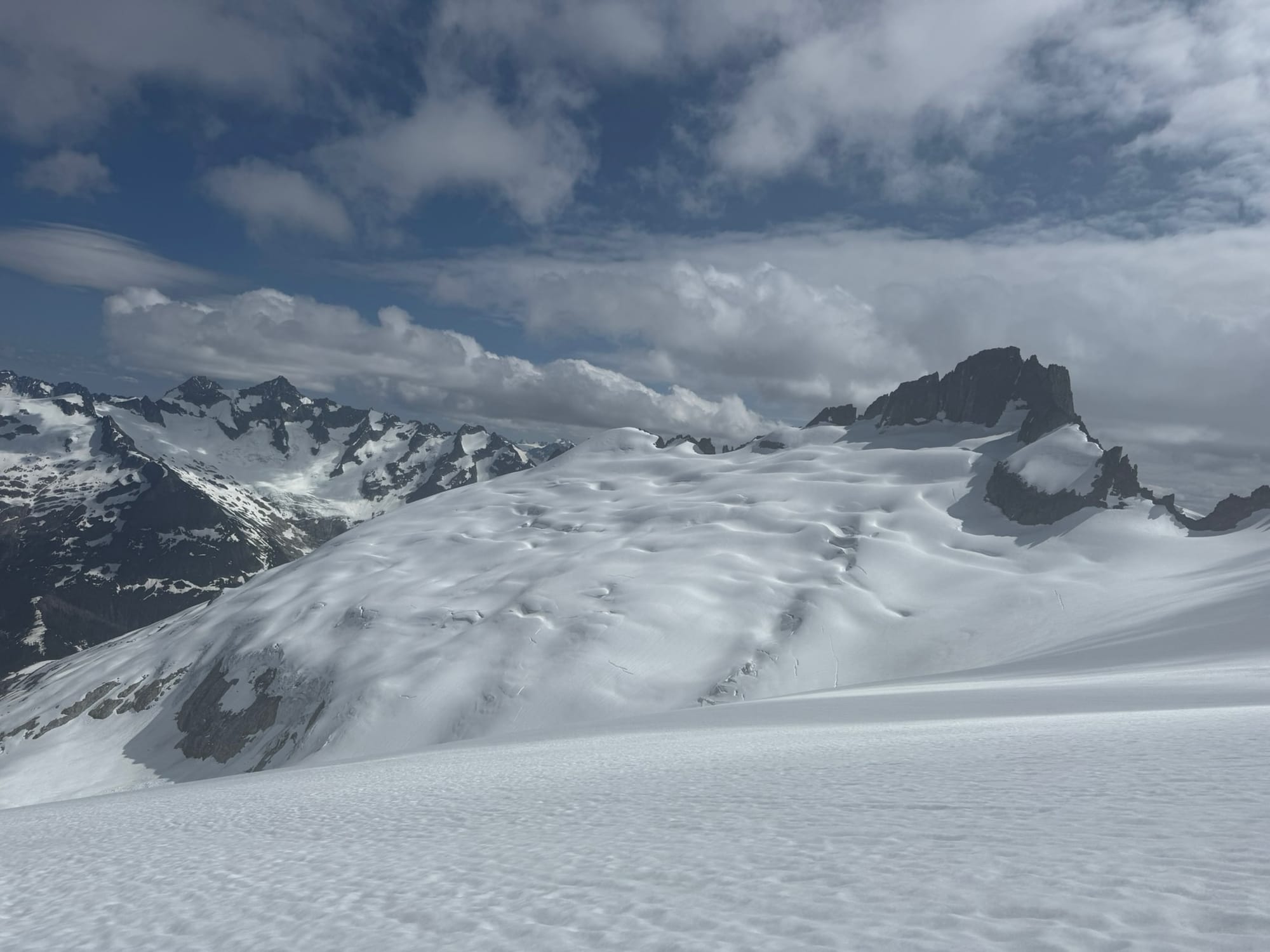
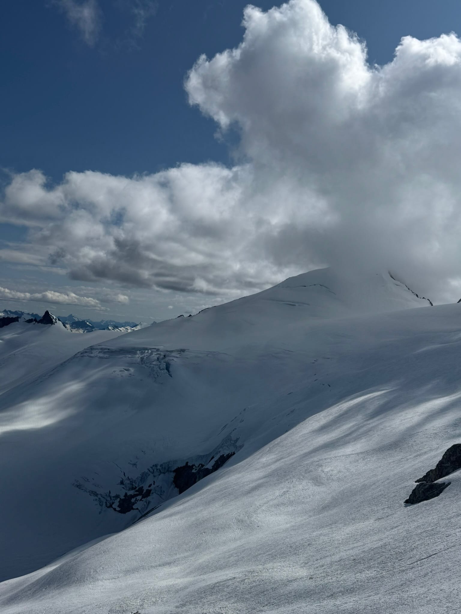
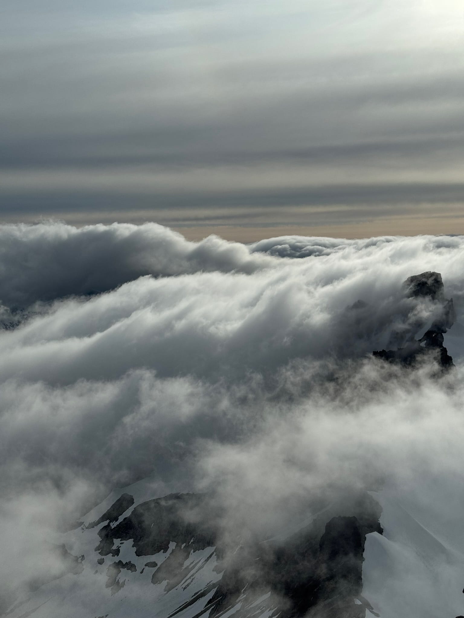
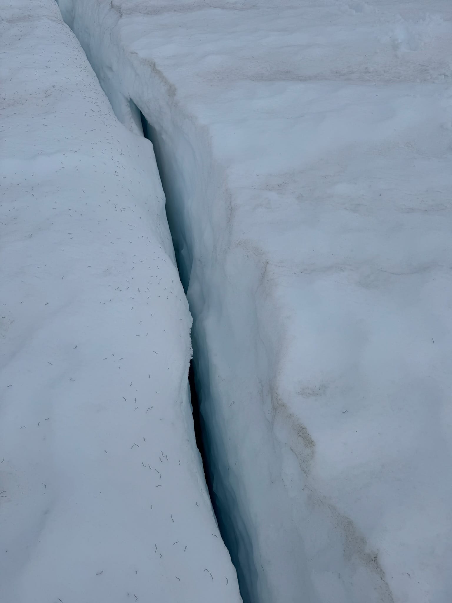
We then descended onto the Neve glacier in fog, enjoying the seemingly endless number of glacier worms. Why do these worms exist? Who do they exist for? Why are there so many of them? Our questions were as endless as they were.
The shifting sunlight and moved the fog and sometimes the peaks poked through. We sang hopscotch songs as we jumped over the small but many glacier cracks. The snow was soupy with visibility for navigation low, but eventually it blew off a little and we ended up under the steep snow ramp up to Neve col.
The blue maw in the middle of the Neve glacier's west arm opened below us and the fog clouds as we made quick but tired work of the steep snow ramp up.
I watched the incredible vista move from my perch ahead of Shaina, in constant awe.
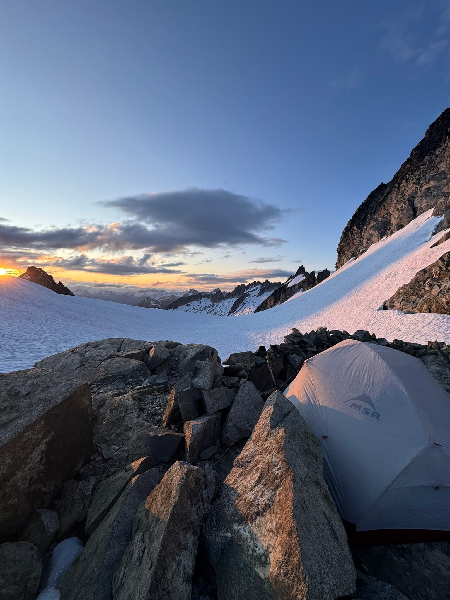
We made it to the amazing looking Neve col camping spot, which has a wind protecting wall and beautifully running water.
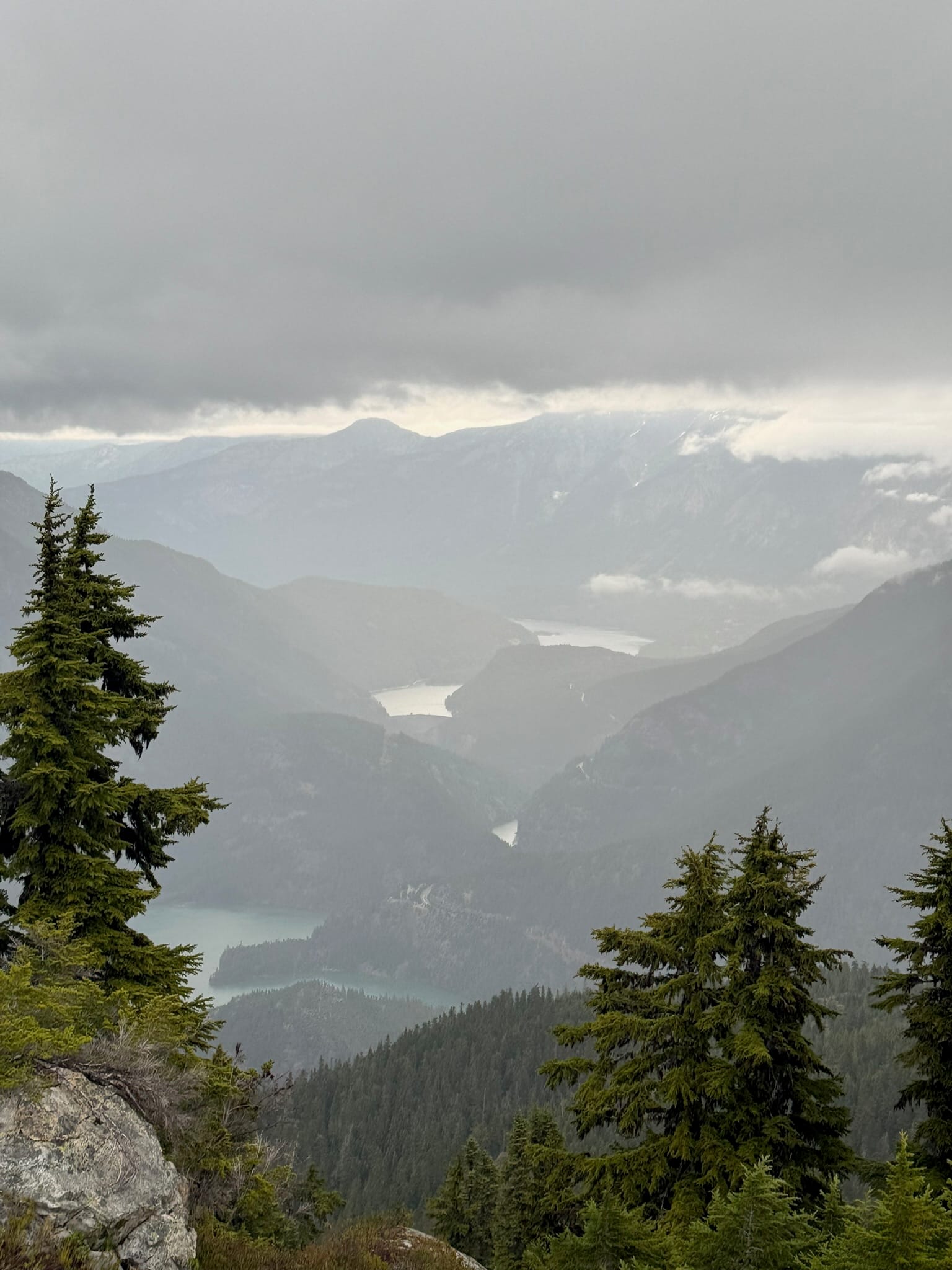
Our last day, Friday, was supposed to have bad weather and it didn't seem right to sit at a col so high up and with such a long glacial descent, so we sighed then put on smiles as we decided to plunged down the Colonial Glacier to Colonial Lake. It was sunset-o-clock and it lit Pyramid peak that looked over us on our descent like cloud-fire.
When we pivoted toward the lake, the gap behind it blazed hot pink.
Like godzilla lurking in the sea, huge chunks of blue ice floated in the middle of growing coloinial lake below us.
The lake was shaped like an imperial starship.
We decided to keep pushing, getting headlamps out and stocking up on 7L of fresh water so we did not have to hunt later. We followed boot pack around the lake and up onto the spiny arm of rock around the lake. With the lake edges melted out, this was the only way around unless we went to polar bear school to learn how to jump ice bergs or re-enacted the Titanic. We had ambitions to camp at the top of Pyramid Trail but were gassed and, as we hit the last 1/3rd of the rock arm, found 5 really well built rock walls and flat-ish camp spouts.
We decided to hide behind one of them as the wind howled.
We enjoyed prebed giggles, 2am tent re-anchoring in the howling wind, and both ended up laying on rock due to sleeping pad failures.
Day 6 - Friday, Colonial Lake Arm to Pyramid Lake Trailhead
5.73 mi, 5h 32m, -4,921ft, +50ft?200ft? max elevation: 5,985ft, min elevation: 1,073ft
We both started wiggling to a 5am alarm to the howling wind.
Taylor Swift had been blasting in my head for hours as I was lying on the cold hard ground.
Disoriented, we made the commitment and slid out of our sleeping bags after our all-nighter singing with the wind and cold ground below us.
We packed fast and sprinted off along the ridgeline. Cairns lead the way to and fro on the ridgeline before putting us back onto snow. The snowpack melt out speed means this all will be punchy soon & more of a side-hilling-talus adventure. We had crampons on and switched them off just before ascending some steep and loose dirt to the snowy Pyramid ridge.
Sleet caught us here and we traversed the snow and rock before beginning a 5k ft plunge down steep wet heather, mud, branches, trees, and rock. Our butts touched the ground a lot.
After a few navigation snafus and some shockingly slow descents given the steepness (what do you mean we only dropped 500 ft since I last checked my phone?!) we ended up around Pyramid lake where the National Park Service trail started.
This meant we went from ruddy shit to some nice maintained dirt. God I loved that well maintaned dirt.
Just under the lake, we saw our first human since Sunday! He was so clean. I turned around after passing him and said "look Shaina, our first human since Sunday!" then told him that he was the first human we saw since sunday. He seemed unimpressed but acknowledged this fact before scurrying onward and we laughed about our awkward approach to people.
We saw 7 other really clean humans. One was a lady that stepped well clear of us with a perfect perm and a marvelous collection of Maroon Clothing that was spotless. I told her I liked her marroon to which she did not respond. We started giggling a lot as our spirits soared with each foot down in elevation. We jogged around a last bend and spilled out onto the highway.
Shaina's car sat right where we left it. A kiddo tried to ask me about what we just did and I felt bad but I had a car to be in, so I rushed past and told him "we looped around the park." Sorry guy, if you find us, I will talk more now.
We drove off in her space-ship like VW id.4 and hovered into a spot next to my tank at the Thunder Creek trailhead where we had a wet changing party among families moving around from campsite to campsite.
I thanked the prior me that had left some peppercini & honey dijon kettle chips that I munched on happily. I turned on my car with glee at the roar it made and the heat that poured from the vents.
We hugged goodbye,
Grateful to have experienced such an amazing part of our planet.