South Dakobed Loop

Total Journey
41.49mi, +/- 11017ft
Pictures
https://www.icloud.com/sharedalbum/#B2OGdIshaGx3L5F
Summary
I will call this a "South Dakobed Loop".
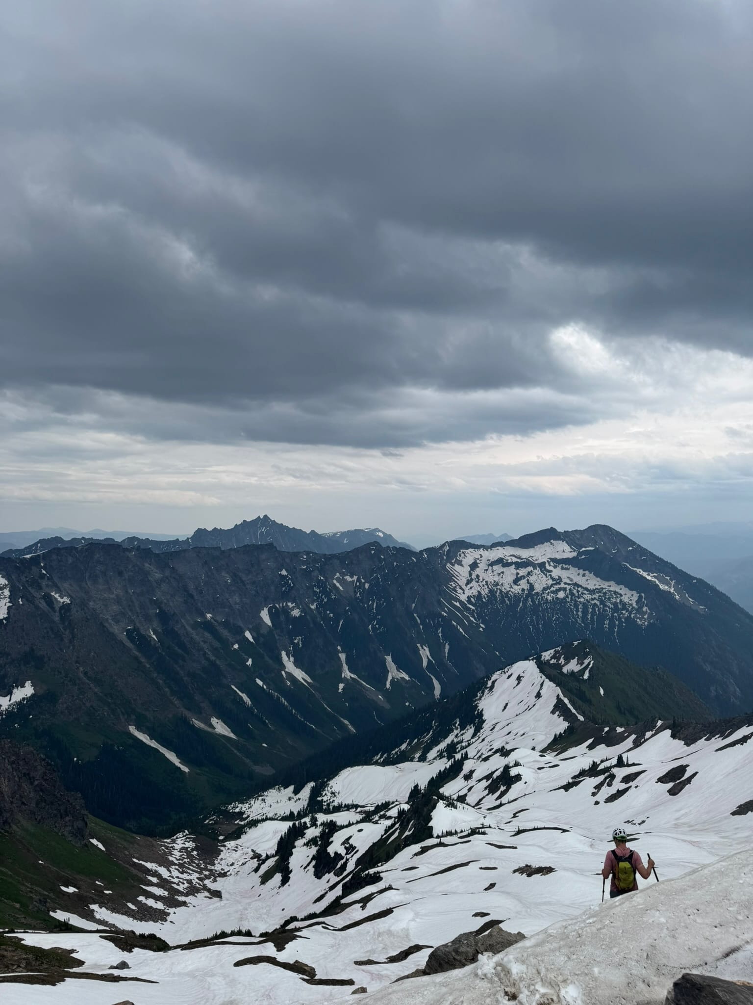
I went up White River Trailhead to the Boulder Creek trail. Before Boulder Creek Pass, I broke off and moved up a climber's trail to the arm and back of Clark. I went up Clark, camped at the saddle before Lauhna. I went up Lauhna, sidetraversed over then up Chalangin. I carried over onto Butterfly Glacier, plunged down underneath the Ten Peaks and onto the Honeycomb Glacier. I stood 20ft under Kololo east where I was stymied. From there, I followed the White River then White Chuck Glaciers out to the Glacier Peak Climbers path and connected to the PCT. From the PCT, I went out Indian Pass to Indian Creek Trail to White River Trailhead.
One of 3 original Major Hopes and Dreams for the summer, to experience East Fury, became a deferred dream. What's a girl to do when her Hopes are deferred?
Since my entire existence and self-worth this summer is based on "Mountaineering", I searched for something to fill the void.
In that searching, I decided my social life needed some air. I made the upcoming Pride weekend a priority and unceremoniously shoved this newly-stitched trip in between my minimum recovery time from the Inspiration / Isolation and The Weekend. I am grateful for this flexibility and these as my problems.
Not that going outside to any particular place needs a particular reason, but I felt this route might give me opportunities to experience the glory of several glaciers, experience the edge of the "Fabled" Napeequah valley, and feel small under the soaring Glacier Peak. I am grateful that it did just that. I also love the names of peaks, glaciers, and themes along this route, culminating in "The Hive" & "Honeycomb."
I would recommend this route 2 snow-pack weeks before mine. Although 2 weeks before, some spots may be punchy where they were bare for me, other spots I think would provide the right consistency where I struggled.
I planned 3 nights but decided on morning of day 3 to cut the 3rd night for a titillating 24 mile, 15 hour adventure.
Night 1: I camped out in my car at White River trailhead, a solid 15miles deep into a valley with not a soul in sight. There are no vault toilets.
I set up camp, always a little on guard when the last thing I passed were a number of communes around a Christian camp, alone in the woods. Fortunately, no one accosted me.
Day 1: trailhead , boulder creek, clark peak summit, and camping on the clark shoulder between lauhna,
Day 1: 12.3mi, +6,475ft, -1,159 ft
Max: 8,563ft
Min: 2,310ft
11h 6m
Around 530 am, a door slammed and woke me with a start. Disoriented as the sun is now up at 530am, I sat up and saw it was another 4Runner. After deciding it was not someone from the Christian camp coming for me, I napped a bit longer before sliding out of my 4runner and getting ready.
I put the finishing touches on my outfit and makeup as a forest service truck pulled up as well as a man on a motorcycle.
The forest service workers were headed to the White River trail not far from the trailhead. In their own words in response to the outline of my trip, "That's Beautiful Country" - hell yeah!
I left around 0915 - who is in a rush on a beautiful day?
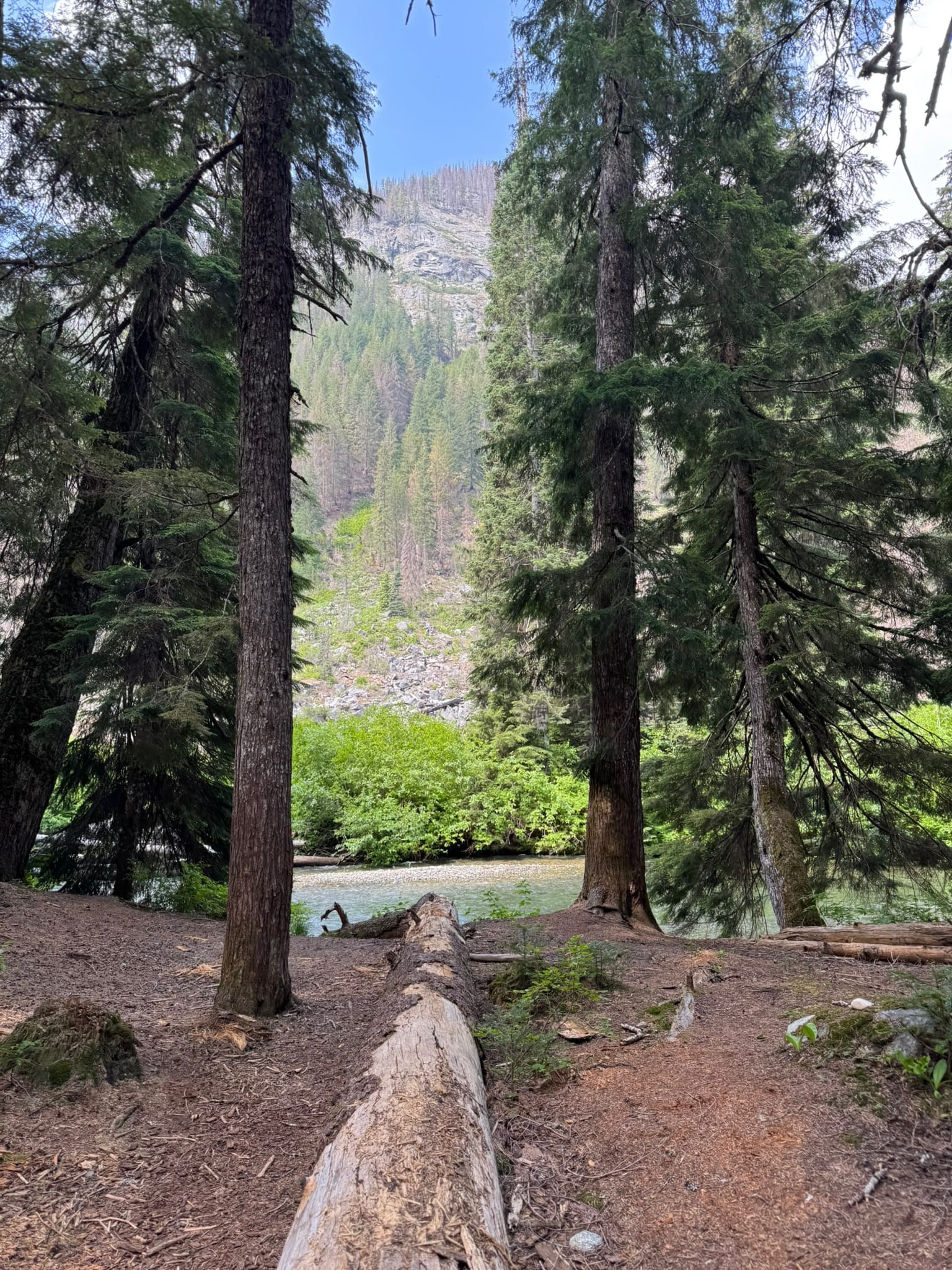
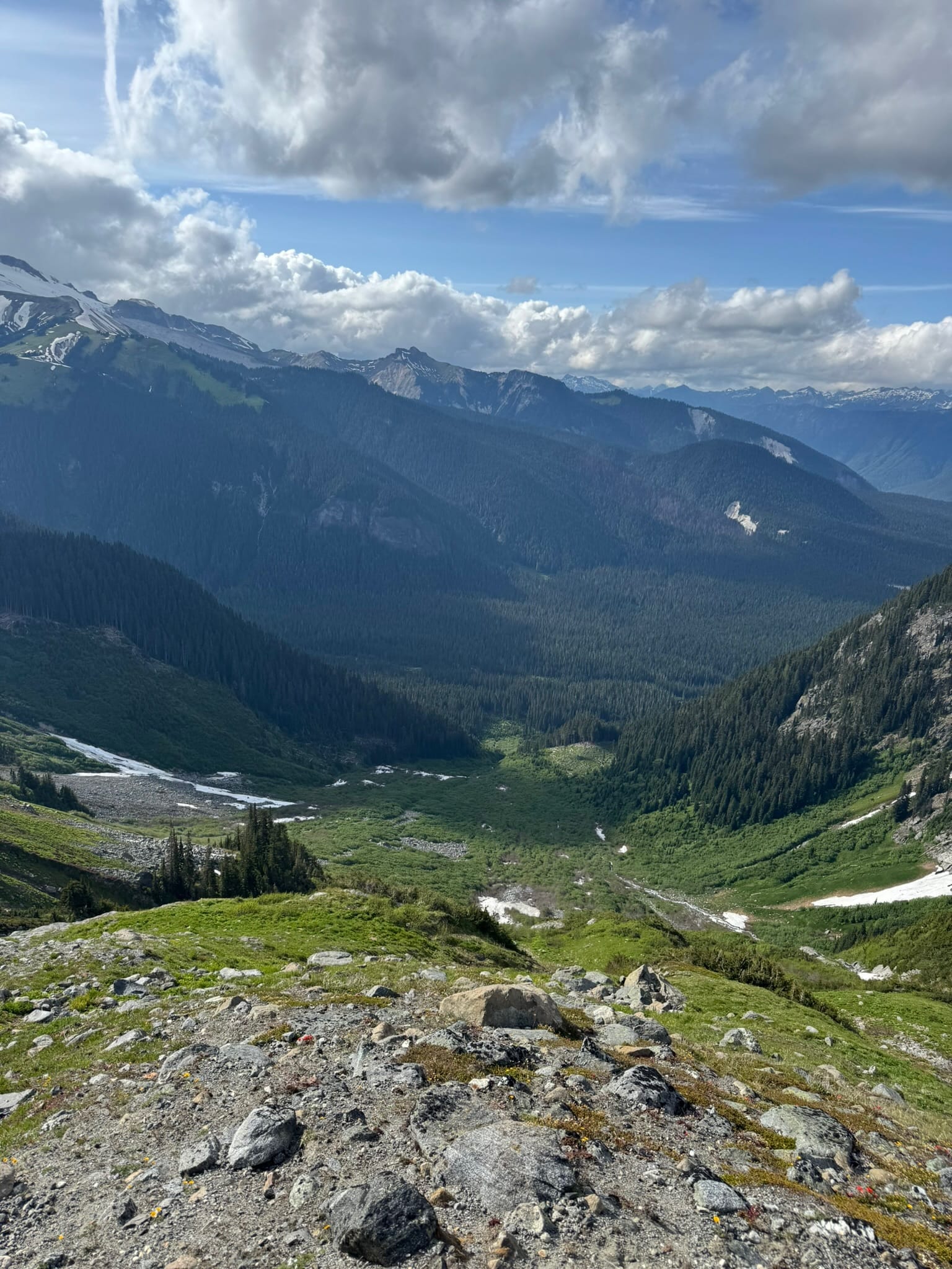
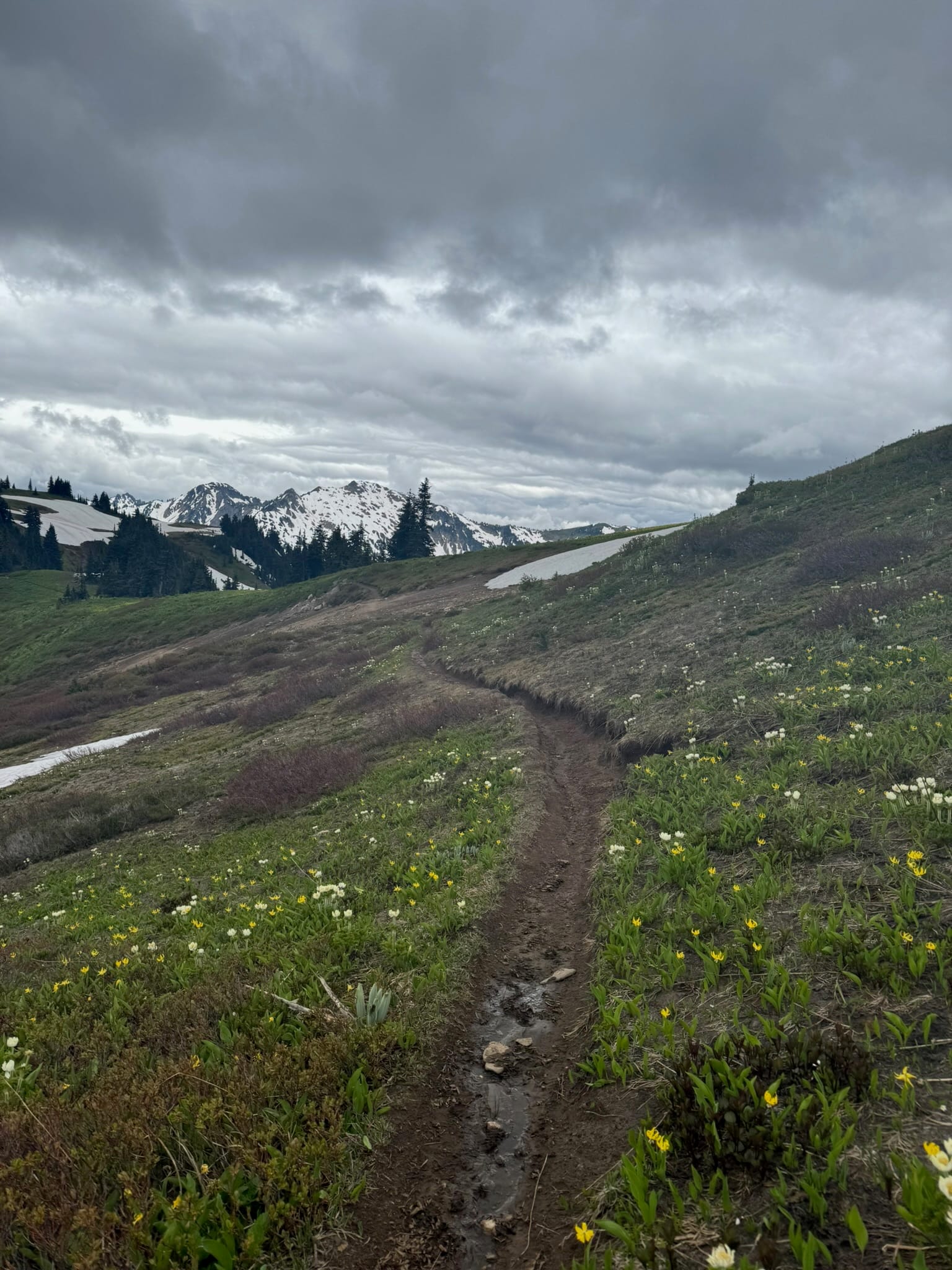
I set a steady pace along the White River trailhead and who could remember an approach being so nice. Aside from hungry mosquitos, I enjoyed the roar of the creek and the blooming brush.
At a T, miles upriver, I started up the Boulder Creek trail, with its beautifully maintained switchbacks, a nice reprieve from direct-climb climbers paths.
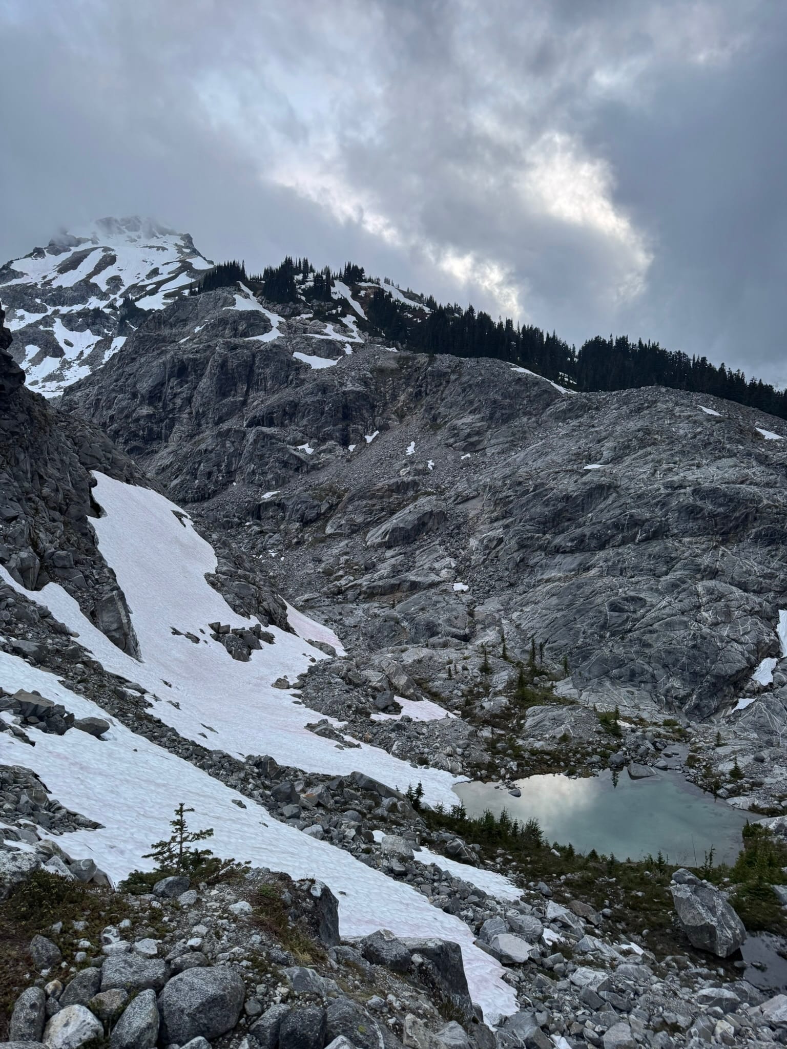
As I pulled up into the boulder creek basin, I enjoyed the vistas of Clark's eastern arm and lushness of the valley.
Aside from 1 avalanche scar where I lost the trail briefly, all was well.
An eager beaver to get off the trail and onto the climber's path up to the back of clark, I hopped across the intermittent snow and growing brush, across Boulder Creek #1, then shimmed across on a log on Boulder Creek #2, just below the first arm of rock west of the main basin.
I cut up from here and joined the climbers path that is better looking than some maintained trails. I wandered through the brush and zigged and zagged, another marvelous hiker's path.
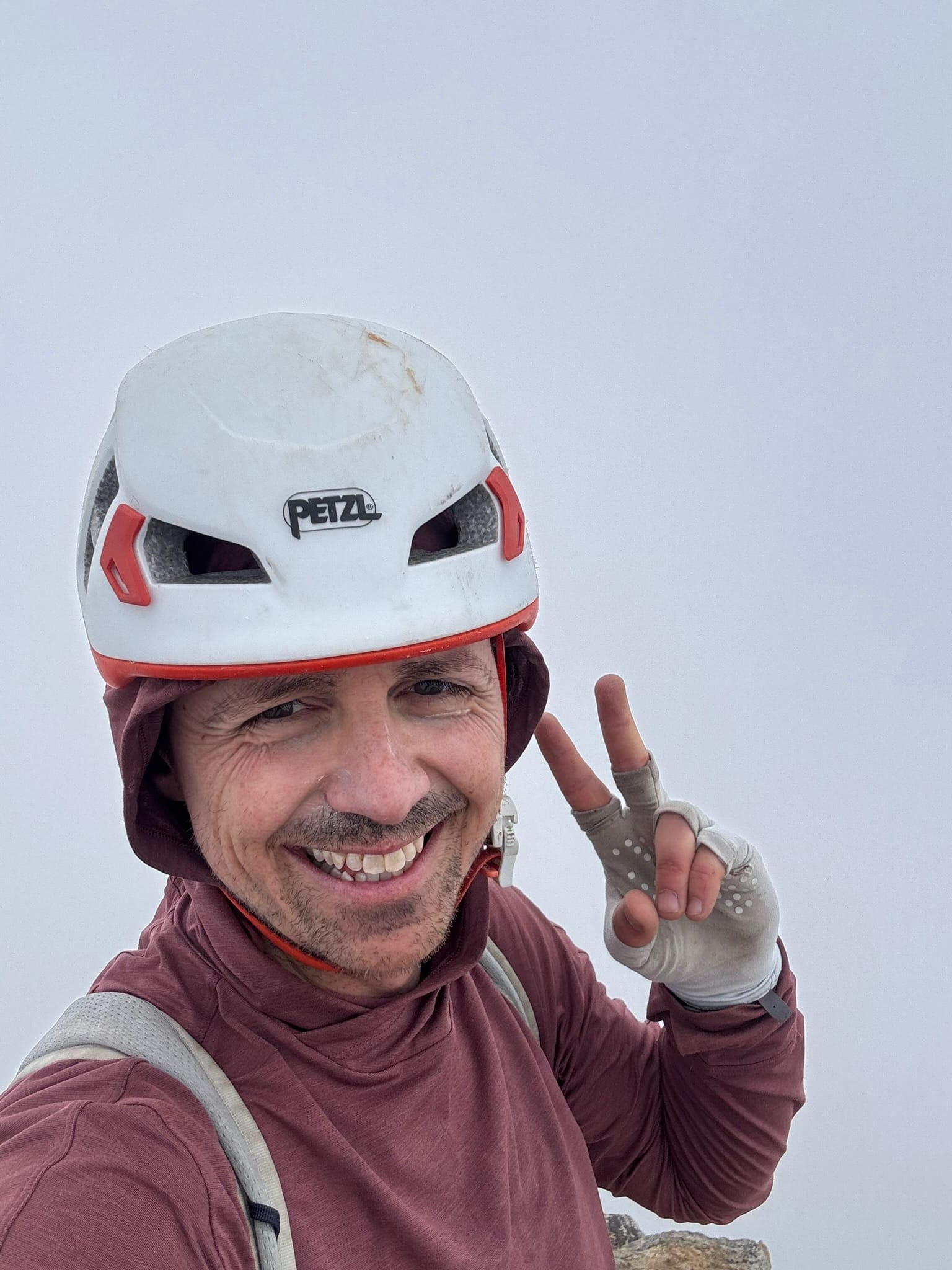
I eventually hit snow around 5500 ft. At about 6k ft as I started to curve into consistent and steeper snow, I decided to do The Great Swap into my Mountaineering boots from my trailrunners.
This ritual involves taping hot spots on both feet and doing a full sock swap. At some point, I might get lighter and quicker, but for now this is the process. As the instagram influencers tell me, trust the process and stick with it!
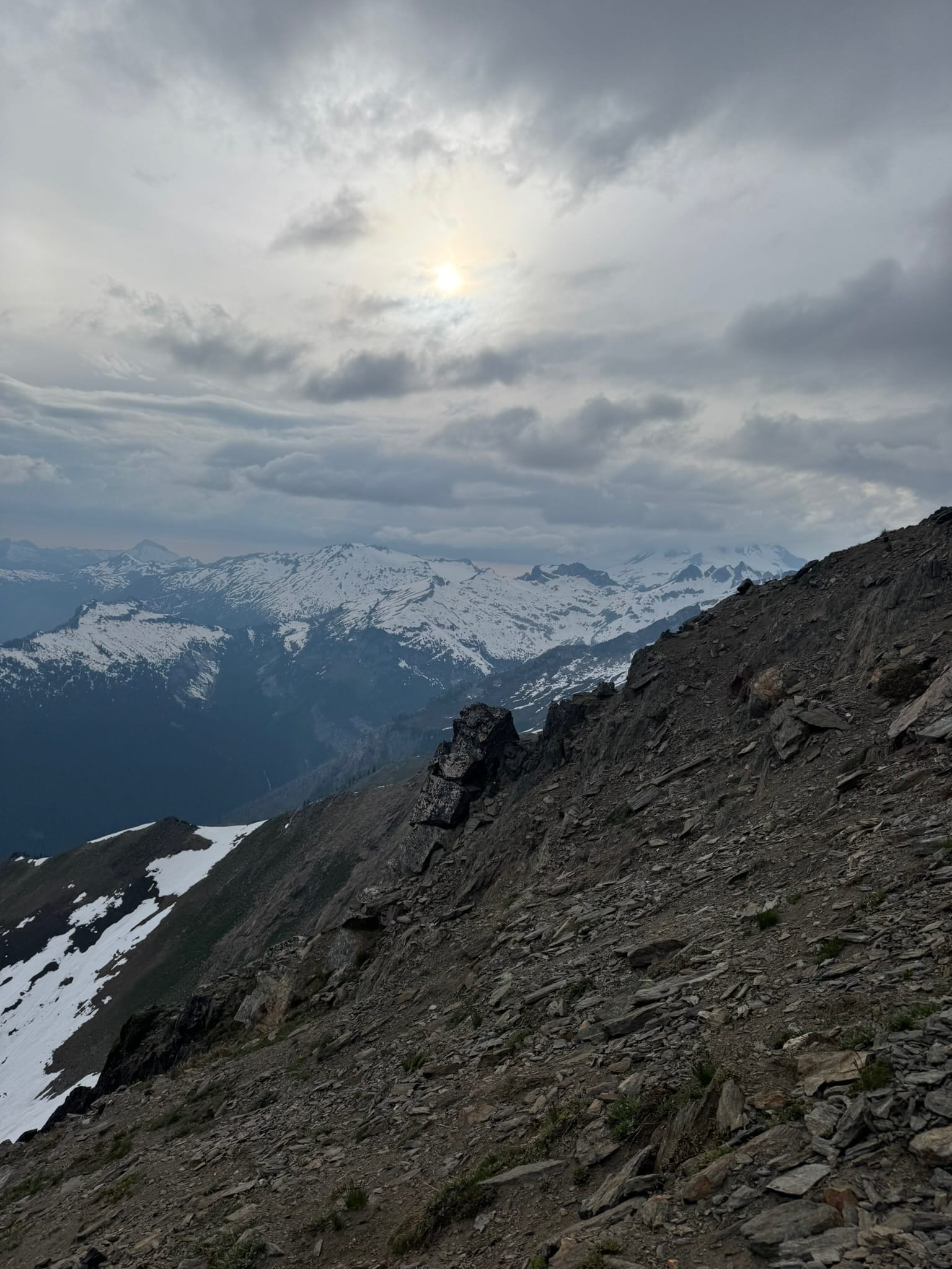
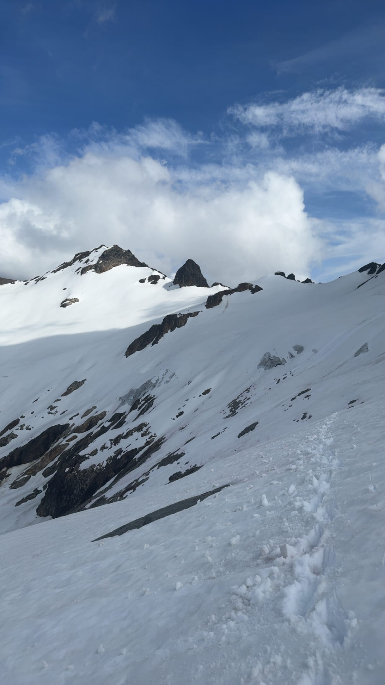
There are a number of notches on the ridge in front of this slope. I will call the notch desired "the Middle One," as it is not the really tempting one to the left that looks so appealing, nor is it the one with nice snow ramps that goes to a more jagged section under a Clark sub peak. No, it's the one with steep shit dirt. We love it.
Throughout the morning, I had crossed a set of tracks on and off and wondered if it was my 0530 am 4runner non-Christian-Camp friend. As I cut up and angled toward The Middle Notch, slipping on loose dirt & feeling the 0530 am wakeup, a figure appeared in the notch! These stumblings in the wilderness, for me at least, usually occur when I sound the most deranged. Sometimes I am muttering to myself, sometimes I am in a full-on rant, sometimes I am just making ungodly noises. Those moments are usually when I turn the corner and someone is there.
In this case, it was merely a case of swearing at the earth beneath my feet. Did the earth really deserve it? No.
As it turns out, I drew close enough, and the figure was Andrew Leach!
Andrew Leach and Andrew Willard met at the notch. Well, near the notch.
Andrew Willard unceremoniously huffed and puffed, trying to move closer to the notch while standing on the steep sloping hill while Andrew Leach volley'd some questions. Andrew Leach was checking off Bulgers summits and had experienced Lauhna and was on his way back down. After a quick chat about various motivations and the technicalities of the route, the two Andrew's swapped an apple note and fist bumped, parting ways. Andrew Leach to one of the 2 Andrew 4runners, and Andrew Willard onward to Clark.
Meeting someone in the woods is a spiriting experience.
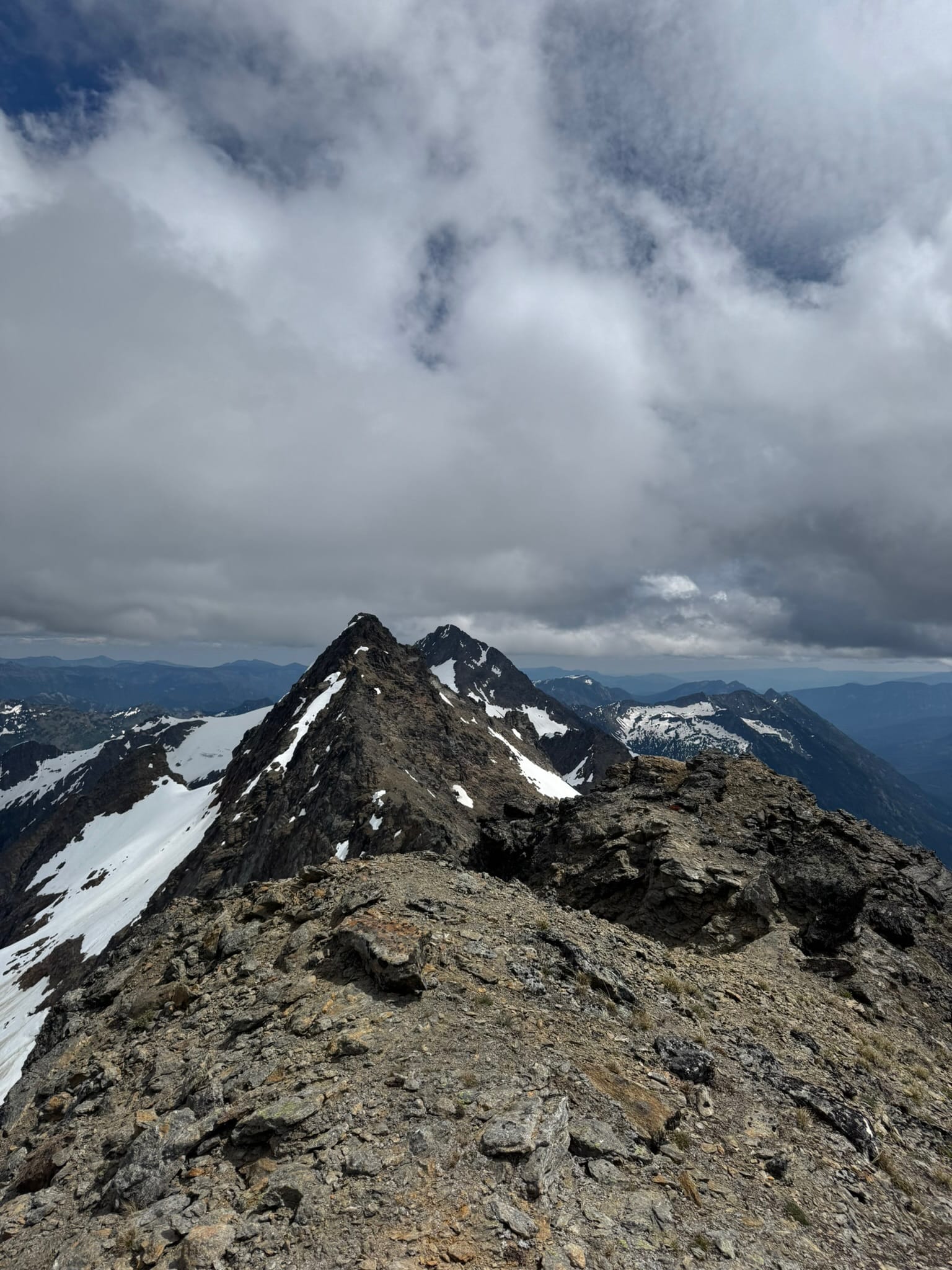
Over the notch, the back of Clark spread open.
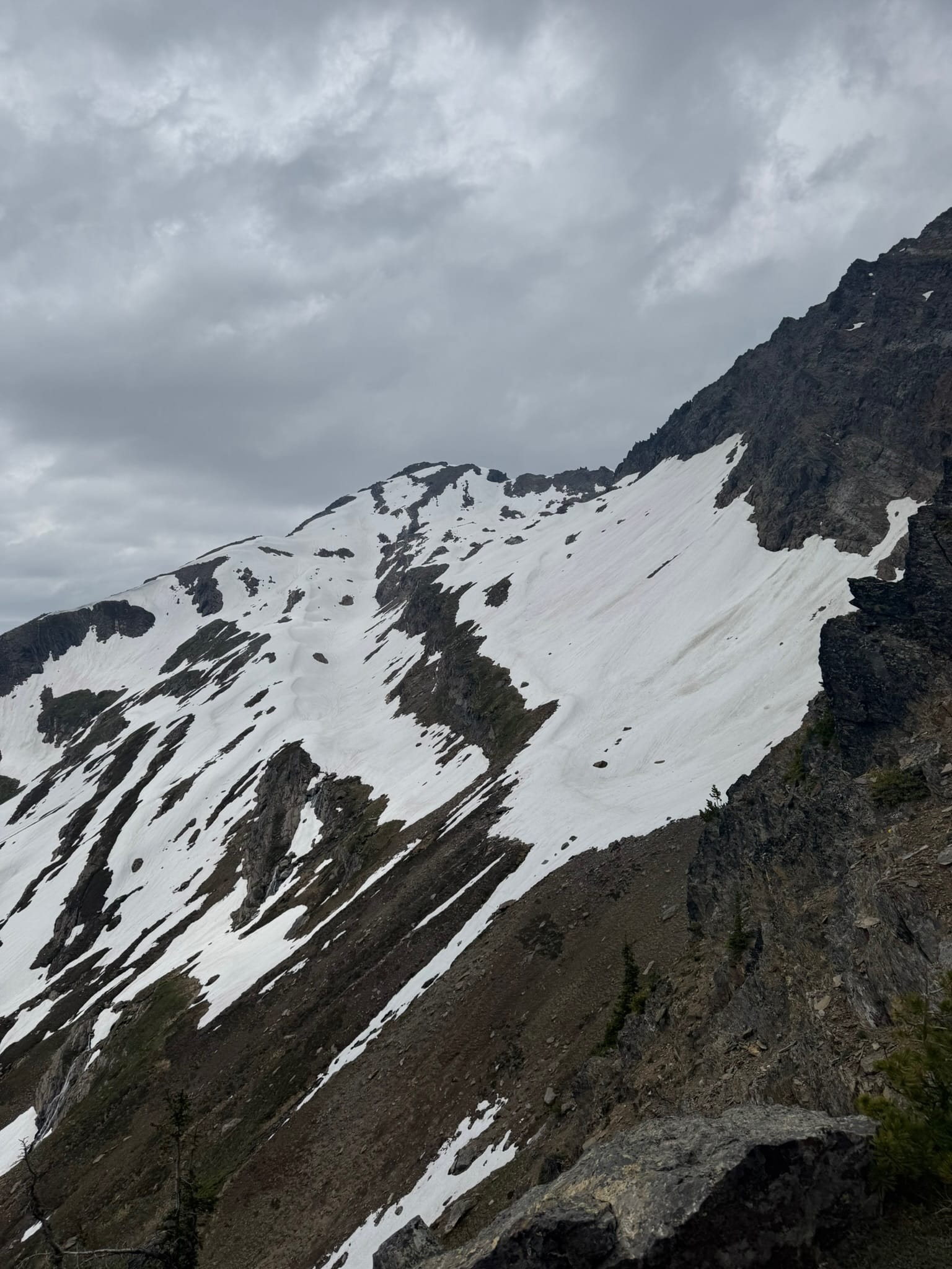
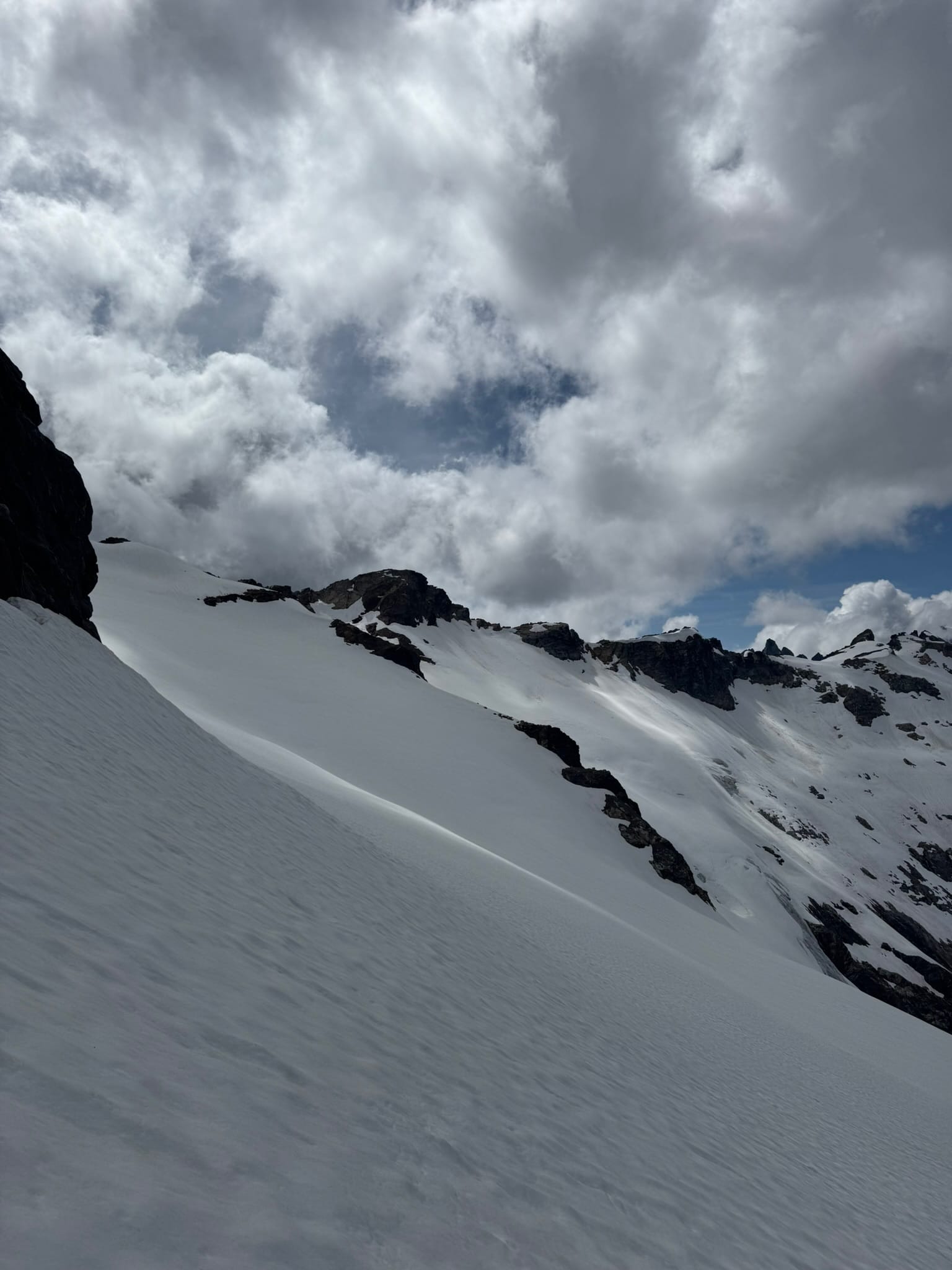
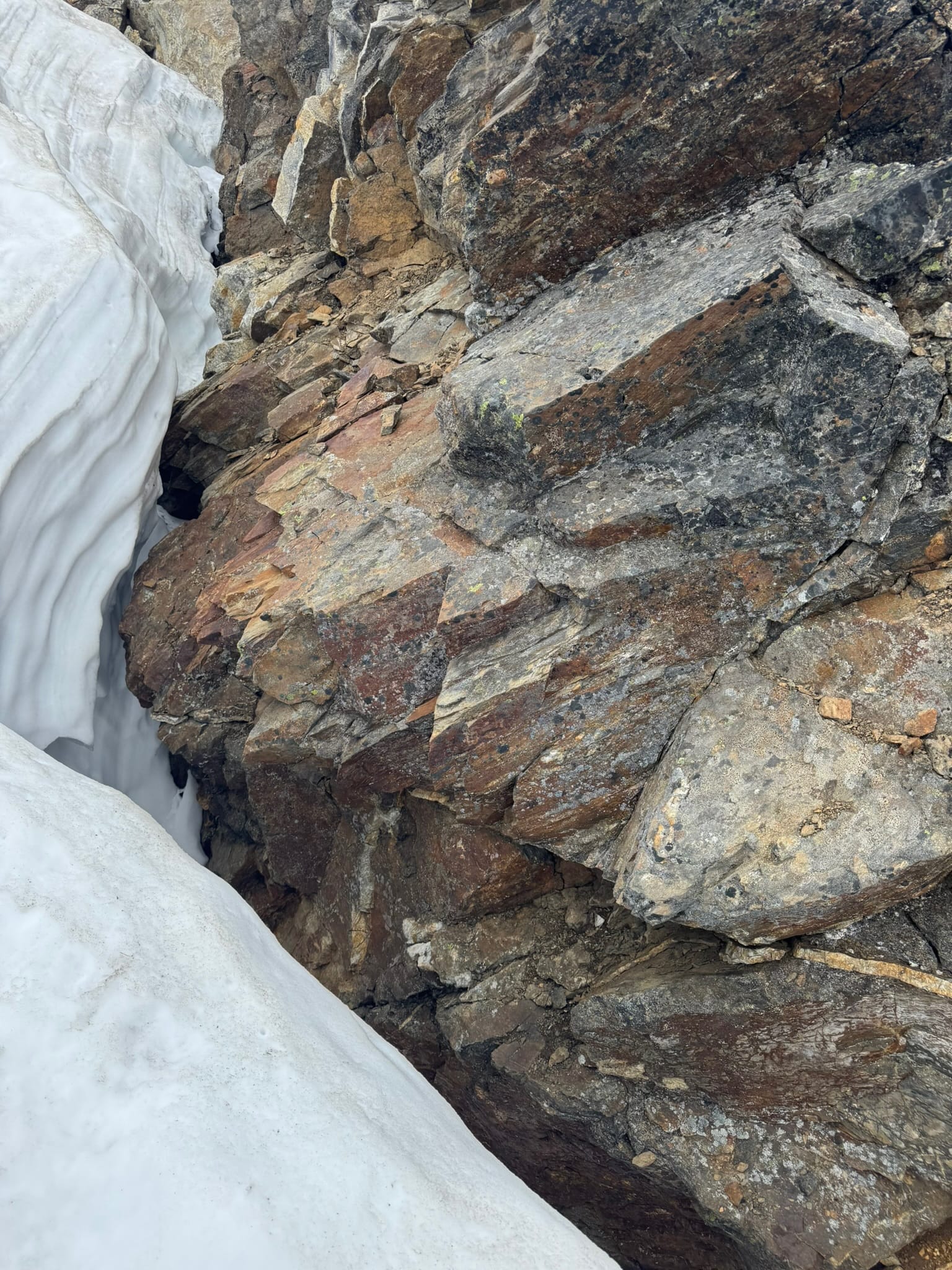
This is the first area where 2-week-prior snow cover would help. To the side were mercilessly steep ledges and cliffs. Below was a mercilessly steep icy snowfinger in a gully that had some moats around the sides. Some folks seemed to climb on ledges like Goats. Or maybe it was Just the Goats. Who can say.
I stepped off a moat at the top of the snowfinger and looked around the ledges. I ended up swearing a lot and climbing back onto the icy snow finger. I faced toe in and stomped my way down to the dirt below where it seamed with steep snow. I slowly downclimbed loose and wet dirt & rock until I could reach the next snow, where I gratefully traversed upward and sideways until I reached the main snowpatch. This is a generous and gently ascending ramp up to the arm of Clark. Easy peasy.
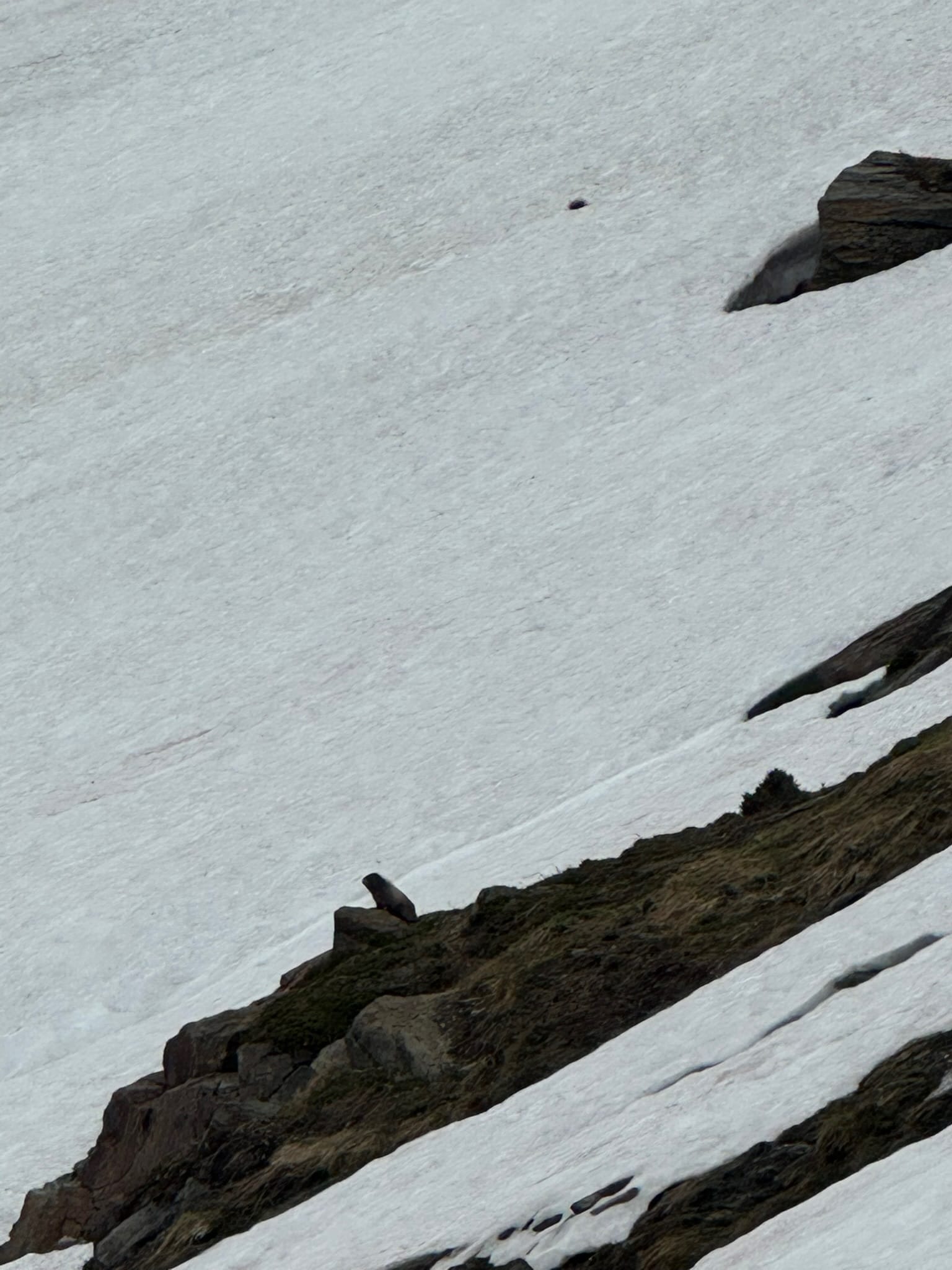
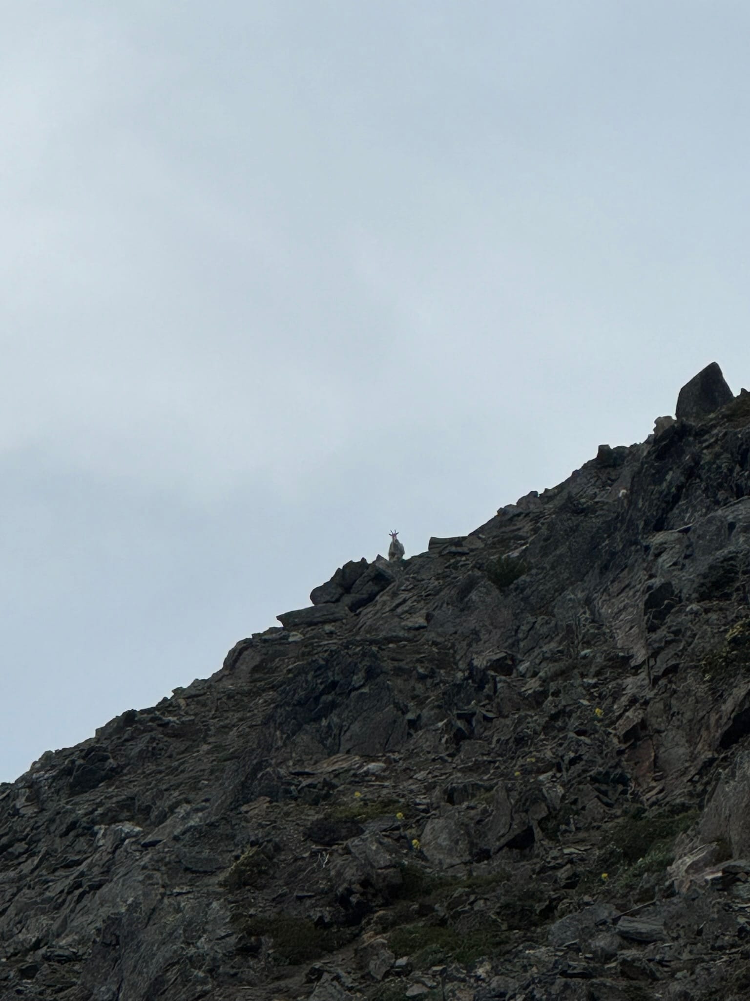
I noted a number of goat tracks in the snow. It turns out I was going to be best friends with goats for the next little while. And Marmots. They were screaming and singing. I felt like they were my biggest fans.
I made it up to the arm of Clark with no issue aside from feeling my 0530 start time.
At some point on this arm, I looked over at the "Steep" of Clark that prevents most people from carrying over the top. I noted many steep ledges and thought, That would Be A Pain, Good Thing I am Headed Down After This, for the main route seemed to descend into a basin below that held snow and grass.
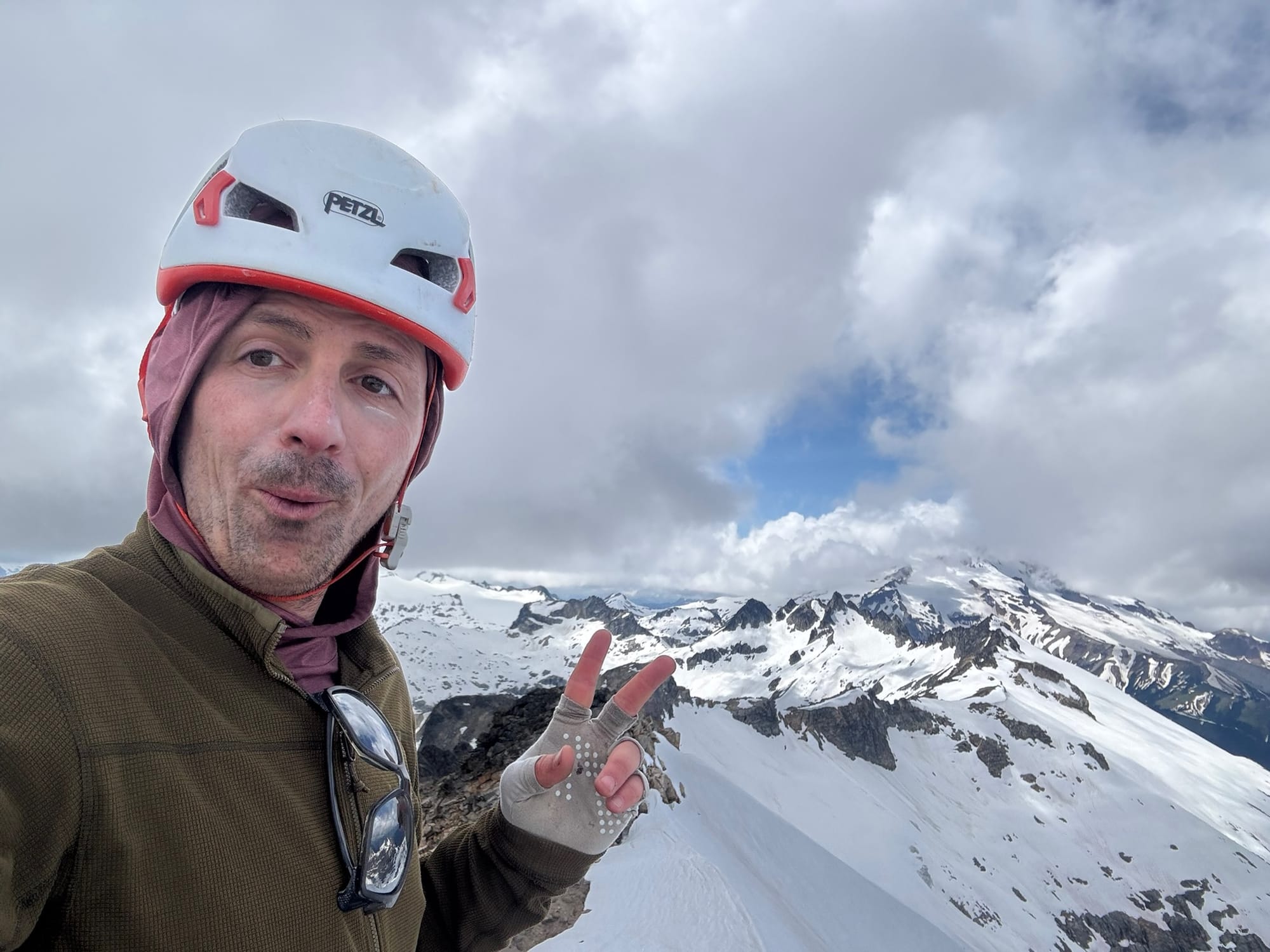
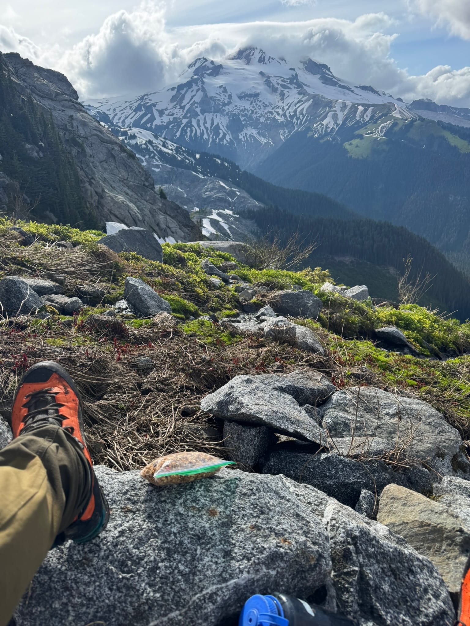
I swapped to a summit pack and scurried up. When I got up high and was just thinking about where the peak was, I noted colored rock where lichen was worn off and a crumbly path that took me to the summit. Why blaze your own path when others have paved it for you?
I enjoyed the visibility available and devoured gummy worms that were burning a hole in my pocket. I double checked the route that carries over the peak top and could not see myself enjoying it.
After some time up top, I down plunged on snow to my pack where I reassembled. I could see the basin and thought that it would be tiresome but nice to plunge down to grass and snow, then upclimb to the saddle between Lauhna and Clark.
As I downplunged to The Notch, a pit opened in my stomach as I noted that the main route does in fact cross across ledges and does not in fact get anywhere near the grass and snow. This is a place where I might have enjoyed 2-week-prior season snow.
I skittishly, and with much swearing, moved across the backside of Clark for the next, "Checks my Notes," Several Hours. That my last 1/2 mile took as long as my first 9 miles felt inspiring.
The Goat hoofprints appeared in patches of dirt that clung to the ledges. After a bit, I looked on the ledges above and saw that real goats had come into view. They seemed to look down upon me , a monkey out of its element. Additionally, horned goats are on of the Top 5 Scariest Creatures in the Woods. Look at those horns and those empty eyes and the primal needs.
Alas. I stayed away from these goats.
As I shimmied along, I can only say I recommend adding more flexibility to dropping and gaining elevation than I had. I think I automatically tried to stay high more often than I should have and sometimes put myself in tighter moves than I would have otherwise.
I sighed when the walk-off to the snowpatch came into view.
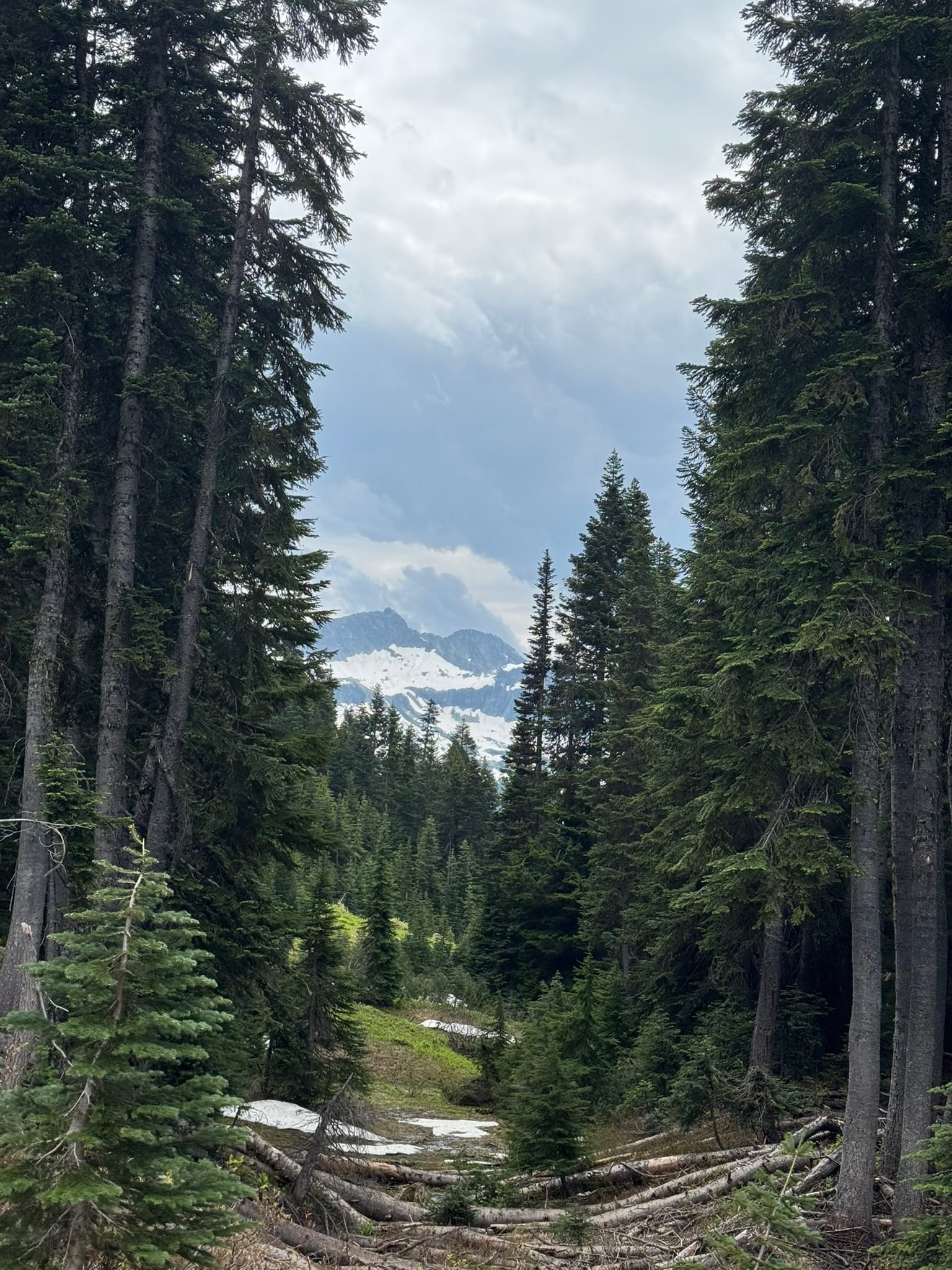
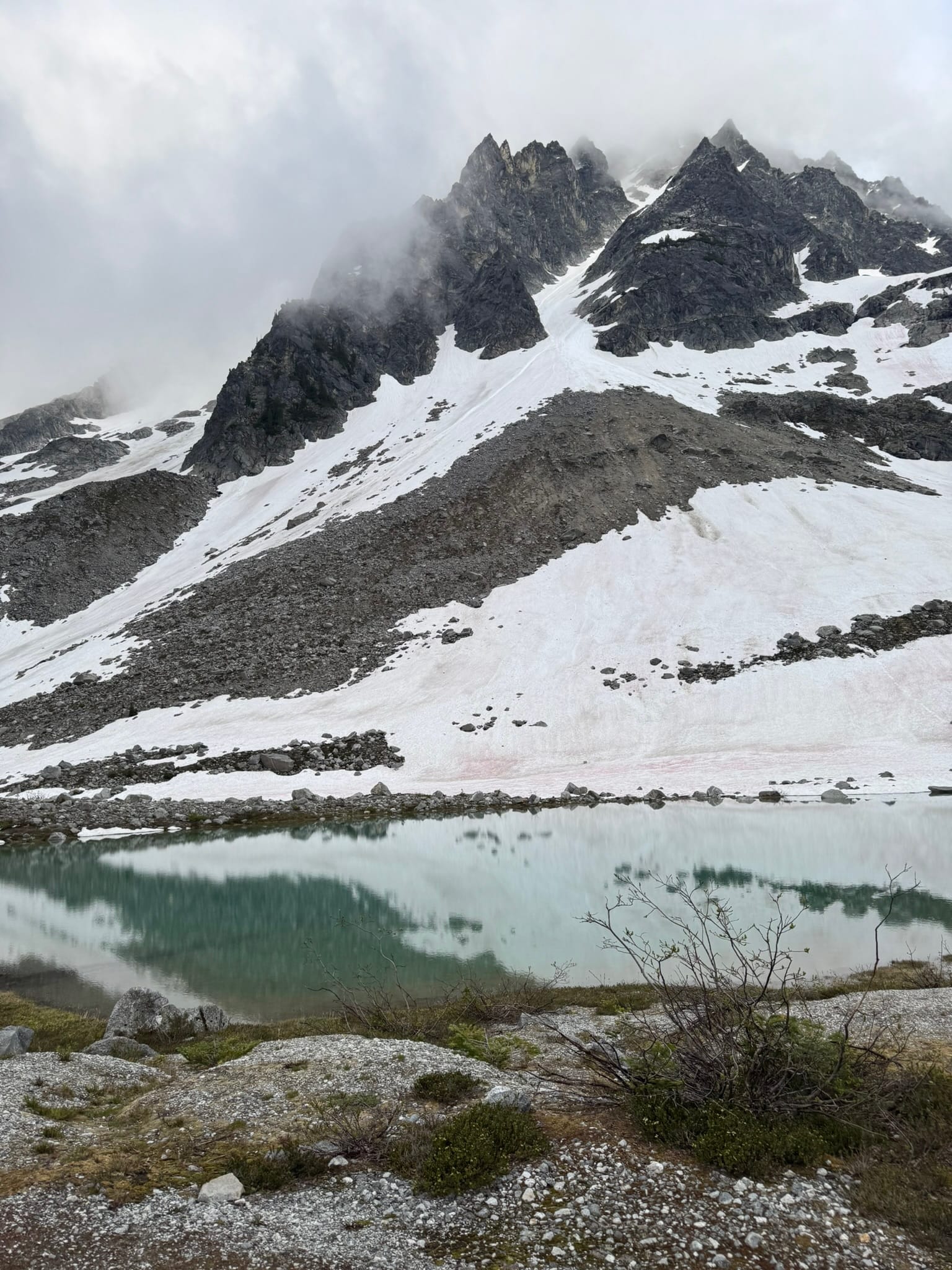
From here, I could angle up to the saddle that Clark shares with Lauhna. After a bit of wandering up in the saddle area, I decided I would try to camp via a flat-ish patch of sandy-dirt next to a bivvy site. There was no protection for my tent, but it worked well enough. I spent an hour boiling water and watching the sunset over Luahna with its majestic ridge.
Day 2: Clark Shoulder, Lauhna Peak, Chalangin Peak, Across Butterfly and descent to Ten peak basin above honeycomb lake
Day 2, 5.39mi, +1,454ft, -3,557ft
Max Elevation: 8,449 ft
Min Elevation: 5,530 ft
9h 53m
I awoke to the screaming of my marmot fans and got a mercilessly slow start.
When I got out of my tent, their singing reached a fever pitch and I swear one fainted before they dropped off into silence. I left at a leisurely 0945. As I left, angling up to the saddle just above me, the sun bathed me.
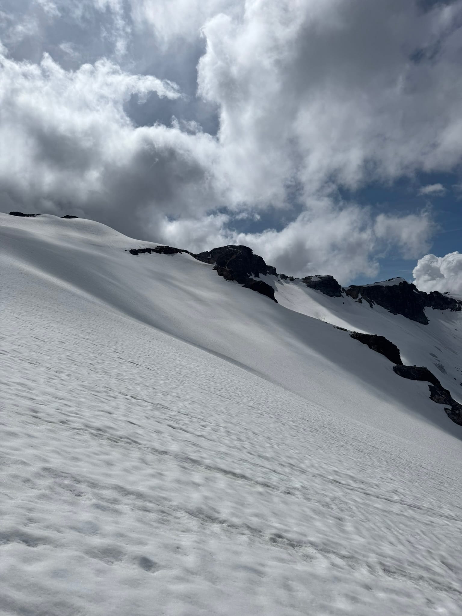
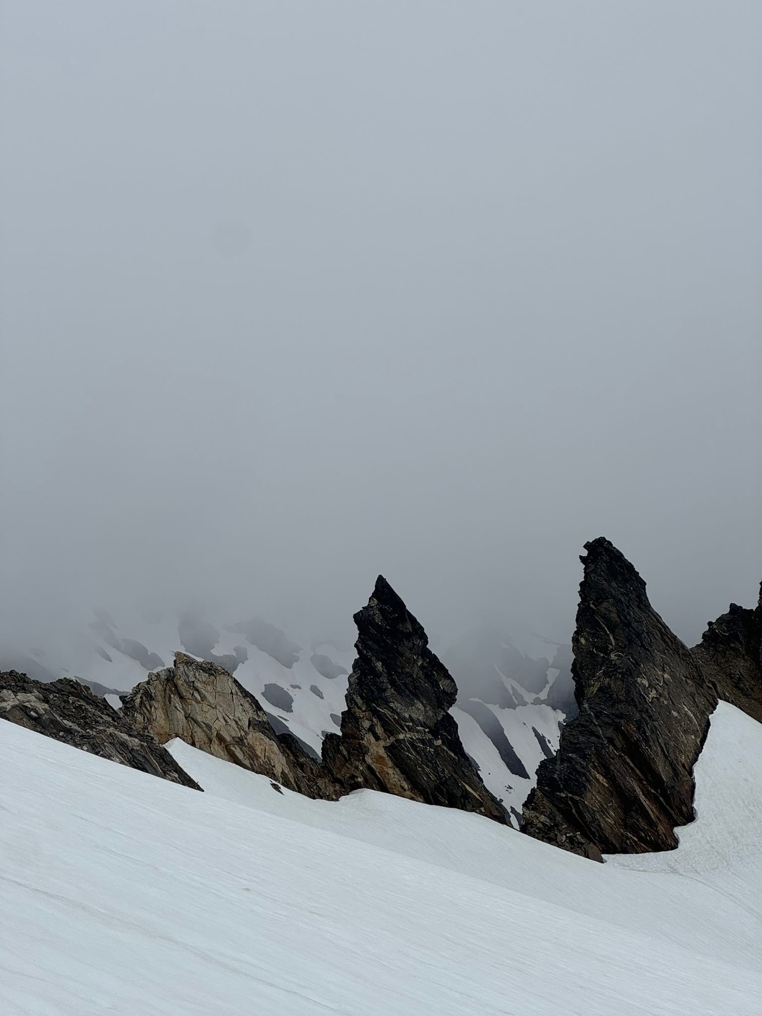
As I angled up and sideways into another steep sidehill on the back of the Vaguely Named Point 7970, I thought that "At least after I get around to the backside of Lauhna, I will be done with the steep sidehilling."
When I turned the corner under the Vaguely Named Point 7970, I saw that I had some steep sidehilling ahead of me. I was not sure how I was going to get to Chalangin, less the Butterfly Glacier, but you know the motto - knuckle up- we're going one section at a time!
At this point, clouds moved in and Luahna stood shrouded. After the vaguely named point 7970, I hit a snowpatch that followed to where the GPX track and Andrew Leach's footprints got off the snow onto rock. There was one duck here to follow upward. I swapped out my pack and started scurrying.
I think I made a mistake here. Adjectives used in trip reports were "Fun Scramble," "Far more Enjoyable Than Clark," "Class 3 & 3+ good times,"
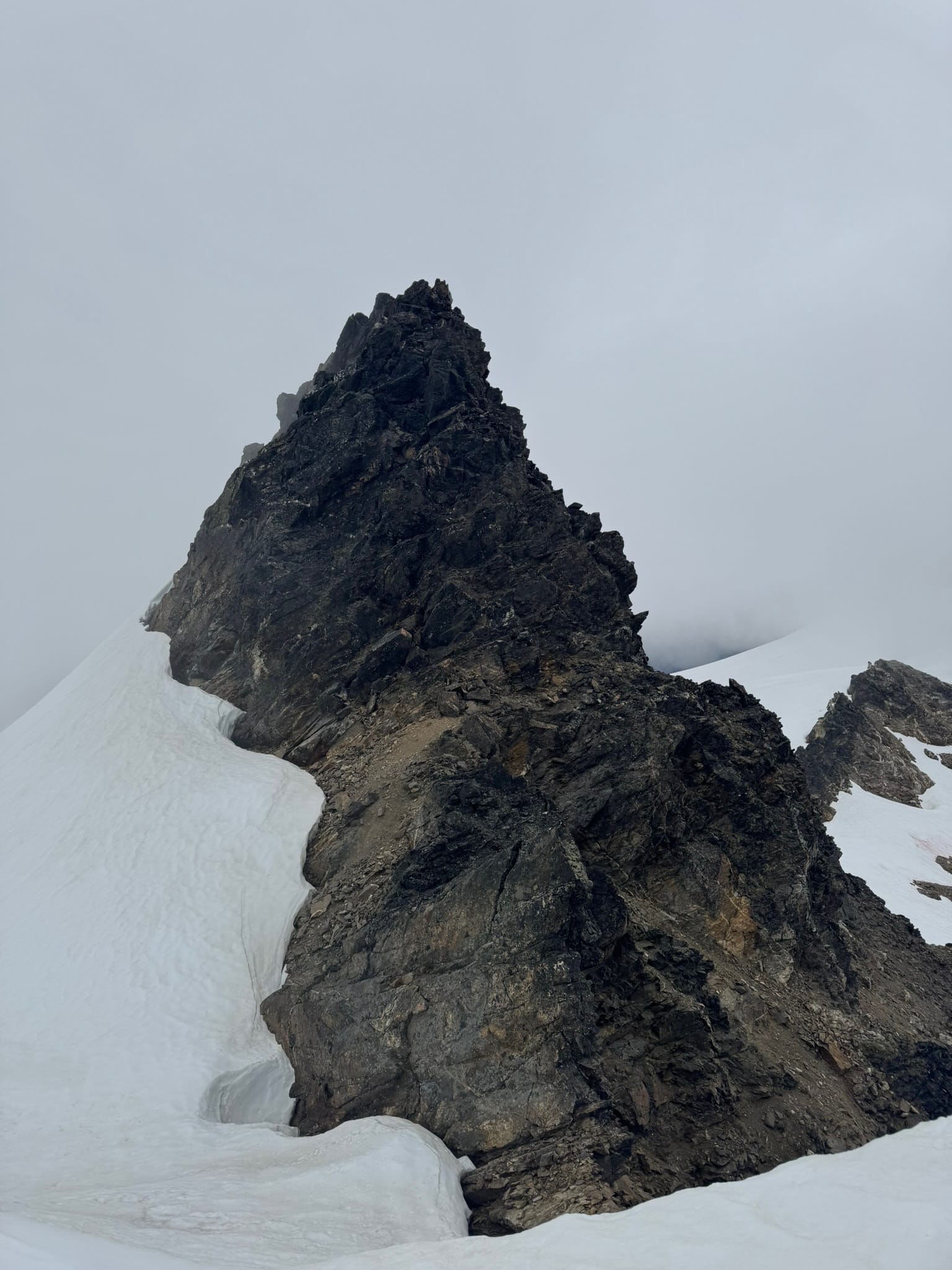
My adjectives were "What the hell is this garbage," - I ended up angling underneath Lauhna on loose dirt and shit sidehilling, thinking it was just a part of the game. As an amateur route finder, using context clues on the rock at the top of Lauhna, I think I was meant to scramble up directly above where I left my pack, end up on the ridge, then scramble across firm rock up the back of Lauhna. I did not confirm this, but the reports I read did not mention 90% of the climb being loose downslope rock gullies and ledges. I digress. The last 10% was firm nice rock that I followed up to a summit.
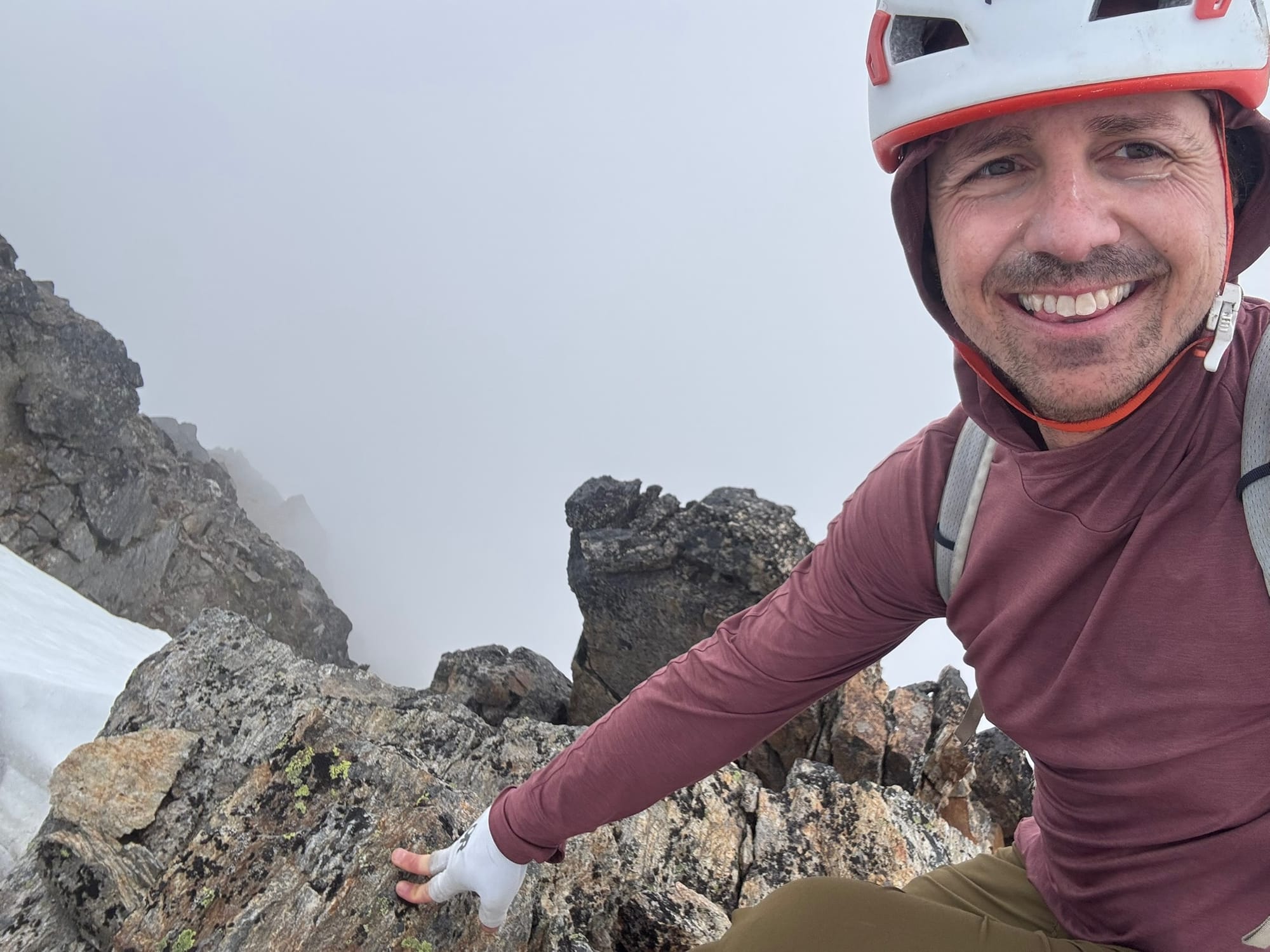
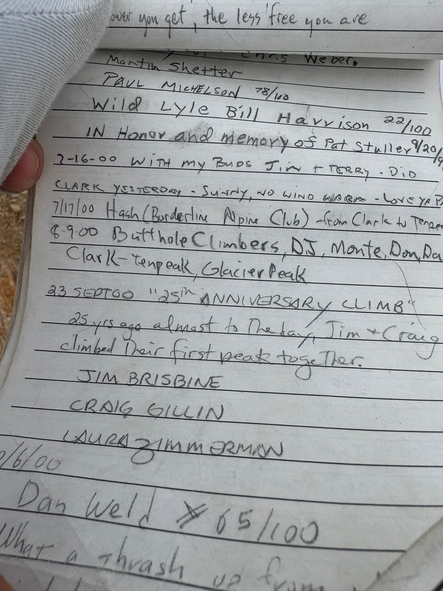
Fog devoured my view, but I got to read The Summit Scroll.
Unfurling the sturdy yellowed paper, sitting there since the early 90s, felt imperious and I decided more communications should be done in such a way. I found my friend's 25th anniversary climb. It felt really awesome to connect through time over a shared experience of this summit.
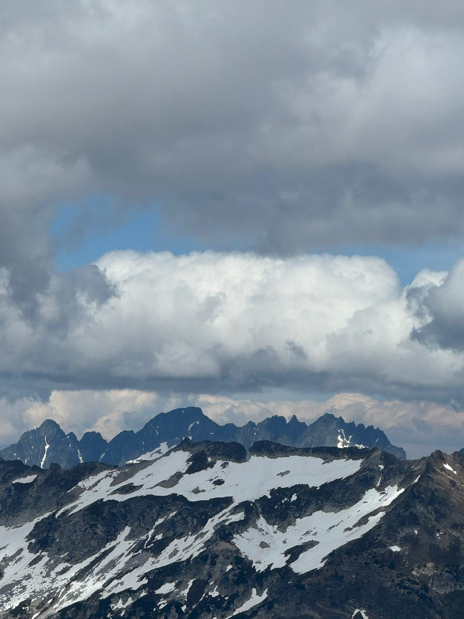
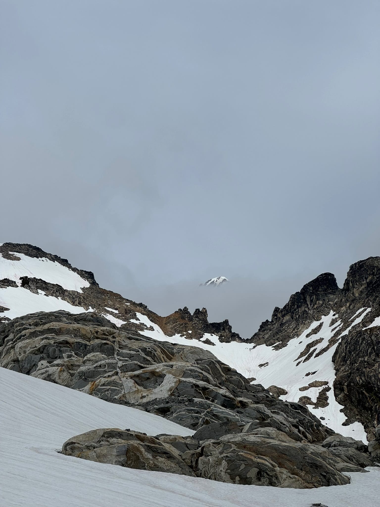
I shivered in the fog and wind and sat on the north side of the summit, watching the clouds move in and out with occasional breaks in views over the pitz & richardson glaciers.
To quote the Forest Service Dude, this is Beautiful Country.
I had quite a hunch at this point that I should follow the ridge, but the familiarity of where I had been was too strong. I downclimbed then slid down loose rock on my way back - wondering about the alternate approach as I performed maneouvers on shit loose dirt and in interesting gullies. I made it back to the snow and across to the ledge I left my pack on. I shivered as I swapped out gear and got my pack back on. Time to ride! I ended up on snow for a bit before it became a series of ledges again that had me singing. I wondered how I was going to manage THIS.
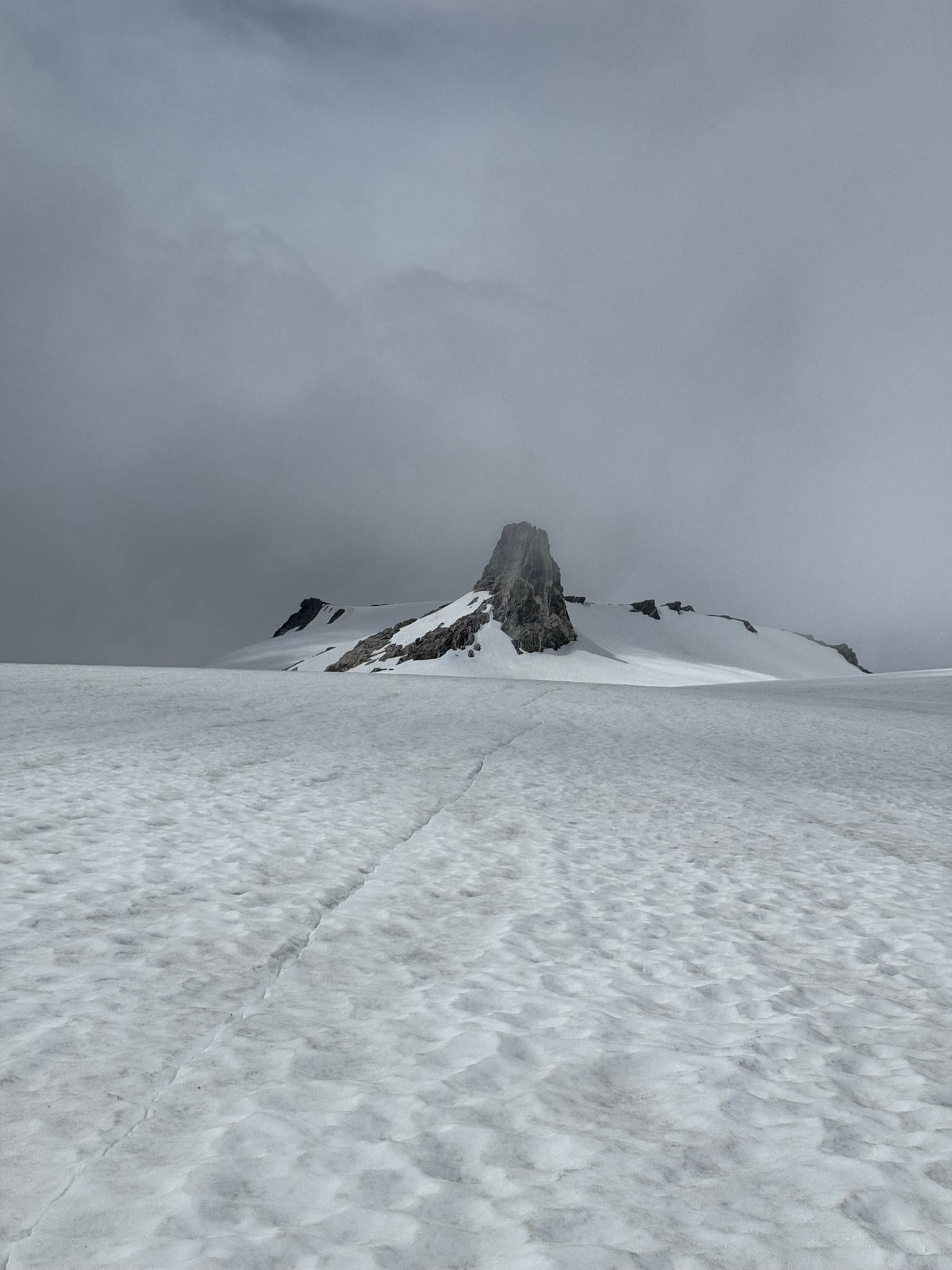
I made a painstakingly slow traverse up and down ledges, again following the footsteps of my brethren goats. I made it through the next section, allowing a little more freedom to hop up and down on ledges to gain and lose elevation, before making it to the Arm of Chalangin. I only had 1 track for Chalangin and that person had so far taken more risks than I.
Despite this, Chalangin was the same amount of sidehilling as before on its eastern flank, eventually transitioning to a scurry up a last steep section of dirt to the summit area.
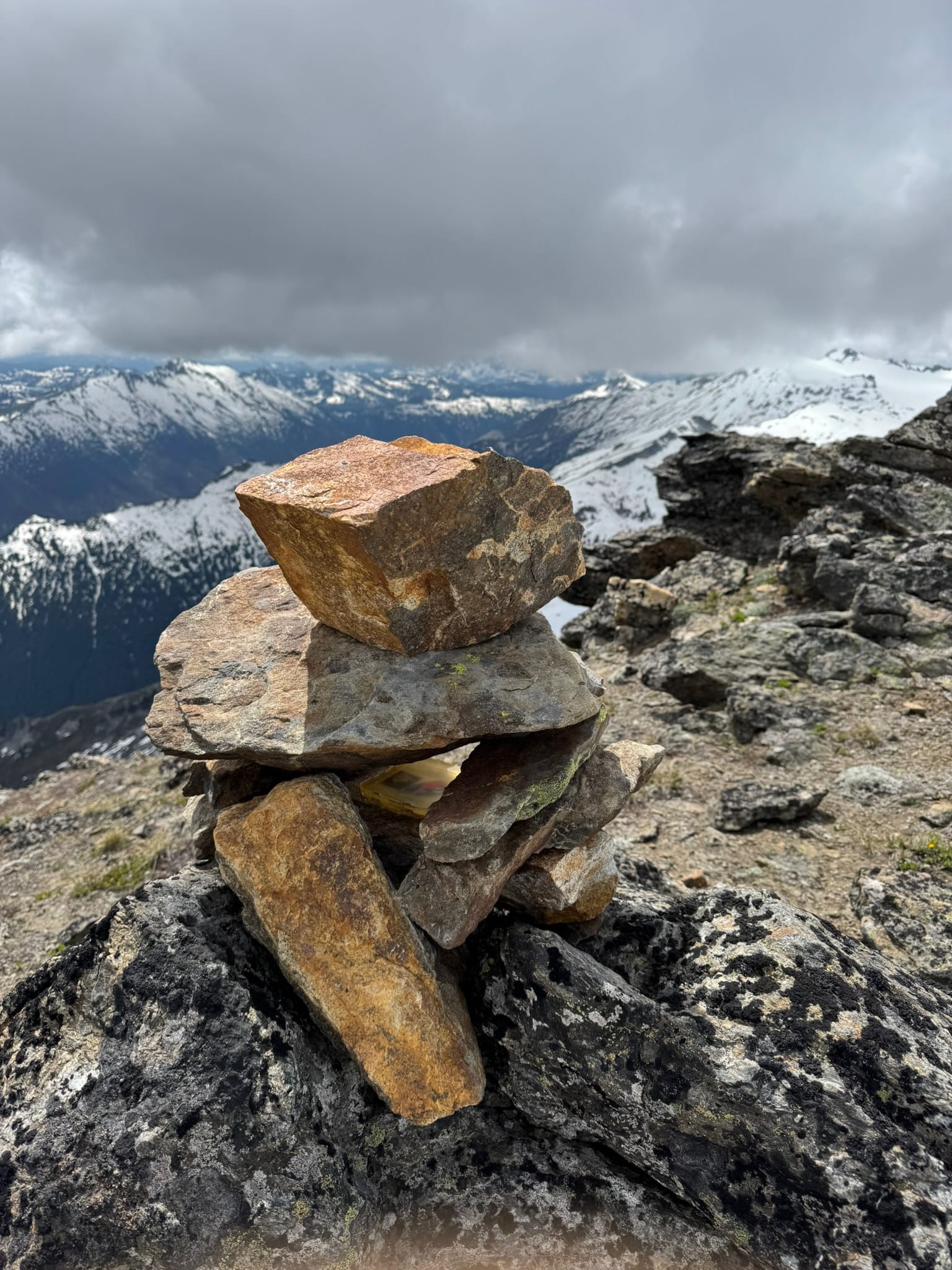
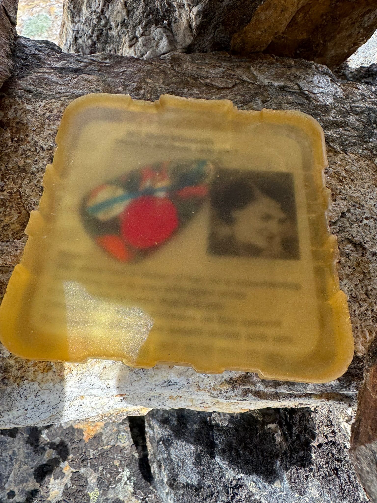
There was a pile of rocks in the middle hump, I went to grab the thing in between rocks, thinking it was some new form of summit register...But my fingers grabbed something I did not expect that was not movable. I pulled them back and saw this was a .. .Shrine! To someone from long ago. Who knew.
I scurried leftward and westward up to what I thought was the summit.
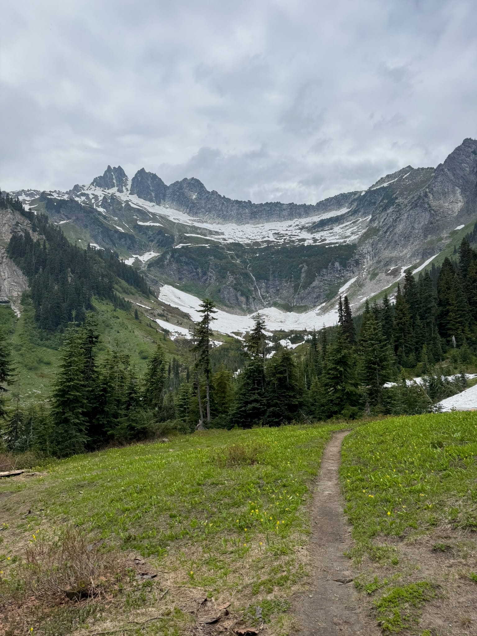
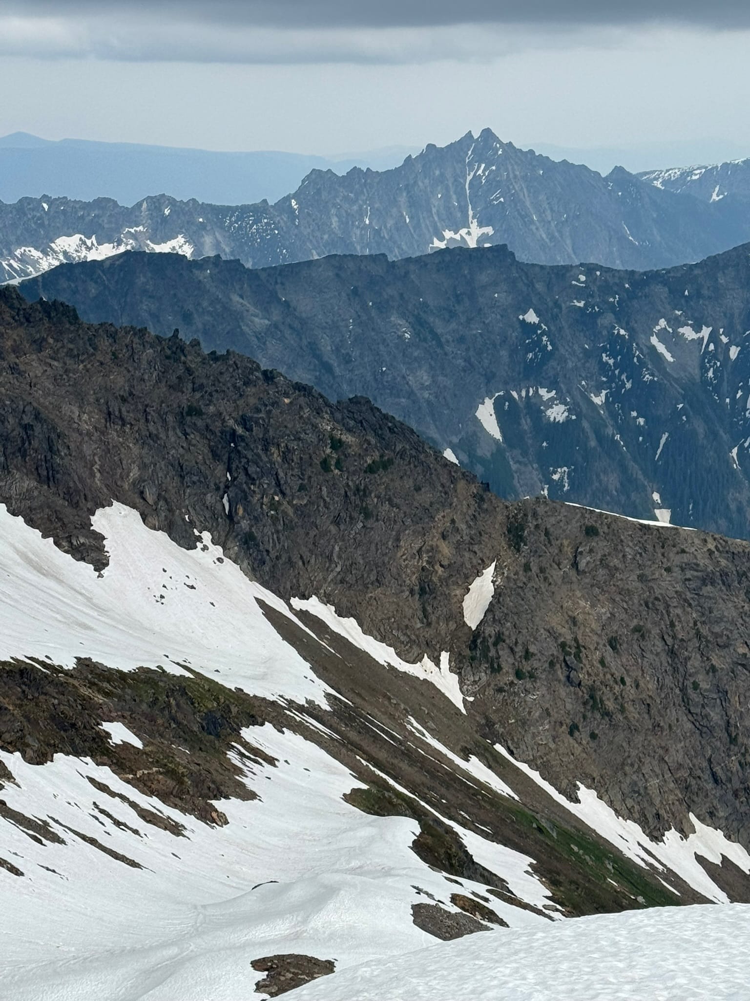
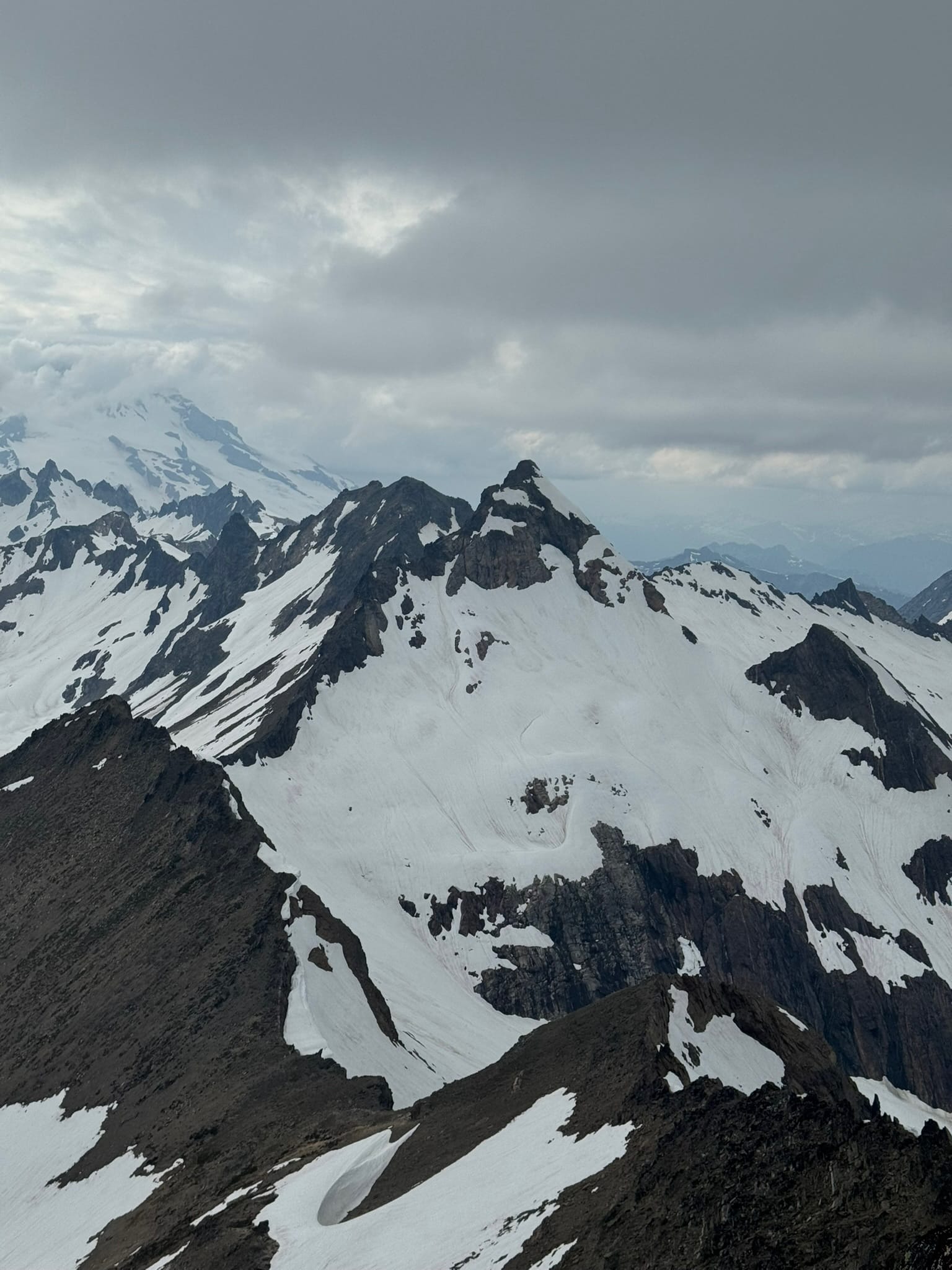
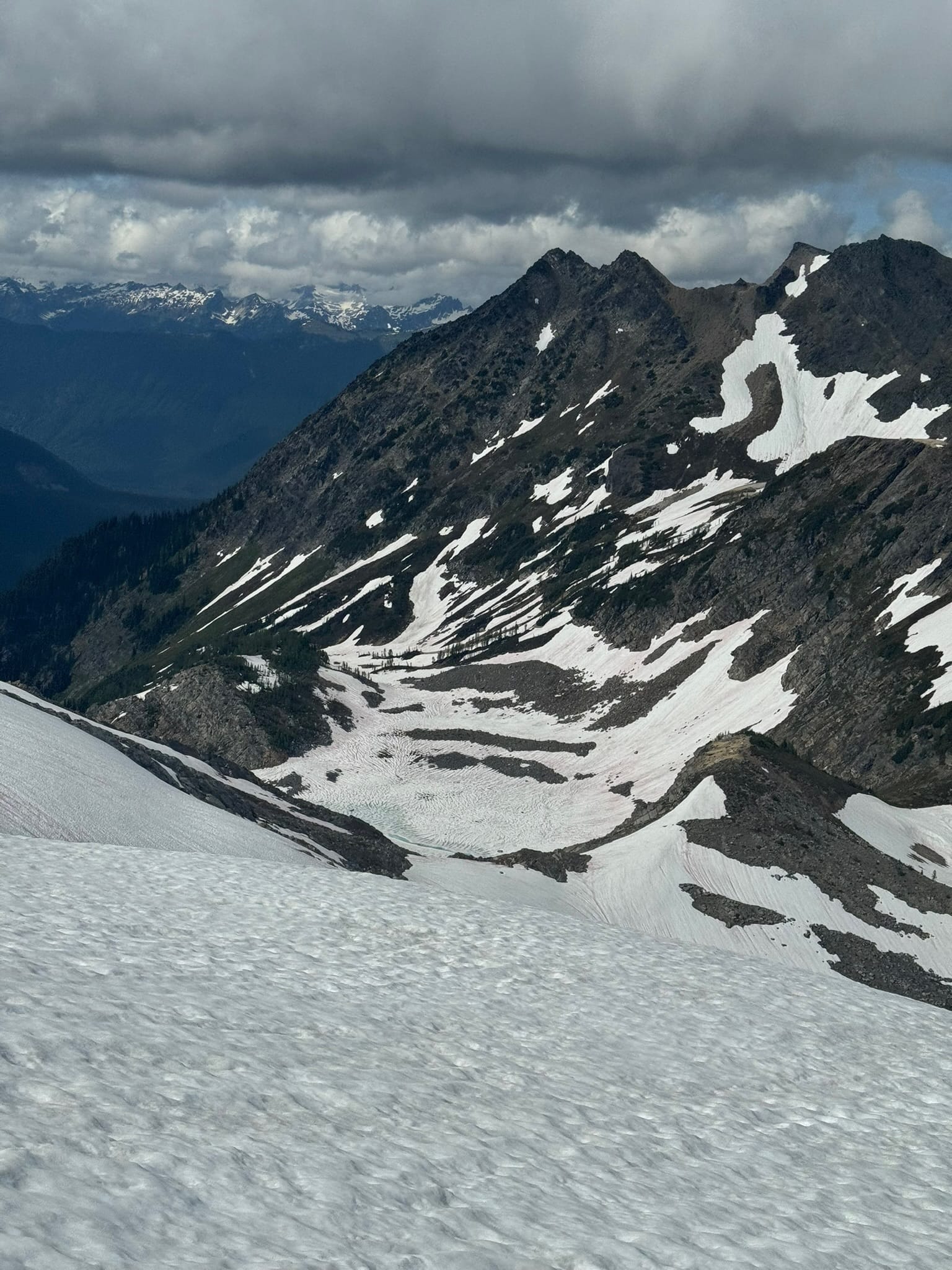
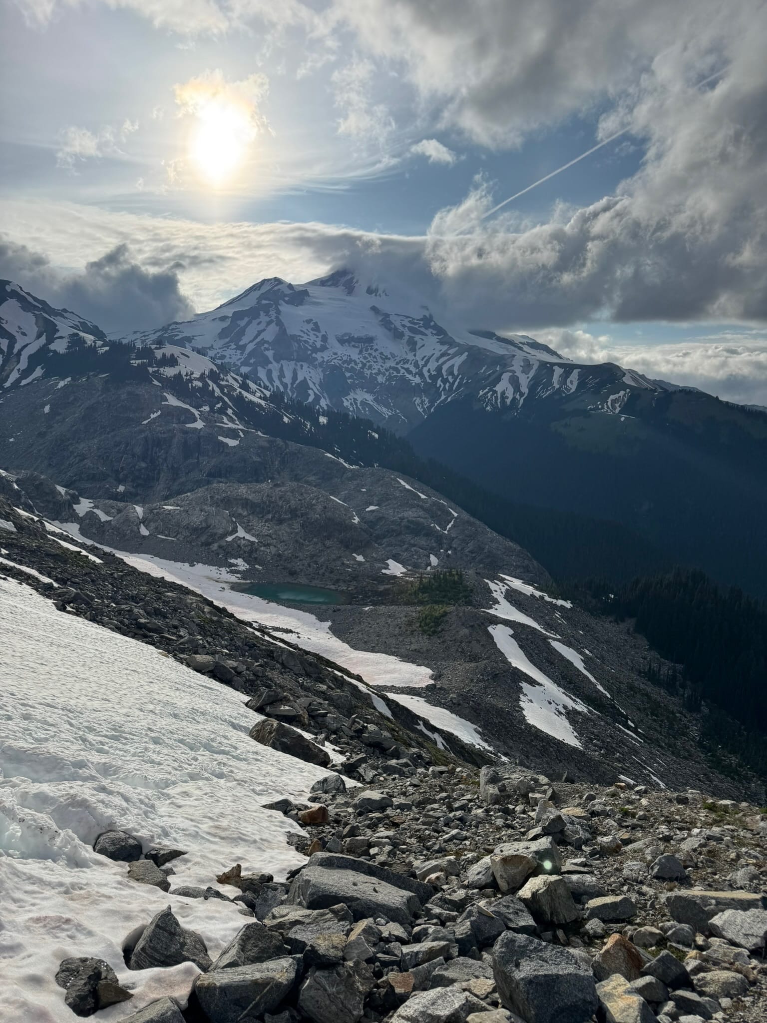
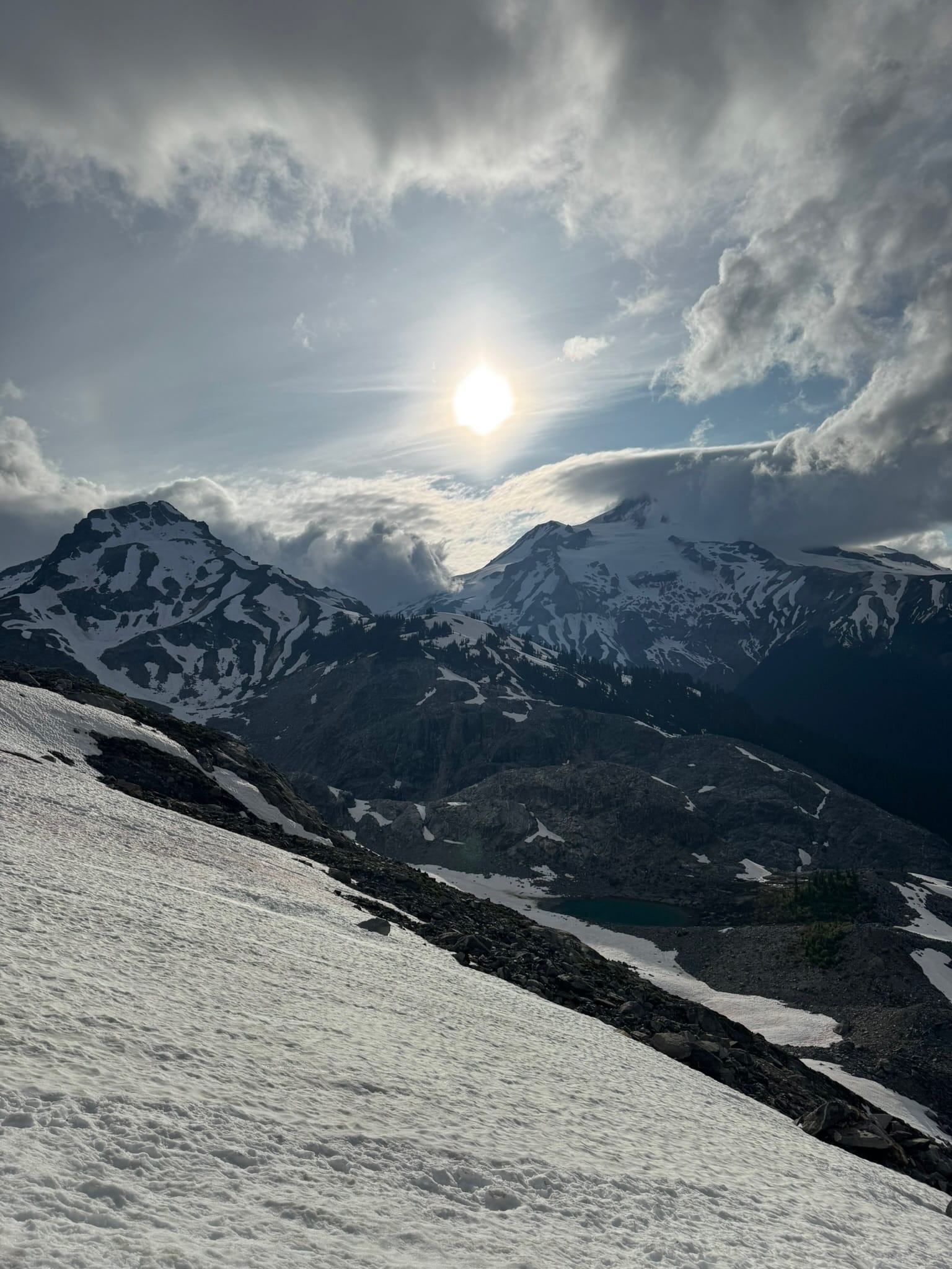
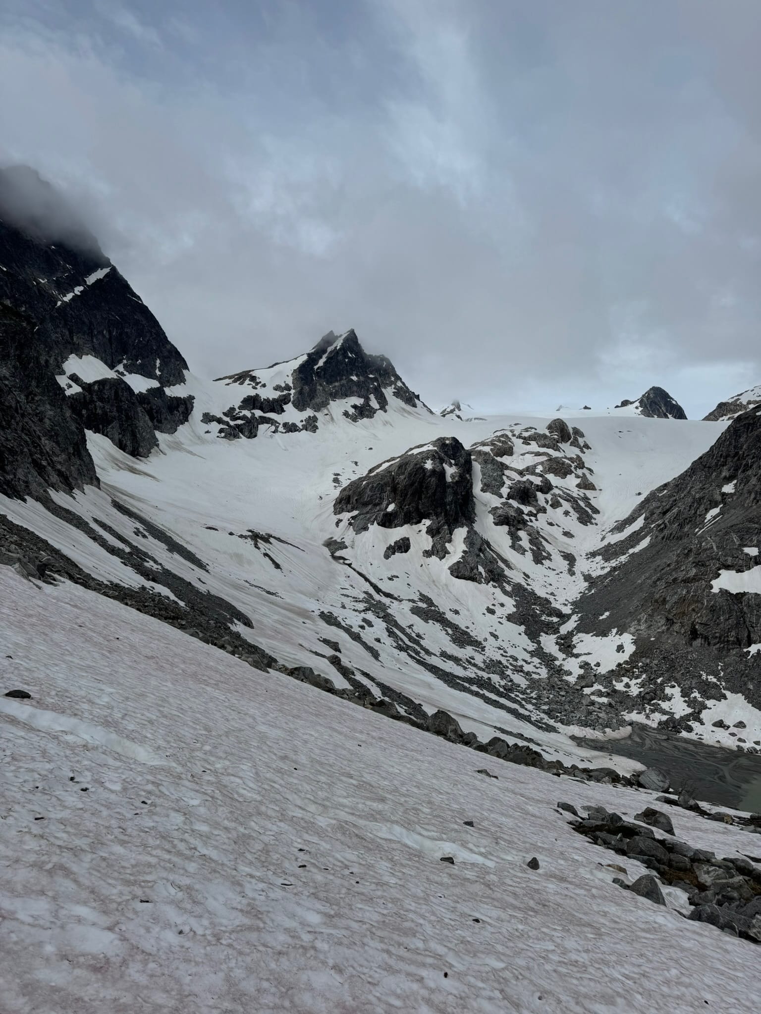
I dropped my pack and hunted for 15 minutes for the summit register. I must not be good at this activity, as I did not find it. I sat on a rock and enjoyed some gummy worms and VIEWS. The sun did not completely break through, but I could clearly see Clark & Lauhna, the "Fabled Napeequah Valley," and its ranges beyond, the arm of Glacier Peak, and the Ten Peaks area as well as the Butterfly Glacier before me.
Color me tickled!
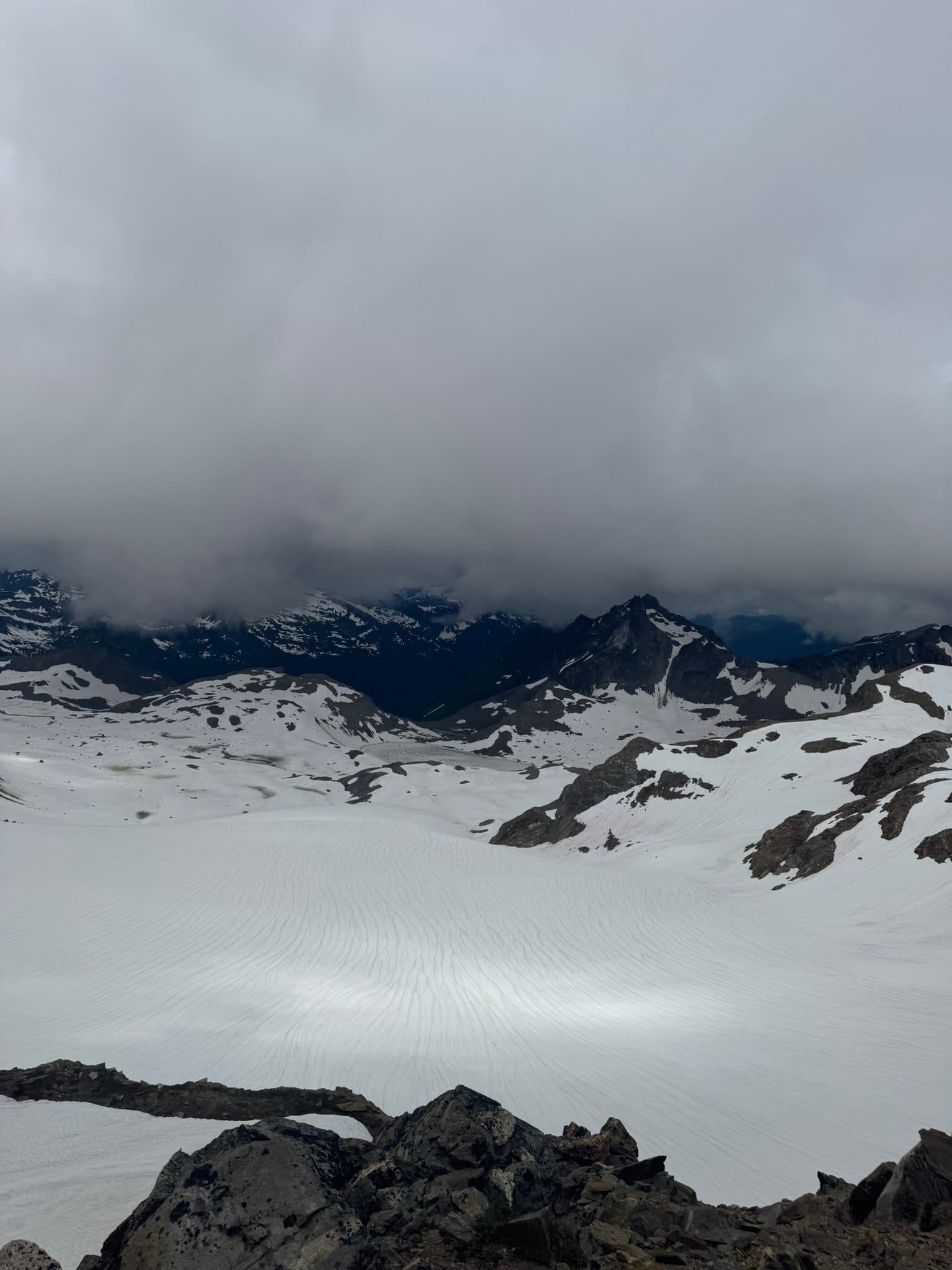
At this juncture, it became My Route, and was time to engage in Choose My Own adventure. I scoped out a patch of snow just off the summit that I could do a couple simple but slow moves, then get on a steep snow finger, onto a steep snowfield, and plunge around some cliffs to the flatter part of the butterfly glacier. I could wrap along the band of glacier above the basin below, hugging onto the wall, then off the arm of Neyah point. Alternatively, I could plunge down into the Butterfly Basin ( I will call it) in the Nepeequah valley.
After chewing over this with some gummy worms, I decided to stay high and traverse across the upper part of butterfly glacier instead of dropping, since I could not see the potential cliff bands below me.
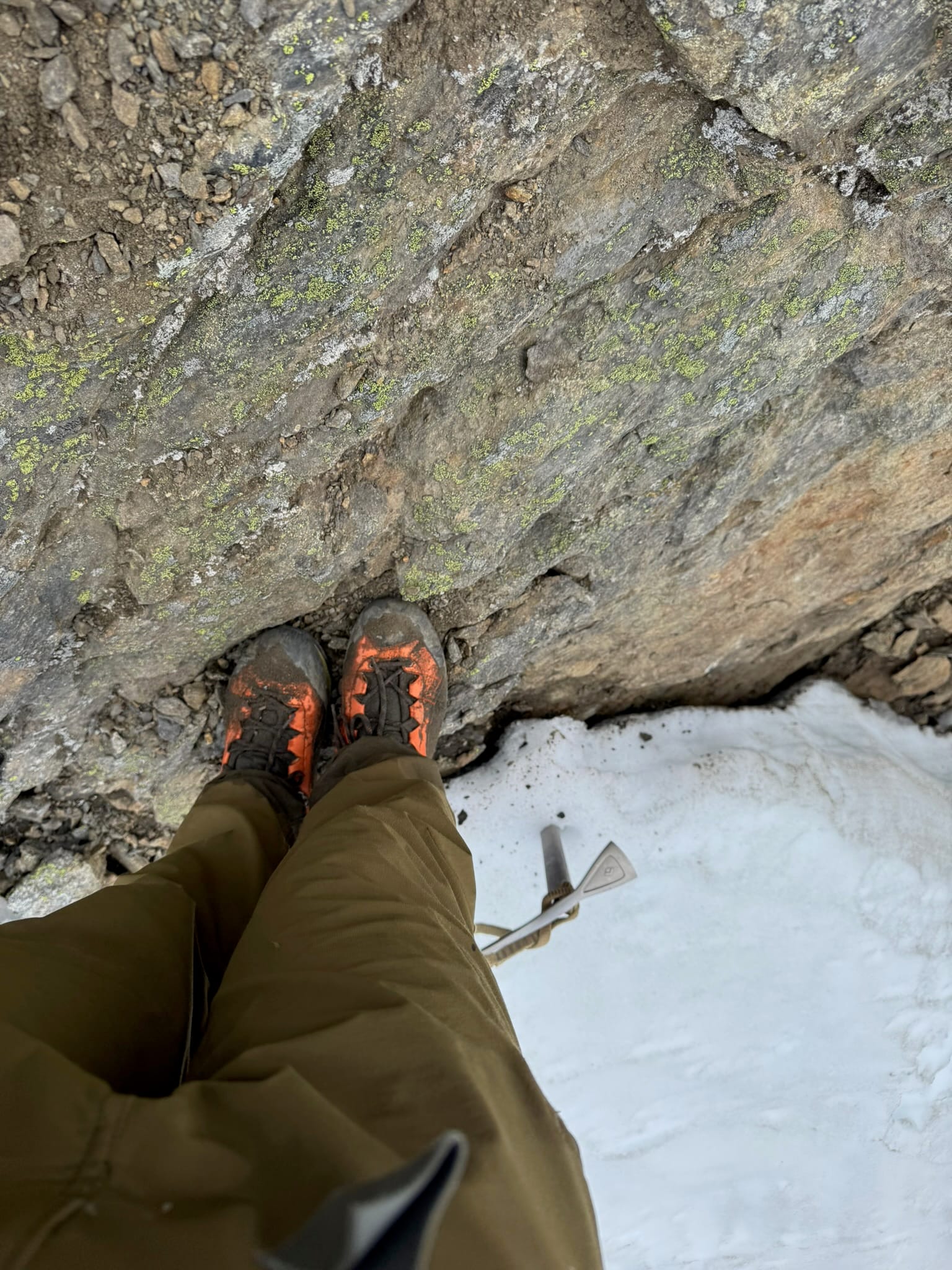
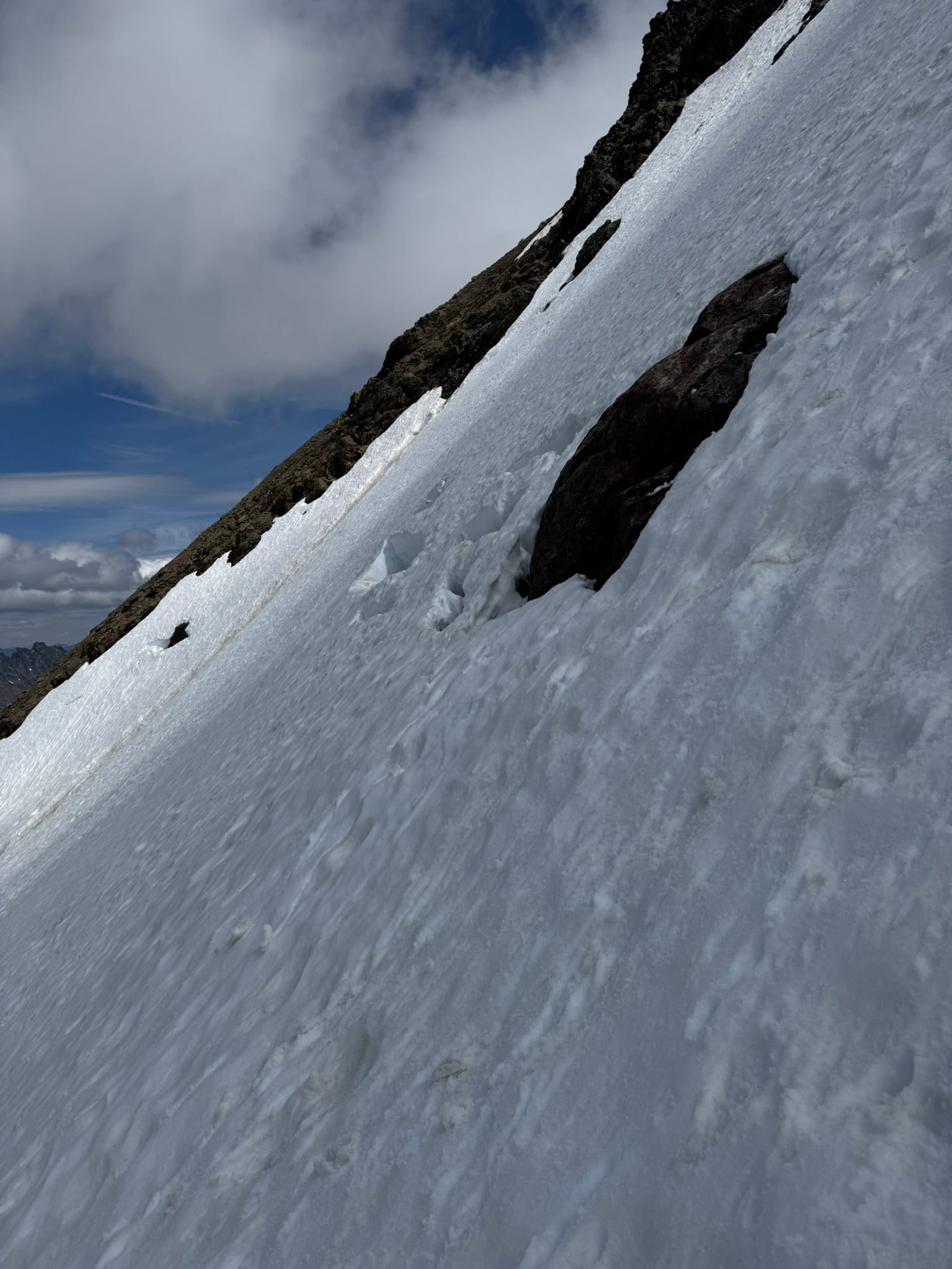
The drop was steep but I managed. I crampon'd up and started stomping sideways.
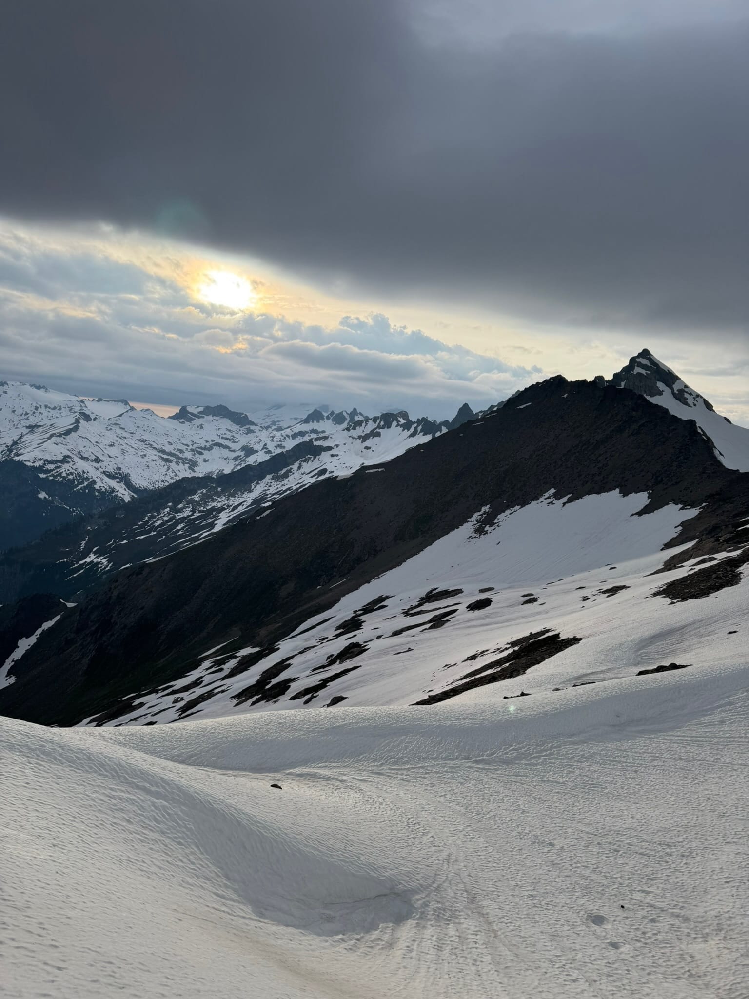
I flew across the glacier, enjoying the magnificent light patterns that scattered across the smooth glacier snow & the toothy peaks above me, intermittent with cloud cover.
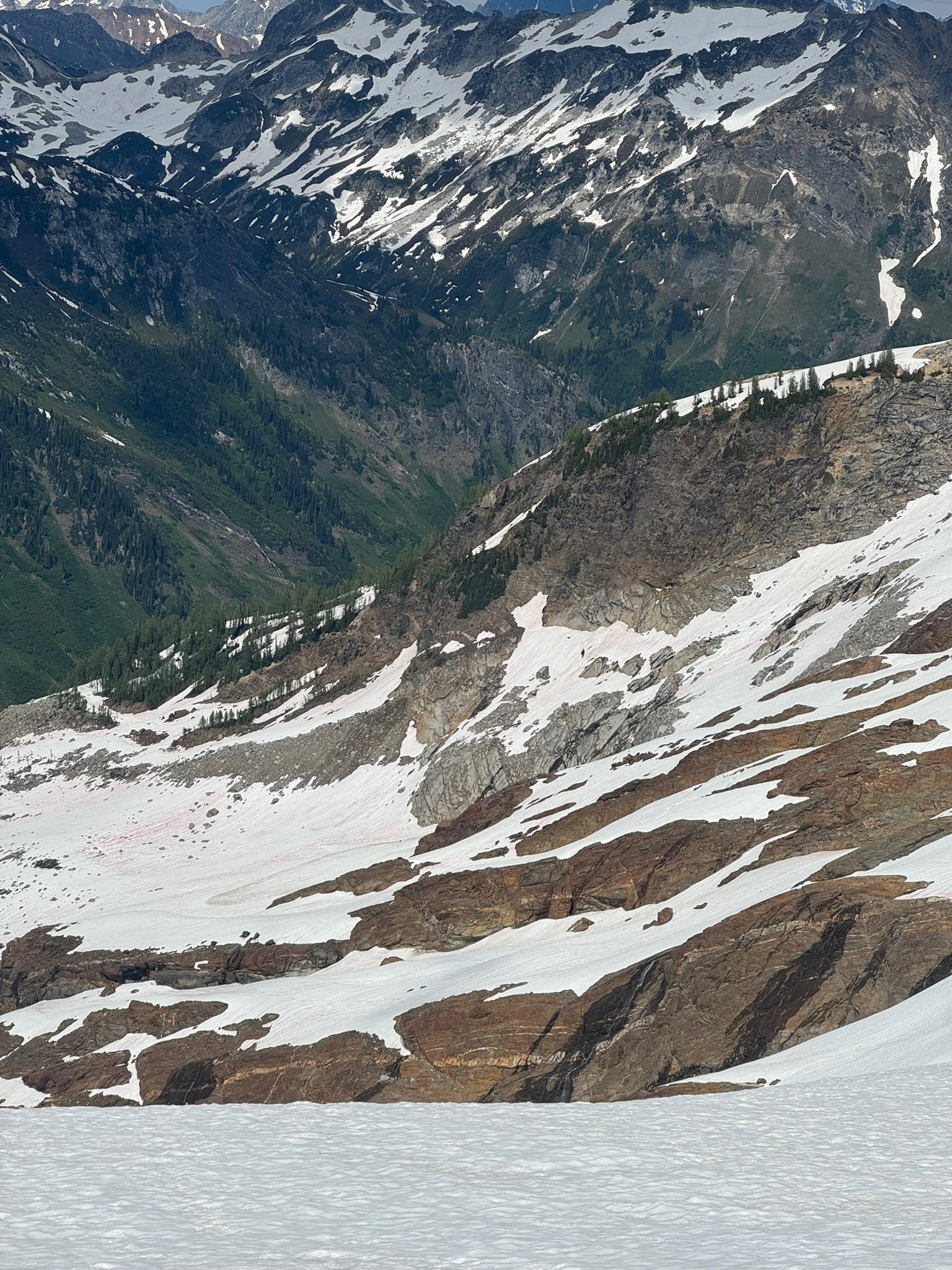
I enjoyed the deep green hues and redness of rock across the valley. Truly magical.
One section above the saddle between napeequah and glacier peak valleys engaged more aggressive sidehilling, just before an arm that flattened a bit, before turning the literal and figurative corner into the realm of Ten Peaks.
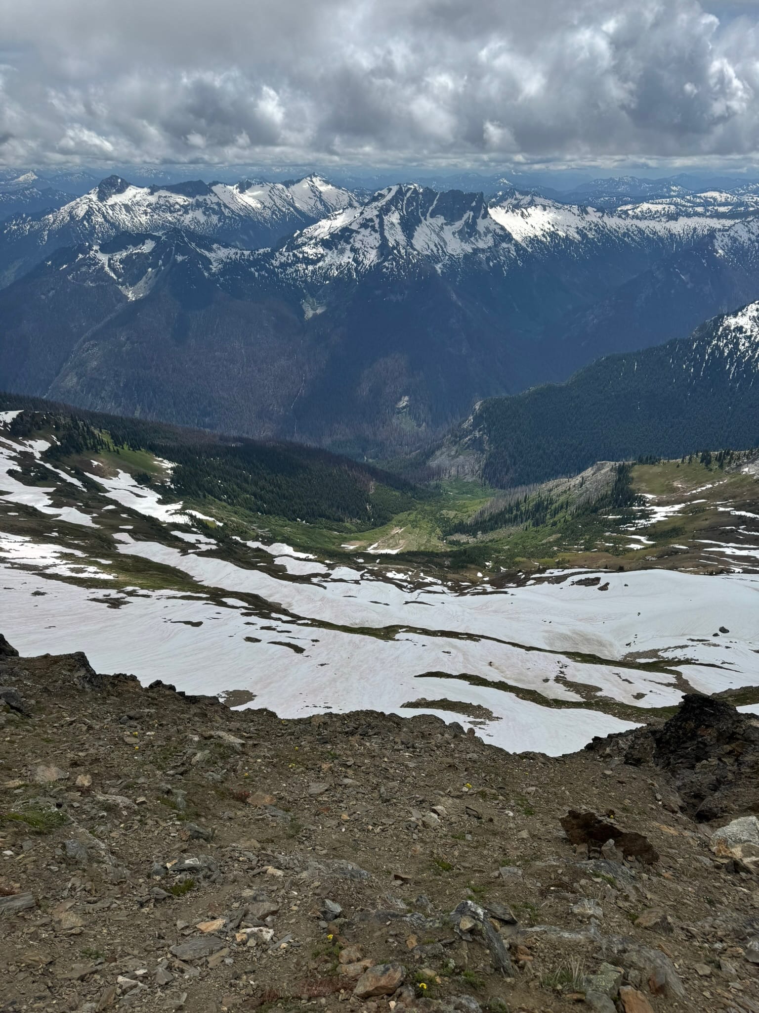
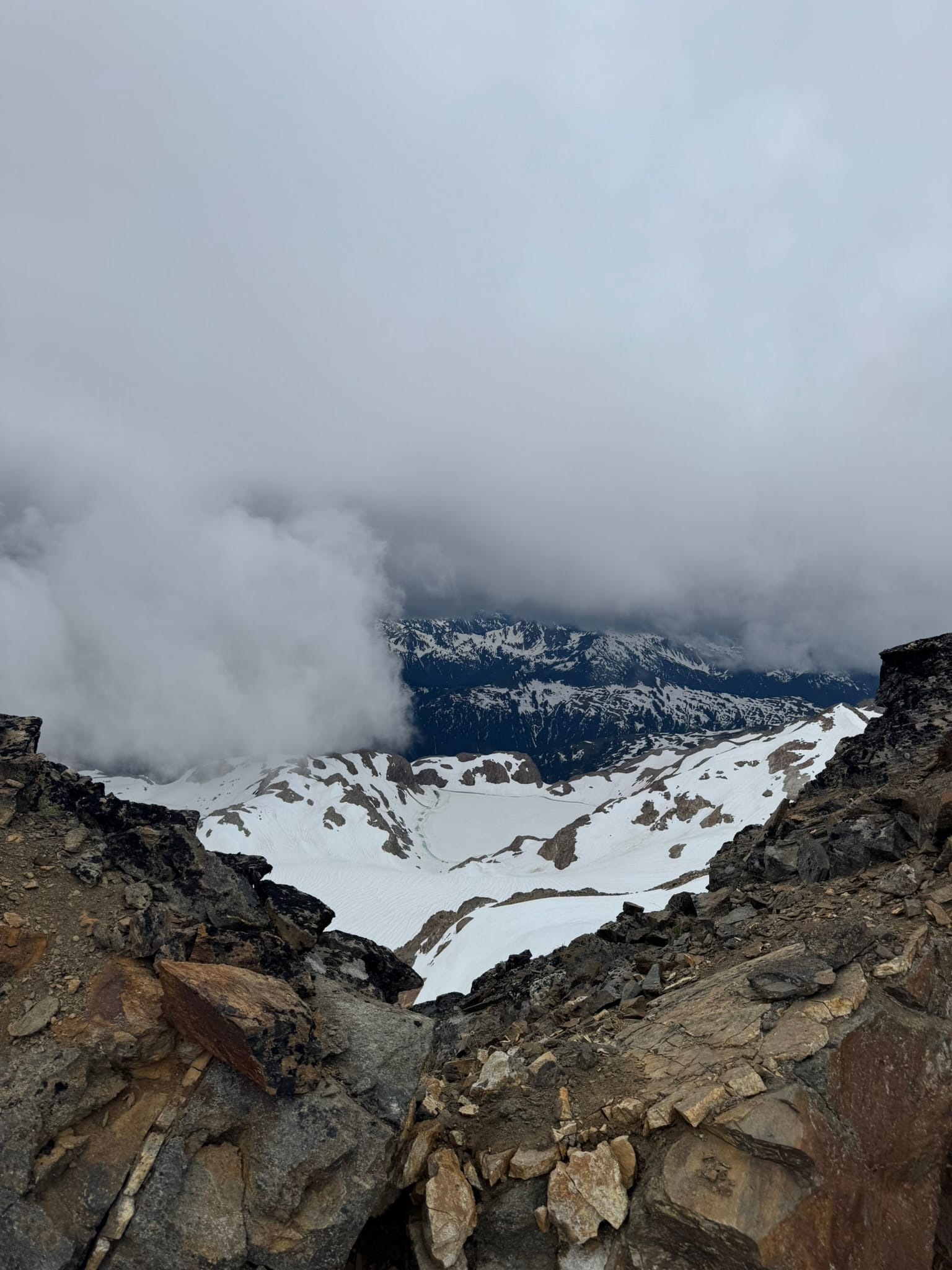
This section sits above a blooming lake and starts to have views of the Dusky Ridge & Gamma Ridge arms of Glacier peak. This view shows the vastness of Glacier as it devours the region around it.
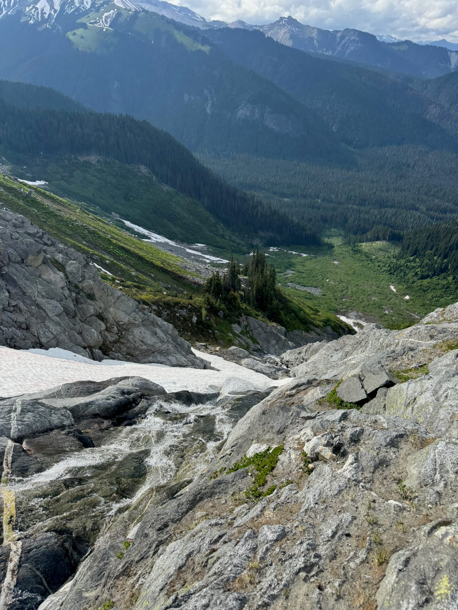
I traversed to Ten Peak's arm before dropping. If I did this differently, I would have dropped a little sooner. This part was quite steep. I dropped to about 6800ft, thinking I was close to the crossover of Ten Peak's arm. I had 800 more feet to go. Perplexed, I weaved in between cliffs and thin snow. Of all areas on this trip, I would have appreciated the 2 weeks prior snowpack most in this vertical area.
I ended up walking off the steep snow onto a lump of vegetation with the arm of Ten Peaks and a raging creek on one side and some snow finger and plunge to the valley below on the other. I sat next to a gurgling stream with a view of Dusty ridge and the lush vegetation around me and the Ten peak arm in front of me. This was truly an enjoyable break spot.
I thought I could go to my 6000 ft turning point by staying on the vegetation arm, but after descending, it quickly became apparent that the roaring creek had carved a deep plunging gap with smooth walls far down on the left.
On the right, a gentler descent leads to its own plunging gap and I could not see where these merged back together except maybe way down in the 5000-5400 ft range. That did not seem right.
What I really needed was to plunge down on the steep snow that was between me and the Ten Peak arm. There is an opening with a snowfinger that leads to the next series of basins underneath Ten Peaks that enables an oscillating traverse along moraine and boulder fields to the Honeycomb Glacier.
What I did not miss is that the snowfinger was heavily dissolved and the creek devouring it was angry.
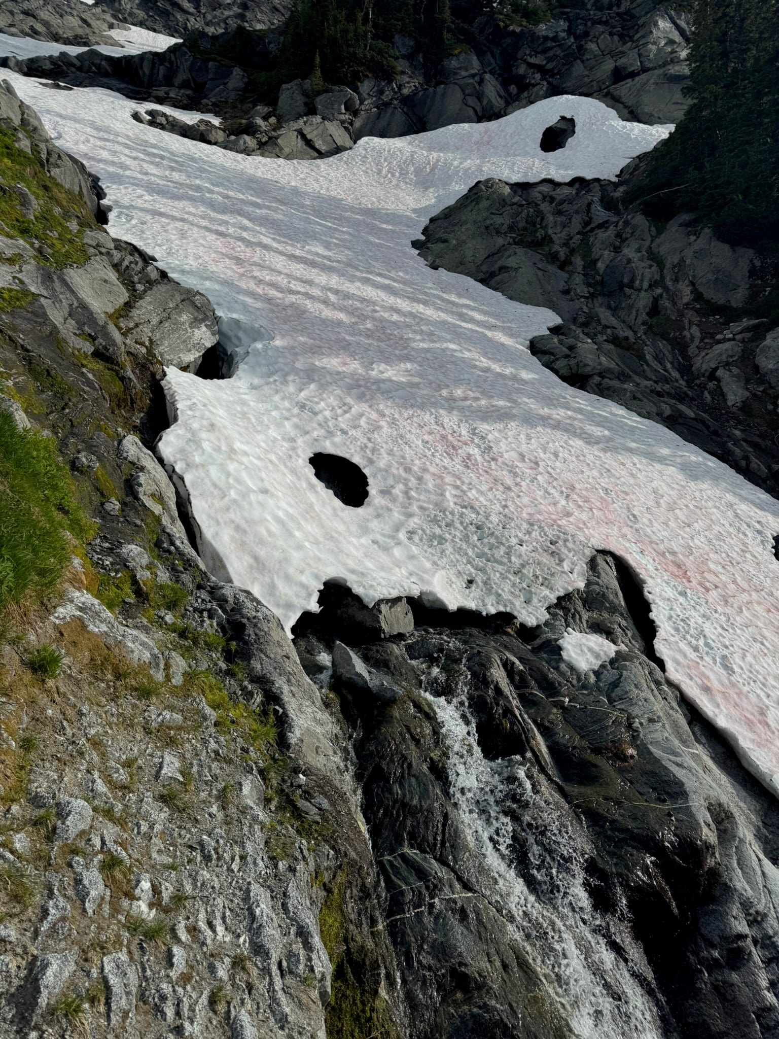
I sighed and braced myself. I upclimbed above the gaping maw of the creek-waterfall that plunged along smooth rock. I got crampons on and stomped to the middle of the snowfinger and uneasily stepped down. Midway down to my destination snow patch was an opening from the ten peak wall that went until the snow finger was only 3ish feet wide between it and the roaring creek. I could see part of the moat on the ten peak side and decided if I was going to slip, that was the preferred way compared to the creek, though no way was preferred.
I sat on my butt and heaved a sigh and decided losing control was the best way to stay in control. I zoomed across the crack before arresting 20ft below, creek still distanced to my one side. I could now see my target opening to get onto snow. Shaken, I stood up, snowed myself off, and side climbed the snow over to the opening, happy that my pants were clean and that I was not in any moat or creek.
The next part was more exhausting than anything and I was far too stubborn to take off my crampons. I upclimbed too far for my transition and downclimbed a little and punched through an area to get back on to the main snow finger. I clung to around 6k feet and spikily stumbled across rock patches as I sideclimbed snow up and over to the first arm under the Ten Peaks cluster, which towered moodily above me. I swam through snow in spots. The pattern went snow -> rock -> snow -> vegetated & rocky arm -> new snow basin -> rock -> snow -> vegetated & rocky arm.
Along the way, I stayed far too high so I could keep my crampons on. Sensing a theme yet?
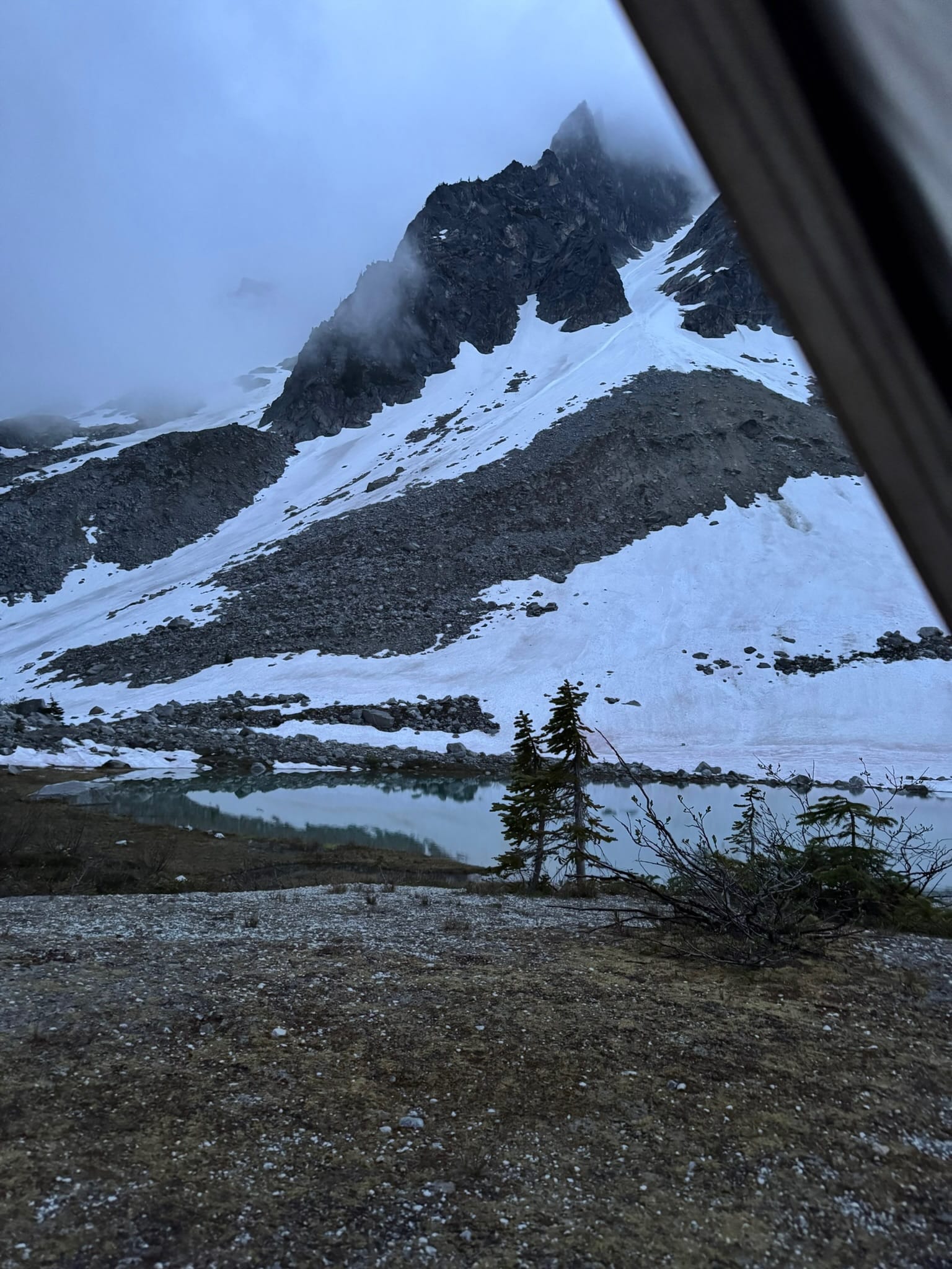
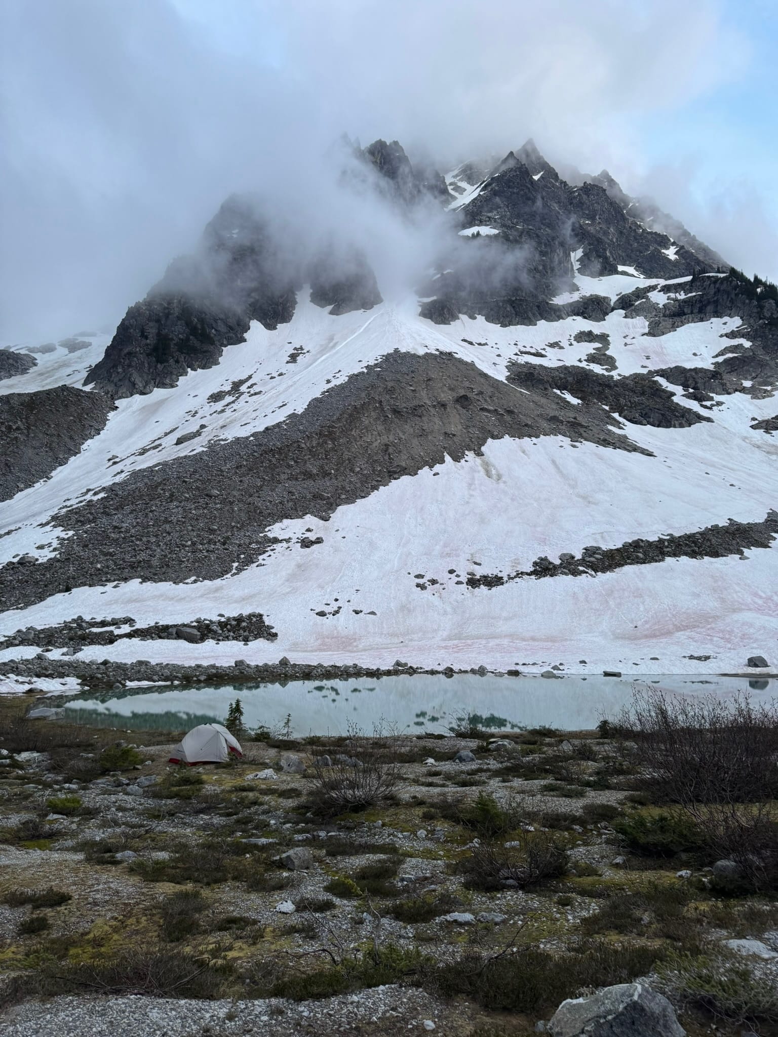
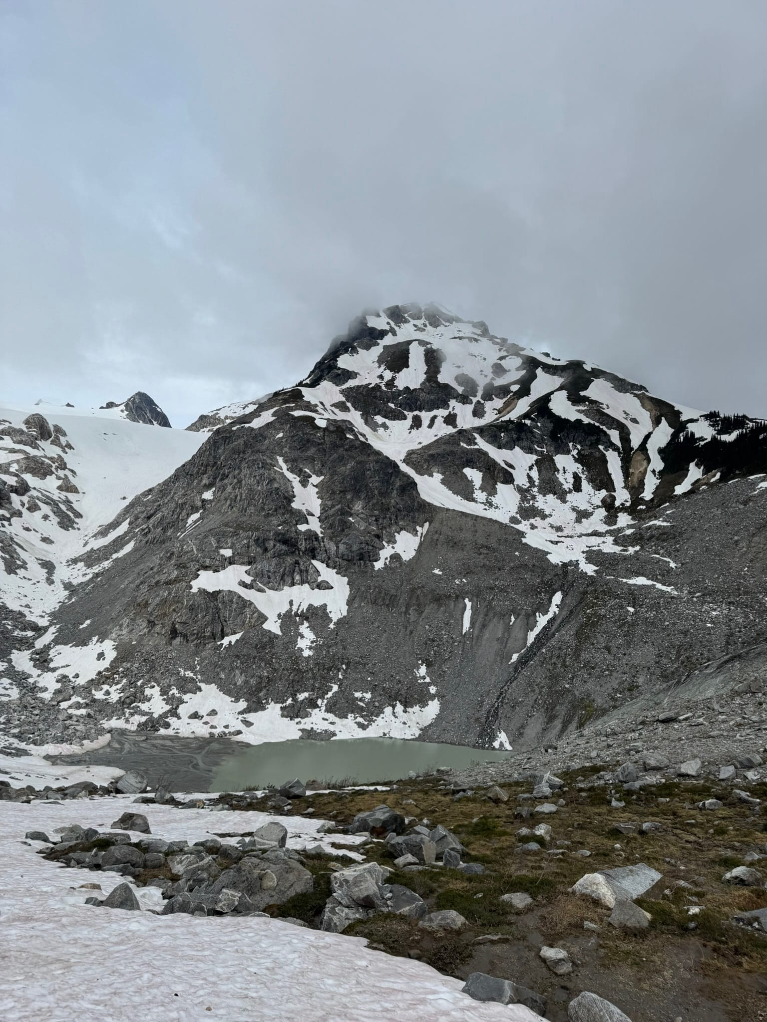
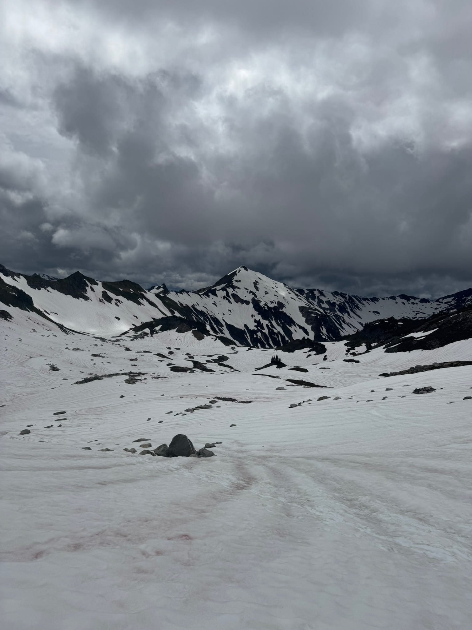
I had aspirations to make it to Glacier gap. At some point, I decided that was a fools errand. I had just come over a rock arm and looked down at this beautiful clear-blue tairn that had appeared. After consulting the time and its many flat spots and aesthetics, I decided that it would make a great camp spot. I plunged down consistent snow to 5400ft.
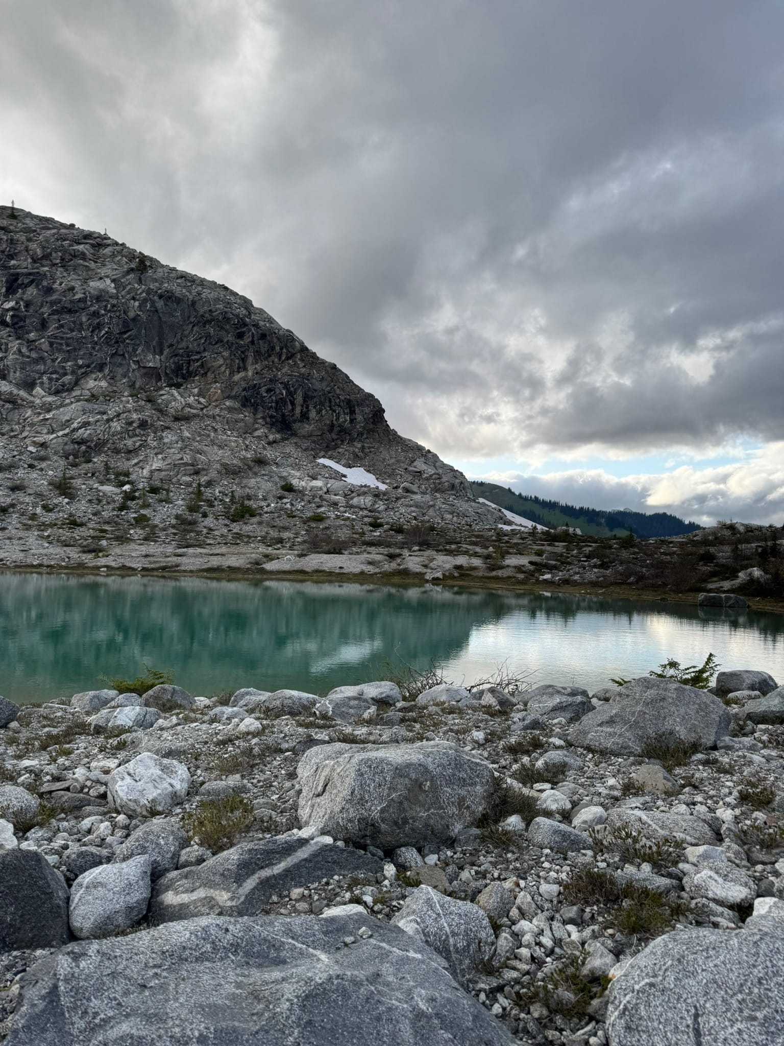
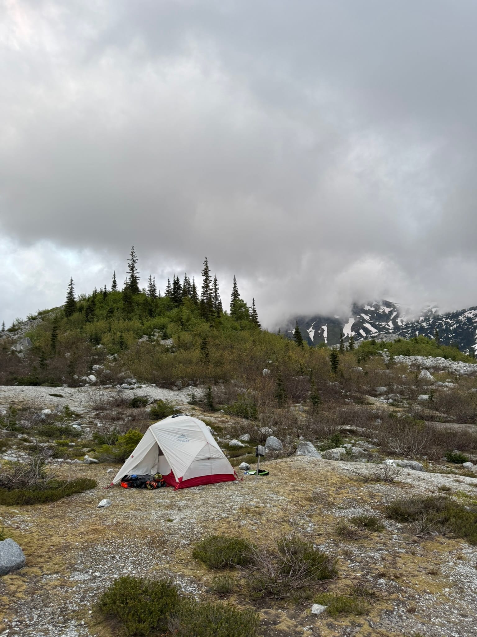
Of all things I enjoyed most at this camp spot, it's the space. I love a good thing-splosion, and I spewed the contents of my bag everywhere. It felt cathartic.
I spent the rest of the evening at a slow pace, watching the clouds move across Ten Peaks and the flickering daylight transition into dusk, reflected in the cool blue of the pond.
Marmots surrounded me. They watched me from rocks up high and squeaked and squawked and sang throughout the night,
Day 3: Tenpeak Basin to trailhead with 20ft Away Kololo Summit
Day 3: 23.8mi, +3,088 ft, -6,430 ft
Max Elevation: 8,186 ft
Min Elevation: 2,303 ft
15h 7m
I did not wake up with the express intention of getting to my car, but I thought I might have a dr. appt that I could not recall & I had an itch to get reset before the weekend started.
I am always grateful that I am able to do the things I do, but I craved to feel apart of normal society for a second.
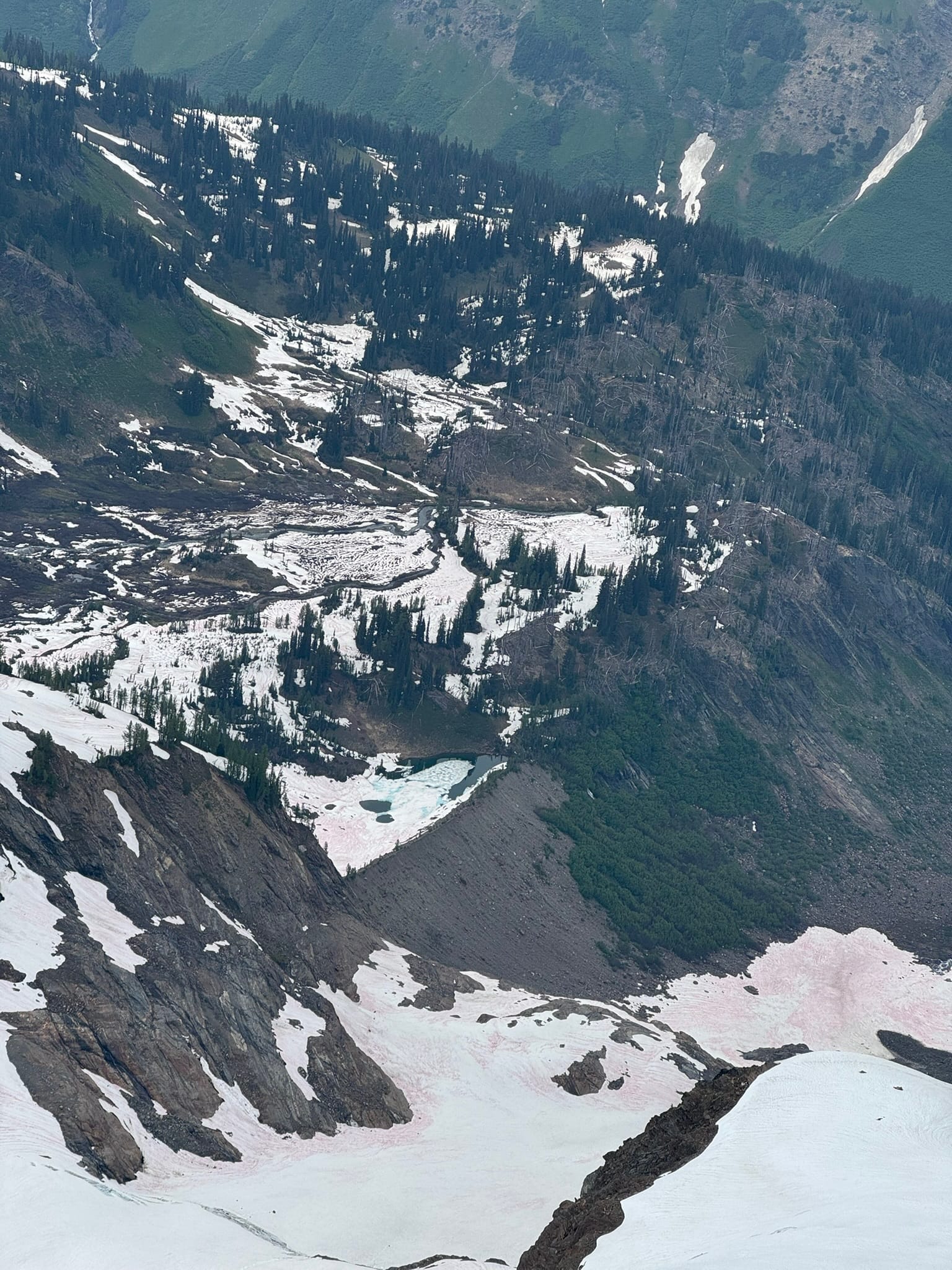
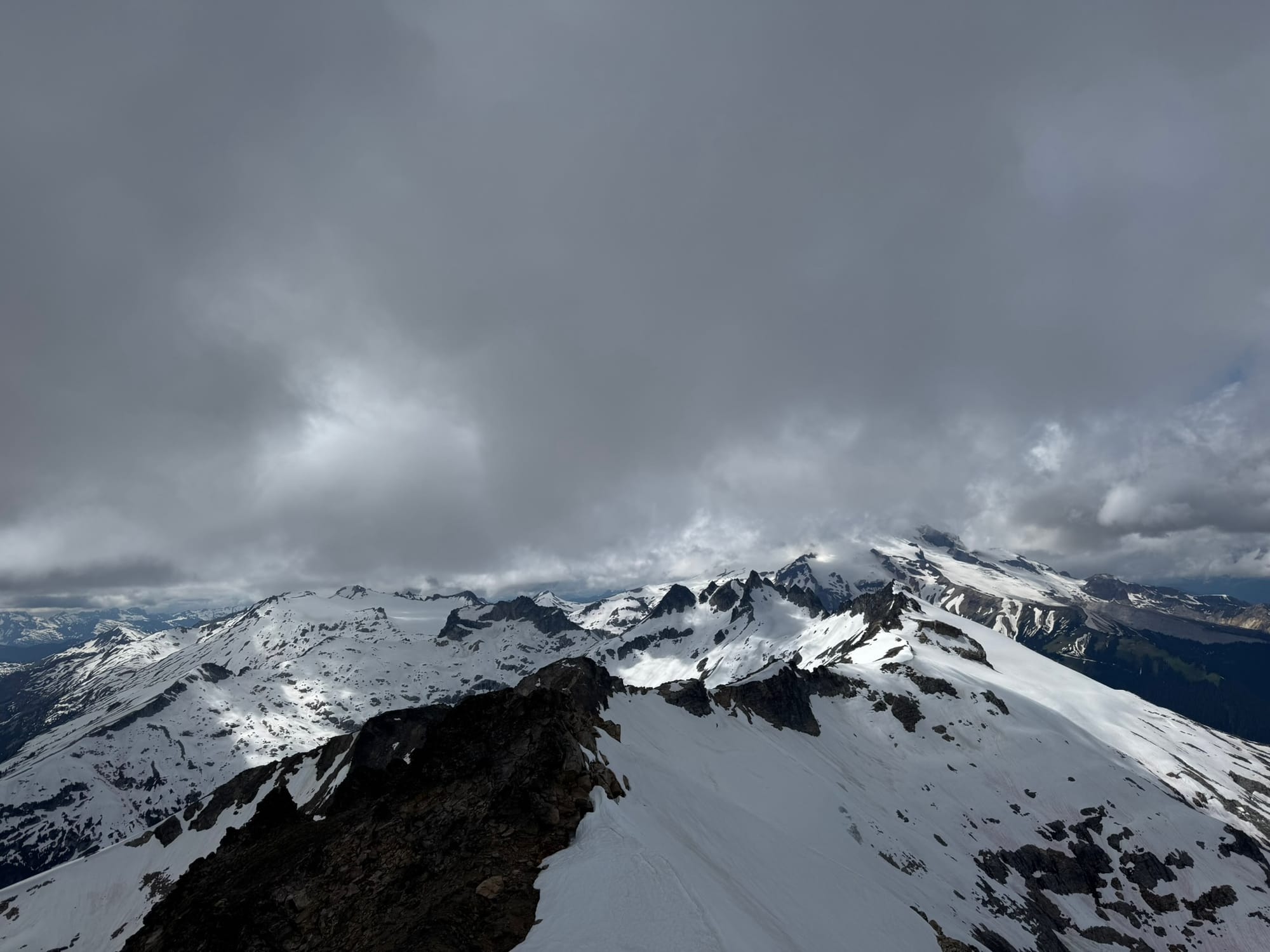
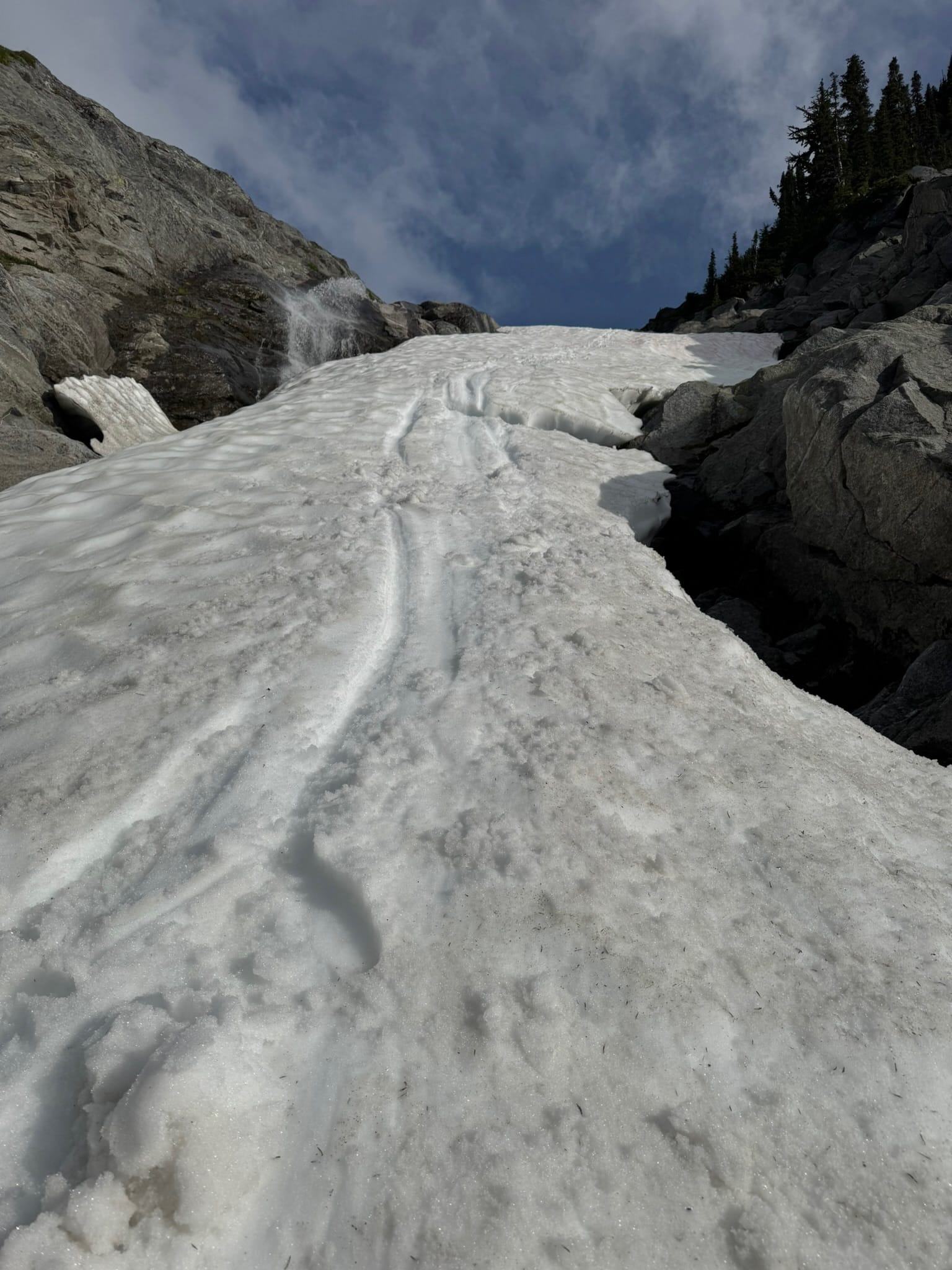
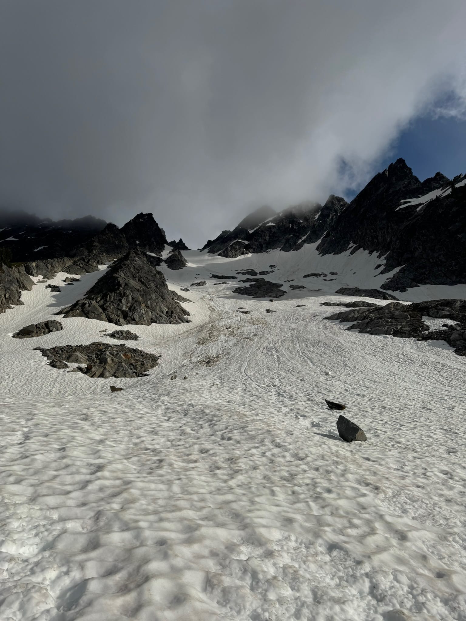
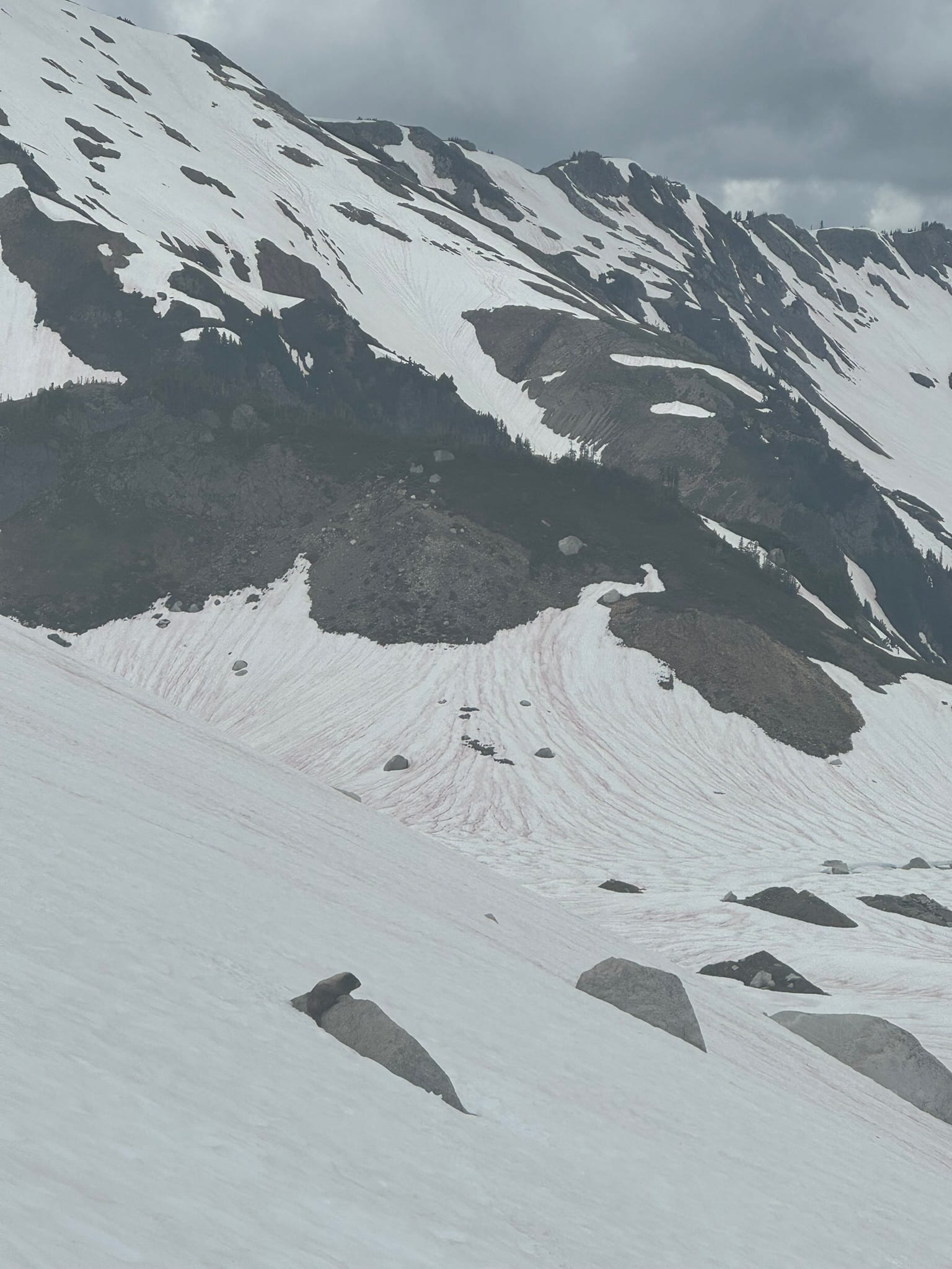
Clouds billowed around Ten Peaks above me as I got ready. I enjoyed my beautiful campground as I moved at a regular cadence and set off around 0830. I started an immediate steep 200ft ascent out of the bowl I was in, crampons on. Over the ridge was piecemeal snow patches at around 6100ft, where I think 2 week prior snowpack would have helped, with the monstrous silty honeycomb lake slurping down the gushing waters from honeycomb glacier.
I think the move here would have been to drop 80ft to a rocky outcrop that cut above The Honeycomb Lake, then to side traverse to snow then enjoy a consistent snow ramp above the inlet of honeycomb lake.
Always terrified of losing elevation and choosing a straightforward option, I opted to stay high and cross-traverse a patchwork of steep snow and rock underneath rockfall and wet slides. I click clacked with my crampons, groaning in silliness when I had to take them off for an awkwardly long and steep section of talus, before throwing them back on. As the great lyricist Nicki Minaj says, High Heels on my Tippies, Dolce and Gabana on my Titties.
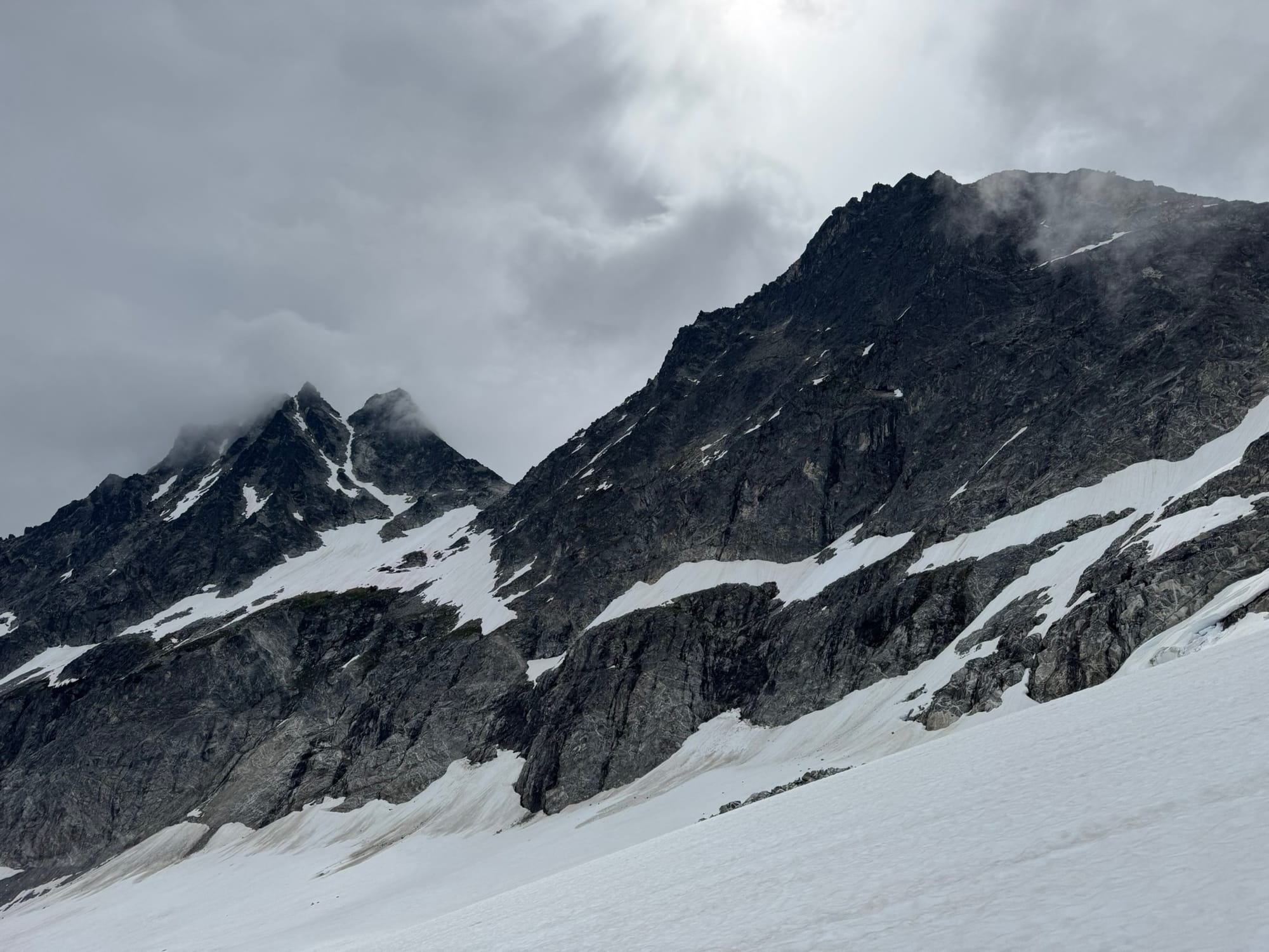
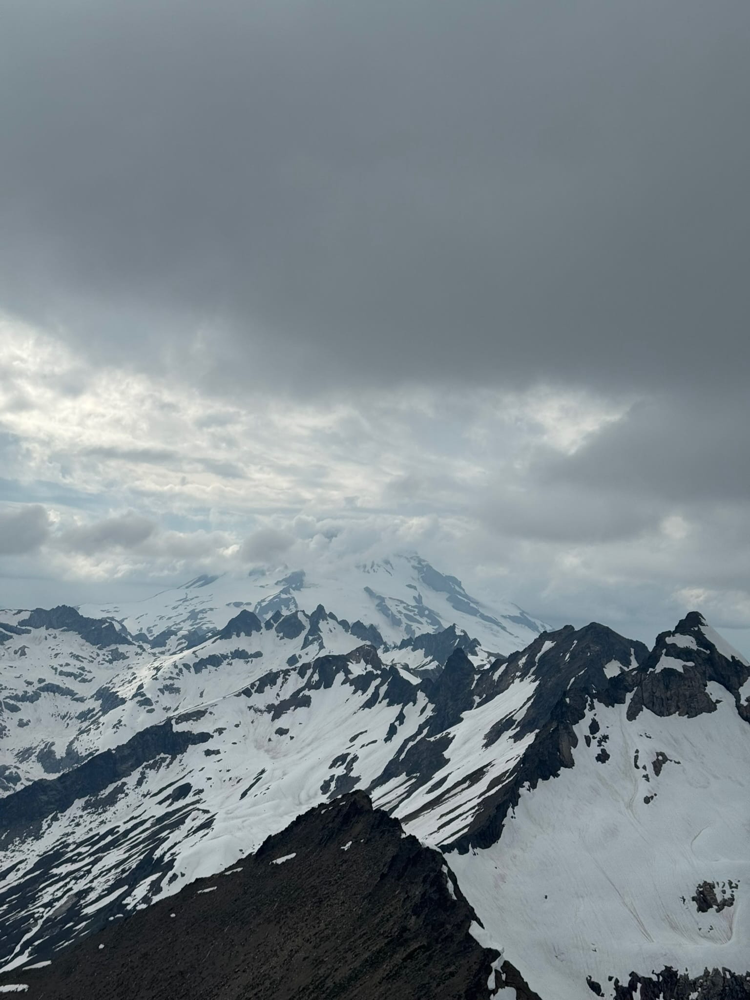
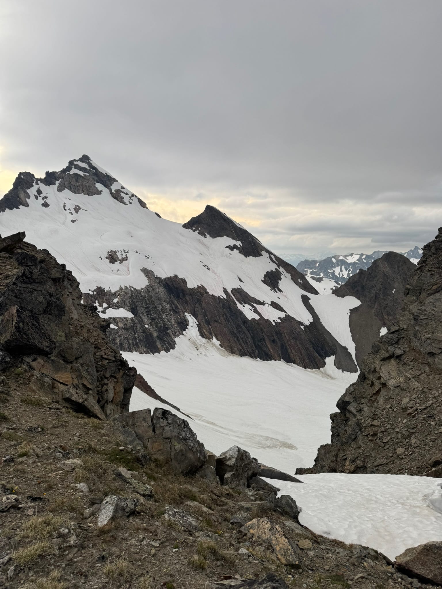
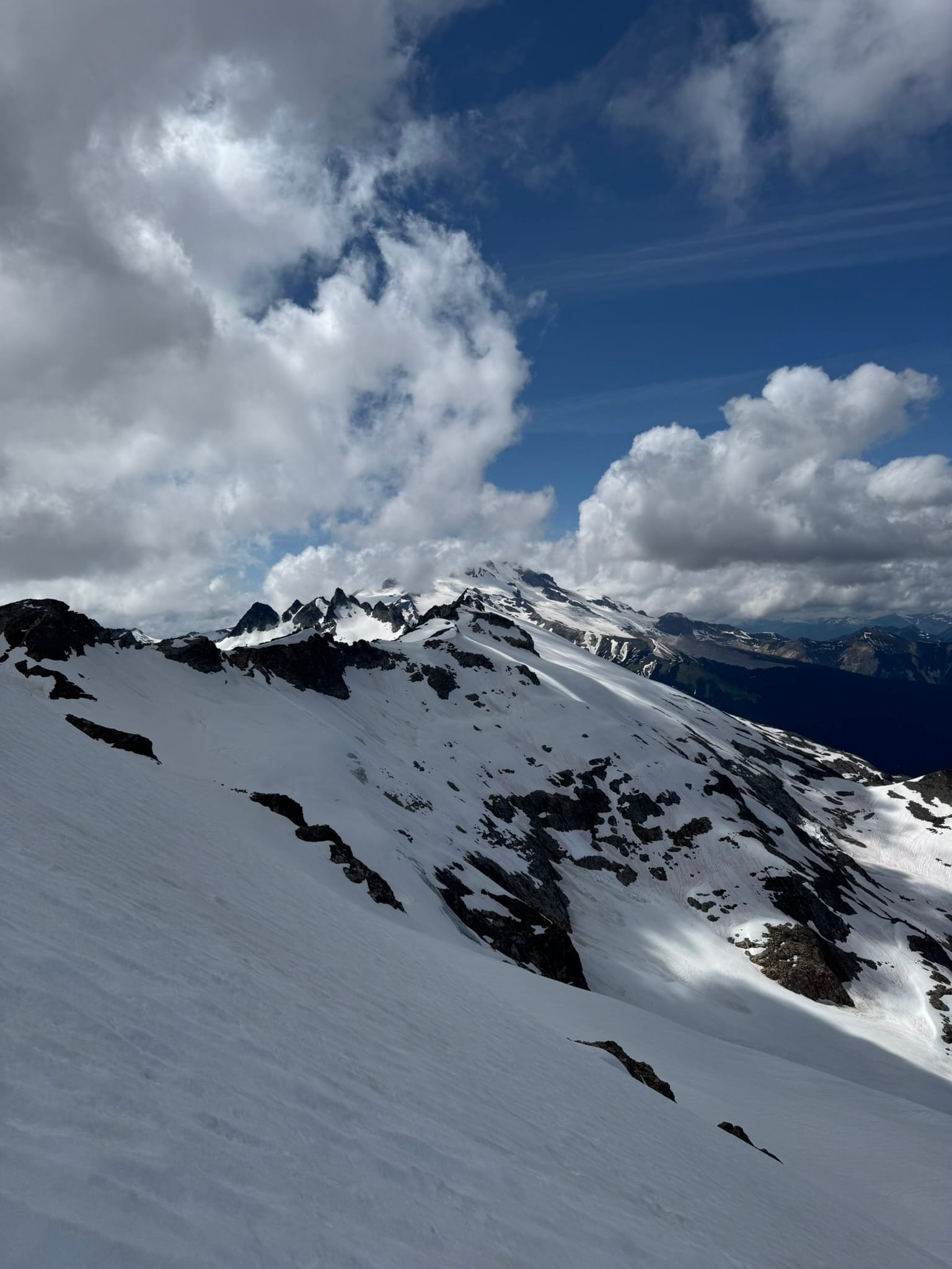
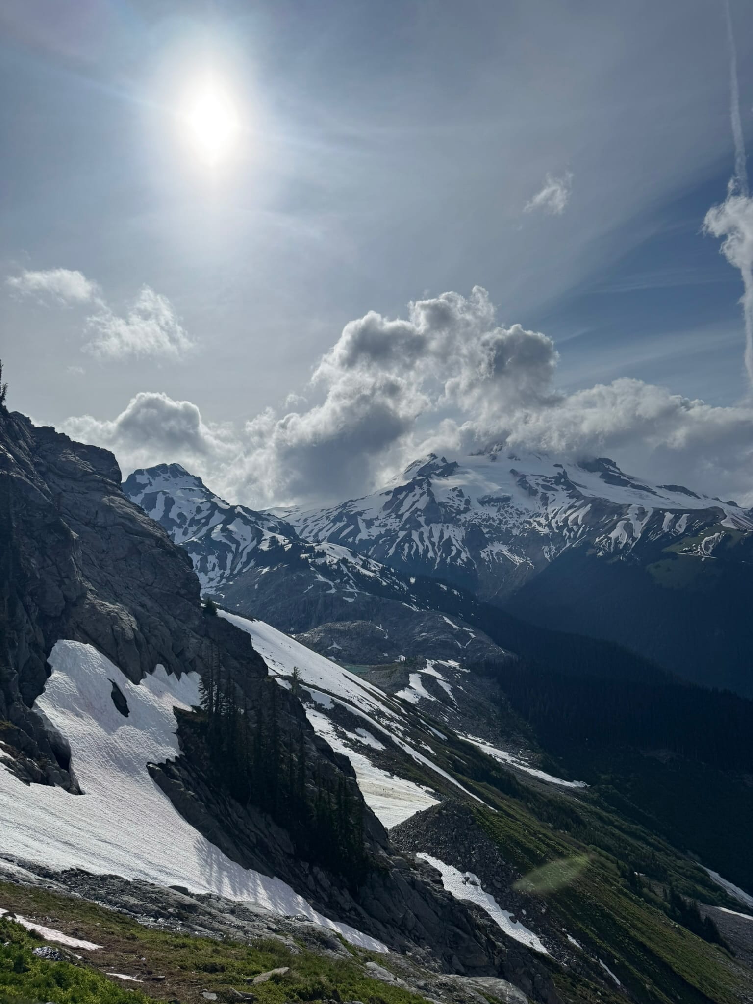
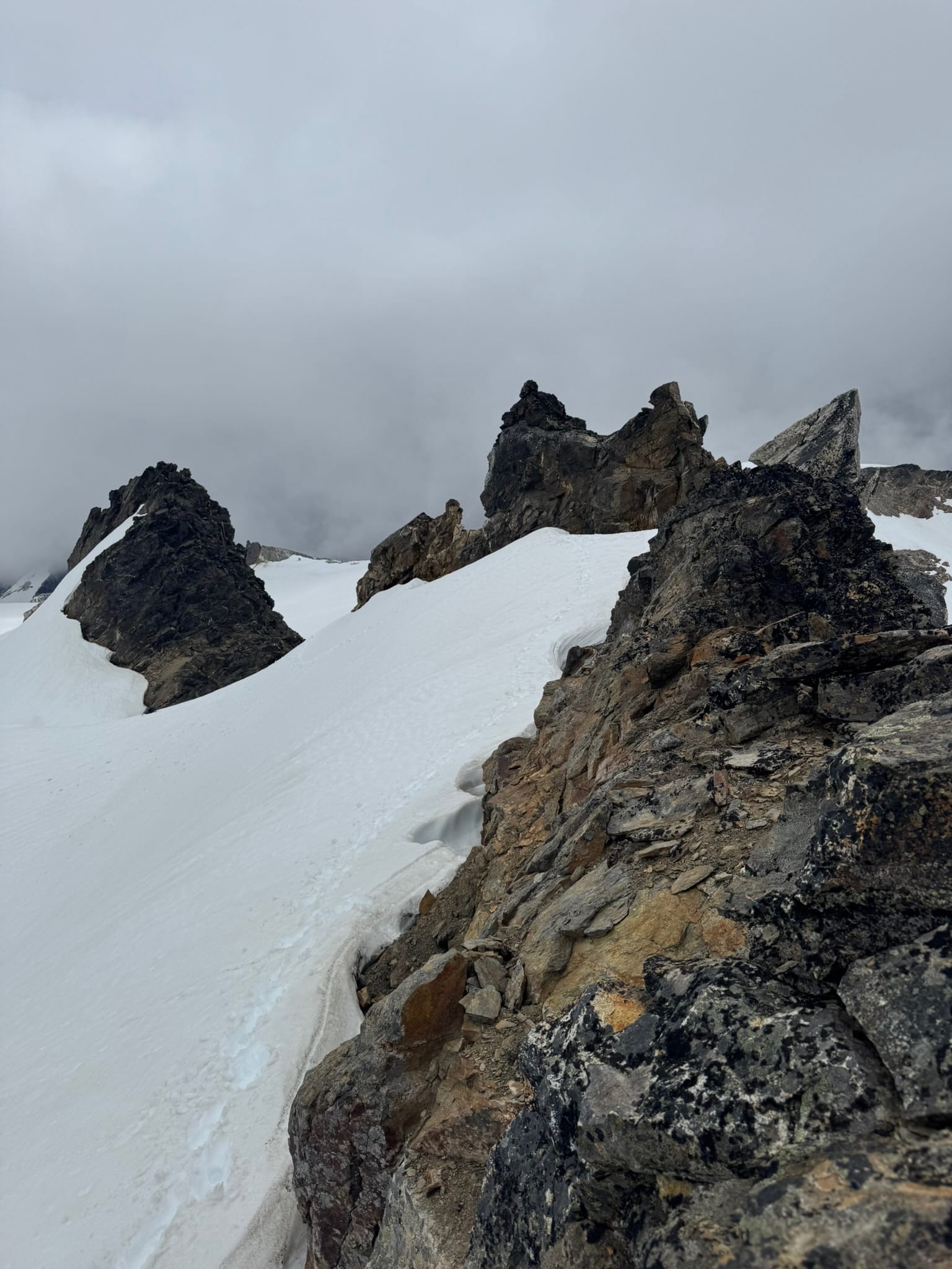
After a while of these sillinesses and obsessing over what could have been had I dropped, I ended up on the consistent snow patch of The Honeycomb Glacier. I love a good theme and enjoyed that the beautifully streaked rock of the Hive sat above me as I sauntered my way up from 6100 ft to the 7800ft plateau that sits just under the Kololo peaks. The cloud cover moved the sunlight in patches and across the toothy and color-streaked peaks above me. I had little but the crunch of my footsteps in the snow for a while. I shivered a bit when I took breaks but overall handled this part well enough.
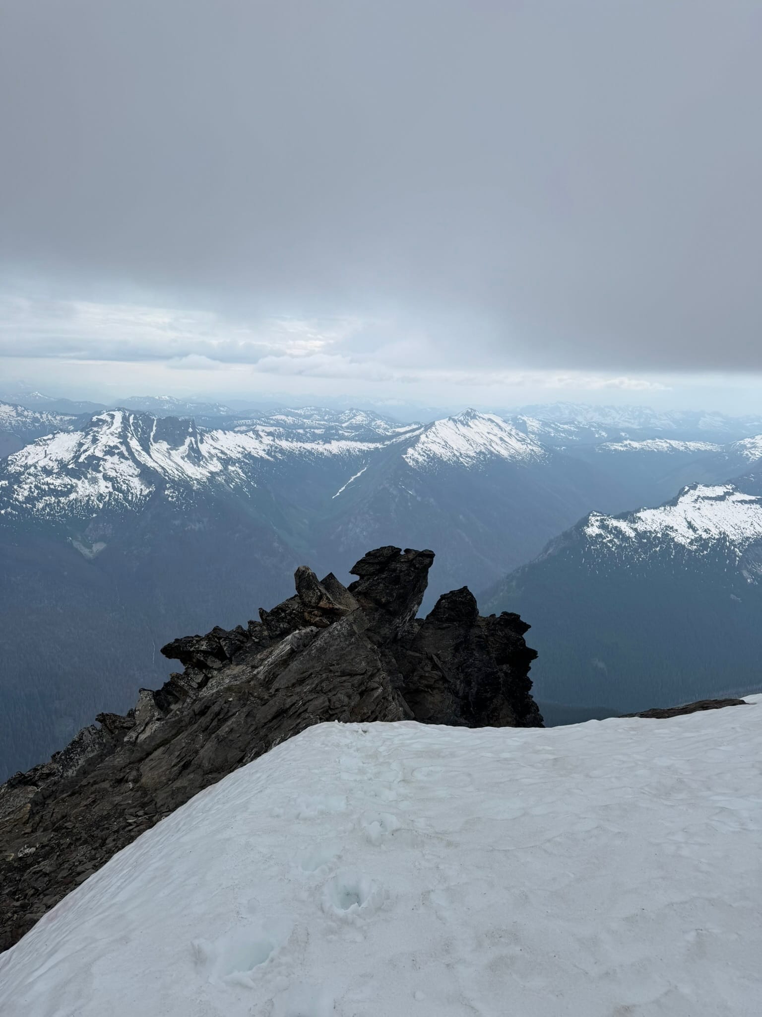
After a little bit of seesawing on the decision, I decided to commit to my original plan to run up and check out the Kololo Peaks area. I love the names of these peaks, and the East one is pretty in particular. I also hoped to have a view of Glacier Peak.
Cloudcover had another plans for my second goal that day. I ended up at the 8100 ft mark and dropped my pack to climb, before I realized I was in front of the wrong peak. I looked up to my right and then to my left, and asked "is the peak on the right really taller?"
Gaia said so and Gaia is my only boss, so I moved my pack.
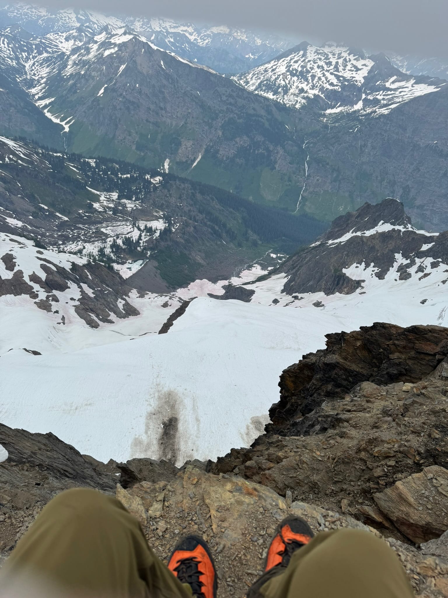
This new peak had some pros and cons. Pros - the snow went almost to just under the summit on the north side. Almost. This is where 2 week prior snowpack would have helped. The snow just under the summit was very soft on the west -north side and had Very Big Moats on the direct north side. I ended up on the east arm. I scurried up and ended up facing a very large black lichen block. To my north (right) side was a steep drop into a steep moat and to my south (left) side was a steep series of ledges. I think here if I had not pressured myself to move quickly, I would have gently dropped to the south-side ledges and tried to walk down and around the ledge underneath the Big Black Block, but my brain locked up because it was highly exposed and this was meant to be "Class 2+", so I reversed course.
For my next act, I cut under neath the north side where the respectable maw of a 15-20ft deep moat with a single-foot-single-use snow bridge to rock existed. I looked at this rock and realized my prior Big Black Block was not the summit - it was this other well-worn block 20ft above me. I looked hard at the snowstep. The rock would have gone, and I could have jumped down on the way back. But I thought all of these things, with the steep snow pitch I stood on, were wrong for a solo-ist.
I went further west to a notch in the ridge that connected to the peak and stepped onto it. I looked to my left toward the peak and it looked like I was blocked out by one Large Rock. Maybe again, had I looked further down on the south side of the ridge, it would have gone.
Instead I sighed and paused. I took in the drop off and glacier below me. I decided to back down and focus on getting out of the area, as it was supposed to rain a lot later.
I got back to my pack and simmered on if this is what I wanted.
Yes, yes it was.
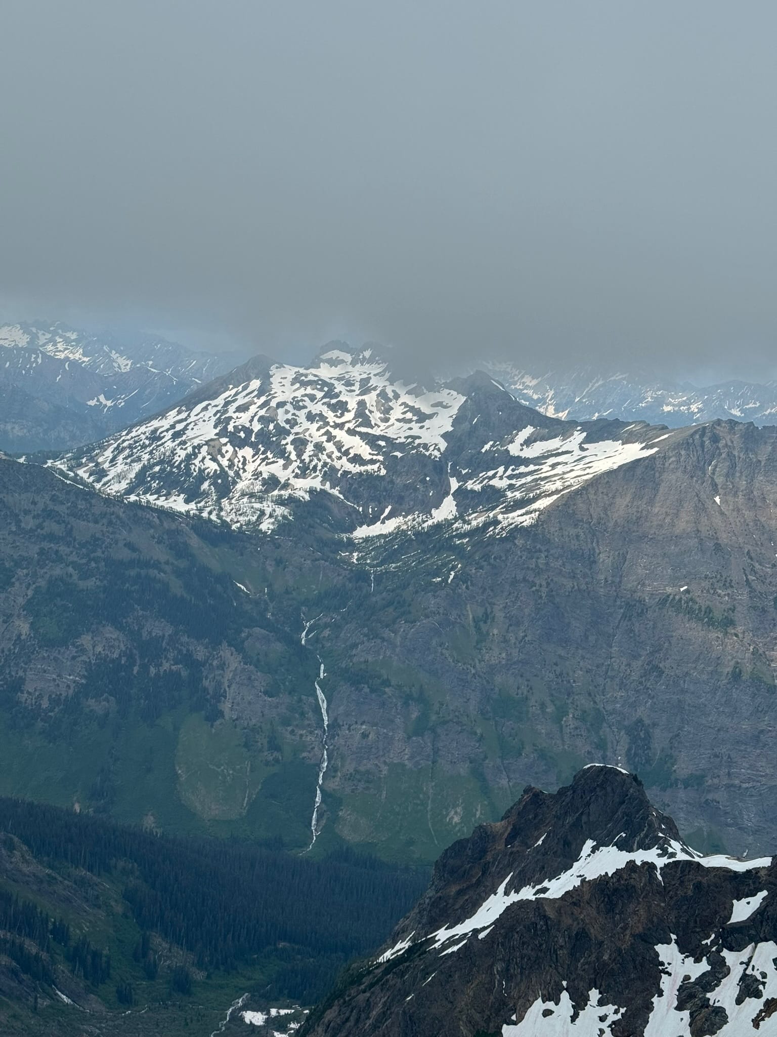
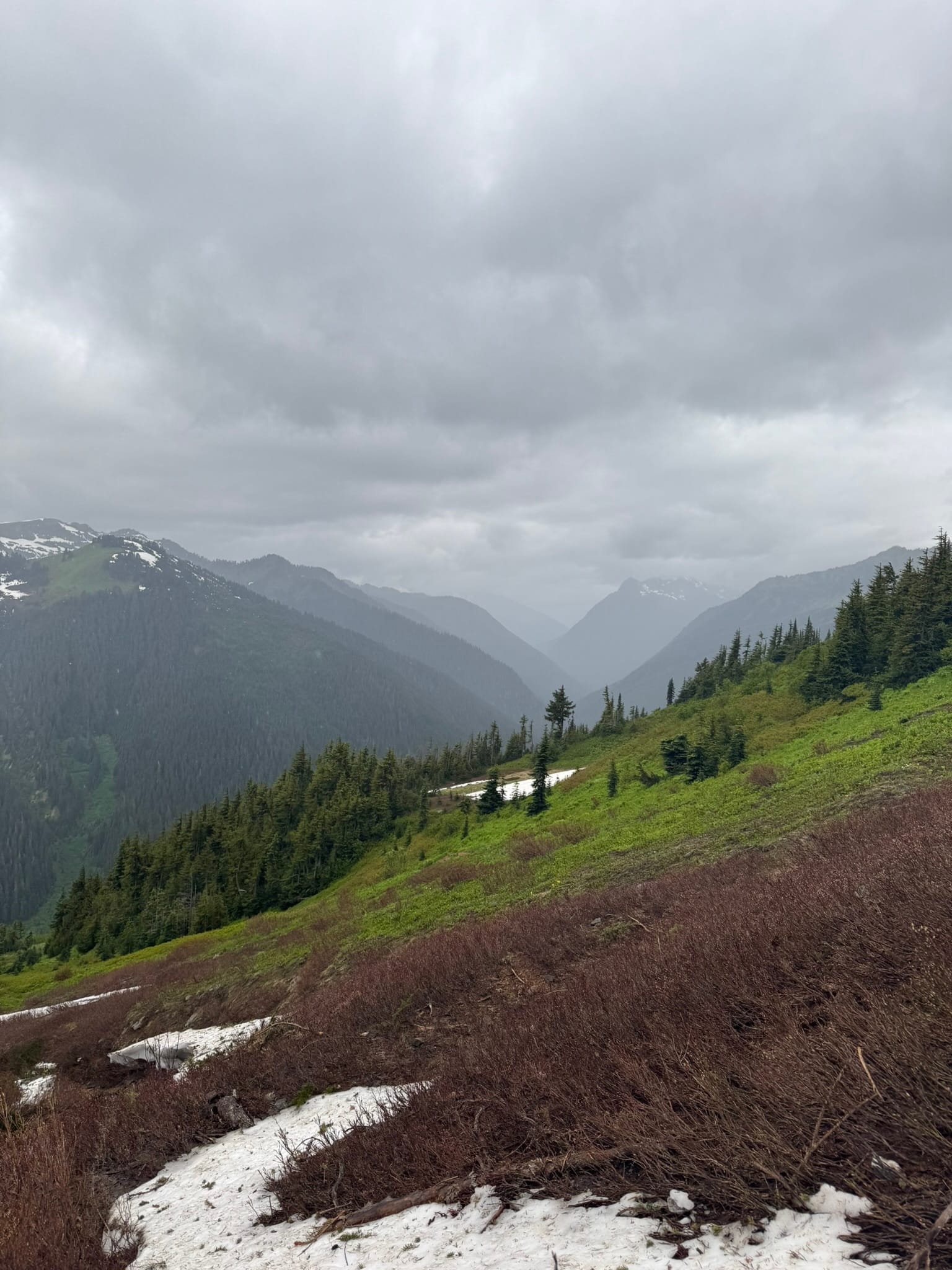
I paused to get a view of White River Glacier.
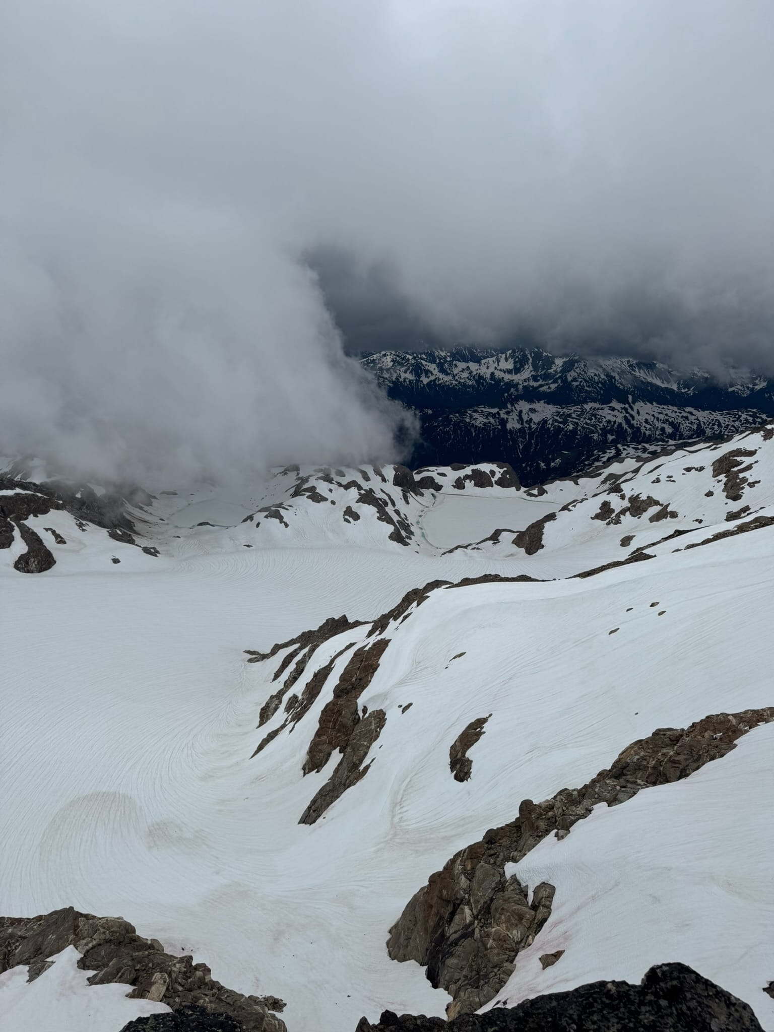
It breathily filled the valley and spilled out into a flat basin with two melting out lakes below. The size of these glaciers always takes my breath away.
I decided this versus what I saw from the west-side notch was much more filled in and desirable, so I walked along a steep corniced ridge underneath Kololo, before sliding down a non-corniced rib to the consistent snow below. I downplunged along some cliff bands singing a merry tune.
Then I turned the corner.
And realized a track I had, pointed toward Up.
I thought I had broken up with Up.
I thought I had entered a relationship with Down.
I checked the loosely followed track on my Topo from a couple different angles and concluded that Oh Shit, this Pointed Up. I realized that from the west notch of East Kololo that I had not been looking at the White Chuck glacier, but a snow field in between White River Glacier and White Chuck Glacier.
I put on my silly crampons and grumpily accepted my silly ascent to the silly saddle. On my silly ascent, my foot got stuck and I dug it out with my ice axe. I felt extra silly.
The path I chose gained Silliness as I ignored the main track and ended above the saddle I wanted. I downclimbed silly stuff and sideways climbed silly stuff and ended up crossing across some thin and punchy sillier stuff.
I rejoiced when I slipped out of the silly stuff and ended on the correct Glacier and could see The Place Where People go to Climb Glacier Peak ahead. I hopped and skipped my way down, Listening to How To Flirt With a Hellhound, a gracious masterpiece of Fluff.
As I rounded the corner under some pointy peak on the snow, I decided at this point that I wanted to attempt to get to my Car.
I thought I'd be at White Pass no later than 15:00.
As I rounded out The Place Where People go to Climb Glacier Peak at 1430, I had a moment thinking I needed to reassess my timeline. As I slopped around on weak snow, threading toward to the PCT, I saw one group of climbers setting up camp. They were a couple hundred feet off and I did not want to detour with my ambitions and the weak snow. So I slipped onward, merging with their tracks and dropping down into a basin, then pulling up to a Green Saddle with numerous snow patches around it. The Green Saddle called out like a Beacon.
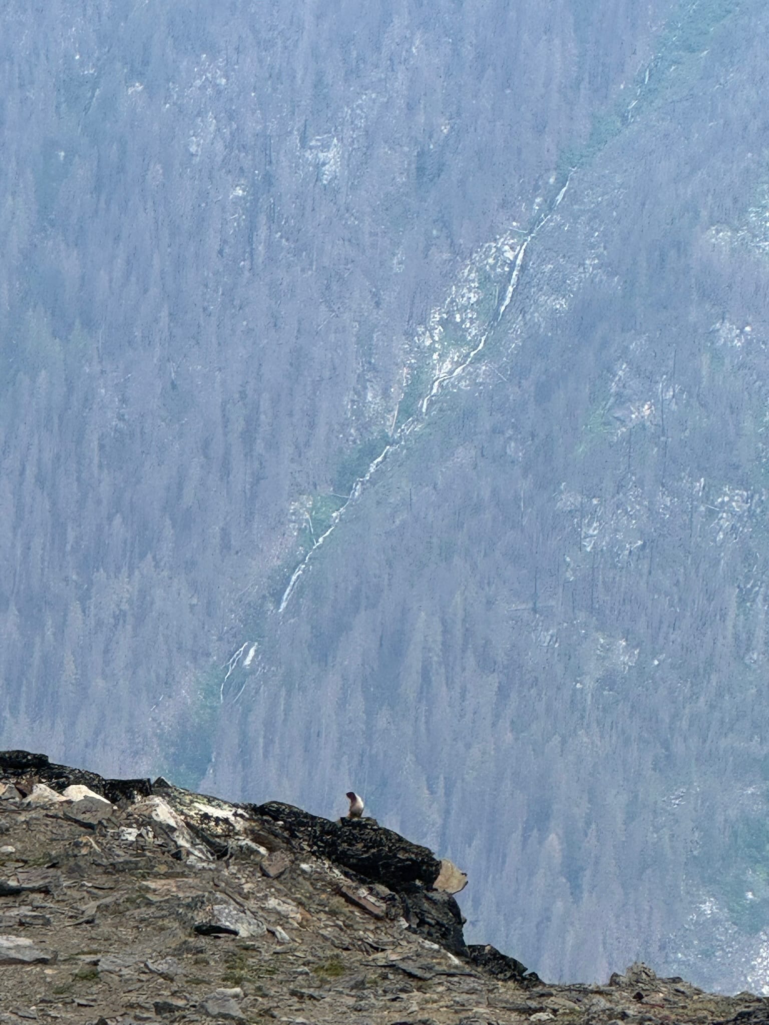
I will call this area Marmot Land,
as it began a series of nonstop marmot encounters. The Marmots grew incredibly bold, watching me mere feet away from the sides of the path at times. After moving onto the Green Patch, I looked back into the basin and decided it would be a good area to come back up when a lake nearby melted out.
As I sauntered on, I questioned if someone had a pet marmot as I followed fresh-ish human footprints that interspersed with a clear set of marmot tracks. What would a pet marmot be like?
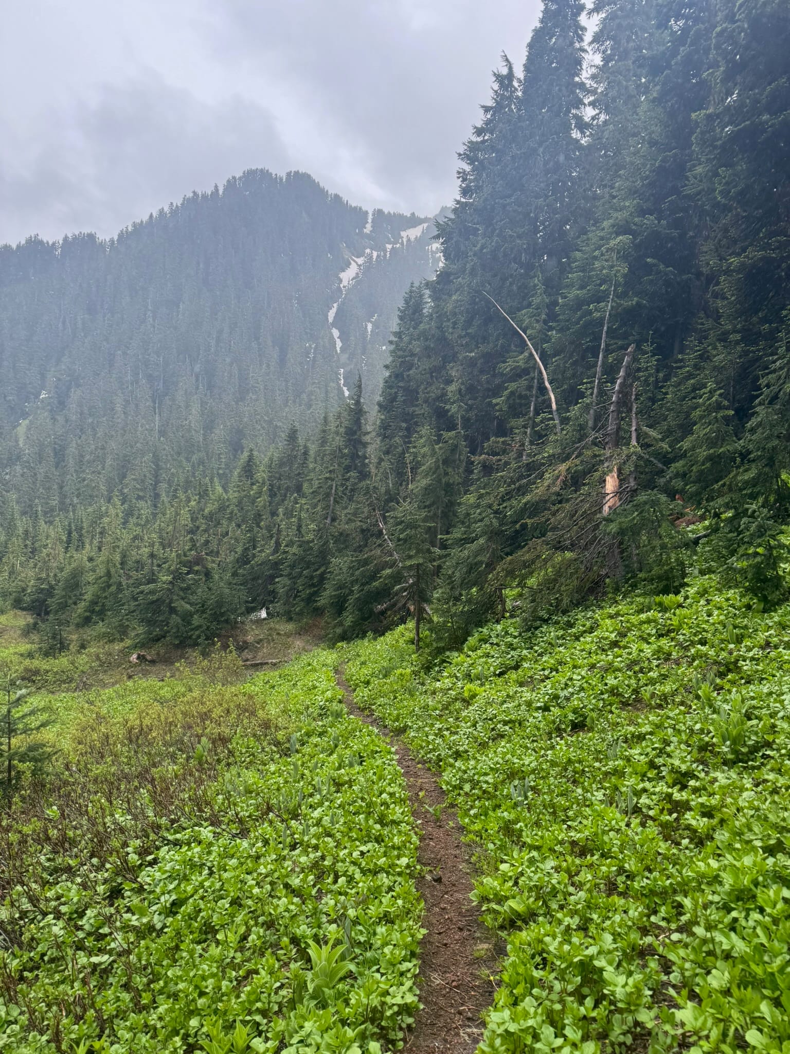
This backside section is lush and green and chill.
I strutted on my crampons as long as possible. The darkened cloudy views made for deep hues of greens and wildflowers pop.
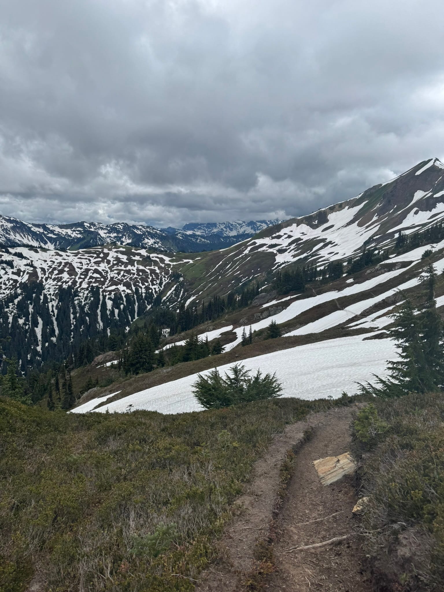
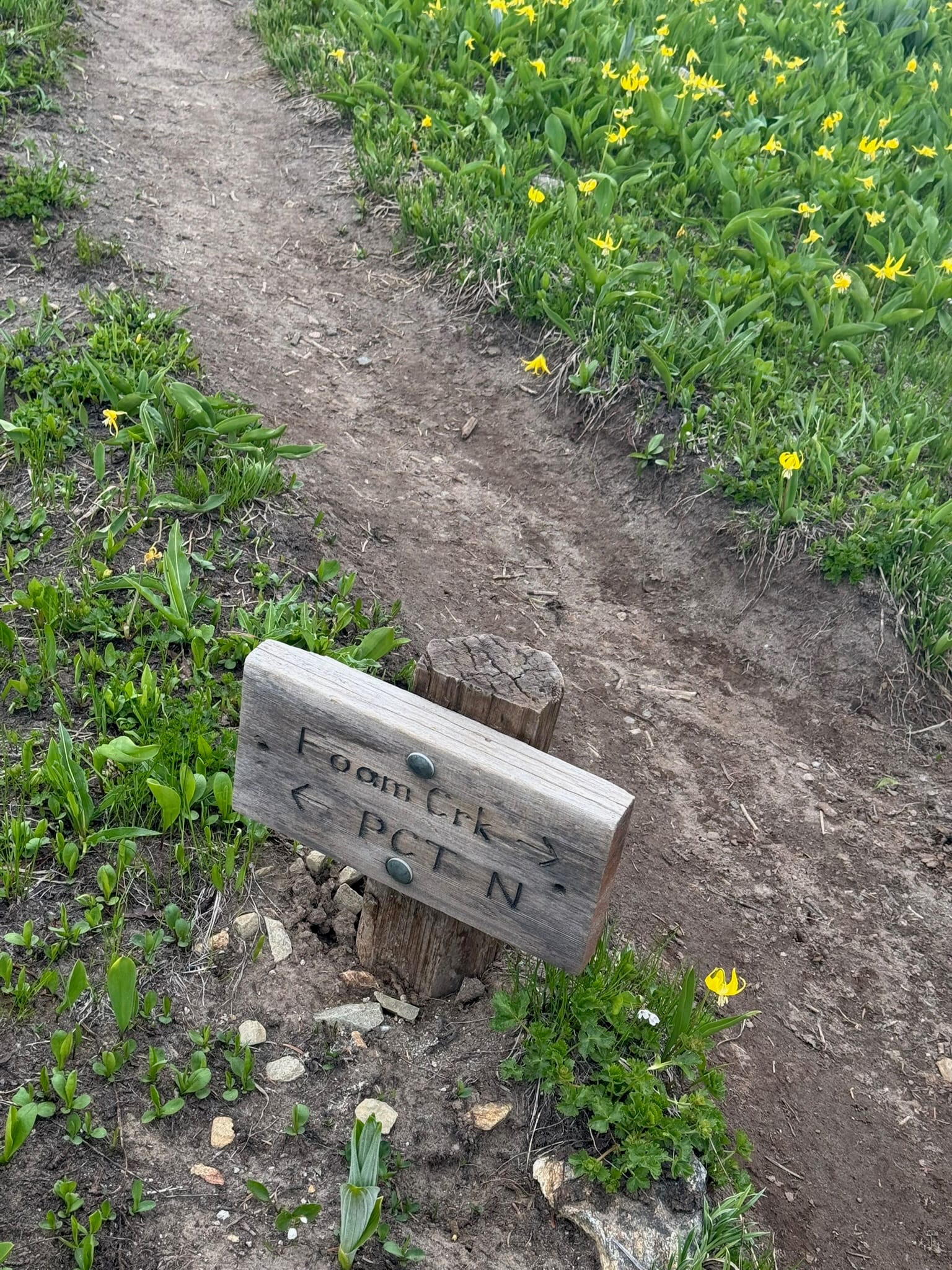
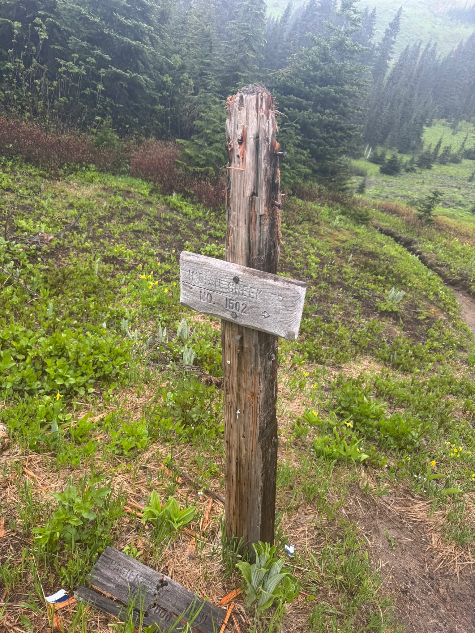
I connected to White Pass camp at 1615. I decided that I would charge onward to Indian Pass where I would catch a hopefully not-to-brushy Indian Creek Trail.
I followed the PCT along patches of snow and grass as it contours. Some firm snow and sidehilling made me wish I had kept crampons on, but overall I followed my marmot and friend footsteps along the ridge, enjoying the deep greens and budding wildflowers continued with the moody overcast ceiling and shrouded peaks.
I rejoiced as I turned the corner to Indian Pass at 1800.
It promptly started pouring. I dropped down the trail quickly until I found a steep but dry-ish copse in between trees that lacked brush.
I performed the Reverse Mountaineering Boots ritual and slipped into rotten smelling socks and my trailrunners, which felt merciful on my tired feet.
It took a while on the steep and loose tree rubble I sat on, but I made it and stepped out into the rain for a dive into the Indian Creek trail.
There are notes about this trail being a bushwhack.
I will say that for about 80% of it , the trail is easy enough to follow even through brush. The blow down is not bad. In some parts, the grass towered above my head and it was only by focusing on specific parts of where my feet were that I knew by feel that I was on some kind of path. More blow down existed in the 5 -> 2 miles from the trailhead than anywhere else. I met 1 person who had hopped of the PCT and had hopes to loop around Boulder Creek pass up through High Pass & enjoy a cinnamon role in Stehekin before curving to SR20. I wished them well.
Otherwise this part was a mind numbing journey that left me dizzy with route finding and staring at my feet nonstop for 5.5 hours. I lost the trail 3 times for brief moments.
I jumped and skipped, hemming and hawing, at the trills of being close to the end of the trail when I ended up on some mellow switchbacks and thought I was at the trailhead.
I crossed a small tree foot bridge and was both on the wrong side of the river and not at my car. I pulled my phone out and saw that I had actually rounded a corner across Indian creek and had 3 more miles to go. What a tasteful thrill.
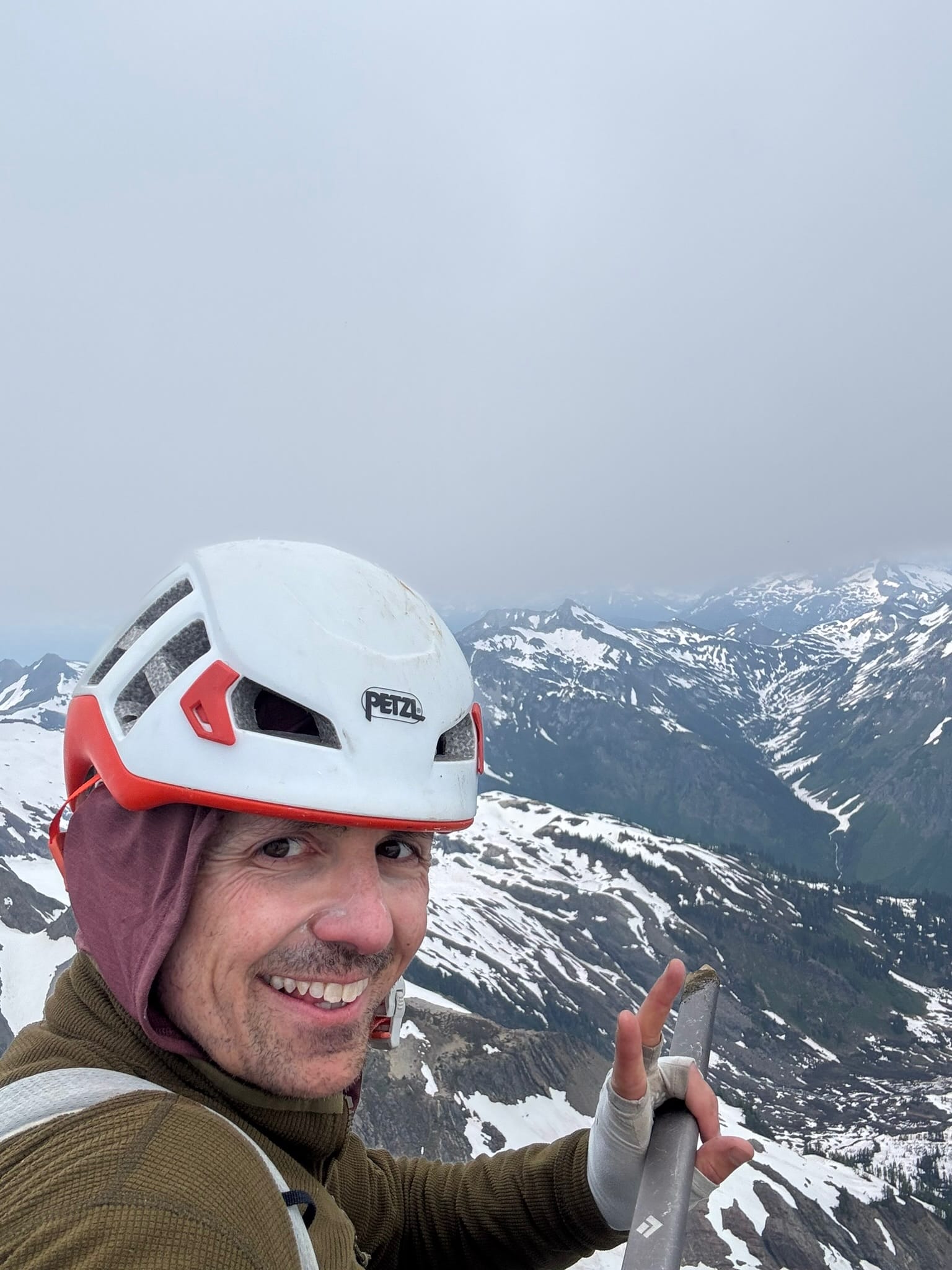
A sopping wet and delirious Andrew Willard got back to the car about 2330. No one else was in the lot.
I scampered about to change into mercifully warm and dry clothes and deconstruct my bag enough that I could access what I would need for the drive but be able to quickly re assemble the bag for getting it into my apartment late at night. Sprinkles splattered me just as I got in my car and rolled away, grateful for another adventure in these marvelous enchanced mountains.
I landed in bed in Seattle just after 3am, just in time to kick off the weekend festivities just after 7am.